Mori Atlas logo
National parkYaguas National Park

Mapping pristine Amazonian rainforest and critical transboundary conservation corridors.

Yaguas National Park: Protected Landscape and Geographic Context in Loreto Region

Yaguas National Park, a significant national park in Peru's Loreto Region, protects nearly 8,689 square kilometers of vibrant Amazonian tropical forest. Established in 2018, it serves as a vital component of an expansive transboundary biological corridor connecting protected areas in Peru and Colombia. This page offers an atlas-driven view of Yaguas National Park, detailing its geographic scope, unique landscape features, and its crucial role in regional conservation.

Amazon RainforestTransboundary ConservationNational ParkTropical BiodiversityAmazonian WildlifePeruvian Protected Areas

Yaguas National Park

National park

Park overview

Structured park overview, official facts, and landscape profile for Yaguas National Park

Yaguas National Park park facts, protected area profile, and essential visitor context

Review the core facts for Yaguas National Park, including designation, size, terrain, visitor scale, habitats, and operating context in one park-focused overview.

About Yaguas National Park

Yaguas National Park represents a landmark achievement in Amazonian conservation, established in 2018 to protect one of the most biologically rich regions in the Peruvian Amazon. The park's location in northeastern Loreto places it within a complex network of protected areas that extend across the border into Colombia, forming a biological corridor of significance that spans both nations. This transboundary approach to conservation acknowledges that ecosystems do not respect political boundaries and that effective protection requires coordinated international effort. The park's vast extent of tropical forest provides habitat for an extraordinary diversity of species, from large mammals traversing the forest floor to fish navigating the river systems that bisect the protected area. Beyond its ecological significance, the park serves as a vital watershed for rivers that support local communities and maintains ecological processes that extend far beyond its boundaries.

Quick facts and research context for Yaguas National Park

Yaguas National Park is located in the Loreto Region of Peru, approximately 150 kilometers west of the city of Iquitos, near the Colombian border. The protected area encompasses roughly 8,689 square kilometers of lowland Amazon rainforest, making it one of the larger national parks in Peru. The park was officially established in January 2018 under the management of SERNANP, Peru's national protected areas service. The region experiences a tropical climate with consistently high temperatures averaging 31°C and humidity levels around 80% throughout the year, with annual precipitation averaging approximately 2,827 millimeters.

Protection and recognition

Tracing terrestrial conservation frameworks and transboundary designations across borders

Yaguas National Park Protection Status and Transboundary Park Designation

Documented terrestrial conservation frameworks outline the official boundary management and protection status of Yaguas National Park. Reviewing established transboundary alignments and global designation history clarifies the role of Yaguas National Park within the wider regional geography.

Protection details

Protection scope
Terrestrial
Transboundary protection
Yes
Park context

Deeper park guide and search-rich context for Yaguas National Park

Yaguas National Park history, landscape, wildlife, and travel context

Explore Yaguas National Park through its history, landscape character, ecosystems, wildlife, conservation priorities, cultural context, and seasonal travel timing in a structured park guide built for atlas discovery and search intent.

Why Yaguas National Park stands out

Yaguas National Park is best known for its exceptional biodiversity and its role as a critical node in a transboundary conservation corridor spanning the Peru-Colombia border. The park protects extraordinary concentrations of wildlife, including approximately 600 bird species, 150 mammal species, and more than 300 fish species. It is particularly notable for housing populations of iconic Amazonian megafauna including the giant otter, South American tapir, Amazon river dolphin, and Amazonian manatee. The park also protects the Arapaima gigas, the world's largest freshwater fish. Its flora is equally impressive, with more than 3,500 plant species documented, including the distinctive ceiba tree (Ceiba pentandra) that towers over the canopy.

Yaguas National Park history and protected-area timeline

Yaguas National Park was officially created on January 10, 2018, representing the culmination of years of scientific survey and conservation planning in the Peruvian Amazon. The establishment of the park marked a significant expansion of Peru's protected area network in the Loreto Region, an area that had historically lacked formal protection despite its extraordinary biodiversity. The park's creation was part of a broader initiative to establish a coherent conservation framework across the Peru-Colombia border, linking Yaguas with existing protected areas including Amacayacu National Park in Colombia and regional conservation areas on the Peruvian side such as Maijuna Kichwa and Ampiyacu Apayacu. The governing body for the park is SERNANP (Servicio Nacional de Áreas Naturales Protegidas por el Estado), Peru's national protected areas authority, which administers the national park system.

Yaguas National Park landscape and geographic character

The landscape of Yaguas National Park is characterized by extensive lowland tropical rainforest typical of the Amazon basin, with flat to gently rolling terrain interspersed with rivers, lagoons, and wetland areas. The park sits at relatively low elevation, consistent with its location in the western Amazon lowlands. Rivers flowing through the park create diverse habitat types, from main channels to floodplain forests that experience seasonal inundation. The forest canopy is dominated by tall trees including the iconic ceiba (Ceiba pentandra), which can reach impressive heights and is a distinctive feature of the Amazon landscape. The terrain's flatness and the high water table create conditions favoring the formation of wetlands, oxbow lakes, and flooded forests that add heterogeneity to the landscape and provide critical habitat for aquatic species.

Yaguas National Park ecosystems, habitats, and plant life

The nature of Yaguas National Park is defined by its position within the Amazon biome, one of Earth's most biodiverse regions. The park protects extensive areas of tropical rainforest that support extraordinary species richness across multiple taxonomic groups. With more than 3,500 plant species documented, the park's flora includes valuable timber species such as Cedrelinga cateniformis, medicinal trees like Simarouba amara, and the culturally significant Hura crepitans. The forest structure includes emergent trees that rise above the canopy, a middle story of smaller trees and epiphytes, and a dense understory. This vertical complexity creates numerous ecological niches and supports the high biodiversity for which the park is known. The river systems within the park add an additional dimension to the habitat mosaic, providing aquatic environments that support distinct communities of fish, amphibians, and semi-aquatic mammals.

Yaguas National Park wildlife and species highlights

The wildlife of Yaguas National Park is exceptionally diverse, with the park serving as habitat for approximately 600 bird species, 150 mammal species, 110 amphibian species, 100 reptile species, and more than 300 fish species. Notable mammal residents include the brown woolly monkey, anteater, South American tapir, giant otter, Amazonian manatee, and Amazon river dolphin. The river systems support remarkable fish diversity, including the Arapaima gigas, which can reach lengths of over three meters and represents the largest freshwater fish species in the world. Perhaps uniquely, the park is home to fish species that have adapted to life in the forest canopy, traveling between branches without swimming or floating, feeding on fruits rather than aquatic prey. This extraordinary adaptation demonstrates the diverse evolutionary pathways present in the Amazon and highlights the importance of protecting both aquatic and terrestrial habitats.

Yaguas National Park conservation status and protection priorities

Yaguas National Park plays a critical role in regional conservation strategy as part of a transboundary biological corridor that connects protected areas across the Peru-Colombia border. This corridor approach recognizes that effective conservation in the Amazon requires maintaining connectivity between habitat patches, allowing species to migrate, maintain genetic diversity, and respond to environmental changes. The park is linked with Río Puré, Cahuinarí, and Amacayacu National Parks in Colombia, as well as the Maijuna Kichwa and Ampiyacu Apayacu Regional Conservation Areas in Peru. Together, these protected areas form a contiguous network that protects some of the most intact Amazonian ecosystems remaining in the region. The establishment of Yaguas in 2018 represented a major step in completing this conservation mosaic, filling a critical gap in the protected area network.

Yaguas National Park cultural meaning and human context

Yaguas National Park is situated in a region inhabited by indigenous communities whose traditional territories overlap with the protected area. The park's name derives from the Yaguas River, a watercourse that flows through the protected area and has historically served as a travel corridor and source of resources for local populations. The establishment of the park as a protected area requires balancing conservation objectives with the rights and livelihoods of indigenous communities who have long depended on the forest and its resources. The transboundary nature of the broader conservation corridor also implies coordination between Peru and Colombia in managing shared natural resources and addressing common conservation challenges.

Top sights and standout views in Yaguas National Park

Yaguas National Park stands out as one of Peru's newest and largest national parks, protecting a critical segment of Amazonian wilderness near the Colombia border. The park's participation in a transboundary biological corridor with four Colombian protected areas and two Peruvian regional conservation areas makes it a cornerstone of international conservation cooperation in the western Amazon. Its exceptional biodiversity includes globally significant populations of Amazonian megafauna and more than 3,500 plant species. The presence of fish species that live in forest trees represents a remarkable ecological phenomenon found in few other places on Earth. The park's establishment in 2018 marked a significant achievement in expanding Peru's protected area network to cover some of the most biodiverse but previously unprotected regions of the Amazon basin.

Best time to visit Yaguas National Park

The climate of Yaguas National Park is consistently tropical year-round, with average temperatures around 31°C and humidity near 80%. The park experiences a wetter period from October through May, with March typically receiving the highest rainfall at around 9.5 mm daily, while August is the driest month with approximately 3.5 mm daily precipitation. The annual rainfall totals approximately 2,827 mm. Visitors interested in wildlife viewing may find that the dry season months offer certain advantages for spotting animals at water sources, though the park's remote location and limited visitor infrastructure mean that access is generally restricted to research and specialized eco-tourism programs managed by the governing authority.

Monthly climate preview

Analyze annual temperature trends and precipitation patterns in the Loreto Region

Long-Term Climate Profile and Monthly Weather Averages for Yaguas National Park

Long-term climatology data for Yaguas National Park indicates a stable equatorial profile with mean monthly temperatures hovering between 24 and 26 degrees Celsius. Comparing the complete twelve-month cycle reveals distinct precipitation fluctuations that shape the dense rainforest ecosystems of the Loreto Region.
Annual mean25 °C
25 °C26 °C
Jan25°
Feb25°
Mar25°
Apr25°
May25°
Jun25°
Jul25°
Aug25°
Sep26°
Oct26°
Nov26°
Dec25°
Warmest month
October

25.6 °C

Coolest month
July

24.7 °C

Wettest month
March

9.3 mm/day

Driest month
August

4.5 mm/day

Park location guide

Geography guide, regional context, and park location map for Yaguas National Park

Yaguas National Park park geography, regions, and map view in Peru

Understand where Yaguas National Park sits in Peru through a broader geographic reading of the surrounding landscape, nearby location context, and its mapped position within the national park landscape.

How Yaguas National Park fits into Peru

Peru is a megadiverse country in western South America with a population of over 34 million. It spans three distinct geographic regions: the Pacific coastal desert in the west, the Andes mountains running north to south, and the Amazon rainforest in the east. The country has one of the longest histories of civilization in the world, tracing back to the Caral-Supe civilization of the 10th millennium BCE, and was home to the Inca Empire before Spanish colonization in the 16th century.

Wider geography shaping Yaguas National Park in Peru

Peru is located in western South America along the Pacific coast. The country encompasses three major geographic regions: the coastal desert plains along the Pacific, the Andes mountain range extending from north to southeast, and the Amazon basin rainforest in the eastern interior. It shares borders with Ecuador and Colombia to the north, Brazil to the east, Bolivia to the southeast, and Chile to the south.

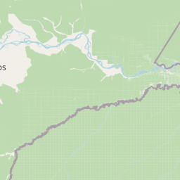
Map view of Yaguas National Park

Use this park location map to pinpoint Yaguas National Park in Peru, understand its exact geographic position, and read its mapped placement within the surrounding landscape more clearly.

Pigeon | © OpenStreetMap contributors

Location context for Yaguas National Park

Loreto Region
Natural feature types

Browse the Full Collection of Natural Features in Yaguas National Park

Use this structured atlas to navigate the diverse natural landmarks and physical terrain within Yaguas National Park. MoriAtlas provides a clear geographic view of the forests, wetlands, and rivers that define this expansive protected zone in the Amazon basin of Peru.
Park atlas

Uncover the regional spread of conserved Amazon basin ecosystems and compare their unique features.

Browse Related National Parks and Protected Areas Surrounding Yaguas National Park

Discover national parks and protected areas in the geographic vicinity of Yaguas National Park, tracing shared Amazonian landscapes and contiguous transboundary conservation efforts. Comparing these protected areas provides essential atlas context, illustrating diverse ecosystems and the extensive reach of regional conservation in the western Amazon basin.
National parkColombia
32 km away#1 closest

Southeast

Amacayacu National Natural Park: Amazonian Flooded Forest and Protected Geography

Explore mapped park boundaries and biodiversity within the Amazon River ecosystem.

Amacayacu National Natural Park is a premier protected area in Colombia, defined by its expansive Amazonian rainforest along the Amazon River. This national park safeguards a complex geography of seasonally flooded forests, river islands, and intact jungle, supporting exceptional biodiversity. Users can explore the mapped extent of Amacayacu National Natural Park, understand its role as a crucial habitat for Amazon river dolphins and primates, and appreciate the dynamic landscape shaped by the river's pulse, all within a comprehensive atlas context.

Area
2,935 km²
Established
1975
IUCN
II
Relief
Lowland
Wildlife reserveLoreto Region
353 km away#2 closest

Northwest

Huimeki Communal Reserve: Amazonian Geography and Protected Forest Atlas

Key wildlife reserve located in the Loreto Region, Peru

Huimeki Communal Reserve stands as a sentinel of the Putumayo basin, protecting vital lowland Amazonian environments. This reserve serves as a crucial link in a wider ecological corridor, preserving habitats that are restricted to this remote northeastern frontier of the Peruvian landscape.

Area
1,412.34 km²
Established
2012
IUCN
VI
Relief
Lowland
Wildlife reserveLoreto Region
353 km away#3 closest

Northwest

Airo Pai Communal Reserve: Protected Wildlife and Amazonian Landscapes in Loreto, Peru

Analyzing the geographic character of this communal wildlife reserve

Airo Pai Communal Reserve serves as a pillar of conservation in the Loreto Region of northern Peru. This wildlife reserve features a complex hydrological mosaic of upland forest, palm-dominated swamps, and periodically flooded lowlands. By protecting these vital ecosystems, the reserve ensures the continuity of both indigenous cultural heritage and the habitats of iconic Amazonian aquatic species.

Area
2,478.88 km²
Established
2012
IUCN
VI
Relief
Lowland
Nature reserveLoreto Region
About 376 km away#4 closest

Southwest

Tapiche Reserve: Geographic and Ecological Overview of a Peruvian Amazon Protected Area

Mapping forest mosaics and blackwater systems in Loreto

Spanning over 18,000 hectares in the Loreto Region, Tapiche Reserve protects a contiguous block of Amazonian forest. The landscape is characterized by its distinct transition from flooded aguajal swamps to well-drained terra firme slopes, all threaded by the acidic, dark waters of the Tapiche River system.

Area
188.03 km²
Relief
Lowland
Climate
Tropical
Access
Remote access
National parkPeru
387 km away#5 closest

Southwest

Sierra del Divisor National Park: Peru's Sacred Amazonian Protected Landmark

Explore dramatic mountain terrain and protected lowland rainforest.

Sierra del Divisor National Park in Peru is a vital protected area conserving over 1.35 million hectares of Amazon rainforest. Characterized by the unique Sierra del Divisor mountain range and the sacred pyramid peak of Cerro El Cono, the park offers a distinct landscape within the broader Amazon basin. As one of Peru's newer national parks, it represents a significant commitment to preserving critical biodiversity corridors and understanding the geographic context of protected lands in a region facing environmental pressures.

Area
13,544.8 km²
Established
2015
IUCN
II
Relief
Mixed relief
National parkPeru
393 km away#6 closest

Northwest

Güeppi-Sekime National Park: Protected National Park Atlas in Peru

Mapped landscape and regional geography of this Amazonian protected area.

Güeppi-Sekime National Park is a prominent protected area in Peru, recognized as a national park safeguarding a substantial expanse of tropical forest. Its landscape is characterized by diverse terrain, including rolling hills and seasonally inundated lowlands, vital for a rich tapestry of flora and fauna. The park's strategic location on the Ecuador border underscores its importance for transboundary conservation and ecological connectivity within the western Amazon basin. This page offers detailed information on its protected area identity, geographic context, and the mapped natural features that define this significant conservation landscape.

Area
2,036 km²
Established
2012
IUCN
II
Relief
Mixed relief
Wildlife reserveSucumbíos
409 km away#7 closest

Northwest

Reserva de Producción de Fauna Cuyabeno: Geography of an Amazonian Wildlife Reserve

Explore protected boundaries and flooded landscape patterns in Sucumbíos

Reserva de Producción de Fauna Cuyabeno serves as a benchmark for Amazonian conservation, characterized by its extraordinary hydrological dynamics. The landscape comprises a network of blackwater rivers and semi-permanent lagoons that sustain an immense variety of species. As a protected area within Sucumbíos, it showcases the intricate relationship between seasonally submerged forests, terra firme terrain, and the vital river arteries that define this region.

Area
5,901.12 km²
Established
1979
IUCN
VI
Visitors
12K annual
National parkEcuador
416 km away#8 closest

West

Yasuní National Park: Ecuador's Protected Landscape and Geographic Atlas Entry

Explore the mapped boundaries and regional terrain of this key national park.

Delve into the atlas-level details of Yasuní National Park, Ecuador's designated national park. This entry provides essential geographic context, focusing on the park's mapped boundaries and its role as a protected landscape within the region. Understand the specific terrain and protected area distribution that makes Yasuní National Park a significant point of geographic interest for atlas exploration.

Area
10,227.4 km²
Established
1979
IUCN
II
Relief
Lowland

Common questions about visiting, size, designation, and location context for Yaguas National Park

Yaguas National Park FAQs for park facts, access, geography, and protected area context

Find quick answers about Yaguas National Park, including protected-area facts, park geography, trail and visitor context, and how the park fits into its surrounding country and regional landscape.
MoriAtlas Explorer

Continue Your Protected Areas Search Across the Global Atlas

Deepen your exploration by continuing the structured search for national parks and protected areas worldwide. Utilize the comprehensive filtering capabilities to compare different conservation landscapes and refine your understanding of global park geography. Discover more about the distribution and characteristics of protected natural areas.

Global natural geography