Why Yanga National Park stands out
Yanga National Park is best known for its exceptional wetland values and waterbird populations. The park contains twelve different wetland types classified under the Ramsar Convention system, making it one of the most ecologically diverse wetland complexes in eastern Australia. It supports some of the largest waterbird breeding colonies on the continent and provides critical habitat for colonial nesting species including ibis, egrets, spoonbills, and cormorants when flood events occur. The park is also significant for protecting the endangered southern bell frog, which represents the largest known population in New South Wales. The extensive river red gum forests along the Murrumbidgee River corridor form a component of the world's largest continuous tract of this iconic Australian tree species.
Yanga National Park history and protected-area timeline
Yanga National Park has a rich European settlement history dating to the 1830s when explorer William Wentworth established the Yanga pastoral station. The property later became part of C.B. Fisher's extensive pastoral empire and at its peak covered approximately 210,000 acres, making it the largest privately owned station in the southern hemisphere. The Yanga homestead was constructed around 1870 and remains standing within the park today as a heritage reminder of the property's pastoral era. Prior to government purchase in 2005, over 90 percent of the land had been used for grazing, with the exception of the 1,932-hectare Yanga Nature Reserve established in 1974 under the National Parks and Wildlife Act 1974. In July 2005, the New South Wales Government announced the purchase of the station for conservation purposes, and the area was officially gazetted as a national park on 28 February 2007. In 2010, Yanga became part of the larger Murrumbidgee Valley National Park, created to protect the interconnected floodplain ecosystem. The park also holds significance for the Muthi Muthi people, whose traditional tribal lands encompass the area, and the NSW National Parks and Wildlife Service maintains an Aboriginal sites register documenting mounds, scarred trees, historic sites, burials, and middens throughout the park.
Yanga National Park landscape and geographic character
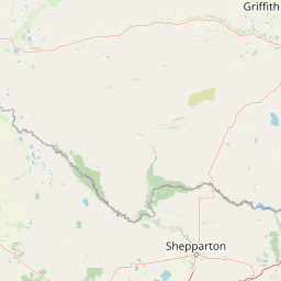
The Yanga National Park landscape is dominated by the extensive Lowbidgee Floodplain, a flat to gently undulating terrain characterized by river channels, lakes, billabongs, and expansive wetlands. The Murrumbidgee River flows through the park for 170 kilometres, with the river red gum forest forming a prominent green corridor along its banks. The floodplain contains four major lakes: Yanga Lake, Tala Lake, Piggery Lake, and Irrigation Lake, alongside numerous smaller water bodies and interconnected waterways. Beyond the river corridor, the landscape transitions into black box woodlands on the floodplain margins and extensive lignum shrubland in the drier zones. The semi-arid setting receives approximately 320 millimetres of rainfall annually, yet the floodplain's hydrology supports permanent wetland vegetation despite the surrounding arid conditions. The flat terrain is broken only by subtle elevation changes as the floodplain rises toward surrounding semi-arid plains, creating a landscape where water, forest, and open woodland intermingle across vast distances.
Yanga National Park ecosystems, habitats, and plant life
The ecological character of Yanga National Park centers on its diverse wetland systems, with twelve different wetland types identified according to the Ramsar Convention classification system including both inland wetlands and human-made wetlands. Seventeen distinct vegetation classes have been recorded within the park, supporting more than 300 plant species. The river red gum forest and woodland represents the dominant vegetation community along the Murrumbidgee corridor, while black box woodland occupies the floodplain margins. Lignum shrubland dominated by Chenopodium nitrariaceum and spike rush sedgeland characterize the wetland margins. The Lowbidgee Floodplain's national environmental significance was recognized through its listing as a Nationally Important Wetland in 2000, acknowledging its exceptional value as a breeding site for waterbirds when flooded and its role in supporting ecological processes throughout the Murray-Darling Basin.
Yanga National Park wildlife and species highlights
Yanga National Park supports remarkable biodiversity across multiple animal groups. The park records 24 reptile species including geckos, goannas, dragons, skinks, snakes, and turtles, while 18 fish species have been documented with European carp dominating many waterways. Thirty-three mammal species occur in the park, including seven introduced species such as red fox, red deer, feral cat, brown hare, rabbit, house mouse, and feral pig. The waterbird fauna is particularly significant, with 64 waterbird species from 14 families recorded in the park. Twelve species listed as vulnerable under the Environment Protection and Biodiversity Conservation Act 1999 have been documented, including the Australasian bittern, freckled duck, and blue-billed duck. The park supports the largest known population of the endangered southern bell frog in New South Wales, a species that has declined dramatically across its former range in southeastern Australia since the early 1980s. Eleven migratory bird species protected under international agreements including JAMBA, CAMBA, and ROKAMBA regularly use the wetlands, including Caspian tern, Latham's snipe, cattle egret, and black-tailed godwit.
Yanga National Park conservation status and protection priorities
Yanga National Park plays a crucial role in protecting some of Australia's most significant wetland ecosystems within the Murray-Darling Basin. The park forms part of a Nationally Important Wetland and supports two endangered ecological communities under New South Wales law: Myall woodland and an aquatic ecological community in the natural drainage system of the lower Murray River catchment. Twenty-one endangered or vulnerable fauna species have been recorded within the park, alongside two endangered and two vulnerable flora species. The park's protection addresses major conservation threats including habitat loss from historical grazing, altered flow regimes from river regulation, and impacts from introduced species. Environmental watering programs have delivered over 200,000 megalitres of water to the wetlands since 2005, achieving remarkable ecological recovery in flood-dependent vegetation communities and supporting threatened species populations. The establishment of the park ended destructive land management practices including grazing, clearing, logging, and burning that had degraded the floodplain ecosystem.
Yanga National Park cultural meaning and human context
Yanga National Park lies within the traditional tribal areas of the Muthi Muthi people, whose cultural connection to the landscape predates European settlement by thousands of years. The NSW National Parks and Wildlife Service has developed an Aboriginal sites register covering the park that documents various heritage features including mounds, scarred trees, historic sites, burials, and middens, reflecting the long history of Aboriginal occupation and land use in the area. The Service maintains a statutory role in the protection and preservation of these Aboriginal sites. The park also holds significance for early European exploration and settlement in the region, with the Yanga homestead built around 1870 still standing as a reminder of the pastoral era when this was the largest privately owned station in the southern hemisphere.
Top sights and standout views in Yanga National Park
The Yanga National Park experience centers on its extraordinary wetland wilderness in an otherwise semi-arid landscape. Visitors can explore extensive river red gum forests along the Murrumbidgee River, where the Mamanga campground provides access to the waterway. The park's wetland systems support exceptional birdwatching opportunities, with colonial nesting waterbirds including ibis, egrets, spoonbills, and cormorants breeding in the lignum floodways and flooded forest areas. The four major lakes, particularly Yanga Lake, provide permanent water bodies supporting diverse waterbird populations year-round. The park's recent establishment in 2007 and incorporation into the larger Murrumbidgee Valley National Park in 2010 means the ecosystem is in active recovery through environmental watering programs that have restored areas not flooded since the late 1980s.
Best time to visit Yanga National Park
The optimal time to experience Yanga National Park depends on water conditions, which vary significantly between years based on rainfall and environmental water deliveries. Spring and autumn typically offer the most comfortable temperatures for outdoor exploration, with mild days and cooler nights. The park's wildlife viewing is particularly rewarding following periods of flooding, when waterbird breeding colonies become active and the landscape transforms with abundant water and lush vegetation. Summer months can be extremely hot with temperatures regularly exceeding 40 degrees Celsius, while winters are mild but the park's wetlands may be at their driest. Visitors interested in waterbird observation should monitor conditions, as the park's ecological character depends on wet periods to support the breeding cycles that make this area so significant for colonial waterbird species.