Mori Atlas logo
National parkYorkshire Dales National Park

Discover the limestone valleys, moorlands, and unique terrain within this North Yorkshire national park.

Yorkshire Dales National Park: Mapped Protected Landscape and Geographic Atlas

Yorkshire Dales National Park stands as a significant protected landscape within North Yorkshire, England. This MoriAtlas entry provides a structured view of its geographic scope, showcasing its distinctive limestone valleys, sweeping moorlands, and the intricate patterns of dry-stone walls that define its character. Users can explore the park's mapped boundaries and understand its place within the broader regional geography, offering a detailed atlas perspective on this iconic natural area.

National ParkLimestone LandscapeWalking DestinationUpland MoorsDark Sky ReservePastoral Landscape

Yorkshire Dales National Park

National park

Park overview

Structured park overview, official facts, and landscape profile for Yorkshire Dales National Park

Yorkshire Dales National Park park facts, protected area profile, and essential visitor context
Review the core facts for Yorkshire Dales National Park, including designation, size, terrain, visitor scale, habitats, and operating context in one park-focused overview.

About Yorkshire Dales National Park

Yorkshire Dales National Park protects one of Britain's most emblematic rural landscapes, a terrain of limestone crags, green valleys, and open moorland that has shaped both the region's ecology and its cultural identity. The park encompasses the core of the Yorkshire Dales, a collection of valleys that radiate eastward from the Pennine watershed, along with the Howgill Fells and Orton Fells in the north-west that share similar geological and landscape character. The underlying Carboniferous limestone creates a landscape of exceptional geological interest, with cave systems, sinkholes, and karst features woven throughout the terrain. Above the limestone, younger Millstone Grit forms the higher moorland summits and plateaus, creating a diverse mosaic of habitats from flower-rich grasslands to wild upland heaths. The human imprint on this landscape is profound, with centuries of pastoral farming creating the field patterns, barns, and dry-stone walls that define the Dales character. Five visitor centers at Aysgarth Falls, Grassington, Hawes, Malham, and Reeth provide orientation and interpretation for the millions who visit each year. The park's economy revolves around tourism and agriculture, with farm diversification and visitor services supporting rural communities that have lived in these dales for generations.

Quick facts and research context for Yorkshire Dales National Park

Yorkshire Dales National Park is located about 50 miles north-east of Manchester, with major towns like Leeds, Bradford, and Harrogate situated to the south and southeast. The park was established in 1954 and expanded westward in 2016, increasing its area by nearly 24 percent. The highest point is Whernside at 736 meters above sea level, one of the famous Yorkshire Three Peaks. The park contains an extensive network of long-distance walking routes including the Pennine Way, Dales Way, and Coast to Coast Walk. More than four million visitors explore the park annually, drawn by its famous walking opportunities, geological features, and traditional rural character.

Park context

Deeper park guide and search-rich context for Yorkshire Dales National Park

Yorkshire Dales National Park history, landscape, wildlife, and travel context
Explore Yorkshire Dales National Park through its history, landscape character, ecosystems, wildlife, conservation priorities, cultural context, and seasonal travel timing in a structured park guide built for atlas discovery and search intent.

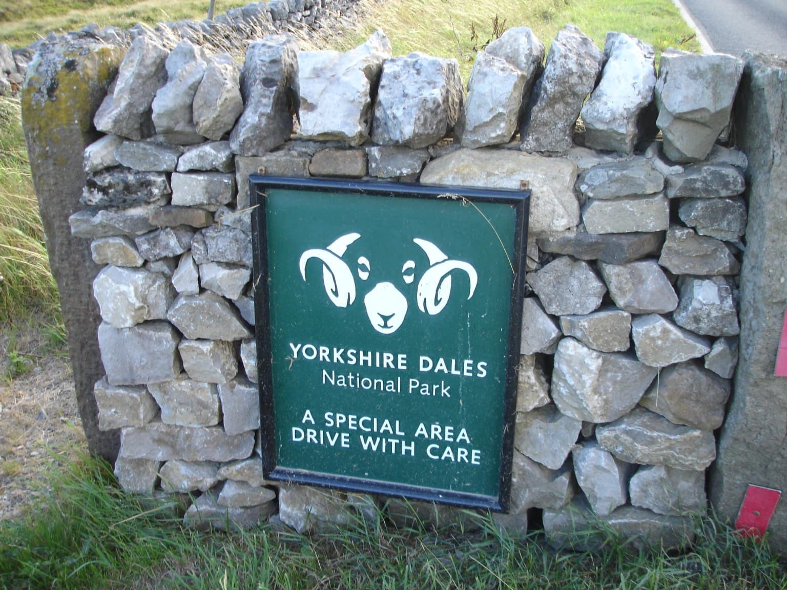
Why Yorkshire Dales National Park stands out

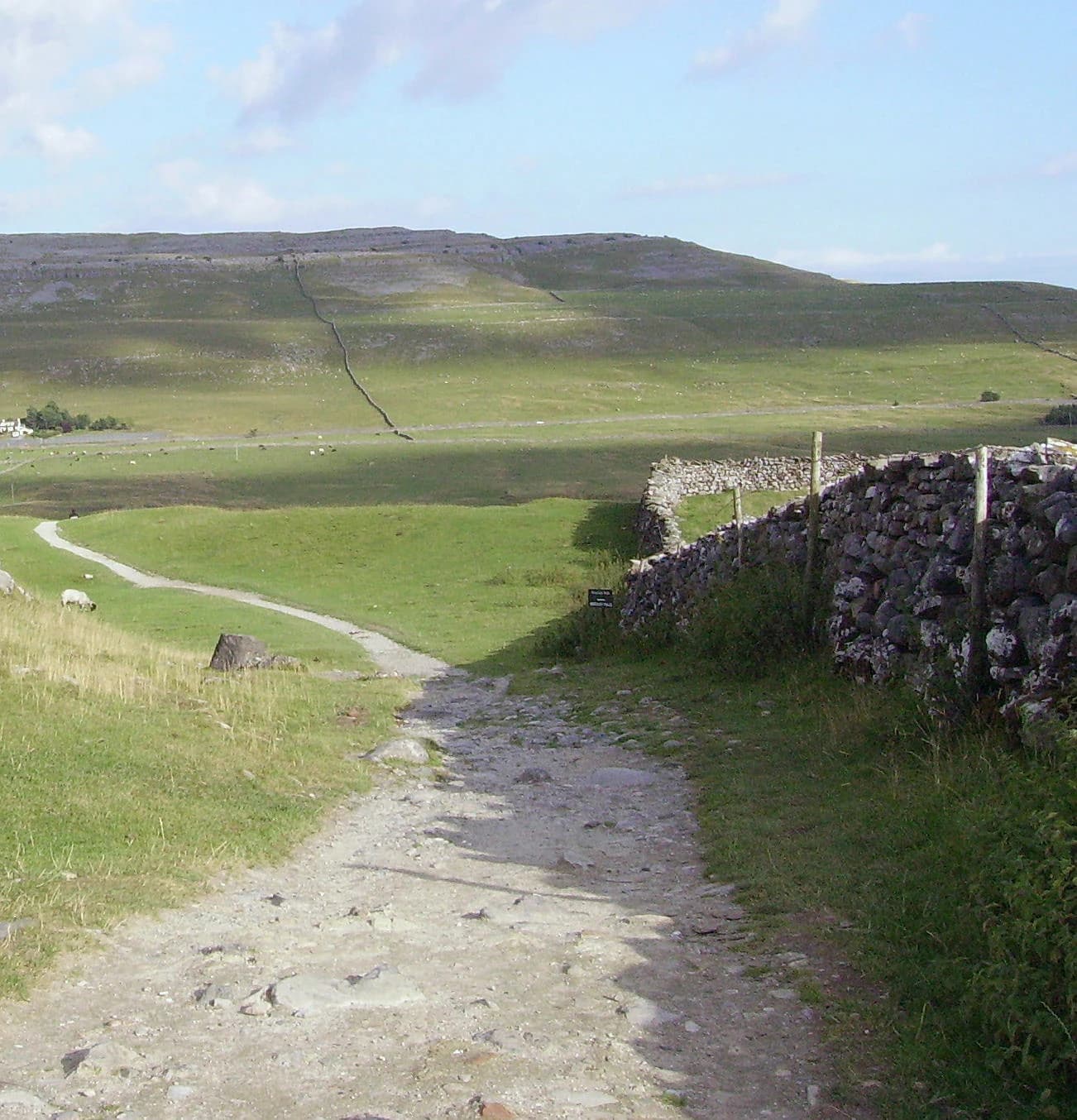
Yorkshire Dales is best known for its distinctive limestone terrain, characterized by dramatic valleys, sweeping pavements, and natural arches. The Yorkshire Three Peaks, Ingleborough, Pen-y-ghent, and Whernside, form one of the most celebrated walking challenges in Britain. The park's network of scenic dales including Wensleydale, Wharfedale, and Swaledale showcase the classic U-shaped valleys carved by glaciation. Waterfalls such as Hardraw Force, Aysgarth Falls, and Cautley Spout are major attractions, while geological wonders like Malham Cove and Gaping Gill demonstrate the park's karst landscape. The area is equally famous for its dry-stone walls, traditional stone villages, and the heritage railway lines that traverse this historic landscape.

Yorkshire Dales National Park history and protected-area timeline

The Yorkshire Dales National Park emerged from post-war planning efforts to protect England's finest landscapes. The 1947 Hobhouse Report recommended creating a national park covering parts of the West Riding and North Riding of Yorkshire, though notably excluding Nidderdale which was instead designated an Area of Outstanding Natural Beauty. The park was formally established in 1954, one of the later additions to the initial wave of national parks created in the 1950s. Following the Local Government Act 1974, most of the park transferred to the new county of North Yorkshire, while Dentdale, Garsdale, and Sedbergh moved to Cumbria. Management of the park passed from county councils to the Yorkshire Dales National Park Authority in 1997, providing dedicated stewardship for this protected landscape. A significant milestone came in 2016 when the park expanded westward into Lancashire and Westmorland, adding land between the original boundaries and the M6 motorway. This extension brought the Howgill Fells and most of the Orton Fells within the park, increasing the total area by nearly 24 percent and extending the park's reach toward towns like Kirkby Lonsdale and Kirkby Stephen. The park's cultural prominence received a modern boost when the 2020 television series All Creatures Great and Small, filmed extensively in the Dales, drove increased visitor interest.

Yorkshire Dales National Park landscape and geographic character

The Yorkshire Dales landscape presents a dramatic interplay of limestone and gritstone terrain shaped by glacial processes. The characteristic dales are U-shaped valleys carved by ancient glaciers, with rivers now winding along their floors through meadows and woodland. The limestone areas feature spectacular rock formations including vertical cliffs, natural arches, and limestone pavements where the bedrock has been eroded into distinctive grike patterns. Malham Cove, a massive curved limestone cliff rising 80 meters high, and Gordale Scar, a narrow gorge with waterfalls, rank among the most impressive natural landmarks. Gaping Gill, one of Britain's largest caverns, swallows a stream before dropping 110 meters into the cavern floor. The higher ground consists of gritstone moors and heath, with peat soils supporting characteristic upland vegetation. The park contains notable waterfalls throughout, from the multi-tiered Aysgarth Falls in Wharfedale to Hardraw Force in Wensleydale, which drops 100 meters in a single drop. The Yorkshire Three Peaks—Ingleborough, Pen-y-ghent, and Whernside—form the distinctive skyline of the western dales, each rising above 700 meters with their characteristic profiles visible across the park.

Yorkshire Dales National Park ecosystems, habitats, and plant life

The Yorkshire Dales supports a remarkable diversity of habitats reflecting its geological variety and climate. Limestone grasslands on the valley slopes and crags support some of Britain's richest wildflower meadows, with rare species including spring gentian, rock rose, and mountain avens in appropriate locations. The dales woodlands, though limited in extent, provide important habitat for birds and mammals, while the rivers and streams support populations of Atlantic salmon and brown trout. Blanket bog and wet heath dominate the higher elevations, with characteristic plants like cottongrass and cross-leaved heath thriving in these nutrient-poor conditions. The park's rivers—including the Wharfe, Ouse, and Lune—drain eastward to the North Sea, with the Wharfe being one of the longest rivers in Yorkshire. Geological interest extends beyond surface features to important cave systems that provide habitat for specialist invertebrates and hibernating bats. The designation as an International Dark Sky Reserve in 2020 recognized the park's low light pollution and excellent conditions for astronomical observation, linking dark sky conservation to broader ecological protection.

Yorkshire Dales National Park wildlife and species highlights

The Yorkshire Dales supports characteristic upland and woodland wildlife within its varied habitats. Upland areas provide nesting habitat for birds including golden plover, curlew, and merlin, while peregrine falcons nest on cliff ledges throughout the limestone areas. Red grouse inhabit the heather moorlands, and the park's streams and rivers support breeding populations of dipper and grey wagtail. Woodland areas, though fragmented, host populations of tawny owl, buzzard, and woodcock, while the hedgerows and field margins support breeding songbirds including yellowhammer and lapwing in declining farmland habitats. Mammals present include roe deer in the woodlands, while the park's moorlands support populations of mountain hare and, in some areas, reintroduced species. Bat species including pipistrelle, Daubenton's, and brown long-eared bats roost in the cave systems and old buildings. The rivers support populations of Atlantic salmon and sea trout that migrate from the sea to spawn in the clean gravel beds of the dales streams, though populations have declined from historic levels.

Yorkshire Dales National Park conservation status and protection priorities

Yorkshire Dales National Park plays a vital role in conserving both wildlife habitats and traditional agricultural landscapes. The park's designation as an International Dark Sky Reserve in 2020 added nocturnal environment protection to its conservation mandate, recognizing the ecological and cultural importance of dark skies. Habitat management focuses on maintaining species-rich grasslands through traditional grazing practices, while restoration efforts work to recover damaged peat bogs and improve water quality in the river systems. The park authority works with farmers to maintain the dry-stone walls, hedgerows, and field patterns that define the Dales character while supporting viable agricultural businesses. Conservation priorities include protecting the special features of the limestone pavement habitats, managing visitor pressure on sensitive sites, and maintaining the ecological connectivity of habitats across the farmed landscape. The park's cultural landscape, shaped by generations of pastoral farming, is itself a conservation priority, recognizing that the natural and cultural elements are inseparable in this living landscape.

Yorkshire Dales National Park cultural meaning and human context

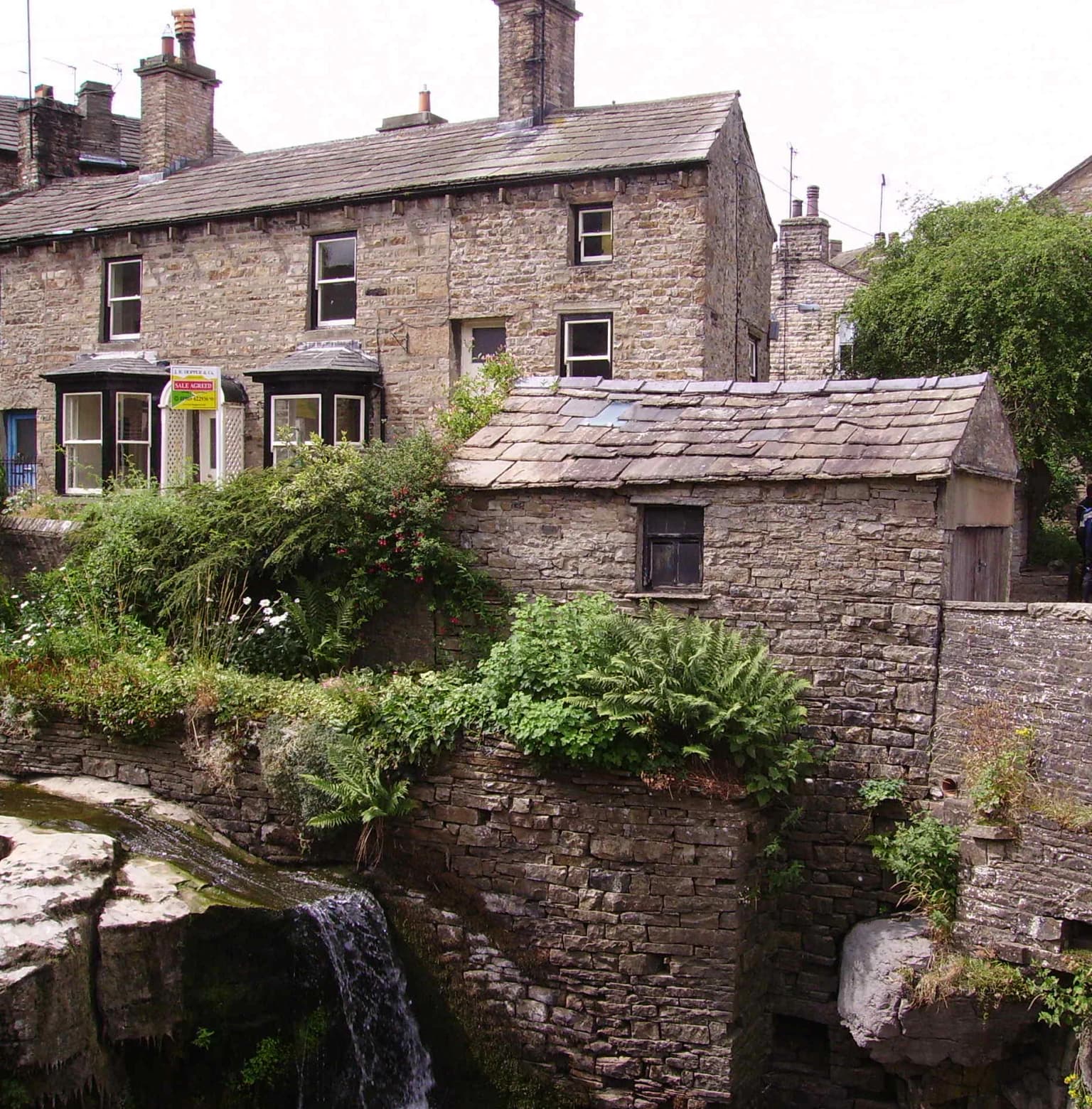
The Yorkshire Dales carries deep cultural significance as a traditional pastoral landscape shaped by centuries of farming. The distinctive dry-stone walls that pattern the hillsides represent an ancient craft tradition, with walls built without mortar to divide fields and contain livestock. The villages throughout the dales—Hawes, Grassington, Reeth, Settle, and many others—feature traditional stone buildings that reflect local building materials and architectural styles developed over generations. Medieval landmarks including Bolton Castle, a 14th-century fortification in Wensleydale, provide historical anchors within the landscape. The area's literary connections include associations with the romantic poetry of William Wordsworth and the more recent cultural resonance of James Herriot's All Creatures Great and Small, whose television adaptation filmed extensively in the Dales in 2020. Traditional agricultural events including sheep shows and agricultural fairs continue to form part of the annual calendar, maintaining connections to the pastoral heritage that defines the Dales identity.

Top sights and standout views in Yorkshire Dales National Park

Yorkshire Dales offers exceptional walking with trails ranging from gentle valley walks to demanding peak scrambles. The Yorkshire Three Peaks walk, covering approximately 40 kilometers and circling the three main peaks of Ingleborough, Pen-y-ghent, and Whernside, represents one of Britain's classic long-distance challenges. The Pennine Way traverses the park from south to north, following the backbone of England through some of the most remote and scenic terrain. Geological attractions include Malham Cove's limestone cliff, Gaping Gill's deep cavern, and the cave systems accessible to guided tours. The Settle to Carlisle Railway, featuring the impressive Ribblehead Viaduct, provides an alternative way to experience the landscape. Traditional villages like Hawes, with its connection to Wensleydale cheese production, and the scenic drives through each major dale offer less demanding ways to appreciate the park's character.

Best time to visit Yorkshire Dales National Park

The Yorkshire Dales can be enjoyed throughout the year, though each season offers distinct experiences. Spring brings new life to the landscape as lambs appear in the fields and wildflowers bloom across the limestone grasslands, with longer days encouraging extended walks. Summer provides the warmest conditions for walking and the longest daylight hours, though this is also the busiest period, particularly around school holidays. Autumn offers perhaps the most atmospheric conditions, with the moors turning to purple heather in August and September, morning mists filling the valleys, and fewer visitors on the trails. Winter transforms the landscape, with snow often capping the higher peaks while lower dales remain accessible, though daylight hours are limited and some facilities may have reduced hours. The dark sky reserve status makes autumn and winter particularly good times for stargazing, with the clear skies and longer nights providing optimal conditions for astronomical observation.

Park location guide

Geography guide, regional context, and park location map for Yorkshire Dales National Park

Yorkshire Dales National Park park geography, regions, and map view in United Kingdom
Understand where Yorkshire Dales National Park sits in United Kingdom through a broader geographic reading of the surrounding landscape, nearby location context, and its mapped position within the national park landscape.

How Yorkshire Dales National Park fits into United Kingdom

The United Kingdom is a parliamentary constitutional monarchy located in northwestern Europe, consisting of four constituent countries: England, Scotland, Wales, and Northern Ireland. As a major global power with over 69 million residents, it maintains significant international influence in politics, economics, and culture.

Wider geography shaping Yorkshire Dales National Park in United Kingdom

The United Kingdom is an island nation located in northwestern Europe, surrounded by the Atlantic Ocean, North Sea, English Channel, Celtic Sea, and Irish Sea. It shares a land border with the Republic of Ireland to the west. The territory includes the island of Great Britain, the northeastern portion of Ireland, and most of the smaller British Isles islands.

Map view of Yorkshire Dales National Park

Use this park location map to pinpoint Yorkshire Dales National Park in United Kingdom, understand its exact geographic position, and read its mapped placement within the surrounding landscape more clearly.

Pigeon | © OpenStreetMap contributors

Location context for Yorkshire Dales National Park

CumbriaNorth Yorkshire
Park atlas

Trace the Mapped Geography of Protected Areas and Compare Landscapes Surrounding Yorkshire Dales National Park

Explore Other National Parks and Protected Landscapes Near Yorkshire Dales National Park
Browse a detailed atlas of national parks and other protected areas found within the broader geographic region surrounding Yorkshire Dales National Park. Compare distinct upland moorlands, limestone formations, and traditional pastoral landscapes, gaining broader regional context and protected-area insights.
National parkCumbria

Lake District National Park: Protected Landscape Atlas and Geographic Exploration

Mapped mountain terrain and glacial valleys in Cumbria

Delve into the geography of Lake District National Park, a protected area renowned for its dramatic mountainous terrain, U-shaped glacial valleys, and stunning natural lakes. This atlas perspective highlights the park's unique landscape features, mapped boundaries, and its significance within Cumbria, offering a comprehensive view for geographic discovery.

Area
2,292 km²
Established
1951
IUCN
V
Relief
Mountain
Watercolor illustration showing rolling hills, green vegetation, and a pale sky
National parkNorth Yorkshire

North York Moors National Park: Explore its Protected Landscape and Geography

Discover mapped moorland, dales, and coastlines.

The North York Moors National Park is a vital protected landscape in North Yorkshire, celebrated for its extensive heather moorland and distinctive deeply incised dales. This page provides an atlas-style exploration of the park's geography, highlighting its unique terrain, mapped boundaries, and its integral role within the regional landscape context. Understand the diverse natural features that define this iconic national park, from the upland plateau to the dramatic Jurassic coast.

Area
1,430 km²
Established
1952
IUCN
V
Relief
Upland
National parkUnited Kingdom

Peak District National Park: Explore Protected Landscape and Regional Geography

Mapped boundaries and natural terrain context for this UK national park.

Investigate the Peak District National Park, a cornerstone of the United Kingdom's protected natural areas. This MoriAtlas entry provides essential details on its geographic scope, mapped boundaries, and landscape characteristics. Engage with structured data to understand how this national park fits into the atlas of the United Kingdom, supporting detailed geographic and protected-area discovery for researchers and explorers.

Area
1,440 km²
Established
1951
IUCN
V
National parkNorthumberland

Northumberland National Park: England's Northernmost Protected Landscape and Dark Sky Wilderness

Explore its mapped boundaries, Roman heritage, and remote moorland terrain.

Northumberland National Park protects over 1,050 square kilometers of remote and stunning natural beauty in northern England, bordering Scotland. This page provides a structured overview of its protected landscape, focusing on its geographic context within the county of Northumberland, its designation as a National Park, and its renowned status as Europe's largest Dark Sky Park. Users can discover the park's characteristic moorland terrain, the archaeological significance of Hadrian's Wall, and the vast expanses of Kielder Forest, offering an atlas-level understanding of this unique frontier landscape.

Area
1,050 km²
Established
1956
IUCN
V
Relief
Highland
National parkWales

Snowdonia National Park: Protected Landscape and Map Exploration in North Wales

Mountain terrain, glacial lakes, and regional geography.

Snowdonia National Park offers a profound exploration of mountainous protected landscapes in North Wales. This page details the park's mapped boundaries, revealing a terrain shaped by glaciation, featuring dramatic peaks like Snowdon, steep valleys, and pristine glacial lakes. Understand its geographic identity within the United Kingdom and how its protected status contributes to the regional landscape context, providing a unique focus for atlas-based discovery.

Area
2,142 km²
Established
1951
Relief
Mountain
Climate
Temperate
Watercolor illustration showing mountains, green forests, a loch, and a river in a landscape
National parkScotland

Loch Lomond and The Trossachs National Park: Scotland's National Park Atlas and Protected Landscape

Mapping Scotland's Highland Boundary Fault and diverse natural terrain.

As Scotland's first national park, Loch Lomond and The Trossachs National Park offers a prime example of a protected landscape shaped by significant geological features. This atlas entry highlights its strategic location along the Highland Boundary Fault, which delineates distinct highland and lowland terrains. Users can explore the park's extensive network of lochs, including Loch Lomond, its mountainous Munros, and its native woodland ecosystems, providing a rich geographic context for discovery.

Area
1,865 km²
Established
2002
IUCN
V
Visitors
2.9M annual
National parkWales

Brecon Beacons National Park: Explore Wales' Iconic Protected Mountain Landscape

Discover mapped terrain, park boundaries, and regional geography.

Brecon Beacons National Park, officially Bannau Brycheiniog, stands as a premier protected area within Wales, covering over 1,344 square kilometers of striking mountainous terrain. This national park is defined by its dramatic Old Red Sandstone ranges, including Pen y Fan, South Wales' highest peak, and features diverse landscapes from heather moorland to extensive river valleys. Its mapped boundaries encompass unique geological features, significant historical sites, and provide context for regional geographic exploration, making it a key destination for understanding protected lands in the UK.

Area
1,344 km²
Established
1957
IUCN
V
Visitors
4.4M annual
Watercolor illustration of a landscape with mountains, a lake, and trees
National parkCounty Wicklow

Wicklow Mountains National Park: Protected Landscape and Geographic Atlas Mapping

Explore County Wicklow's mapped natural terrain and park boundaries.

Understand the geographic scope and protected landscape identity of Wicklow Mountains National Park. This page offers detailed information on its mapped boundaries and its context within County Wicklow, providing a foundation for atlas-based discovery of Ireland's natural areas. Explore how this national park contributes to the region's mapped geography and conservation landscapes.

Area
205 km²
Established
1991
IUCN
II
Relief
Mountain

Common questions about visiting, size, designation, and location context for Yorkshire Dales National Park

Yorkshire Dales National Park FAQs for park facts, access, geography, and protected area context
Find quick answers about Yorkshire Dales National Park, including protected-area facts, park geography, trail and visitor context, and how the park fits into its surrounding country and regional landscape.
MoriAtlas Explorer

Continue Your Protected Areas Search Across the Global Atlas

Deepen your exploration by continuing the structured search for national parks and protected areas worldwide. Utilize the comprehensive filtering capabilities to compare different conservation landscapes and refine your understanding of global park geography. Discover more about the distribution and characteristics of protected natural areas.

Global natural geography