Mori Atlas logo
National parkZov Tigra National Park

Navigate the mapped boundaries and regional geography of this important Russian national park.

Zov Tigra National Park: Protected Landscape Atlas and Geographic Context in Primorsky Krai

Zov Tigra National Park stands as a key protected area within the vast geography of Primorsky Krai, Russia. This page offers an atlas-driven exploration of its specific location, mapped natural landscapes, and protected boundaries. Understand how Zov Tigra National Park fits into the regional context and discover its significance as a national park through structured geographic data and visual mapping tools.

tiger conservationmountain parksprotected areasRussian Far EastSikhote-Alinbroadleaf forests
Stylized illustration of a mountainous landscape with pine trees, a waterfall, and a sun in the sky

Zov Tigra National Park

National park

Park overview

Structured park overview, official facts, and landscape profile for Zov Tigra National Park

Zov Tigra National Park park facts, protected area profile, and essential visitor context
Review the core facts for Zov Tigra National Park, including designation, size, terrain, visitor scale, habitats, and operating context in one park-focused overview.

About Zov Tigra National Park

Zov Tigra National Park occupies a remarkable position in the Sikhote-Alin mountains, a range that runs north-south through Primorsky Krai along Russia's Pacific coast. The park's location at the southern end of this mountain range places it at a significant ecological crossroads, where warm waters of the Sea of Japan meet continental climate patterns and where species from temperate and subtropical zones overlap. The southern end of Primorsky was not glaciated during the most recent ice age, creating conditions that allowed for the survival and evolution of diverse plant and animal species. This geological history, combined with the park's position between continental Asia and the Pacific Ocean, has resulted in the highest biodiversity levels found anywhere in Russia.

The terrain is rugged and challenging, with steep mountain slopes, narrow river canyons, and limited access points. Only a few former logging roads approach the park, and even these can become impassable during certain seasons. The park contains significant water systems, including tributaries of the Ussuri River that flow northward to the Amur River and the Milogradovka River system that flows south to the Sea of Japan. The elevation differential from valley floors at 155 meters to peak elevations at 1,854 meters creates distinct vegetation zones across the park's extent.

Access to the park is restricted, reflecting its conservation priorities. Visitors must submit applications in advance and may only enter designated recreation areas in the company of park rangers. The areas open to tourism are limited corridors to major attractions such as waterfalls and mountain viewpoints, and facilities remain minimal. This approach ensures that the park's primary function as a wildlife refuge takes precedence over visitor recreation.

Quick facts and research context for Zov Tigra National Park

Zov Tigra National Park lies in the Lazovsky District of Primorsky Krai in the Russian Far East, occupying the southern highlands of the Sikhote-Alin mountain range. The terrain is rugged and isolated, with 56 peaks exceeding 1,000 meters and the highest point at Mount Cloud at 1,854 meters above sea level. The park contains the headwaters of the Ussuri River, which flows northward to the Amur River system, while the Milogradovka River flows south to the Sea of Japan. The park was established in 2007 and was consolidated with the Lazovsky Nature Reserve in 2014, creating a larger contiguous protected area extending southward. The climate is humid continental with warm summers, featuring significant temperature differences between the cooler northern sections and milder southern portions.

Park context

Deeper park guide and search-rich context for Zov Tigra National Park

Zov Tigra National Park history, landscape, wildlife, and travel context
Explore Zov Tigra National Park through its history, landscape character, ecosystems, wildlife, conservation priorities, cultural context, and seasonal travel timing in a structured park guide built for atlas discovery and search intent.

Why Zov Tigra National Park stands out

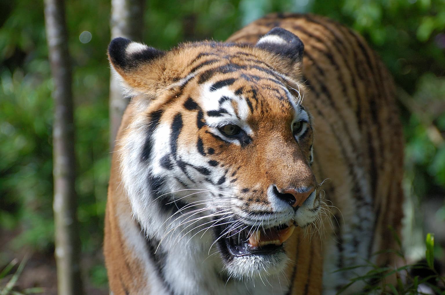
Zov Tigra is best known as a protected refuge for the Amur tiger, also called the Siberian tiger, one of the rarest and most endangered big cats in the world. The park's designation as a tiger conservation area reflects its role as source habitat supporting both resident tigers and transient individuals moving through the region. The park also protects one of Primorsky's highest peatlands and contains ecological zones where temperate and subtropical species coexist in unusual combinations due to the region's unique position at the meeting point of continental and maritime influences at approximately 45 degrees north latitude.

Close-up of an Amur tiger with orange and black stripes, white chest, and distinctive facial markings standing in a forest
Amur tiger (Panthera tigris altaica) in a forested environment

Zov Tigra National Park history and protected-area timeline

Zov Tigra National Park was established on June 2, 2007, with the specific purpose of protecting habitat for the endangered Amur tiger and its prey species. The park was created in response to conservation concerns about tiger populations in the Russian Far East, where habitat loss and poaching had threatened the species' survival. The establishment of the park represented an expansion of protected area coverage in a region already known for its biological significance.

In 2014, the administration of Zov Tigra was consolidated with the adjacent Lazovsky Nature Reserve, which extends protection southward from the park and covers approximately 120,000 hectares. This consolidation created a larger contiguous protected area that supports tiger populations moving between the two reserves. Between these protected areas exists a small area managed by a private hunting club. The merged administration allows for more coordinated conservation management across the broader landscape.

The region contains archaeological evidence of human occupation dating to the 12th-century Jurchen Empire, with fortified towns and villages located near the park's boundaries. These sites remain incompletely investigated and represent potential cultural heritage significance within the broader landscape context.

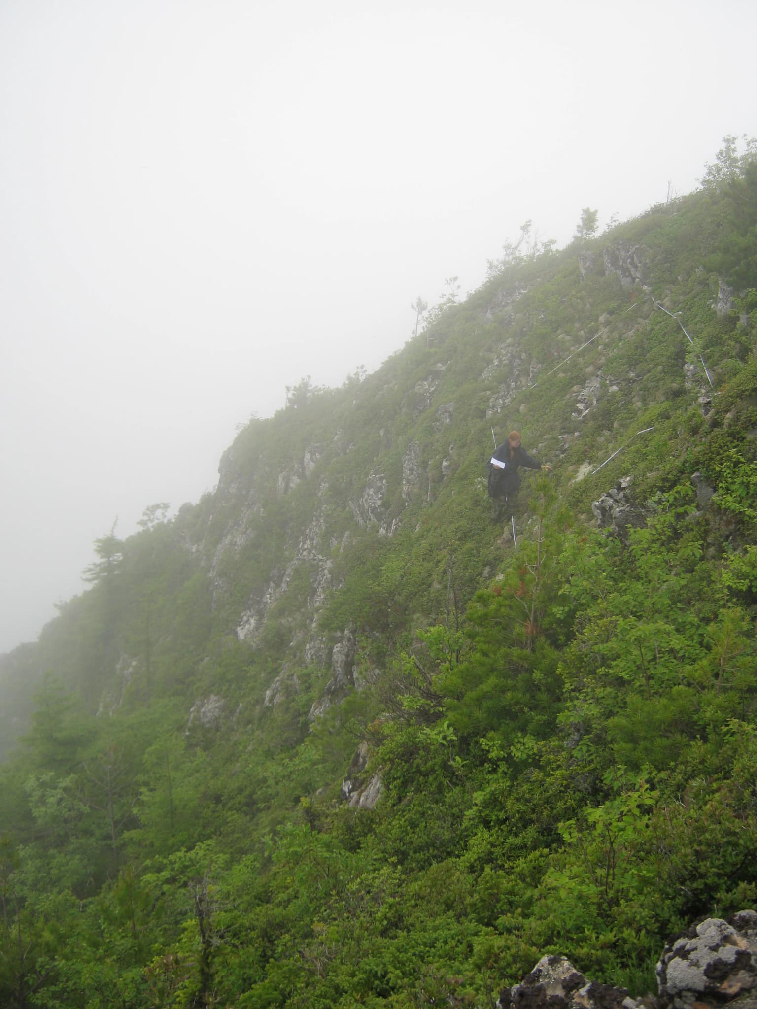
Zov Tigra National Park landscape and geographic character

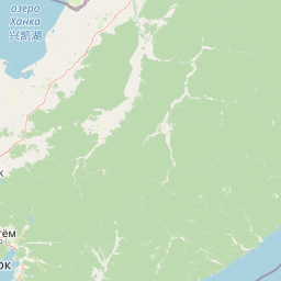
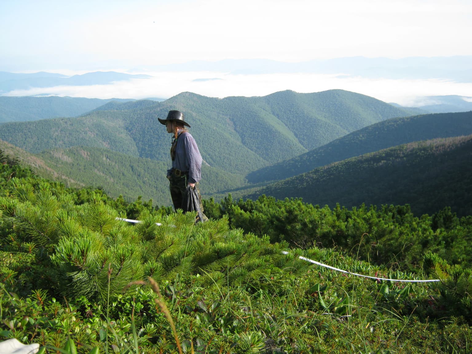
The landscape of Zov Tigra is characterized by the mountainous terrain of the southern Sikhote-Alin range, featuring steep ridges, narrow valleys, and rapid-flowing rivers that drop through canyons with significant rapids. The mountains are medium in height, with 56 peaks exceeding 1,000 meters and the highest point, Mount Cloud, rising to 1,854 meters above sea level. Valley floors reach as low as 155 meters, creating elevation differentials exceeding 1,200 meters between valley and peak.

The park contains the headwaters of two significant river systems. The upper reaches of the Ussuri River flow northward through the park before joining the Amur River system, while the Milogradovka River flows southward to the Sea of Japan. These rivers drop quickly through narrow canyons, and spring rains can cause sudden flooding conditions. The park also contains Primorsky's highest peatland, a large bog area of approximately 4-6 kilometers by 1.5-2 kilometers on the upper Ussuri/Milogradovka watershed.

The terrain is heavily forested and difficult to access. Former logging roads approach the park from limited directions, and even these routes can become impassable during wet seasons. The combination of rugged topography, dense forest cover, and limited access has helped preserve the area from extensive human development.

A person standing on a grassy hillside with dense green vegetation, overlooking a valley with rolling mountains under a partly cloudy sky
A person observing the mountainous landscape of Zov Tigra National Park with dense vegetation and rolling ridges under a partly cloudy sky

Zov Tigra National Park ecosystems, habitats, and plant life

Zov Tigra lies within the Ussuri broadleaf and mixed forests ecoregion, an area characterized by wide daily and annual temperature variations and continuous forest cover. The park's position at approximately 45 degrees north latitude places it at a remarkable ecological meeting point, where continental and maritime climate influences converge and where species from both temperate and subtropical zones overlap. This positioning, combined with the region's escape from recent glaciation, has produced the exceptional biodiversity that makes Primorsky Krai the most biodiverse region in Russia.

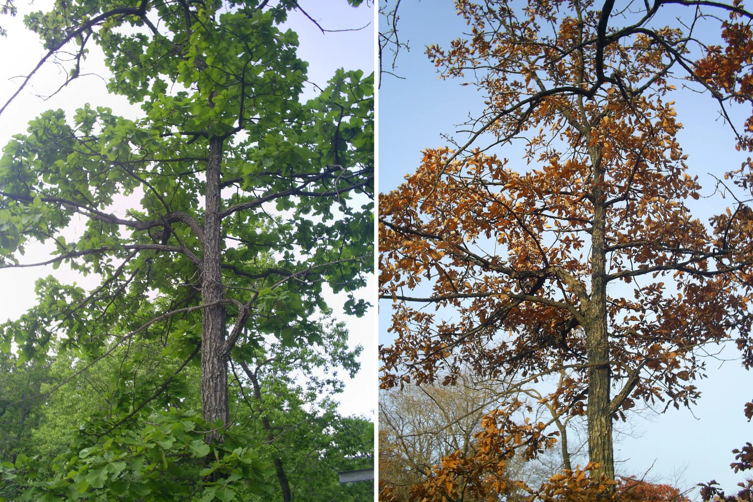
Vegetation follows distinct altitude zones across the park. Below 600 meters, the valleys and lower slopes support mixed forests of coniferous and broad-leafed trees, with oak forest belts in the milder southern areas. From 600 to 1,100 meters, fir-spruce forests predominate, often covered with epiphytic mosses and lichens. Above 1,100 meters, subalpine shrubs and firs give way to alpine meadows at the highest elevations. The region supports over 2,500 plant species, with 343 vulnerable plant species and 55 fungal species recorded in the Primorsky region's Red Book of rare and threatened species.

Two side-by-side images of a tall tree with green foliage on the left and brown-orange foliage on the right
Mongolian Oak tree in green foliage (June) and brown-orange foliage (October) within Zov Tigra National Park

Zov Tigra National Park wildlife and species highlights

Zov Tigra was established specifically to serve as source habitat for Amur tiger recovery, and the park supports a small but significant population of these endangered cats. A 2012 survey identified four Amur tigers permanently resident within the park, with an additional four individuals regularly visiting the protected areas. The tiger population depends on a healthy prey base, and census data shows approximately 1,200 Manchurian wapiti, 800 roe deer, 99 sika deer, and 189 wild boar supporting the predator population. These ungulates constitute roughly 85 percent of the Amur tiger's diet, making prey species conservation integral to tiger recovery efforts.

Beyond tigers, the park supports diverse mammal populations including Ussuri brown bears at densities of 0.4-0.5 individuals per 10 square kilometers, lynx at similar densities, and Far Eastern forest cats in the broadleaf and oak valleys. The critically endangered Amur leopard, once present in the region, has not been resident since the 1970s, though conservation efforts aim to support potential recolonization as protection levels increase. The park's position on major migration routes also contributes to its significance for migratory bird species.

Foggy mountain slope with dense green vegetation and a hiker ascending a trail
Hiker ascending a foggy mountain slope within Zov Tigra National Park

Zov Tigra National Park conservation status and protection priorities

Zov Tigra represents one of Russia's most important tiger conservation areas, functioning as both protected habitat and ecological corridor for Amur tigers moving between protected landscapes. The park's designation as a national park under IUCN category II reflects its dual role in ecosystem protection and species recovery. Tigers serve as an umbrella species, meaning that successful conservation of tigers and their habitat also protects the numerous other species that share these ecosystems.

The primary threats to wildlife include poaching, forest fires, and historical logging pressure. Park management, in collaboration with conservation organizations, has strengthened anti-poaching patrols and enforcement efforts. The consolidation with Lazovsky Nature Reserve in 2014 expanded the protected landscape and improved connectivity between tiger habitats. The park's restricted access policy, requiring advance applications and ranger accompaniment for visitors, reflects a management philosophy that prioritizes species protection over tourism development.

Zov Tigra National Park cultural meaning and human context

While Zov Tigra is primarily valued for its ecological significance, the surrounding region contains evidence of historical human presence. Archaeological sites of fortified towns and villages from the 12th-century Jurchen Empire exist near the park's boundaries, representing the remains of a sophisticated medieval civilization that controlled this region of the Far East. These sites remain inadequately investigated and represent an aspect of the park's broader cultural landscape that could merit future scholarly attention. The region historically served as a transition zone between different cultural spheres, though the park itself remained largely wilderness.

Top sights and standout views in Zov Tigra National Park

Zov Tigra offers visitors access to some of Russia's most pristine Far Eastern landscapes, including dramatic mountain peaks reaching over 1,800 meters, ancient forests where coniferous and broadleaf species intermingle, and river systems originating in highland peatlands. The park provides rare opportunities to observe the endangered Amur tiger in its natural habitat, supported by healthy populations of prey species including Manchurian wapiti and sika deer. The region's famous golden Far East autumn brings clear, warm, dry weather with spectacular fall foliage. Visitors with proper authorization can explore narrow recreation corridors to viewpoints, waterfalls, and mountain summits, though the challenging terrain ensures a wilderness experience.

Best time to visit Zov Tigra National Park

The park experiences a humid continental climate with significant seasonal variation. Summer months of July and August bring warm temperatures reaching 30 degrees Celsius, while winter temperatures can drop to minus 17 degrees Celsius. The northern sections of the park are noticeably colder than the southern areas, with average temperatures around 0.4 degrees Celsius compared to 2.4 degrees Celsius in the south. Precipitation is distributed throughout the year, with annual rainfall ranging from 539 millimeters in the north to 764 millimeters in the south. Winter brings approximately 50 centimeters of snow to forested slopes. The autumn season is often described as the golden Far East autumn, characterized by clear skies, warm temperatures, and dry conditions as temperatures gradually decline. Visitors should note that the park may close temporarily during high fire danger periods, as occurred in 2015.

Park location guide

Geography guide, regional context, and park location map for Zov Tigra National Park

Zov Tigra National Park park geography, regions, and map view in Russia
Understand where Zov Tigra National Park sits in Russia through a broader geographic reading of the surrounding landscape, nearby location context, and its mapped position within the national park landscape.

How Zov Tigra National Park fits into Russia

Russia is a transcontinental nation spanning eleven time zones, bordered by fourteen countries. It is the world's largest country by area, covering 17,098,246 km². Moscow is the capital and largest city, while Saint Petersburg is the second-largest and a major cultural centre.

Wider geography shaping Zov Tigra National Park in Russia

Russia spans Eastern Europe and North Asia, covering 17,098,246 km². It shares land borders with fourteen countries, more than any other nation, and spans eleven time zones. The landscape includes vast plains, mountain ranges such as the Urals and Caucasus, and extensive coastlines along the Arctic Ocean, Pacific Ocean, Baltic Sea, Black Sea, and Caspian Sea.

Map view of Zov Tigra National Park

Use this park location map to pinpoint Zov Tigra National Park in Russia, understand its exact geographic position, and read its mapped placement within the surrounding landscape more clearly.

Pigeon | © OpenStreetMap contributors

Location context for Zov Tigra National Park

Primorsky Krai

Visually trace the rugged terrain, dense forests, and critical Amur tiger habitats within this key Russian Far East protected landscape.

Zov Tigra National Park Photos: Explore Mountain Landscapes, Forest Scenery, and Protected Area Views
Browse detailed imagery of Zov Tigra National Park to visually grasp its rugged Sikhote-Alin mountain landscapes, dense coniferous and broadleaf forests, and crucial Amur tiger habitats. These protected area views offer insight into the park's distinct terrain, rapid river systems, and the unique ecological crossroads of Russia's Primorsky Krai.

Close-up of an Amur tiger with orange and black stripes, white chest, and distinctive facial markings standing in a forest

A light brown deer with slender legs standing on a forest floor covered in fallen leaves

A person standing on a grassy hillside with dense green vegetation, overlooking a valley with rolling mountains under a partly cloudy sky

Two side-by-side images of a tall tree with green foliage on the left and brown-orange foliage on the right

Foggy mountain slope with dense green vegetation and a hiker ascending a trail

Park atlas

Discover nearby protected areas and trace geographic connections within Russia's Primorsky Krai, expanding your atlas view beyond Zov Tigra National Park.

Explore Other National Parks and Protected Areas Near Zov Tigra National Park
Browse a comprehensive list of national parks, wildlife refuges, and other protected areas situated in the same unique geographic region as Zov Tigra National Park. Comparing these adjacent landscapes provides crucial atlas context, allowing you to trace ecological corridors, understand regional conservation strategies, and explore the diverse terrain of Primorsky Krai.
Watercolor illustration of rolling green hills, scattered trees, and distant mountains under a pale sky.
National parkPrimorsky Krai

Land of the Leopard National Park: Protected Area Map and Geographic Context in Primorsky Krai

Atlas exploration of Russia's critical Amur leopard habitat.

Investigate Land of the Leopard National Park, a nationally significant protected area situated in Primorsky Krai, Russia. This park is celebrated as the exclusive remaining sanctuary for the critically endangered Amur leopard, making it a focal point for global conservation efforts. Its varied landscape, characterized by forested slopes and mountainous terrain, serves as essential habitat not only for leopards but also for Siberian tigers. The park provides a rich geographic setting for understanding protected land distribution and regional ecosystems within the Russian Far East.

Area
2,799 km²
Established
2012
IUCN
II
Relief
Mixed relief
Watercolor painting of a landscape featuring green forests, distant mountains, and a body of water in the foreground
National parkPrimorsky Krai

Udegeyskaya Legenda National Park: National Park with Mapped Protected Boundaries

Explore Protected Landscape Geography in Primorsky Krai

Gain an atlas-level understanding of Udegeyskaya Legenda National Park, a designated national park situated in Russia's Primorsky Krai. This resource provides insights into the park's geographic setting and the extent of its protected landscape. It is designed for users interested in the mapped features and regional context of protected natural areas, offering a clear view of the park's role within its geographic domain.

Area
1,037 km²
Established
2007
IUCN
II
Relief
Mountain
National parkHeilongjiang

Northeast China Tiger and Leopard National Park: Protected Natural Landscape and Geographic Context

Explore Heilongjiang's national park and mapped terrain.

This entry provides a detailed atlas view of Northeast China Tiger and Leopard National Park, a designated national park located in Heilongjiang. Understand its protected landscape, geographic positioning, and the regional natural terrain it encompasses. The focus is on its mapped boundaries and contribution to the broader protected-area geography, offering a factual basis for understanding its landscape context within China.

Area
14,612 km²
Established
2021
Relief
Mountain
Climate
Temperate
Watercolor painting showing a river flowing through a forested valley with mountains in the background
National parkPrimorsky Krai

Bikin National Park: A Vast Protected Landscape in Primorsky Krai's Sikhote-Alin Mountains

Explore Russia's largest old-growth forest and Amur tiger stronghold.

Bikin National Park is a monumental protected area safeguarding the largest remaining tract of old-growth temperate rainforest in the Northern Hemisphere. Situated within Primorsky Krai, it serves as a vital refuge for an estimated 10% of the world's wild Amur tigers, making its mapped boundaries essential for conservation. Recognized as a World Heritage Site, the park's extensive forests and complex terrain offer a unique glimpse into one of Asia's last great wilderness areas, supporting unparalleled biodiversity and crucial ecological processes.

Area
11,600 km²
Established
2015
IUCN
II
Relief
Mountain
National parkHokkaido

Shikotsu-Tōya National Park: Hokkaido's Premier Volcanic National Park with Caldera Lakes

Explore mapped terrain, geothermal features, and active volcanoes.

Shikotsu-Tōya National Park, located in Hokkaido, Japan, is a prime example of a protected area defined by its intense volcanic geology. The park features prominent caldera lakes, including Lake Shikotsu and Lake Tōya, surrounded by active volcanic cones and dramatic geothermal landscapes. Its distinctive terrain makes it a key destination for understanding regional geography and the mapped protected areas of Japan's northern island, offering a unique glimpse into dynamic geological processes.

Area
994.73 km²
Established
1949
IUCN
II
Relief
Mountain
National parkHokkaido

Rishiri-Rebun-Sarobetsu National Park: Volcanic Islands and Coastal Wetlands of Northern Hokkaido

Explore its mapped geography and unique subarctic alpine flora.

Rishiri-Rebun-Sarobetsu National Park in Hokkaido, Japan, offers a unique exploration of dramatic volcanic islands and vital coastal wetland ecosystems. This protected area showcases striking geological formations, from the conical peaks of Rishiri and Rebun islands to the vast peat bogs of the Sarobetsu Plain. Its subarctic environment supports a rich tapestry of alpine flora, providing a distinct case study in protected landscape geography and mapping for the region.

Area
241.66 km²
Established
1974
IUCN
II
Visitors
730K annual
National parkJapan

Towada-Hachimantai National Park: Mapping Japan's Volcanic and Alpine Protected Landscapes

Explore the geography of this northern Honshu national park.

Towada-Hachimantai National Park offers a unique atlas perspective on Japan's dynamic volcanic geology and alpine ecosystems. This national park protects a vast expanse of rugged terrain, featuring the iconic caldera of Lake Towada and the expansive volcanic plateaus of the Hachimantai region. Understanding its mapped boundaries reveals the distribution of its characteristic landscapes, from old-growth beech forests along river valleys to subalpine environments crowning volcanic peaks, providing a deep dive into its protected natural geography.

Area
855.34 km²
Established
1936
IUCN
II
Visitors
5.9M annual
Watercolor painting of a river flowing through green hills with pink flowering trees and distant mountains under a light sky
National parkKhabarovsk Krai

Anyuysky National Park: Mapped Protected Landscape and Geographic Setting in Khabarovsk Krai

Explore its unique terrain and ecological corridor status.

Delve into Anyuysky National Park, a crucial protected area in Khabarovsk Krai known for its role as an ecological corridor linking the Amur River floodplain to the Sikhote-Alin mountains. This page provides detailed insight into the park's mapped landscape, from its western alluvial plains to its eastern mountain canyons, highlighting its distinct geographic features and the diverse habitats it safeguards. Understand its significance as a protected zone and its place within the regional geography for atlas-based discovery.

Area
4,294 km²
Established
1999
IUCN
II
Relief
Mixed relief

Common questions about visiting, size, designation, and location context for Zov Tigra National Park

Zov Tigra National Park FAQs for park facts, access, geography, and protected area context
Find quick answers about Zov Tigra National Park, including protected-area facts, park geography, trail and visitor context, and how the park fits into its surrounding country and regional landscape.
MoriAtlas Explorer

Continue Your Protected Areas Search Across the Global Atlas

Deepen your exploration by continuing the structured search for national parks and protected areas worldwide. Utilize the comprehensive filtering capabilities to compare different conservation landscapes and refine your understanding of global park geography. Discover more about the distribution and characteristics of protected natural areas.

Global natural geography