Mori Atlas logo
Wildlife reserveRichardson Lake Migratory Bird Sanctuary

Tracing the boreal wetland geography and waterfowl habitat of the Peace-Athabasca Delta

Richardson Lake Migratory Bird Sanctuary: Mapped Protected Landscapes in Northern Alberta

Richardson Lake Migratory Bird Sanctuary serves as a critical node in the Peace-Athabasca Delta, protecting expansive waterfowl staging grounds and boreal wetland ecosystems in northern Alberta. This sanctuary encompasses a complex mosaic of open water, sedge-dominated marshes, and riparian shorelines shaped by the hydrologic history of the Athabasca River floodplain. By examining its protected boundaries and regional terrain, observers gain insight into the conservation of boreal waterfowl habitat within the broader Canadian landscape.

migratory bird sanctuaryboreal wetlandwaterfowl refugeImportant Bird AreaPeace-Athabasca Deltalake habitat

Richardson Lake Migratory Bird Sanctuary

Wildlife reserve

Park overview

Structured park overview, official facts, and landscape profile for Richardson Lake Migratory Bird Sanctuary

Richardson Lake Migratory Bird Sanctuary park facts, protected area profile, and essential visitor context

Review the core facts for Richardson Lake Migratory Bird Sanctuary, including designation, size, terrain, visitor scale, habitats, and operating context in one park-focused overview.

About Richardson Lake Migratory Bird Sanctuary

Richardson Lake Migratory Bird Sanctuary is a federally protected bird sanctuary in the boreal landscape of northeastern Alberta, Canada, set within one of the largest and most ecologically important freshwater deltas in North America. The sanctuary centres on Richardson Lake, a shallow boreal lake fringed by sedge marsh and surrounded by boreal forest, with the Athabasca River defining much of its northern extent. Together, these features form a mosaic of open water, emergent vegetation, riparian margins, and upland coniferous forest that supports a wide variety of breeding, migrating, and staging birds.

The site is administered by the Canadian Wildlife Service as part of Canada's national network of Migratory Bird Sanctuaries, a system established primarily to protect habitat for migratory birds protected under international migratory bird treaties. Within this system, Richardson Lake is notable for its geographic setting at the interface between the Peace-Athabasca Delta and the surrounding boreal plain, and for the layered protection status it enjoys: it is both a federal Migratory Bird Sanctuary and part of the broader Richardson Wildland Provincial Park, and it is embedded within the Peace-Athabasca Delta Important Bird Area designated by BirdLife International.

Ecologically, the sanctuary is defined by its role as a waterfowl production and staging area. The lake and its associated wetlands provide nesting habitat for several species of dabbling ducks, feeding and resting habitat for migrating geese, swans, and shorebirds, and seasonal habitat for a range of boreal-breeding and passing Arctic-nesting species. The combination of lake, river margin, sedge meadow, and boreal forest creates the habitat heterogeneity that makes the area important for waterfowl throughout the annual cycle, from spring arrival to autumn migration.

Historically, the sanctuary is significant because its habitat quality has been influenced by upstream water management. Following the construction of the W. A. C. Bennett Dam in 1968, average water levels in the Athabasca Delta declined, leading to long-term changes in wetland extent, vegetation composition, and bird habitat availability. This history has made Richardson Lake an important reference site in discussions of boreal wetland conservation, the ecological impacts of large dams, and the long-term protection of migratory bird habitat in Canada's north.

Quick facts and research context for Richardson Lake Migratory Bird Sanctuary

Richardson Lake Migratory Bird Sanctuary is a federally designated Migratory Bird Sanctuary located in northeastern Alberta within the Peace-Athabasca Delta region. It covers roughly 108 square kilometres centred on Richardson Lake and bounded to the north by the Athabasca River, and is administered by the Canadian Wildlife Service under the Migratory Birds Convention Act framework.

The sanctuary was established in 1949 at the suggestion of naturalist J. Dewey Soper and is part of the Peace-Athabasca Delta Important Bird Area recognized by BirdLife International. It also falls within the larger Richardson Wildland Provincial Park, which extends the protected landscape beyond the federal sanctuary boundary. The nearest settlement is Fort Chipewyan, about 30 kilometres to the north.

Protection and recognition

Examine the official protected area designation and documented management scope.

Richardson Lake Migratory Bird Sanctuary Protection Status And Records

Richardson Lake Migratory Bird Sanctuary protection status compiles verified records from global databases like the WDPA. Structured metrics outline the official designation framework and recorded recognition history for this protected landscape.

Protection details

WDPA ID
18696
Park context

Deeper park guide and search-rich context for Richardson Lake Migratory Bird Sanctuary

Richardson Lake Migratory Bird Sanctuary history, landscape, wildlife, and travel context

Explore Richardson Lake Migratory Bird Sanctuary through its history, landscape character, ecosystems, wildlife, conservation priorities, cultural context, and seasonal travel timing in a structured park guide built for atlas discovery and search intent.

Why Richardson Lake Migratory Bird Sanctuary stands out

Richardson Lake Migratory Bird Sanctuary is best known as a critical waterfowl refuge in the Peace-Athabasca Delta, supporting large concentrations of breeding ducks, spring and autumn staging flocks of geese and swans, and a diverse community of boreal shorebirds, loons, grebes, gulls, and terns. Its combination of open lake habitat, Athabasca River margin, and surrounding boreal wetland makes it a regionally important node for migratory bird conservation in western Canada. The sanctuary is also recognized for its historical connection to J. Dewey Soper, the Canadian naturalist who advocated for its protection, and for its role as a documented example of how Peace River regulation after the W. A. C. Bennett Dam affected wetland-dependent bird habitat in the Athabasca Delta.

Richardson Lake Migratory Bird Sanctuary history and protected-area timeline

The sanctuary was formally established in 1949, at the initiative of the Canadian naturalist J. Dewey Soper, who recognized the lake and its surrounding wetlands as valuable habitat for migratory waterfowl in the Athabasca Delta region. Soper's advocacy for protected-area designation in northern Canada contributed to its inclusion in Canada's early postwar system of Migratory Bird Sanctuaries.

A defining event in the sanctuary's later history was the construction and operation of the W. A. C. Bennett Dam on the Peace River in 1968. The dam altered the natural flow regime of the Peace River and reduced the frequency and magnitude of spring ice-jam floods that had historically replenished wetland habitats downstream in the Athabasca Delta. Average water levels in and around Richardson Lake dropped, with documented negative effects on waterfowl habitat.

In the decades since, the sanctuary has continued to be administered by the Canadian Wildlife Service and has been integrated into broader conservation frameworks. It forms part of the Peace-Athabasca Delta Important Bird Area, recognized by BirdLife International, and overlaps with the Richardson Wildland Provincial Park, which adds a provincial-level protection layer to the surrounding boreal landscape. Together these designations reflect the site's continued importance as a refuge for migratory birds in a landscape that has been significantly affected by upstream water management.

Richardson Lake Migratory Bird Sanctuary landscape and geographic character

The sanctuary's physical setting is defined by a chain of boreal wetlands, open water, and forest along the southern margin of the Athabasca Delta. Richardson Lake itself is a relatively shallow boreal lake, bordered by sedge-dominated marshes, wet meadows, and gently sloping shorelines that transition into upland boreal forest dominated by spruce and other conifers typical of the northern Alberta landscape.

The Athabasca River forms much of the northern boundary of the sanctuary, and its floodplain contributes shallow margins, wet meadows, and riparian shrub communities that interact hydrologically with the lake itself. The surrounding landscape is flat to gently rolling, characteristic of the western boreal plain, with poorly drained soils supporting extensive peatland and muskeg in addition to the more productive wetland margins around the lake.

Hydrology is the dominant shaper of the landscape. Historically, seasonal flooding from the Athabasca and Peace rivers regularly recharged wetland habitat and maintained open water and emergent vegetation across the delta. After the construction of the W. A. C. Bennett Dam in 1968, reduced flood pulses and lower average water levels changed the mosaic of open water, marsh, and shrub wetland in and around the sanctuary, altering shoreline exposure and vegetation succession along the lake margins.

Richardson Lake Migratory Bird Sanctuary ecosystems, habitats, and plant life

Ecologically, Richardson Lake Migratory Bird Sanctuary sits within the boreal wetland zone of northeastern Alberta, where lakes, fens, muskeg, riparian margins, and boreal forest form an interconnected mosaic. The sanctuary captures a representative slice of this system, with shallow open water, sedge and grass marshes, wet shrub margins, and upland coniferous forest all present within its boundaries.

The combination of open water, emergent marsh, shoreline mudflats, and adjacent boreal forest gives the area high habitat heterogeneity for waterfowl and shorebirds. Shallow margins support emergent vegetation used by nesting dabbling ducks and brood-rearing habitat, while open water supports diving ducks, grebes, and loons. Sedge meadows and riparian shrub provide cover and food resources for passerines and small mammals, and the boreal forest fringe supports typical boreal forest species.

The sanctuary's nature is closely tied to the broader Peace-Athabasca Delta, one of the largest inland freshwater deltas in North America. The delta's ecological processes, including spring flooding, ice-jam dynamics, and seasonal water-level fluctuation, shape habitat availability across the sanctuary, and changes in those processes have been reflected in shifts in wetland vegetation and bird habitat over the post-dam period.

Richardson Lake Migratory Bird Sanctuary wildlife and species highlights

The sanctuary is distinguished by its exceptional diversity and abundance of waterbirds, particularly ducks, geese, swans, and shorebirds. Breeding dabbling ducks documented in the area include mallard, northern pintail, American wigeon, northern shoveler, gadwall, blue-winged teal, and green-winged teal, which use the lake margins and sedge meadows for nesting and brood-rearing.

The lake and its wetland margins also serve as important spring and autumn staging habitat for migratory geese and swans, including snow goose, Ross's goose, greater white-fronted goose, and tundra swan, which concentrate in the delta during seasonal migrations. Additional waterbird species regularly observed in the sanctuary include American bittern, Wilson's snipe, spotted sandpiper, lesser yellowlegs, common loon, horned grebe, and red-necked grebe.

During the summer months, the sanctuary hosts a wide range of shorebirds, gulls, and terns. Documented summer visitors include semipalmated sandpiper, spotted sandpiper, ring-billed gull, California gull, Franklin's gull, mew gull, Bonaparte's gull, common tern, Arctic tern, Caspian tern, and black tern. The richness of breeding waterfowl combined with migratory staging concentrations makes the site regionally important for waterfowl monitoring and conservation in western Canada.

Richardson Lake Migratory Bird Sanctuary conservation status and protection priorities

As a federally designated Migratory Bird Sanctuary, Richardson Lake is protected primarily for its value to migratory bird populations. The sanctuary provides regulated protection of nesting, staging, and migratory habitat for waterfowl and other migratory birds, restricting activities that could disturb birds or damage their habitat. Its designation places it within Canada's broader Migratory Birds Convention Act framework.

The sanctuary has heightened conservation significance because of its position within the Peace-Athabasca Delta Important Bird Area, recognized by BirdLife International for its globally important congregations of waterfowl and shorebirds. The overlapping Richardson Wildland Provincial Park extends protection beyond the federal sanctuary boundary to the surrounding boreal landscape, providing additional protection for upland and riparian habitats that complement the lake and wetland core.

Conservation concern at the site is strongly linked to hydrological change. The construction of the W. A. C. Bennett Dam in 1968 reduced flood pulses and average water levels in the Athabasca Delta, with documented negative effects on waterfowl habitat around Richardson Lake. The sanctuary therefore serves both as an active refuge for migratory birds and as a long-term reference site for understanding how large-scale flow regulation affects boreal wetlands and their dependent bird populations.

Top sights and standout views in Richardson Lake Migratory Bird Sanctuary

Richardson Lake Migratory Bird Sanctuary stands out as a boreal waterfowl sanctuary established in 1949 at the initiative of naturalist J. Dewey Soper, anchoring a key portion of the Peace-Athabasca Delta and recognized by BirdLife International as an Important Bird Area. Its layered protection, combining federal Migratory Bird Sanctuary status with the Richardson Wildland Provincial Park, makes it a notable example of overlapping conservation designations in northern Alberta.

Its exceptional breeding dabbling duck diversity, significant spring and autumn use by snow geese, Ross's geese, white-fronted geese, and tundra swans, and documented suite of loons, grebes, shorebirds, gulls, and terns, give the sanctuary a strong waterbird identity. The post-1968 hydrological changes linked to the W. A. C. Bennett Dam add a distinctive conservation history, making the site important both ecologically and as a case study in large-river management and boreal wetland protection.

Best time to visit Richardson Lake Migratory Bird Sanctuary

The sanctuary lies in a remote northern boreal setting and is primarily a protected-area designation rather than a developed visitor destination, so visit possibilities depend largely on access via Fort Chipewyan and regional routes. Seasonally, late spring through early autumn is the most relevant window for observing active bird life, as breeding waterfowl are present on the lake and surrounding marshes through summer.

Spring and autumn are particularly significant for waterfowl, when large numbers of ducks, geese, and swans use the sanctuary and the broader Peace-Athabasca Delta as staging habitat during migration. Summer brings breeding activity and the presence of diverse shorebirds, gulls, and terns. Winter conditions are harsh in this part of northeastern Alberta, with long, cold seasons and limited accessibility, which generally makes the warmer months the practical period for any bird-focused visit or observation.

Monthly climate preview

Long term temperature ranges and monthly precipitation patterns across representative terrain

Richardson Lake Migratory Bird Sanctuary Climate Normals and Weather by Month

Representative coordinate records show an annual temperature range spanning from severe winter subfreezing averages to warmer summer highs alongside varying monthly precipitation rates. Detailed multiyear climate normals provide complete month by month comparisons for temperature and precipitation measurements.
Annual mean-1 °C
-23 °C18 °C
Jan-23°
Feb-19°
Mar-11°
Apr
May
Jun16°
Jul18°
Aug16°
Sep10°
Oct
Nov-11°
Dec-20°
Warmest month
July

18.4 °C

Coolest month
January

-22.7 °C

Wettest month
June

2.3 mm/day

Driest month
February

0.7 mm/day

Park location guide

Geography guide, regional context, and park location map for Richardson Lake Migratory Bird Sanctuary

Richardson Lake Migratory Bird Sanctuary park geography, regions, and map view in Canada

Understand where Richardson Lake Migratory Bird Sanctuary sits in Canada through a broader geographic reading of the surrounding landscape, nearby location context, and its mapped position within the national park landscape.

How Richardson Lake Migratory Bird Sanctuary fits into Canada

Canada is a federal parliamentary constitutional monarchy spanning North America from the Atlantic to the Pacific and Arctic Oceans. With a population of over 41 million, it is officially bilingual in English and French at the federal level. The country gained independence from the United Kingdom through a gradual process culminating in 1982.

Wider geography shaping Richardson Lake Migratory Bird Sanctuary in Canada

Canada occupies the northern portion of North America, sharing its longest international border with the United States. The country extends from the Atlantic Ocean to the Pacific Ocean and northward into the Arctic Ocean, giving it the longest coastline of any nation.

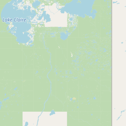
Map view of Richardson Lake Migratory Bird Sanctuary

Use this park location map to pinpoint Richardson Lake Migratory Bird Sanctuary in Canada, understand its exact geographic position, and read its mapped placement within the surrounding landscape more clearly.

Pigeon | © OpenStreetMap contributors

Location context for Richardson Lake Migratory Bird Sanctuary

Alberta
Park atlas

Compare adjacent wetland reserves, regional wildlife refuges, and connected northern ecosystems.

Explore Parks Near Richardson Lake Migratory Bird Sanctuary and Surrounding Boreal Protected Areas

Continue browsing protected natural areas near Richardson Lake Migratory Bird Sanctuary to examine similar boreal wetland ecosystems and regional waterbird habitats. This selection connects individual sanctuary records with broader territorial geography across northern Alberta.
National parkNorthwest Territories
8.1 km away#1 closest

Northwest

Wood Buffalo National Park: Mapped Protected Landscape and Geographic Context

Explore Canada's Wood Buffalo National Park mapped boundaries.

Wood Buffalo National Park serves as a critical protected area, offering a detailed view of its mapped boundaries and regional geographic setting within Northwest Territories. As a national park, it represents a significant natural landscape to explore. This entry provides structured information ideal for understanding the park's specific location and its role in the broader atlas of protected lands.

Area
44,741 km²
Established
1922
IUCN
II
Visitors
2.4K annual
National parkNorthwest Territories
About 493 km away#2 closest

North

Thaidene Nëné National Park Reserve: Northwest Territories National Park Atlas Overview

Mapped geography and protected landscape context.

Investigate Thaidene Nëné National Park Reserve, a key national park within the Northwest Territories. This detailed entry focuses on its protected area status, mapped geographic boundaries, and regional landscape context, crucial for understanding its role in the broader atlas of conservation lands.

Area
14,070 km²
Established
2019
IUCN
II
Relief
Highland
National parkSaskatchewan
521 km away#3 closest

Southeast

Prince Albert National Park: Saskatchewan National Park and Protected Area Geography

Mapped Landscape Boundaries and Regional Natural Terrain Context

Prince Albert National Park represents a distinct national park entity within Saskatchewan, vital for understanding regional geography and protected landscapes. This page offers detailed insights into its mapped boundaries and the surrounding natural terrain. It is designed to help users comprehend the park's specific protected area identity and its contribution to the broader geographic atlas of Canada's natural spaces.

Area
3,874 km²
Established
1927
IUCN
II
Visitors
287.4K annual
National parkAlberta
526 km away#4 closest

South

Elk Island National Park: National Park Protected Landscape and Alberta Geography

Discover the mapped terrain and protected boundaries.

Elk Island National Park, a designated national park in Alberta, Canada, offers a distinct protected landscape for geographic exploration. This detail page focuses on its mapped boundaries, regional setting within Western Canada, and the specific natural terrain that constitutes its protected area. Users can gain a structured understanding of Elk Island National Park's role as a conserved natural entity, ideal for atlas-based discovery and geographic context.

Area
194 km²
Established
1913
IUCN
II
Visitors
401.9K annual
A minimalist watercolor illustration showing a light blue lake, green trees, and soft yellow ground.
Wildlife reserveAlberta
596 km away#5 closest

Southwest

Saskatoon Lake Migratory Bird Sanctuary: Protected Wetland Landscape in Alberta

Geographic overview of sanctuary boundaries and habitat zones

Examine the territorial footprint and environmental setting of Saskatoon Lake Migratory Bird Sanctuary. This site highlights the intersection of shallow aquatic basins and boreal parkland vegetation, providing a deep look into protected areas within the Grande Prairie region of Alberta.

Area
11.5 km²
Established
1948
IUCN
III
Wildlife reserveSaskatchewan
626 km away#6 closest

South

Scent Grass Lake Migratory Bird Sanctuary: Regional Geography and Wetland Protected Area Maps

Key waterfowl breeding and molting ground in Saskatchewan.

Examine the ecological significance of Scent Grass Lake Migratory Bird Sanctuary, a critical wildlife reserve within the Saskatchewan Aspen Parkland. This protected area offers essential open water and sedge marsh environments for migratory waterfowl, serving as a vital staging and breeding site that maintains regional habitat stability in the Canadian prairies.

Area
6.47 km²
Established
1948
IUCN
IV
Relief
Lowland
Watercolor painting of a long truss bridge spanning a river winding through a valley with hills and trees in the background.
State or regional parkBritish Columbia
About 628 km away#7 closest

West

Kiskatinaw Provincial Park: A Protected Landscape Along the Historic Alaska Highway

Geography and heritage in the Peace River region of British Columbia

Kiskatinaw Provincial Park encompasses a distinctive horseshoe meander of the Kiskatinaw River, creating a deep gorge carved into the terrain of northeastern British Columbia. This protected area serves as a focal point for understanding both the river geomorphology of the Peace River Country and the engineering history of the original Alaska Highway, exemplified by the iconic 1942 wooden trestle bridge.

Area
0.58 km²
Established
1962
IUCN
II
Relief
Upland
Wildlife reserveSaskatchewan
About 646 km away#8 closest

Southeast

Thickwood Hills National Wildlife Area: Geography and Protected Landscape Analysis

A study of transitional Saskatchewan prairie and aspen ecosystems

Located northeast of Blaine Lake, this Canadian wildlife reserve encompasses a precise 299-hectare footprint. The site serves as a vital example of regional conservation, maintaining wetlands and native grasslands that define the transition between open prairie and northern boreal forest landscapes.

Area
2.99 km²
Established
2025
IUCN
IV
Relief
Lowland

Common questions about visiting, size, designation, and location context for Richardson Lake Migratory Bird Sanctuary

Richardson Lake Migratory Bird Sanctuary FAQs for park facts, access, geography, and protected area context

Find quick answers about Richardson Lake Migratory Bird Sanctuary, including protected-area facts, park geography, trail and visitor context, and how the park fits into its surrounding country and regional landscape.
MoriAtlas Explorer

Continue Your Protected Areas Search Across the Global Atlas

Deepen your exploration by continuing the structured search for national parks and protected areas worldwide. Utilize the comprehensive filtering capabilities to compare different conservation landscapes and refine your understanding of global park geography. Discover more about the distribution and characteristics of protected natural areas.

Global natural geography