
Lakes
Park geography
Analyzing the physical landscape, area statistics, and terrain features of the park.
Geographic Profile and Mapped Boundaries for Zuid-Kennemerland National Park
Review the precise geographic scope of Zuid-Kennemerland National Park, encompassing 38 square kilometers of protected land in North Holland. This profile details the lowland terrain, including recorded peaks, lakes, and viewpoints mapped within the park boundaries.
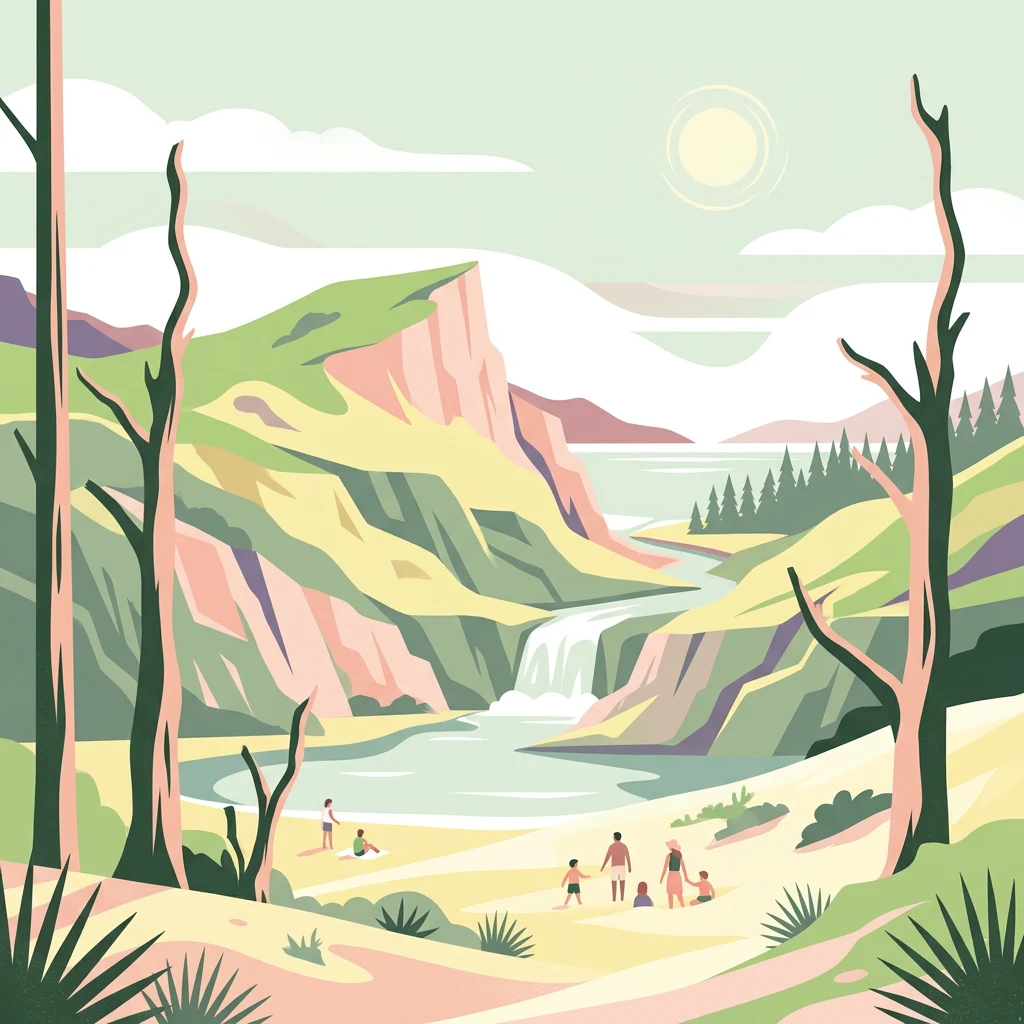
Coastal dune landscape west of Haarlem with rich biodiversity and conservation heritage
Zuid-Kennemerland National Park
Zuid-Kennemerland National Park is a protected coastal dune area in the province of North Holland, situated west of the city of Haarlem along the Dutch North Sea coast. Established in 1995, the park encompasses approximately 3,800 hectares of diverse dune landscape, making it one of the Netherlands' significant nature conservation areas. The park protects a dynamic dune ecosystem characterized by calcium-rich soils supporting plant species rare in the Dutch context, ancient woodlands on dune fringes, and stretches of coastal beach. Originally emerging from De Kennemerduinen, which was established in 1950 following advocacy by noted Dutch conservationist Jac. P. Thijsse, the park today represents decades of collaborative conservation effort involving multiple organizations and stakeholders.
- Location
- Netherlands
- Park type
- National park
- Established
- 1995
- Area
- 38 km²
Location overview
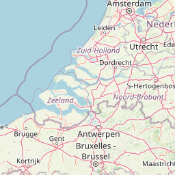
Regional position and coastal geography in North Holland
Geographic Location of Zuid-Kennemerland National Park
Zuid-Kennemerland National Park is situated in the North Holland province of the Netherlands. Regional data highlights the coastal status and geographic relationships of the protected landscape.
- Countries
- Netherlands
- Regions
- North Holland
- Primary location
- North Holland
- Geographic setting
- Coastal
Boundary and coordinates
Interactive geometry, recorded area, and coordinate bounds
Zuid-Kennemerland National Park Boundary Map and Spatial Extent
Mapped park boundaries provide direct spatial context for analyzing protected area dimensions. Accompanying records detail derived area measurements, coordinate limits, and geographic spans.
- Boundary area
- 35.5 km²
- Boundary perimeter
- 54.6 km
- Northernmost point
- 52.455° N
- Southernmost point
- 52.3665° N
- Easternmost point
- 4.6318° E
- Westernmost point
- 4.5392° E
- Geographic centre
- 52.4141° N, 4.5838° E
- North–south span
- 9.8 km
- East–west span
- 6.3 km
Terrain and natural features
Lowland terrain classification and recorded physical features within the park
Zuid-Kennemerland National Park Terrain and Named Natural Features
Zuid-Kennemerland National Park contains lowland terrain classifications alongside twenty recorded natural features located within its boundaries. Linked feature cards provide individual names, types, measurements, and spatial relationships where documented.
Selected named natural features
Forests
Scheidingsbos
Peaks
Starreberg
30 m
Lakes
Vogelmeer
Viewpoints
Uitzichtpunt Blinkertweg
Viewpoints
Wisenten Kraansvlak
Environmental setting
Temperate lowland relief, coastal dunes, and partial forest cover records
Zuid-Kennemerland National Park Environmental Setting and Habitat Classification
Recorded landscape features and habitat types outline the physical setting of Zuid-Kennemerland National Park across temperate lowland zones. Stored environmental categories connect directly to related atlas destinations for structured geographical comparison.
- Relief
- Lowland
- Climate
- Temperate
- Water
- Minor water
- Forest cover
- Partial forest
- Seasonality
- Year-round
Landscape features
Dunes · Forest · Beach · Grassland
Habitat types
Temperate broadleaf forest · Grassland · Dune habitat · Heath
Park atlas
Browse the regional park geography and connected protected landscapes surrounding Zuid-Kennemerland National Park.
National Parks Near Zuid-Kennemerland National Park: Explore More Protected Areas and Coastal Dunes
Discover more national parks and protected areas across North Holland, tracing the unique coastal dune systems and surrounding conservation landscapes beyond Zuid-Kennemerland National Park. Compare different protected landscapes and their ecological features within the regional context, gaining a deeper understanding of the diverse natural areas near the Dutch North Sea coast.
Nature reserveFlevoland
32 km away#1 closest
East

Markermeer & IJmeer Nature Reserve: Mapping Dutch Freshwater and Polder Landscapes
A vast protected lake system shaped by historic water engineering
Spanning the distance between Flevoland and North Holland, Markermeer & IJmeer represents a significant freshwater protected area. The landscape features large lake basins framed by dike systems and recent island developments, offering a prime example of Dutch wetland geography and managed water ecosystems.
- Area
- 79.553 km²
- Established
- 2009
- Relief
- Lowland
- Climate
- Temperate
National parkFlevoland
37 km away#2 closest
East
Nieuw Land National Park: Mapped Wetland Landscape on Flevoland's Reclaimed Land
Protected area geography and ecological discovery in the Netherlands
Nieuw Land National Park offers a distinctive protected landscape forged on land recently reclaimed from the sea in the Dutch province of Flevoland. This national park is characterized by its vast expanse of wetlands, artificial islands like the Marker Wadden, and critical importance for migratory bird populations. Delve into the park's geographic context and mapped features to understand its unique conservation value and role within the wider European atlas of protected areas.
- Area
- 289 km²
- Established
- 2018
- IUCN
- II
- Relief
- Lowland
Nature reserveFlevoland
38 km away#3 closest
East
Lepelaarplassen Nature Reserve: Protected Polder Wetlands and Marshland Geography
Ecologically significant wetland habitats in Flevoland
Lepelaarplassen is a protected wetland reserve situated on the edge of the young Flevoland polder. Featuring a blend of excavated lakes, willow marshes, and expansive reed fringes, the area provides essential habitat for colonial breeding birds and migratory species. This detailed look covers the landscape structure and regional geography of one of the most vital wetland zones along the Oostvaardersdijk.
- Area
- 5 km²
- Established
- 1971
- Relief
- Lowland
- Access
- Moderate access
Nature reserveFlevoland
43 km away#4 closest
East
Oostvaardersplassen Nature Reserve: Mapped Geography and Protected Area Context
Explore the marshland and polder terrain in Flevoland, Netherlands
Oostvaardersplassen represents a landmark in modern Dutch conservation, covering a 5,600-hectare mosaic of mudflats, reed beds, and willow thickets. This nature reserve, located between Almere and Lelystad, demonstrates the evolution of a young reclaimed landscape. It provides an essential habitat for marsh birds and large herbivores within the Nationaal Park Nieuw Land region, offering a distinct study in polder-based ecological management and wetland geography.
- Area
- 56 km²
- Established
- 1974
- Relief
- Lowland
- Climate
- Temperate
Protected areaNetherlands
47 km away#5 closest
Northeast
IJsselmeer: Geography and Protected Wetland Mapping of the Netherlands
Engineered freshwater landscapes and polder geography
The IJsselmeer acts as the central freshwater reservoir for the Netherlands, providing a expansive, horizon-dominated landscape shaped by the Afsluitdijk. As an internationally recognized wetland, it supports diverse waterbird populations within its intricate system of dikes, former tidal channels, and emerging nature islands. This protected area stands as a definitive example of large-scale, adaptive hydraulic management in a low-lying coastal nation.
- Area
- 1,133 km²
- Established
- 1932
- Relief
- Lowland
- Climate
- Temperate
Nature reserveFlevoland
About 49 km away#6 closest
East
Eemmeer & Gooimeer Zuidoever: Mapped Geography and Protected Lake-Fringe Landscape
A Natura 2000 wetland reserve within the Flevoland region
The Eemmeer & Gooimeer Zuidoever nature reserve consists of two distinct yet interconnected lake basins that represent the evolving landscape of the central Netherlands. The area is defined by its shallow water fringes and marshy shorelines, which provide essential sanctuary for waterbirds. By tracing the boundary between engineered polders and older mainland provinces, this reserve provides a unique look at the ecological significance of the former Zuiderzee remnants.
- Area
- 15.84 km²
- Established
- 2009
- Relief
- Lowland
- Climate
- Temperate
Nature reserveNetherlands
56 km away#7 closest
East
Arkemheen Nature Reserve: Geography and Protected Landscape Context in the Netherlands
Mapping medieval polder patterns and wetland bird habitats.
Arkemheen is a significant nature reserve in the Netherlands characterized by a flat, open polder landscape and historic fourteenth-century agricultural patterns. The area offers a distinct ecological profile, integrating freshwater border lakes with saline-influenced grasslands that support an internationally recognized population of meadow and wetland birds.
- Area
- 14.3 km²
- Established
- 1356
- Relief
- Lowland
- Climate
- Temperate
National parkNorth Holland
59 km away#8 closest
North
Duinen van Texel National Park: Protected Coastal Dune and Wetland Atlas
Explore the mapped geography and protected landscape of North Holland.
The Duinen van Texel National Park offers a rich exploration of protected coastal dunes and dynamic wetland environments on Texel Island. This atlas-focused page details the park's unique landscape features, including active dune formation at De Hors and the tidal Slufter valley. Understanding its geographic context within North Holland provides a crucial aspect of its protected area status and ecological significance for regional mapped terrain.
- Area
- 43 km²
- Established
- 2002
- IUCN
- II
- Visitors
- 265K annual
MoriAtlas Explorer
Continue Exploring Zuid-Kennemerland National Park's Mapped Landscape and Geography
Deepen your understanding of Zuid-Kennemerland National Park by exploring its specific mapped features and regional geographic context. This MoriAtlas entry is designed to facilitate structured discovery of the park's protected landscape, its unique terrain, and its place within North Holland's natural atlas. Continue to uncover the distinct characteristics that define this vital national park and its conservation significance within the Netherlands.
Browse next
Global natural geography
Explore related park routes
Explore MoriAtlas Global ParksBrowse All MoriAtlas ParksGlobal Park Map DiscoveryMoriAtlas: Browse All CountriesBrowse All MoriAtlas ContinentsNational Park Environment AtlasGrand Canyon National Park AtlasYellowstone National Park AtlasYosemite National Park Atlas and GeographySerengeti National Park AtlasGalápagos National Park Protected LandscapeBanff National Park Geography and AtlasKruger National Park Atlas EntryUluṟu-Kata Tjuṯa National Park AtlasExplore Uluru-Kata Tjuta National Park GeographyPlitvice Lakes National Park AtlasFiordland National Park Protected LandscapeGreat Smoky Mountains National Park AtlasAfghanistan National Parks and Protected AreasAlbania National Parks and Protected AreasAlgeria National Parks and Protected AreasAmerican Samoa National Parks and Protected AreasAndorra National Parks and Protected AreasAngola National Parks and Protected AreasAntarctica National Parks and Protected AreasAntigua and Barbuda Park List