Mori Atlas logo
Countries

Browse mapped natural landscapes and protected land distribution across Swiss cantons.

Switzerland National Parks and Protected Areas: An Atlas for Geographic Discovery

Switzerland, a central European nation renowned for its alpine terrain, features a rich tapestry of national parks and protected natural areas. MoriAtlas provides a structured geographic discovery platform to explore the distribution of these vital landscapes. Users can navigate the mapped boundaries of protected lands, understand their regional context within Swiss cantons, and access detailed information to deepen their geographic understanding of this diverse country.

Switzerland National Parks and Protected Areas: An Atlas for Geographic Discovery
Park system

Switzerland Protected Area Profile and National Park System Data

Analyzing scale, historical establishment, and designation patterns across alpine conservation records

Calculated metrics aggregate known area, median dimensions, and historical records to reveal structural patterns across Switzerland protected areas. Distribution data maps habitat types and climate zones against current atlas records where complete spatial information is available.

Known protected area

3,908 km²

Area data available for 38 of 42 parks.

Median park size

10.6 km²

Median across 38 parks with known area.

Oldest known park

Established in 1876.

Largest known park

Recorded area: 659 km².

Designation distribution

Nature reserve19
Protected landscape9
Regional park8
Natural monument2
Protected area2

2 more categories represented

Habitat distribution

Riverine habitat22
Wetland21
Alpine meadow20
Montane forest17
Peatland13

7 more categories represented

Climate distribution

Alpine23
Temperate16
About

Explore Switzerland's Protected Areas, Mapping Their Geographic Spread Across the Alps, Plateau, and Jura Mountains

Discover National Parks and Protected Areas Across Switzerland's Diverse Geography

Explore the national parks and protected areas of Switzerland through this comprehensive geographic atlas. Discover how these conservation landscapes are distributed across the country's diverse terrain, including the majestic Swiss Alps, the expansive Swiss Plateau, and the distinctive Jura Mountains, providing valuable regional context for park exploration.

Switzerland is a landlocked federal republic in Central Europe comprising 26 cantons, with Bern as the federal city and Zurich as the largest city. The country features the Swiss Alps, Swiss Plateau, and Jura Mountains, with German, French, Italian, and Romansh as official languages. It is noted for its political neutrality, direct democracy traditions, and strong economy.

Switzerland, officially the Swiss Confederation, is a landlocked country located at the intersection of Central, Western, and Southern Europe. It is bordered by Germany to the north, France to the west, Austria and Liechtenstein to the east, and Italy to the south. The country is geographically divided among the Swiss Alps, the Swiss Plateau, and the Jura Mountains, with the Alps covering most of the territory. Switzerland operates as a federal republic composed of 26 cantons, with Bern serving as the federal city. The country encompasses four principal linguistic and cultural regions—German-speaking Switzerland, French-speaking Romandy, Italian-speaking Swiss, and Romansh—reflecting a tradition of multilingualism and cultural pluralism.

Largest city:Zurich
Currency code:CHF
ISO code:CH
Parks count
42
Capital
Bern
Area
41,291 km²
Population
9,060,598 (2,025)

Coastal
Island
Mountainous
Landlocked
Park atlas42 parks

Explore the geographic distribution of Switzerland's national parks and significant protected areas, mapped across its alpine peaks and scenic plateaus.

Discover National Parks and Protected Areas in Switzerland: An Atlas of Alpine Conservation

MoriAtlas provides a structured geographic atlas of national parks and key protected areas throughout Switzerland. Explore comprehensive park profiles to understand their unique distribution across the Swiss Alps, Jura Mountains, and Swiss Plateau, utilizing this country-level park list as a clear gateway to Switzerland's diverse conservation landscapes.
National parkGraubünden

Swiss National Park: Geographic Context and Protected Alpine Wilderness in Graubünden

A comprehensive look at the Engadin valley's premier wilderness sanctuary

Spanning over 170 square kilometers in the canton of Graubünden, the Swiss National Park offers an unparalleled example of a strictly protected Alpine ecosystem. This atlas profile details the park's distinct topography, from the subalpine pine forests near the Ofenpass to the delicate karst lake basins at Macun, providing a deep look into its history as a central reference site for wilderness restoration and geological research.

Area
170.3 km²
Established
1914
IUCN
Ia
Relief
Mountain
A soft watercolor painting of rolling hills and distant mountains in light green and muted tones.
Biosphere reserveLucerne

Entlebuch Biosphere Reserve: Mapped Protected Landscapes in the Canton of Lucerne

Exploring karst formations and alpine wetland ecosystems

Entlebuch stands as a pioneering example of community-driven conservation in the Swiss Alps. This protected landscape encompasses extensive peatlands, forested slopes, and the iconic Schrattenfluh karst massif. Use this geographic entry to understand the regional topography and the spatial distribution of protected habitats throughout this central Swiss valley.

Area
397 km²
Established
2001
Relief
Mountain
Climate
Alpine
Protected landscapeZürich

Wildnispark Zürich: Atlas and Geographic Overview of the Protected Landscape

Swiss nature reserve located in the Canton of Zürich

Wildnispark Zürich manages roughly twelve square kilometers of land, bridging the gap between urban density and wild forest environments. The site includes the Sihlwald, a large tract of mixed beech forest, and the Langenberg wildlife area. This atlas entry covers the park geography, its role within the Mittelland forest corridor, and the distribution of protected zones that support native European species.

Area
12 km²
Established
2009
Visitors
600K annual
Relief
Upland
A watercolor painting of a panoramic mountain landscape featuring a foreground of green trees and distant purple mountain ridges under a soft light.
Nature reserveValais

Aletschwald Nature Reserve: Geographic Insights and Protected Alpine Landscape Context

An ancient high-elevation forest ecosystem in the Swiss Valais.

Situated between 1,600 and 2,200 meters, Aletschwald represents one of the few remaining managed-free subalpine forests in the Alps. The reserve maps the interaction between glacial retreat and forest advancement, featuring a dense mosaic of Arolla pines, larch, and pioneer mosses across diverse lateral moraine formations.

Area
4 km²
Established
1933
Relief
Mountain
Climate
Alpine
Nature reserveAargau

Klingnauer Stausee Nature Reserve: Aargau Wetland and Aare River Floodplain Landscapes

Protected riparian habitat in the northern Swiss Jura

Klingnauer Stausee stands as a primary example of integrated hydropower and conservation. This artificial reservoir and its surrounding wetlands, located in the Aargau region, encompass a variety of protected habitats ranging from open still waters to alluvial forests. These landscapes provide essential refuge for migratory waterbirds and preserve unique remnants of the historical Aare River floodplain structure.

Area
1.16 km²
Established
1935
Relief
Lowland
Climate
Temperate
A horizontal watercolor illustration showing stylized, overlapping mountain ridges in shades of soft green, pink, and yellow against a white background.
Natural monumentGraubünden

Roseggletscher Natural Monument: Alpine Glacier Geography and Proglacial Lake Mapping

Protected landscape data for the Bernina range in Graubünden.

Examine the geographic boundaries and terrain of the Roseggletscher, a protected natural monument situated in the upper Val Roseg. This record captures its glacial extent, the emergence of the Lej da Vadret proglacial lake, and its role within the wider Bernina glacier ensemble of southeastern Switzerland.

Area
6.38 km²
Relief
Mountain
Climate
Alpine
Access
Moderate access
Watercolor illustration of a panoramic mountain landscape with soft green hills, rolling ridgelines in shades of pink and purple, and small patches of blue water in the foreground.
Regional parkCanton of Graubünden

Parc Ela: Regional Nature Park and Alpine Geography in the Canton of Graubünden

A vertical protected landscape in the Swiss Alpine arc.

Parc Ela encompasses a remarkable span of Swiss Alpine geography, protecting everything from low-lying forested gorges at seven hundred meters to high-altitude peaks over three thousand meters. The park serves as a vital refuge for threatened insect species and large alpine mammals, while preserving the linguistic and architectural heritage of the Albula and Oberhalbstein valleys. Explore the mapped terrain where paleontological treasures meet historic trade routes.

Area
659 km²
Established
2012
Relief
Mountain
Climate
Alpine
A watercolor painting showing a panoramic view of green rolling hills and wooded ridges under a soft light.
Regional parkAargau

Jurapark Aargau: Geographic Overview of a Swiss Regional Nature Park and Jura Landscapes

Protected Jura mountain terrain and regional landscape mapping

Located in northern Switzerland, Jurapark Aargau encompasses a vast, connected perimeter defined by the interaction of tabular limestone plateaus and dramatic folded mountain ridges. This regional nature park serves as an essential refugium for native flora, preserving ancient geological history through fossil-rich sediments, steep escarpments, and traditional rural land use that persists between the Aargau, Zurich, and Basel regions.

Area
299 km²
Established
2012
Relief
Mountain
Climate
Temperate
A watercolor painting showing soft rolling green hills, a few small trees, and distant hazy mountain silhouettes under a pale sky.
Nature reserveSchwyz

Ibergeregg Nature Reserve: Mapped Protected Landscapes and Alpine Geography of Schwyz

A highland pass and wetland ecosystem in the Swiss pre-Alps

The Ibergeregg nature reserve represents a high, flat saddle in the Schwyz pre-Alps, serving as a landmark for its expansive raised bogs, flat moors, and protected moor forest systems. This documentation details the geographic features, watershed position, and protected status of the pass as it transitions from alpine pasture to high-altitude wetland habitat.

Relief
Mountain
Climate
Alpine
Access
Easy access
Scope
Terrestrial
A soft watercolor painting of a mountain landscape with rolling hills, pine forests, and a meadow in light green and muted earth tones.
Regional parkCanton of Bern

Regionaler Naturpark Gantrisch: Protected Terrain and Map Exploration in Canton of Bern

A diverse transition zone from glacial moraines to high mountain ridges.

Spanning over 400 square kilometers, Regionaler Naturpark Gantrisch offers a unique look at the Swiss landscape. Its boundaries encompass everything from low-lying agricultural valleys and historic castles to the steep, forested gorges of the Sense and Schwarzwasser rivers and the high-altitude vistas of the southern Gantrisch mountain range.

Area
414 km²
Established
2012
Relief
Mountain
Climate
Alpine
A soft watercolor painting depicting a gentle, rolling landscape with green hills, forests, and abstract meadows against a white background.
Regional parkSolothurn

Regionaler Naturpark Thal: Protected Jura Landscapes and Regional Geography in Solothurn

Examining the folded ridges and pastoral terrain of the Swiss Jura

The Regionaler Naturpark Thal encompasses the entire Thal district, presenting a cohesive regional environment defined by the eastern Jura chain. This protected area features a unique mosaic of cattle-grazed heights, biodiversity-rich dry meadows, and dense mixed forests that anchor the Solothurn landscape. The terrain showcases the classic Jura topography of parallel ridges, secluded valleys, and dramatic klus incisions, providing a rich area for understanding regional mountain ecology.

Area
139 km²
Established
2009
Relief
Mountain
Climate
Temperate
Watercolor painting of soft, rolling alpine terrain, green vegetation, and distant purple-toned mountains under a pale sky.
Nature reserveBern

Naturschutzgebiet Mederlouwenen: Alpine Moor and Protected Glacial Terrain in the Bernese Oberland

A high-elevation nature reserve featuring rare flat-moor vegetation and peat-forming bogs.

Naturschutzgebiet Mederlouwenen occupies a distinctive series of glacial granite terraces in the Bernese Oberland, where high-altitude slope bogs and relict conifer forests create a vital refuge for rare alpine flora. This protected area stands as a primary example of Swiss mountain ecology, blending ancient geological history with the fragile, moisture-dependent ecosystems found at the head of the Aare valley.

Area
0.053 km²
Established
2004
IUCN
IV
Relief
Mountain
Landscape and environment

Understand how Switzerland is shaped by terrain, ecosystems, and seasonal conditions

Switzerland geography, nature, climate, and landscape context for park-focused travel research

Explore the physical geography, natural setting, and climate patterns of Switzerland through a location-first overview built for travel research, national park discovery, and broader regional context. This section helps explain how landscapes, habitats, and environmental conditions shape what people search for, where they travel, and how they experience protected areas in Switzerland.

Switzerland geography and landscape

Switzerland is located in Central Europe at the intersection of Western and Southern Europe. It is bordered by Germany to the north, France to the west, Austria and Liechtenstein to the east, and Italy to the south. The country is geographically divided among the Swiss Alps (covering most of the territory), the Swiss Plateau (where most of the population resides), and the Jura Mountains. Switzerland is landlocked.

Switzerland nature and environment

Switzerland's terrain is dominated by the Swiss Alps, featuring high mountains, valleys, and glacial landscapes. The Jura Mountains form a separate range in the northwest. The Swiss Plateau between these mountain regions contains lakes, rivers, and forested areas.

Switzerland climate and seasonal conditions

Switzerland has a temperate climate that varies with altitude. The Alpine regions experience cold winters with heavy snowfall, while the plateau has milder conditions. The country experiences four distinct seasons.

Explore this place

Related topics and popular queries

Ways to explore Switzerland

Useful phrases, related topics, and discovery prompts connected to Switzerland.
where is switzerland locatedwhat is switzerland known forswiss cantons listswitzerland geography mountainsswitzerland population capitalswitzerland languages officialswitzerland countryswiss confederationcentral europealps mountainsswiss cantonsbern zurichgerman french italian speakinglandlocked europe
Park map

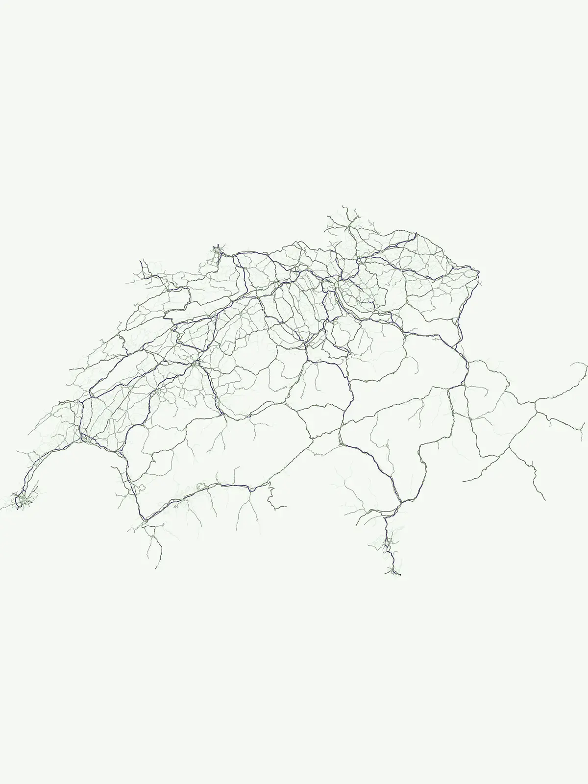
View the mapped distribution of Switzerland's protected areas, providing geographic context for its alpine terrain and cantonal boundaries.

Switzerland National Parks Map: Visualize Protected Areas and Regional Geography

This map preview offers a geographic overview, allowing you to survey the distribution of national parks and protected areas across Switzerland's alpine and plateau regions. Delve into the full country map to explore comprehensive park locations, analyze their mapped geography, and gain deeper insights into Switzerland's conservation landscapes.
Natural feature types

Analyze the Geographic Distribution of Natural Features Across Switzerland

Connect with the physical reality of Swiss protected areas through MoriAtlas. This specialized collection allows for the examination of how distinct natural features are distributed within the national park system, offering a clear perspective on the geography of Switzerland.

Essential answers regarding alpine terrain, regional nature reserves, and protected landscapes

Switzerland National Parks FAQ: Common Questions on Protected Areas

Understanding national parks and protected areas in Switzerland requires clear geographic context across alpine ranges, glacial valleys, and regional reserves. Structured inquiries help trace regional park distribution, conservation boundaries, and environmental characteristics throughout the cantons.
Other countries

Compare Protected Landscapes and National Park Geographies Across Countries Bordering Switzerland

Explore National Parks and Protected Areas in Countries Near Switzerland

Explore an extensive atlas of national parks and other protected natural areas across countries geographically linked to Switzerland. This geographic overview allows for detailed comparison of diverse conservation landscapes and regional park systems, enhancing your broader atlas discovery.

Germany National Parks and Protected Areas: Browse Geographic Distribution

Discover the breadth of Germany's national parks and protected natural areas through a structured geographic atlas. This section enables detailed browsing of mapped boundaries and understanding the regional landscape context for each protected land. It serves as a comprehensive entry point for anyone interested in the geography and distribution of conservation areas within the Federal Republic of Germany.

1,230 parks

France National Parks and Protected Areas: Mapped Geographic Exploration

Navigate France's protected natural areas and national parks with our structured atlas. This resource highlights the geographic distribution of conservation landscapes, enabling users to visually explore park boundaries and understand the country's regional geography. It serves as a foundational tool for discovering the mapped natural terrain and protected lands within France.

283 parks

Austria National Parks and Protected Areas: Geographic Atlas and Landscape Exploration

Navigate Austria's protected natural areas with a focus on geographic discovery. This atlas view highlights the distribution of national parks and significant protected landscapes, offering insights into regional terrain and mapped park boundaries for structured exploration.

23 parks

Belgium National Parks and Protected Areas: An Atlas of Mapped Natural Landscapes

Delve into the structured geography of Belgium's protected natural areas with MoriAtlas. This country-level atlas entry point reveals the mapped distribution of national parks and other protected lands, providing essential geographic context. Understand the landscape patterns and navigate through Belgium's conservation areas, enabling a deeper appreciation of its natural terrain and protected regions.

13 parks

Luxembourg National Parks and Protected Areas: A Geographic Atlas Overview

Navigate the diverse protected natural areas of Luxembourg through a structured geographic lens. This atlas entry point allows for detailed exploration of park boundaries and the distribution of protected landscapes across the country. Understand the regional geography and conservation context of Luxembourg's natural heritage.

12 parks

Explore Slovenia's National Parks and Protected Areas: A Geographic Overview

This entry point to Slovenia's protected natural areas allows for structured geographic exploration. Understand the placement and scope of national parks and other designated lands across the country, using MoriAtlas to visualize their mapped boundaries and regional context. It serves as a comprehensive atlas for discovering Slovenia's diverse natural terrain and conservation efforts.

5 parks

Liechtenstein Protected Areas: An Atlas of National Parks and Landscapes

Delve into the structured geography of Liechtenstein's protected natural areas. This atlas entry point allows for exploration of national parks and conservation landscapes, highlighting their mapped boundaries and regional context within the country. Understand the unique geographic distribution of protected lands in this Alpine microstate through detailed, factual data.

2 parks

Monaco National Parks and Protected Areas: Geographic Atlas Navigation

Access a comprehensive atlas view of national parks and protected areas within Monaco. This resource details the geographic distribution of conservation sites, offering insights into landscape context and park boundaries across the principality. Navigate protected natural areas with structured data for effective geographic exploration.

1 park

Protected area types

Explore Switzerland Protected Area Designations and Park Classification Groups

Access a structured inventory of protected area categories found throughout the Swiss landscape. MoriAtlas organizes these designations to help researchers and enthusiasts understand the regional distribution of nature reserves, regional parks, and national park status across the Swiss cantons.

Switzerland Protected Area Designations
MoriAtlas Explorer

Continue Your Global Geographic Exploration with MoriAtlas Park Discovery

Dive deeper into the world's protected landscapes and national parks through MoriAtlas's structured atlas interface. Discover how continents and countries are organized, and how individual park geography fits into the broader map. Our platform is built for understanding the distribution and context of protected areas worldwide, facilitating your journey through global natural geography.

Global natural geography