Mori Atlas logo
Countries

Browse the mapped distribution of protected lands and natural landscapes across Belgium.

Belgium National Parks and Protected Areas: A Geographic Atlas for Mapped Landscape Discovery

MoriAtlas provides a structured geographic view of Belgium's protected natural areas, functioning as a comprehensive atlas for understanding the nation's conservation landscapes. Users can navigate the country's protected areas, exploring their mapped boundaries and regional geographic context. This platform is designed for detailed map-based discovery, allowing for a clear understanding of how parks and protected lands are distributed throughout Belgium, offering a unique perspective on its natural terrain.

Belgium National Parks and Protected Areas: A Geographic Atlas for Mapped Landscape Discovery
About

Navigate Belgium's Mapped Geography and Protected Landscape Distribution

Belgium's National Parks and Protected Areas: A Comprehensive Atlas Explorer
Discover the breadth of Belgium's national parks and protected areas through a structured atlas view. This geographic entry point allows for detailed exploration of the nation's conservation landscapes and park distribution across its distinct regions. Understand the mapped terrain and the spread of protected areas, establishing Belgium as a key atlas starting point for detailed park discovery.

Belgium is a parliamentary constitutional monarchy and federal state in Northwestern Europe. Located in the Low Countries, it borders the Netherlands, Germany, Luxembourg, France, and the North Sea. The country has three autonomous regions and three official languages, with Brussels as both the capital and largest city. Belgium is a founding member of the European Union and hosts its de facto capital in Brussels.

Belgium is a developed high-income country with an advanced economy, ranking among the world's top 20 in GDP per capita. Its complex federal system reflects linguistic and cultural divisions between Dutch-speaking Flanders in the north, French-speaking Wallonia in the south, and the bilingual Brussels-Capital Region. The country gained independence from the Netherlands in 1830 and has since become a key political center in Europe, hosting major EU institutions.

Largest city:Brussels
Currency code:EUR
ISO code:BE
Parks count
7
Capital
Brussels
Area
30,689 km²
Population
11,825,551 (2,025)

Coastal
Island
Mountainous
Landlocked
Park atlas7 parks

Explore Belgium's Conservation Landscapes and Mapped Protected Terrain

National Parks and Protected Areas in Belgium: A Country Atlas View
Discover the network of national parks and protected areas mapped across Belgium. This atlas view provides essential geographic context for Belgium's conservation landscapes, enabling detailed exploration of its natural reserves. Navigate through the country's protected terrain to find key natural landmarks and understand their regional distribution within Western Europe.
Protected landscapeBelgium

Hohes Venn, Eifel Nature Park: A Protected Landscape in Belgium for Geographic Atlas Exploration

Explore mapped natural terrain and protected area details.

The Hohes Venn, Eifel Nature Park in Belgium represents a key protected landscape for atlas and geographic discovery. This entry focuses on the park's specific identity, its geographic setting within Belgium, and the value it holds for users interested in mapped terrain and protected area exploration. Understand the landscape context and the detailed geographic information available for this significant natural area, supporting structured learning about Belgium's conservation efforts.

National parkLimburg

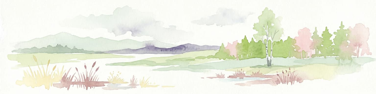
Hoge Kempen National Park: National Park Protected Landscape and Limburg Geographic Context

Explore mapped boundaries within the Limburg region.

Gain a comprehensive understanding of Hoge Kempen National Park as a distinct protected national park. This resource provides critical insights into its geographic setting within the Limburg region, detailing its mapped boundaries and overall landscape context. It serves as an essential point for atlas exploration, allowing users to appreciate the park's role as a protected natural area and its place within the regional geography of Belgium.

Area
67 km²
Established
2006
IUCN
II
Nature reserveBelgium

Zwin Nature Reserve: Belgium's Coastal Wetland and Historic Tidal Inlet Landscape

Mapped protected area boundaries and coastal wetland geography.

Delve into the Zwin Nature Reserve, a significant protected landscape on Belgium's North Sea coast. This area preserves the unique geography of a historical tidal creek system, characterized by extensive salt marshes, mudflats, and specialized coastal vegetation. As a vital habitat for diverse bird species and a showcase of tidal dynamics, Zwin offers a compelling case study in coastal conservation and landscape evolution, providing rich context for geographic and atlas-based exploration.

Area
1.58 km²
Established
1952
Relief
Lowland
Climate
Temperate
National park

De Zoom, Kalmthoutse Heide Cross-Border Park: Transboundary National Park & Heathland Atlas

Explore mapped protected boundaries and regional geography.

This page details the De Zoom, Kalmthoutse Heide Cross-Border Park, a significant national park that merges Belgian and Dutch protected territories. It is recognized for its expansive heathland, a crucial ecosystem in the Benelux region, offering a rich visual and ecological study. The park's mapped landscape context reveals its unique geography, from dry heathlands to Ramsar-designated wetlands, providing valuable insight for atlas-based exploration of protected areas. Understand the park's protected area identity and its role within the regional landscape.

Area
37.5 km²
Established
2001
IUCN
II
National park

Láhko National Park: Northern Norway's Protected Arctic Landscape and Geographic Atlas Entry

Mapped boundaries and terrain of a key Finnmark national park.

Láhko National Park is a significant protected area within Norway's Finnmark region, representing a vast expanse of sub-Arctic wilderness and characteristic tundra ecosystems. This park serves as a crucial element in the atlas of northern European protected lands, offering insights into the geographic features and ecological integrity of high-latitude environments. Explore Láhko National Park through MoriAtlas to understand its landscape context, mapped terrain, and its role in preserving Nordic wilderness.

Watercolor illustration of a landscape with rolling hills, a river, and green vegetation
Protected areaProvince of Luxembourg

Gaume Natural Park: A Protected Area Defining the Landscape of Province of Luxembourg

Explore its mapped natural landscape and geographic context.

Gaume Natural Park is a protected area offering a unique perspective on the natural landscapes found within Belgium's Province of Luxembourg. As a key geographic entity, it provides a vital component for atlas exploration, showcasing distinct mapped boundaries and regional terrain. Understand its significance as a protected natural space contributing to the Ardennes region's extensive geography, making it an essential point for structured discovery of protected lands.

Area
581.04 km²
Established
2014
Relief
Lowland
Scope
Terrestrial
Protected areaBelgium

Burdinale Protected Area: Explore its Mapped Landscape and Geographic Context in Belgium

Mapped protected area discovery within Belgium's geography.

Burdinale Protected Area serves as a key point for understanding Belgium's protected lands from an atlas perspective. This page details the park's specific geographic setting and mapped natural landscape, providing essential context for regional geography exploration. Discover the protected boundaries and terrain features that define Burdinale, contributing to a structured overview of conservation areas.

Scope
Mixed
Water
Major water bodies
Landscape and environment

Understand how Belgium is shaped by terrain, ecosystems, and seasonal conditions

Belgium geography, nature, climate, and landscape context for park-focused travel research
Explore the physical geography, natural setting, and climate patterns of Belgium through a location-first overview built for travel research, national park discovery, and broader regional context. This section helps explain how landscapes, habitats, and environmental conditions shape what people search for, where they travel, and how they experience protected areas in Belgium.

Belgium geography and landscape

Belgium occupies a coastal lowland region in Northwestern Europe known as the Low Countries. It is bordered by the Netherlands to the north, Germany to the east, Luxembourg to the southeast, France to the south, and the North Sea to the west. The country also shares a maritime boundary with the United Kingdom to the northwest.

Belgium nature and environment

Belgium's terrain consists largely of coastal lowlands and rolling hills, with the Ardennes region in the southeast featuring denser forests and higher elevation. The country has several major rivers including the Meuse and Scheldt.

Belgium climate and seasonal conditions

Belgium has a maritime-influenced temperate climate with moderate rainfall and mild temperatures year-round.

Explore this place

Related topics and popular queries

Ways to explore Belgium
Useful phrases, related topics, and discovery prompts connected to Belgium.
where is belgium locatedwhat is belgium known forbelgium population and areabelgium languages and regionsbelgium eu capitalbelgium countrywestern europe nationeu founding memberfederal belgiumbrussels capitalflanders wallonialow countries belgium
Park map

Examine the geographic distribution of Belgium's protected areas and national parks, understanding their spatial context across the Low Countries.

MoriAtlas Map of Belgium's National Parks and Protected Areas
Browse this map to locate Belgium's national parks and protected areas, offering an immediate geographic overview of their distribution across the country's diverse terrain. Access the dedicated full country map for deeper geographic exploration, revealing detailed park boundaries, regional context, and adjacent conservation landscapes in Western Europe.

Common Questions on Belgium's Mapped Park Geography and Protected Landscape Distribution

Frequently Asked Questions About National Parks and Protected Areas in Belgium
Discover frequently asked questions concerning Belgium's national parks, protected areas, and overall conservation geography. These answers offer essential context for understanding the regional distribution of protected landscapes across the Low Countries, providing clear insights into park locations and their unique characteristics for atlas-style exploration.
Other countries

Extend your geographic atlas exploration of national parks, comparing protected landscapes across Western Europe and beyond Belgium's borders.

Beyond Belgium: Explore National Parks and Protected Areas in Neighboring Countries
Continue your geographic exploration of national parks and protected areas beyond Belgium by browsing comprehensive country park lists from neighboring and related European states. This atlas view facilitates structured comparison of diverse conservation landscapes and regional park networks, enhancing your understanding of global protected-area distribution.

Explore Netherlands National Parks and Protected Areas with the MoriAtlas Geographic Navigator

Navigate the rich tapestry of Netherlands' protected natural areas and national parks using a geography-first approach. This platform provides an atlas view of mapped landscapes, enabling detailed exploration of park boundaries and their regional significance. Understand the distribution and context of conservation lands within the Netherlands, offering a structured foundation for geographic discovery and analysis of natural terrains.

25 parks

Germany National Parks and Protected Areas: Browse Geographic Distribution

Discover the breadth of Germany's national parks and protected natural areas through a structured geographic atlas. This section enables detailed browsing of mapped boundaries and understanding the regional landscape context for each protected land. It serves as a comprehensive entry point for anyone interested in the geography and distribution of conservation areas within the Federal Republic of Germany.

17 parks

United Kingdom National Parks and Protected Areas: A Geographic Atlas

MoriAtlas facilitates the geographic exploration of national parks and protected areas within the United Kingdom. Delve into the mapped boundaries of natural landscapes, understand their regional distribution, and navigate the country's protected land entities through a structured atlas perspective. Discover the diverse geographic context of conservation efforts across England, Scotland, Wales, and Northern Ireland.

15 parks

France National Parks and Protected Areas: Mapped Geographic Exploration

Navigate France's protected natural areas and national parks with our structured atlas. This resource highlights the geographic distribution of conservation landscapes, enabling users to visually explore park boundaries and understand the country's regional geography. It serves as a foundational tool for discovering the mapped natural terrain and protected lands within France.

10 parks

Austria National Parks and Protected Areas: Geographic Atlas and Landscape Exploration

Navigate Austria's protected natural areas with a focus on geographic discovery. This atlas view highlights the distribution of national parks and significant protected landscapes, offering insights into regional terrain and mapped park boundaries for structured exploration.

6 parks

Czechia National Parks and Protected Areas: Mapped Landscapes and Geographic Context

MoriAtlas presents a structured atlas view for discovering national parks and protected areas within Czechia. Examine the geographic spread and mapped boundaries of these significant natural landscapes. This resource aids in understanding the country's protected land distribution and regional geographic context, moving beyond simple listings to a deeper, map-aware exploration of Czechia's natural heritage.

5 parks

Denmark National Parks and Protected Landscapes: A Geographic Atlas Overview

This atlas entry for Denmark allows for the exploration of its national parks and protected areas, focusing on their geographic distribution and mapped boundaries. Understand the context of these protected lands within the broader landscape of Denmark, facilitating structured discovery of natural terrain and conservation areas through an intuitive, map-aware interface.

2 parks

Scotland National Parks and Protected Areas: An Atlas for Geographic Exploration

Navigate Scotland's protected natural areas with MoriAtlas, your geographic atlas for country-level insights. This resource details the distribution and mapped boundaries of national parks and other significant protected lands, offering a clear view of Scotland's conservation landscape. Understand the regional context and geographic features of these important natural areas, facilitating structured exploration and discovery of the country's diverse terrain.

1 park
MoriAtlas Explorer

Continue Your Global Geographic Exploration with MoriAtlas Park Discovery

Dive deeper into the world's protected landscapes and national parks through MoriAtlas's structured atlas interface. Discover how continents and countries are organized, and how individual park geography fits into the broader map. Our platform is built for understanding the distribution and context of protected areas worldwide, facilitating your journey through global natural geography.

Global natural geography