Mori Atlas logo
Countries

Discover the mapped boundaries and natural landscapes across Bulgaria's protected territories.

Bulgaria: parks and protected areas

Explore maps and profiles of protected areas in Bulgaria, including Pirin and Central Balkan.

Bulgaria: parks and protected areas
Park system

Bulgaria Park System: Geographic Analysis of Protected Mountain and Forest Areas

Comparing regional scale, historical age, climate zones, and designations across Balkan reserves.

National parks in Bulgaria represent diverse Balkan mountain habitats, old-growth forests, and alpine zones structured across distinct regional conservation classifications. Compiled metrics on median park size, historical establishment years, and climate profiles help trace regional conservation trends across all currently known records.

Known protected area

1,931 km²

Area data available for 3 of 3 parks.

Median park size

717 km²

Median across 3 parks with known area.

Oldest known park

Established in 1962.

Largest known park

Recorded area: 810 km².

About

Explore Bulgaria's diverse protected landscapes and their geographic distribution across the Balkan Peninsula.

Discover National Parks and Protected Areas in Bulgaria: An Atlas of Southeast European Conservation

Bulgaria offers a vital geographic entry point for exploring its national parks and diverse protected areas across Southeast Europe. This atlas provides a structured overview of Bulgaria's conservation landscapes, allowing users to understand their regional context, mapped distribution, and browse comprehensive park lists for effective discovery within this Balkan nation.

Bulgaria is a unitary parliamentary republic in Southeast Europe, bordered by Romania to the north, Serbia and North Macedonia to the west, Greece and Turkey to the south, and the Black Sea to the east. With a population of about 6.4 million and an area of roughly 111,000 km², it is the tenth-largest EU member by area. The country has a rich historical legacy spanning the First and Second Bulgarian Empires and nearly five centuries of Ottoman rule before becoming a modern republic.

Bulgaria, officially the Republic of Bulgaria, is a Balkan country in Southeast Europe. It occupies a strategic position on the eastern portion of the Balkans, bordered by Romania across the Danube to the north, Serbia and North Macedonia to the west, Greece and Turkey to the south, and the Black Sea to the east. The nation has a population of approximately 6.4 million and covers about 111,000 km², making it the sixteenth-largest country in Europe and tenth-largest in the EU. Sofia serves as the capital and largest city, with other major urban centers including Plovdiv, Varna, and Burgas. Bulgaria's history includes the ancient Thracian civilizations, periods of Roman rule, the First and Second Bulgarian Empires, and nearly 500 years under Ottoman domination before achieving independence in 1908 and becoming a republic in 1946.

Largest city:Sofia
Currency code:EUR
ISO code:BG
Parks count
3
Capital
Sofia
Area
110,994 km²
Population
6,437,360 (2,024)

Coastal
Island
Mountainous
Landlocked
Park atlas3 parks

Discover Bulgaria's Mapped Geography of Protected Landscapes

National Parks and Protected Areas of Bulgaria: An Atlas Explorer

Explore the comprehensive atlas view of Bulgaria's national parks and protected areas. This geographic gateway provides structured access to diverse conservation landscapes, from mountain ranges to coastal regions. Delve into Bulgaria's rich natural heritage and understand its protected areas through an organized, map-driven discovery experience, facilitating navigation to individual park details.
Watercolor illustration of green mountains and a lake with trees
National parkBlagoevgrad Province

Pirin National Park: Protected Area and Regional Geographic Context in Bulgaria

Explore Pirin National Park's mapped boundaries and landscape.

Pirin National Park serves as a vital national park entity within the atlas of Blagoevgrad Province, Bulgaria. This page details its protected landscape, offering a structured view of its geographic setting and mapped terrain. Users can investigate the park's specific identity and its relation to the surrounding regional geography, providing essential context for understanding protected areas and natural landscapes within a comprehensive map-driven framework.

Area
403.56 km²
Established
1962
IUCN
II
Relief
Mountain
Watercolor painting showing a mountain range with green hills, a lake, and trees in the foreground
National parkLovech Province

Central Balkan National Park

Explore mapped alpine terrain and ancient forests in Lovech Province.

Central Balkan National Park, in Lovech Province, Bulgaria. Landscapes: mountains, valleys, and cliffs.

Area
716.69 km²
Established
1991
IUCN
II
Relief
Mountain
Watercolor painting of a mountainous landscape with a lake and green fields
National parkBulgaria

Rila National Park: Bulgaria's Largest National Park with Alpine Terrain and Glacial Lakes

Explore mapped boundaries and protected landscape features.

Rila National Park, situated in Bulgaria's Rila mountain range, stands as the country's largest national park and a vital protected landscape. Its territory is characterized by dramatic glacial topography, including the iconic Seven Rila Lakes, and ascends to Musala Peak, the highest summit in the Balkan Peninsula. This atlas entry details the park's extensive mapped boundaries and unique ecosystems, emphasizing its importance for understanding regional geography and protected area networks.

Area
810.46 km²
Established
1992
IUCN
II
Relief
Mountain
Landscape and environment

Understand how Bulgaria is shaped by terrain, ecosystems, and seasonal conditions

Bulgaria geography, nature, climate, and landscape context for park-focused travel research

Explore the physical geography, natural setting, and climate patterns of Bulgaria through a location-first overview built for travel research, national park discovery, and broader regional context. This section helps explain how landscapes, habitats, and environmental conditions shape what people search for, where they travel, and how they experience protected areas in Bulgaria.

Bulgaria geography and landscape

Bulgaria is situated on the eastern Balkans peninsula, occupying the region directly south of the Danube river which forms its northern border with Romania. The country borders Greece and Turkey to the south, Serbia and North Macedonia to the west, and fronts the Black Sea to the east. The terrain is varied, featuring mountain ranges such as the Rila, Pirin, and Rhodope mountains in the south and southwest, fertile plains in the north and northeast, and a coastal plain along the Black Sea.

Explore this place

Related topics and popular queries

Ways to explore Bulgaria

Useful phrases, related topics, and discovery prompts connected to Bulgaria.
where is bulgaria locatedwhat is bulgaria countrybulgaria capital citybulgaria population and areabulgaria geography and bordersbulgaria eu memberbulgaria history first empirebulgaria countryrepublic of bulgariabulgaria locationbulgaria balkanbulgaria eubulgaria capital sofiabulgaria geographysoutheast europe country
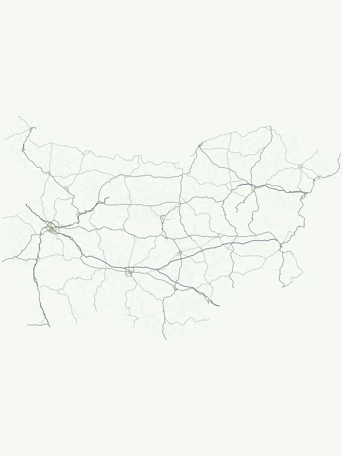
Park map

Visualize the geographic spread of Bulgaria's protected landscapes and major national parks across its diverse terrain.

Bulgaria National Parks Map: Explore Protected Areas and Park Locations

Preview the mapped locations of Bulgaria's national parks and other significant protected areas, understanding their placement within the country's Southeast European geography. This atlas view provides critical spatial context for planning your park exploration and recognizing regional conservation landscapes across the Balkan Peninsula.
Natural feature types

Explore the Complete Collection of Named Natural Features Across Bulgaria

Begin navigating the diverse natural landscape of Bulgaria through this specialized MoriAtlas geographic index. The resource highlights specific geological and environmental markers found within protected park boundaries to support structured regional analysis and national territory discovery.

Explore common questions regarding Bulgaria's protected landscapes, geographic distribution, and conservation efforts across its diverse terrain.

Frequently Asked Questions about National Parks and Protected Areas in Bulgaria

Discover essential insights into the national parks and significant protected areas spanning Bulgaria's diverse geography, from the Balkan Mountains to its Black Sea coast. These frequently asked questions offer a comprehensive understanding of park locations, ecological significance, and the regional context vital for exploring Bulgaria's rich conservation landscapes.
Other countries

Browse the mapped geography of protected areas and compare park systems across the broader Balkan region.

Discover National Parks and Protected Areas in Other Countries Near Bulgaria

From Bulgaria, extend your atlas exploration to other country pages, discovering national parks and protected areas across neighboring and related European geographies. This expanded view helps you compare distinct conservation landscapes and understand regional park distribution within a broader geographic context.

Albania: parks and protected areas

Parks and protected areas in Albania, including Butrint and Primeval Beech Forests of the Carpathians and Other Regions of Europe.

29 parks

Hungary: parks and protected areas

Parks and protected areas in Hungary, including Hortobágy and Aggtelek.

13 parks

North Macedonia: parks and protected areas

Parks and protected areas in North Macedonia, including Lake Ohrid and Mavrovo.

4 parks

Protected area types

Continue Exploring Bulgaria's Protected Area Designations and National Parks

Deepen your understanding of Bulgaria's natural heritage by continuing into its detailed designation categories. Examine the specific geographic attributes and landscape context of its National Parks and other protected areas, providing a comprehensive atlas view of conservation within the country.

Bulgaria Park Designations
MoriAtlas Explorer

National parks and protected areas worldwide

Find a park and explore its geography, habitats, and monthly climate.

Global natural geography