Mori Atlas logo
Countries

Browse and navigate the mapped protected landscapes across North Macedonia's diverse terrain.

North Macedonia National Parks and Protected Areas: A Geographic Atlas

North Macedonia offers a rich tapestry of protected natural areas, from national parks to significant nature reserves. This atlas entry point allows for a structured exploration of the country's geographic distribution of these vital landscapes. Understand the mapped boundaries and regional context of North Macedonia's conserved territories, providing a clear overview for geographic discovery and landscape analysis.

North Macedonia National Parks and Protected Areas: A Geographic Atlas
About

Explore the mapped distribution and regional spread of protected landscapes across North Macedonia.

North Macedonia National Parks and Protected Areas: A Geographic Atlas Overview
Delve into the protected natural areas of North Macedonia with this atlas-focused entry point. Discover the geographic scope and distribution of national parks and conservation landscapes within the country. This resource provides a structured overview, establishing North Macedonia as a key geographic node for navigating its diverse protected areas and understanding their regional context within Southeast Europe.

North Macedonia is a landlocked country in Southeast Europe, constituting the northern third of the historical region of Macedonia. It gained independence from Yugoslavia in 1991 and operates as a unitary parliamentary republic. The country is known for its diverse ethnic composition, with Macedonians forming the majority and Albanians as a significant minority, along with Turks, Roma, Serbs, and other groups.

Largest city:Skopje
Currency code:MKD
ISO code:MK
Parks count
2
Capital
Skopje
Area
25,436 km²
Population
1,836,713 (2,021)

Coastal
Island
Landlocked
Park atlas2 parks

Discover the mapped geography of protected landscapes across North Macedonia's diverse terrain.

National Parks and Protected Areas in North Macedonia: A Geographic Explorer
Explore a curated atlas of national parks and protected areas within North Macedonia. This country-level view provides a structured geographic overview, allowing for detailed discovery of each conservation landscape. Navigate through the protected areas of North Macedonia to understand their distribution and unique characteristics within the Balkan region.
National park

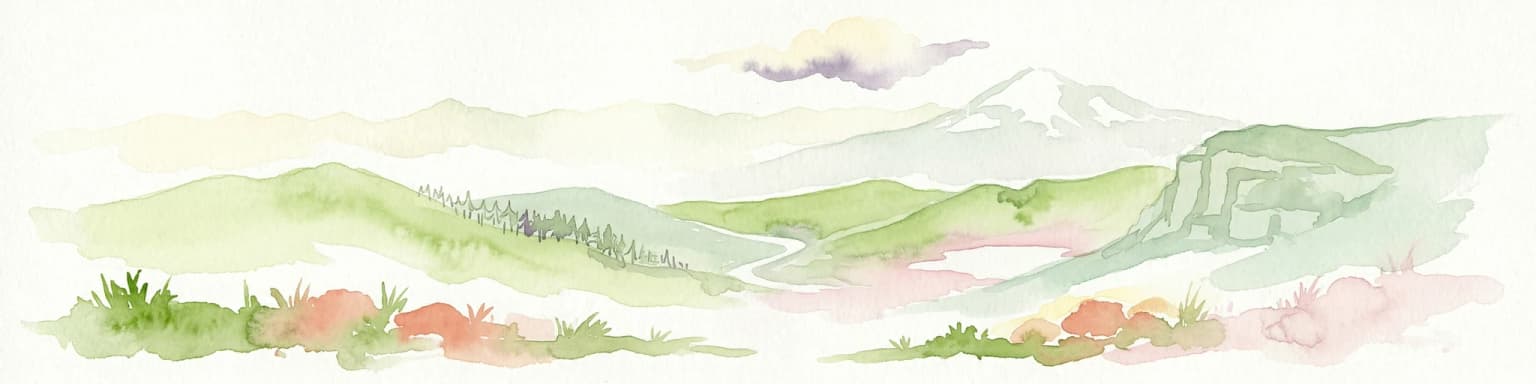
Mavrovo National Park: North Macedonia's Extensive Protected Alpine Terrain and Wildlife

Mapped geography of Alpine peaks, gorges, and unique endemic species.

Mavrovo National Park, North Macedonia's largest protected area, offers a deep dive into a complex Alpine geography. Dominated by the Šar, Korab, and Bistra mountain systems, the park features towering peaks and the dramatic Radika River gorge. This protected landscape is globally significant for its role in conserving the rare Balkan lynx and harbors endemic tertiary relic plant species like Macedonian pine. Explore the mapped boundaries, glacial lakes, and distinct terrain that define this vital conservation area.

Area
730.88 km²
Established
1949
IUCN
II
Relief
Mountain
Watercolor painting of a landscape with green trees, rolling hills, and distant mountains under a light sky
National parkMunicipality of Bitola

Pelister National Park: North Macedonia's Oldest National Park and Alpine Protected Landscape

Explore unique glacial features and endemic forests within Municipality of Bitola.

Pelister National Park, a pioneering protected area in North Macedonia, offers a rich tapestry of alpine geography and unique geological formations. This page provides detailed information on the park's landscape, including its dramatic mountain massif within Municipality of Bitola, the rare Macedonian pine forests, the striking 'stone rivers' formed by ancient glacial processes, and the serene Pelister Eyes glacial lakes. Discover the park's mapped boundaries and its significance as a conservation heritage site within the Balkan Peninsula.

Area
171.5 km²
Established
1948
IUCN
II
Visitors
30K annual
Landscape and environment

Understand how North Macedonia is shaped by terrain, ecosystems, and seasonal conditions

North Macedonia geography, nature, climate, and landscape context for park-focused travel research
Explore the physical geography, natural setting, and climate patterns of North Macedonia through a location-first overview built for travel research, national park discovery, and broader regional context. This section helps explain how landscapes, habitats, and environmental conditions shape what people search for, where they travel, and how they experience protected areas in North Macedonia.

North Macedonia geography and landscape

North Macedonia is located in the central part of the Balkan Peninsula in Southeast Europe. It is landlocked, bordered by Greece to the south, Albania to the west, Bulgaria to the east, Kosovo to the northwest, and Serbia to the north. The terrain varies from mountainous regions to valleys and plains.

North Macedonia nature and environment

The country features diverse landscapes including mountain ranges, forests, and river valleys. The Pelagonia and Tikveš plains are notable agricultural areas, while the mountain regions provide natural habitats and outdoor recreation opportunities.

North Macedonia climate and seasonal conditions

North Macedonia has a Mediterranean climate with continental influences, featuring hot summers and cold winters. The country experiences moderate precipitation patterns across different regions.

Explore this place

Related topics and popular queries

Ways to explore North Macedonia
Useful phrases, related topics, and discovery prompts connected to North Macedonia.
where is North Macedoniawhat is North Macedonia known forNorth Macedonia geography and borderspopulation of North MacedoniaNorth Macedonia capital cityMacedonia Balkan region countriesNorth Macedonia countryRepublic of North MacedoniaMacedonia Balkan stateSkopje capitalSoutheast Europe nationsBalkans countriesMacedonian denar currencylandlocked European country
Park map

See the mapped geography and spatial distribution of protected areas across North Macedonia.

North Macedonia National Parks Map: Explore Protected Areas and Their Geographic Distribution
Use this geographic preview to identify the locations of national parks and other protected areas throughout North Macedonia's diverse terrain. The comprehensive country map provides detailed spatial context, allowing for deeper exploration of conservation landscapes and regional park patterns.

Exploring North Macedonia's protected areas, park geography, and conservation landscapes through common questions.

Frequently Asked Questions About National Parks in North Macedonia
Explore key insights into North Macedonia's national parks and protected areas, detailing their mapped geography and regional context within the Balkan Peninsula. These common questions offer a foundational overview of the country's conservation landscapes, aiding in understanding park distribution for geographic discovery.
Other countries

Explore the diverse protected landscapes and mapped park geographies across the wider Balkan region and Southeast Europe.

Discover National Parks and Protected Areas in Countries Beyond North Macedonia
Continue your atlas exploration from North Macedonia into neighboring countries to discover their national parks and other significant protected areas. This structured view helps you compare regional conservation efforts and mapped terrain across Southeast European nations for comprehensive geographic context.

Romania National Parks and Protected Areas Atlas for Geographic Exploration

This atlas entry point provides structured access to Romania's national parks and protected areas. Explore the geographic distribution of mapped natural landscapes and understand the context of protected territories within the country. MoriAtlas enables detailed map-based navigation and discovery of Romania's diverse natural terrain and conservation zones.

28 parks

Albania National Parks and Protected Areas: A Geographic Atlas Exploration

Access a structured overview of Albania's national parks and protected areas. This resource facilitates exploration of the geographic distribution and mapped boundaries of its natural landscapes, offering an atlas-based perspective on the country's conservation efforts and regional terrain.

12 parks

Croatia National Parks and Protected Areas: Geographic Atlas Explorer

MoriAtlas provides a geographic atlas for exploring Croatia's national parks and protected areas. Navigate the mapped boundaries and understand the distribution of protected lands throughout the country. This resource focuses on the structured discovery of natural landscapes and regional geography, offering a clear overview for understanding conservation areas within Croatia's diverse terrain.

11 parks

Serbia National Parks and Protected Areas: Mapped Landscape Exploration

Discover the protected areas and national parks within Serbia through a structured geographic atlas interface. MoriAtlas details the mapped landscapes and regional natural terrain, allowing users to explore the full scope of conservation efforts across the country. Understand how protected lands are situated within the broader Serbian geography, facilitating a deeper, map-aware approach to natural landscape discovery.

9 parks

Hungary's National Parks and Protected Areas: A Mapped Geographic Overview

Navigate Hungary's protected natural areas through a structured geographic lens. MoriAtlas visualizes national parks and conservation landscapes, enabling users to understand their distribution across the Carpathian Basin. Discover key protected territories and their regional context for a comprehensive atlas-based exploration of Hungary's natural heritage.

8 parks

Greece: National Parks, Protected Areas, and Mapped Landscapes

This section offers a comprehensive atlas view of Greece's national parks and protected areas. Explore the geographic distribution, mapped boundaries, and landscape context of conservation sites across the country. MoriAtlas facilitates a structured understanding of Greece's natural protected regions, making it an essential tool for geographic discovery and atlas-based browsing.

6 parks

Bulgaria National Parks and Protected Areas: Mapped Geographic Context

Access a structured overview of Bulgaria's national parks and protected areas. This atlas-focused resource highlights geographic distributions and mapped boundaries, enabling comprehensive discovery of the country's diverse natural terrain and conservation landscapes.

4 parks

Bosnia and Herzegovina: National Parks and Protected Lands Map Overview

Delve into the protected natural areas of Bosnia and Herzegovina, a key Balkan country. This resource provides a structured view of national parks and other conservation landscapes, emphasizing their geographic distribution and regional context. Understand the mapped boundaries and terrain of these important natural territories, offering a comprehensive atlas-style exploration for geographic understanding.

3 parks
MoriAtlas Explorer

Continue Your Global Geographic Exploration with MoriAtlas Park Discovery

Dive deeper into the world's protected landscapes and national parks through MoriAtlas's structured atlas interface. Discover how continents and countries are organized, and how individual park geography fits into the broader map. Our platform is built for understanding the distribution and context of protected areas worldwide, facilitating your journey through global natural geography.

Global natural geography