Mori Atlas logo
National parkBahía Portete – Kaurrele National Natural Park

Discover the mapped boundaries and regional landscape context of this protected area in La Guajira.

Bahía Portete – Kaurrele National Natural Park: Protected National Park Atlas and Geography

(PNN Bahía Portete – Kaurrele)

Bahía Portete – Kaurrele National Natural Park stands as a significant protected area within the geography of La Guajira, Colombia. As a designated national park, its mapped boundaries offer a distinct focus for understanding regional natural landscapes. This park provides a unique lens through which to explore the mapped terrain and protected land distribution within the broader atlas of Colombian protected areas, facilitating a deep dive into its specific geographic identity.

Marine protected areaSea turtle habitatCaribbean coastDesert ecosystemIndigenous territoryNewest national park
Stylized illustration of desert landscape featuring sand dunes, cacti, and a winding river under a pink sky with a large sun

Bahía Portete – Kaurrele National Natural Park

National park

Park overview

Structured park overview, official facts, and landscape profile for Bahía Portete, Kaurrele National Natural Park

Bahía Portete, Kaurrele National Natural Park park facts, protected area profile, and essential visitor context
Review the core facts for Bahía Portete, Kaurrele National Natural Park, including designation, size, terrain, visitor scale, habitats, and operating context in one park-focused overview.

About Bahía Portete, Kaurrele National Natural Park

Bahía Portete – Kaurrele National Natural Park represents a significant addition to Colombia's conservation estate, established to safeguard the fragile coastal and marine ecosystems of the La Guajira peninsula. The park occupies a unique geographic position at the northernmost point of mainland South America, where the Caribbean Sea meets the arid desert terrain that characterizes this region of Colombia. The protected area encompasses Bahía Portete, a coastal bay with depths ranging from three to twenty metres, surrounded by a landscape of sparse desert vegetation and distinctive cactus formations. The establishment of this park in 2014 marked the culmination of a planning process that began in 2003 and involved collaboration with multiple Wayuu indigenous communities whose ancestral lands encompass the park area. The declaration of the park as protected status prohibits mining and industrial fishing within its boundaries, recognizing both the ecological sensitivity of the region and its importance to local indigenous communities.

Quick facts and research context for Bahía Portete, Kaurrele National Natural Park

Bahía Portete – Kaurrele National Natural Park spans 14,080 hectares along the Caribbean coast of the La Guajira peninsula in northern Colombia. Established in December 2014, it is the northernmost national park on mainland South America. The region experiences a hot and arid climate with average temperatures between 28 and 30 degrees Celsius. The protected area encompasses both marine bay ecosystems and adjacent coastal desert terrain, creating a distinctive contrast between the productive waters of Bahía Portete and the surrounding xeric landscape. The park forms part of Colombia's Caribbean natural region and is administered through the National System of Protected Areas.

Park context

Deeper park guide and search-rich context for Bahía Portete, Kaurrele National Natural Park

Bahía Portete, Kaurrele National Natural Park history, landscape, wildlife, and travel context
Explore Bahía Portete, Kaurrele National Natural Park through its history, landscape character, ecosystems, wildlife, conservation priorities, cultural context, and seasonal travel timing in a structured park guide built for atlas discovery and search intent.

Why Bahía Portete, Kaurrele National Natural Park stands out

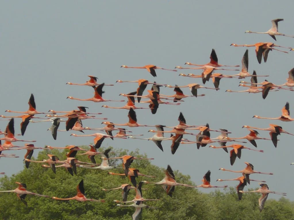
Bahía Portete, Kaurrele is distinguished by its exceptional marine biodiversity within a sheltered Caribbean bay, making it significant for sea turtle conservation. The park protects five species of sea turtles: green, loggerhead, hawksbill, leatherback, and olive ridley. The marine portion contains extensive seagrass meadows supporting diverse fish communities, while the surrounding desert supports a unique cactus flora and resident bird populations including the American flamingo. The park also represents the most recent addition to Colombia's national park system and the northernmost protected area on mainland South America.

A hogfish with orange and white patterns swimming near coral in blue water
Hogfish swimming in coral reef ecosystem of Bahía Portete, Kaurrele National Natural Park

Bahía Portete, Kaurrele National Natural Park history and protected-area timeline

The creation of Bahía Portete – Kaurrele National Natural Park followed a protracted planning process that began in 2003, with formal protection finally conferred on December 20, 2014, making it the 59th national natural park in Colombia's system. The process of establishing the protected area involved consultation and collaboration with numerous Wayuu indigenous communities, including Kamushiwoü, Alijunao, Yariwanischi, Puerto Portete, Ian, Youlepa, Kayuuswaarraaloü and Punta Cosos Espacios. At the formal declaration ceremony, President Juan Manuel Santos highlighted the significance of biodiversity to Colombia, comparing it to the economic importance of oil in Arab nations. The park's history is marked by the tragic events of April 18, 2004, when paramilitary forces attacked the area, resulting in the torture and assassination of six people, including four women, the burning of homes, and the desecration of cemeteries. This violence forced more than 600 Wayuu residents to flee to Venezuela. Historically, during the Spanish conquest in the sixteenth century, the bay was known as El Portichuelo and served as a point where enslaved people were brought into colonial territories.

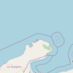
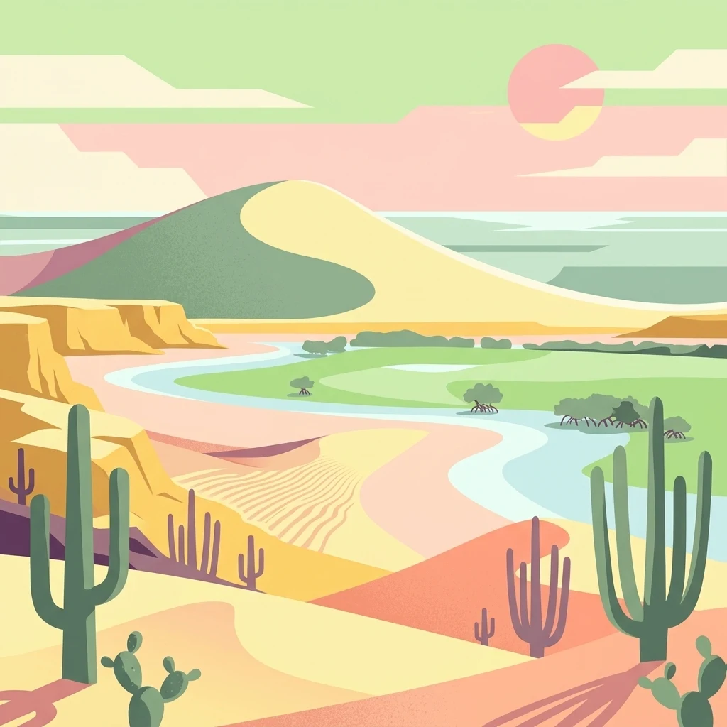
Bahía Portete, Kaurrele National Natural Park landscape and geographic character

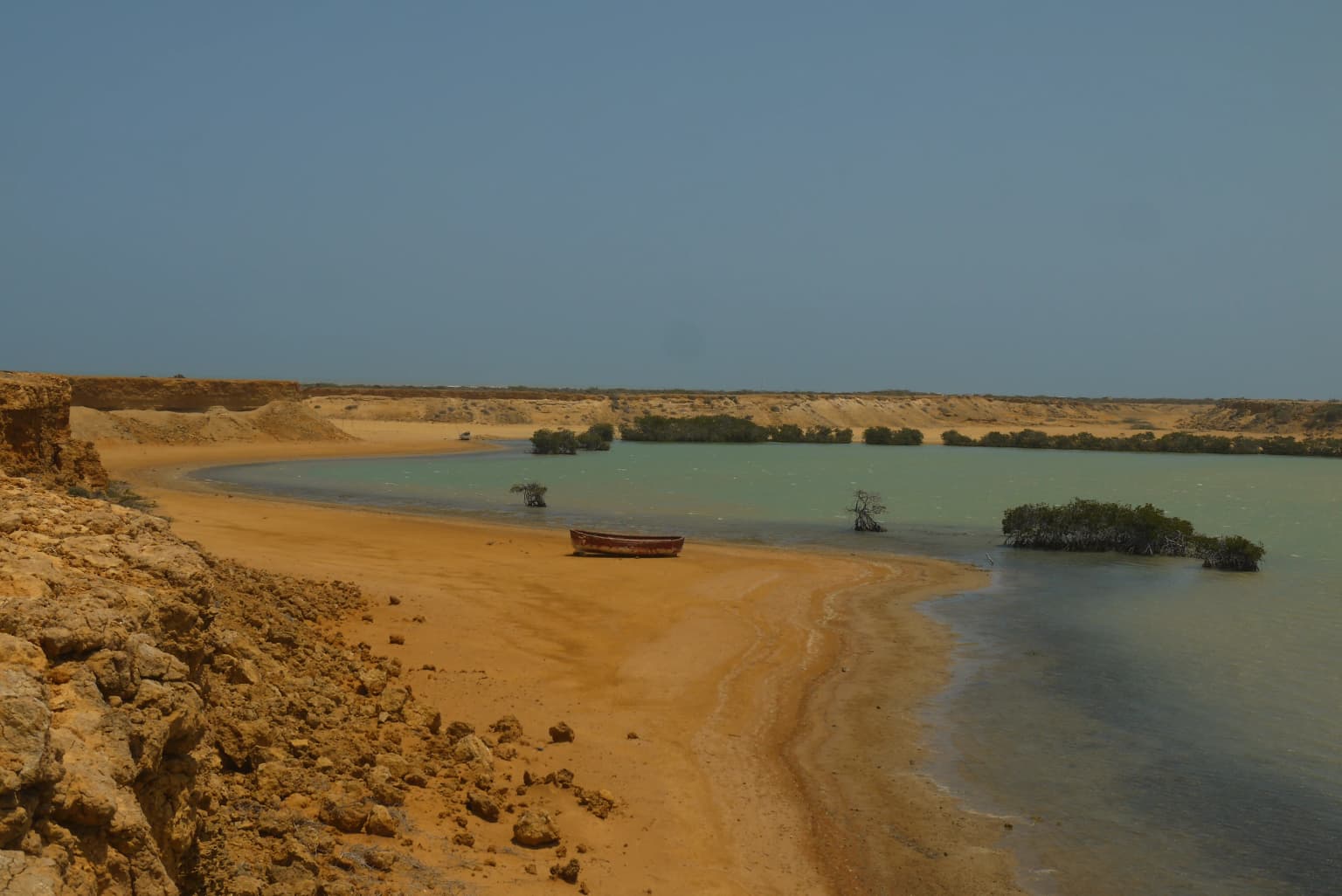
The park occupies a distinctive position where the Caribbean coastline of the La Guajira peninsula meets the marine waters of Bahía Portete. The landscape is characterized by a striking contrast between the arid desert terrain of the surrounding peninsula and the productive marine environment of the protected bay. The coastal area experiences humidity caused by winds from the inland desert, creating unique atmospheric conditions. The bay itself has an average depth of nine metres, with depths ranging from three to twenty metres, providing sheltered conditions for marine life. The terrestrial portions of the park feature the typical xeric vegetation of the La Guajira desert, including extensive cactus communities, while the marine portion contains extensive seagrass meadows. The park lies between two notable geographic features, Cabo de la Vela to the west and Punta Gallinas to the east, the latter being Colombia's northernmost mainland point.

White ibis with long red beak wading in shallow water with green grass background
American White Ibis wading in shallow water

Bahía Portete, Kaurrele National Natural Park ecosystems, habitats, and plant life

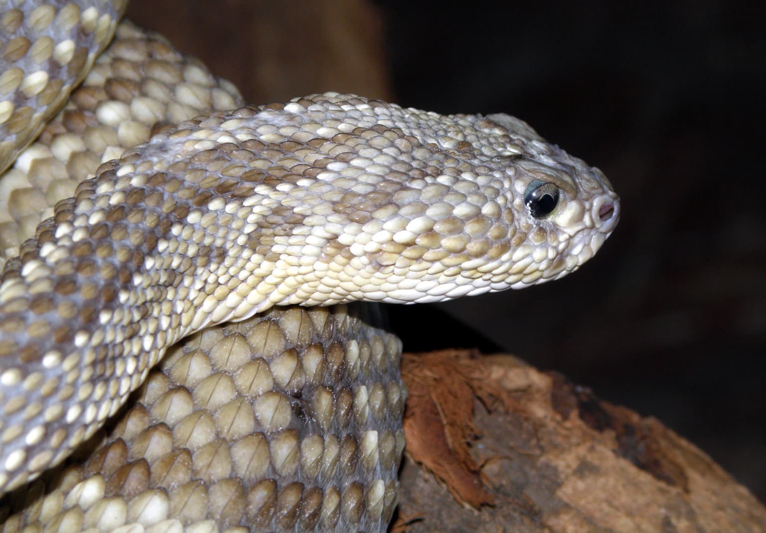
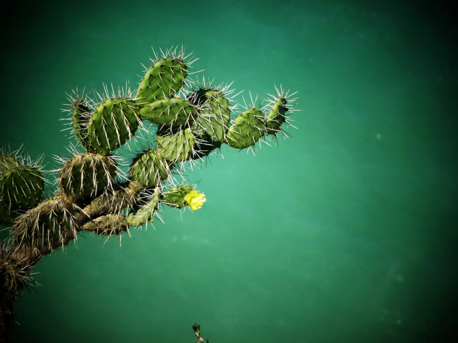
Bahía Portete – Kaurrele encompasses two fundamentally different ecological systems that exist in close proximity. The marine environment of Bahía Portete supports rich biodiversity including extensive seagrass meadows of Thalassia testudinum and Syringodium species, which provide critical habitat for numerous marine species. The coastal zone features mangrove trees of Avicennia germinans, providing additional habitat complexity and coastal protection. In contrast, the terrestrial portions of the park exist within the arid desert environment of La Guajira, where sparse vegetation including Opuntia cactus species survives in extremely challenging conditions. The park hosts 25 species of reptiles and amphibians and has documented 217 marine species, representing a remarkable concentration of biodiversity within a relatively limited area. This ecological richness exists despite the harsh desert conditions that characterize the surrounding landscape.

Sandy beach with shallow turquoise water, rocky cliffs on the left, and small islands in the distance under a clear blue sky
Sandy coastal beach with shallow turquoise water and small islands near Punta Gallinas, La Guajira

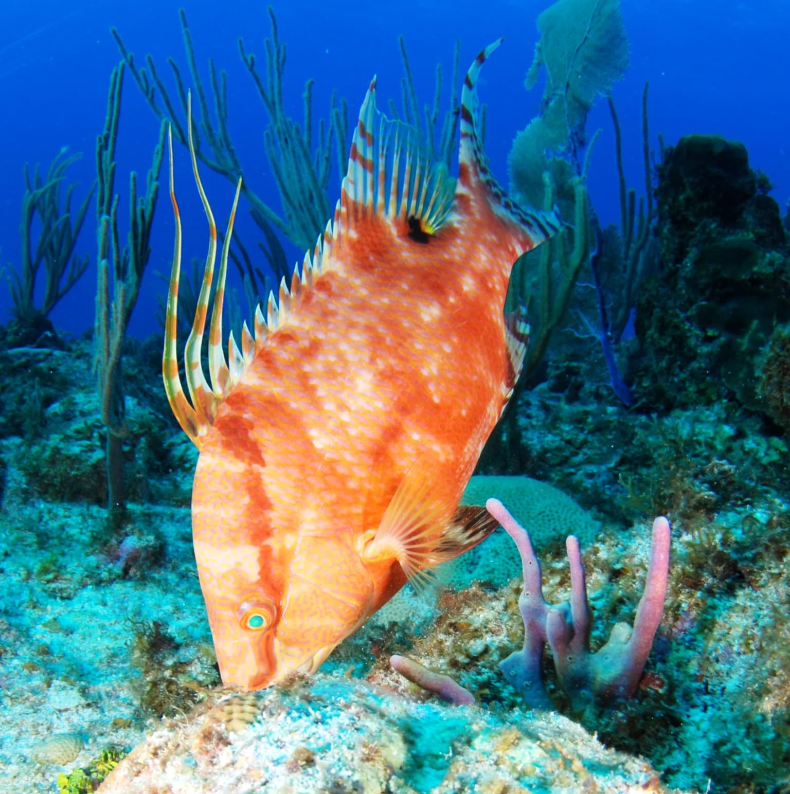
Bahía Portete, Kaurrele National Natural Park wildlife and species highlights

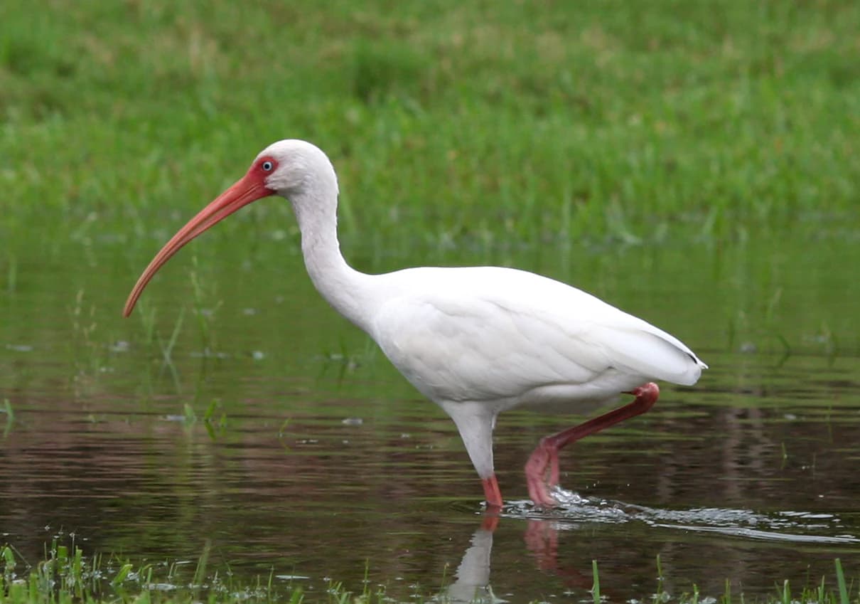
The wildlife of Bahía Portete – Kaurrele reflects the dual nature of the protected area, with significant terrestrial and marine faunal communities. The marine environment supports exceptional sea turtle diversity, with five species documented: green sea turtle, loggerhead, hawksbill, leatherback, and olive ridley. Fish diversity is exceptionally high, with numerous species including common snook, cubera snapper, lane snapper, mutton snapper, Nassau grouper, rainbow parrotfish, and Atlantic tarpon among the documented species. The invertebrate community includes Caribbean spiny lobster, queen conch, blue land crab, and various coral species including elkhorn coral and staghorn coral. Terrestrially, the park supports mammal species including nine-banded armadillo, southern long-nosed bat, red-tailed squirrel, crab-eating fox, white-lipped peccary, and American crocodile. Bird populations include American flamingo, brown pelican, crested caracara, magnificent frigatebird, roseate spoonbill, and scarlet ibis.

A flock of American Flamingos flying in the sky above a line of green trees
American Flamingos in flight over green vegetation at Bahía Portete, Kaurrele National Natural Park

Bahía Portete, Kaurrele National Natural Park conservation status and protection priorities

Bahía Portete – Kaurrele represents Colombia's commitment to protecting its Caribbean coastal and marine ecosystems, completing a network of protected areas along the La Guajira peninsula. The park was designated specifically to protect both marine and littoral ecosystems, addressing a gap in conservation coverage for this region. The formal protection prohibits mining and industrial fishing activities within the park boundaries, recognizing the ecological sensitivity of the area and its importance to local communities. The park's establishment involved the Wayuu indigenous communities as partners in conservation, reflecting Colombia's approach to integrating indigenous knowledge and governance in protected area management. The location at the northernmost tip of mainland South America gives the park additional significance as a representatively northernmost protected area in continental South America.

Bahía Portete, Kaurrele National Natural Park cultural meaning and human context

The park lies within the ancestral territory of the Wayuu people, an indigenous community who have inhabited the La Guajira peninsula for generations. Approximately 500 Wayuu residents inhabit the sparsely populated area surrounding the park. The Wayuu communities played an active role in the establishment of the protected area, with eight communities contributing to the planning process: Kamushiwoü, Alijunao, Yariwanischi, Puerto Portete, Ian, Youlepa, Kayuuswaarraaloü and Punta Cosos Espacios. The historical significance of the area dates to the Spanish conquest, when the bay was known as El Portichuelo and served as an entry point for enslaved people during the colonial period. The region experienced a tragic event in 2004 when paramilitary forces attacked the community, causing deaths and forcing many residents to flee to Venezuela.

Close-up of a rattlesnake with patterned scales resting on a log
Close-up of a rattlesnake

Top sights and standout views in Bahía Portete, Kaurrele National Natural Park

The park's defining features include its status as Colombia's newest national park, established in 2014, and its position as the northernmost national park on mainland South America. The protected area offers exceptional marine biodiversity within a sheltered Caribbean bay, with documented populations of five sea turtle species and more than 200 marine fish and invertebrate species. The contrast between the desert landscape and the productive marine environment creates a distinctive ecological character. The involvement of Wayuu indigenous communities in the park's establishment represents meaningful integration of traditional land stewardship in conservation planning.

Close-up of an Opuntia wentiana cactus with spines and a yellow flower against a green background
Opuntia wentiana cactus with yellow flower against a green sea backdrop

Best time to visit Bahía Portete, Kaurrele National Natural Park

The park experiences a hot and arid climate typical of the La Guajira peninsula, with average temperatures ranging between 28 and 30 degrees Celsius throughout the year. Visitors should expect consistently warm conditions regardless of season. The coastal humidity caused by inland winds affects the immediate bay area, creating slightly different conditions than the surrounding desert. The best conditions for exploring the park would likely correspond to the drier periods when sea conditions are most favorable for marine activities and wildlife observation.

Park location guide

Geography guide, regional context, and park location map for Bahía Portete, Kaurrele National Natural Park

Bahía Portete, Kaurrele National Natural Park park geography, regions, and map view in Colombia
Understand where Bahía Portete, Kaurrele National Natural Park sits in Colombia through a broader geographic reading of the surrounding landscape, nearby location context, and its mapped position within the national park landscape.

How Bahía Portete, Kaurrele National Natural Park fits into Colombia

Colombia is a presidential republic located in the northern part of South America. It spans approximately 1.14 million km² and has a population of around 52 million. The country features the Andes mountain range, extensive Amazon rainforest, and coastal regions on both the Caribbean and Pacific. Spanish is the official language, and Bogotá serves as the capital and largest city.

Wider geography shaping Bahía Portete, Kaurrele National Natural Park in Colombia

Colombia is located in the northwestern part of South America, bordering the Caribbean Sea to the north and the Pacific Ocean to the west. Its mainland neighbors are Venezuela to the east, Brazil to the southeast, Peru and Ecuador to the south and southwest, and Panama to the northwest. The terrain is diverse, featuring the Andes mountain range in the west, Amazon rainforest in the south and east, and coastal plains along both oceans.

Map view of Bahía Portete, Kaurrele National Natural Park

Use this park location map to pinpoint Bahía Portete, Kaurrele National Natural Park in Colombia, understand its exact geographic position, and read its mapped placement within the surrounding landscape more clearly.

Pigeon | © OpenStreetMap contributors

Location context for Bahía Portete, Kaurrele National Natural Park

La Guajira

Visually understand the park's unique desert and marine habitats, plus coastal terrain.

Bahía Portete – Kaurrele National Natural Park: Landscape Photos and Protected Area Scenery
Visually explore Bahía Portete – Kaurrele National Natural Park, a unique Colombian protected area blending arid desert landscapes with a vibrant Caribbean marine bay. Examine imagery of its distinctive coastal terrain, critical sea turtle habitats, and diverse ecosystems to understand the park's conservation significance and ecological character.

A hogfish with orange and white patterns swimming near coral in blue water

Close-up view of a loggerhead sea turtle's head showing its distinctive patterned shell and eye

White ibis with long red beak wading in shallow water with green grass background

Sandy beach with shallow turquoise water, rocky cliffs on the left, and small islands in the distance under a clear blue sky

A flock of American Flamingos flying in the sky above a line of green trees

A large Goliath Grouper with red and black patterns swimming underwater near a diver and coral reef

Close-up of a rattlesnake with patterned scales resting on a log

Close-up of an Opuntia wentiana cactus with spines and a yellow flower against a green background

Red-tailed squirrel perched on a log with green foliage

Close-up view of a coral colony with textured surface among other corals in a marine environment

Underwater scene showing a large green and brown rainbow parrotfish with a smaller striped sergeant major fish swimming near rocky coral reef

A bonefish (Albula vulpes) with silver scales and a streamlined body swimming in shallow water with rocky background

Sand dunes stretching along a coastline with ocean visible on the right and sparse vegetation on the dune slope

A Caracara bird with black, white, and brown plumage, orange beak, and yellow legs standing on dry, sandy ground with sparse vegetation and a cactus in the background

Southern long-nosed bat (Leptonycteris curasoae) in flight with wings fully extended against a dark background

An adult White-lipped Peccary standing over a juvenile peccary on muddy terrain

Park atlas

Compare additional protected landscapes, marine reserves, and desert ecosystems in the wider La Guajira region of Colombia.

Explore Nearby National Parks and Protected Areas Around Bahía Portete – Kaurrele National Natural Park
Browse additional national parks and protected areas near Bahía Portete – Kaurrele National Natural Park, exploring diverse marine, coastal, and arid desert landscapes across the La Guajira region of Colombia. Compare the geographic context and conservation scope of these adjacent protected areas, tracing their ecological significance in northern mainland South America.
National parkLa Guajira

Serranía de Macuira National Park: Protected Landscape and Regional Geography Atlas

Explore mapped boundaries of Serranía de Macuira.

Delve into the geography and protected status of Serranía de Macuira National Park, situated in the La Guajira region. This entity offers insight into the mapped terrain and the distribution of protected lands within Colombia. Understand its unique landscape context and its role within a broader geographic atlas.

Area
250 km²
Relief
Mountain
Climate
Arid
Access
Moderate access
Wildlife reserveColombia

Los Flamencos Sanctuary Wildlife Reserve: Geographic Context and Protected Landscape

Mapped boundaries within Colombia's natural geography.

Los Flamencos Sanctuary is a designated wildlife reserve contributing to the protected landscapes of Colombia. This entry provides a detailed look at its geographic setting and mapped features, crucial for understanding its ecological significance and atlas placement. Explore the protected area's context within the diverse geography of South America, offering a structured perspective for landscape discovery.

Area
0.077 km²
Established
1977
Relief
Lowland
Climate
Tropical
National park

Tayrona National Natural Park: Protected Landscape and Biodiversity Atlas

Explore its unique geography, mapped terrain, and vital ecosystems.

Tayrona National Natural Park serves as a prime example of a protected natural landscape at the confluence of major geographic features. Situated in Colombia's Caribbean coast, it is defined by the foothills of the Sierra Nevada de Santa Marta rising towards the sea, creating a distinct regional geography. Users can explore its mapped boundaries, understand its ecological gradient from coastal zones to montane forests, and appreciate its significance as a vital conservation area with rich biodiversity.

Area
180 km²
Established
1964
IUCN
II
Visitors
545.8K annual
National parkFalcón State

Médanos de Coro National Park: Venezuela's Unique Arid Landscape and Protected Dune System

Explore the mapped geography of this coastal desert in Falcón State.

Médanos de Coro National Park represents a remarkable protected area within Venezuela's Falcón State, renowned for its spectacular and active sand dune systems. This national park encompasses approximately 91 square kilometers of unique terrain, including large sand formations, salt marshes, and mangrove swamps, contributing to its designation as a key conservation site for arid coastal ecosystems. Users can explore the park's distinctive landscape, understand its geographic context, and discover the patterns of wind-sculpted dunes that define this Venezuelan national park.

Area
91 km²
Established
1974
IUCN
II
Relief
Lowland
National parkMagdalena Department

Salamanca Island Road Park National Park: A UNESCO Biosphere Reserve of Coastal Wetlands and Mangroves

Explore its unique estuarine environment and abundant bird populations.

Salamanca Island Road Park, designated a National Park and UNESCO Biosphere Reserve, protects a crucial coastal wetland ecosystem in Colombia's Magdalena Department. Its landscape is defined by vast mangrove forests, tidal flats, and the unique meeting of the Magdalena River's fresh water with the Caribbean Sea's salinity. This park is a significant area for birdwatching, with hundreds of species inhabiting its estuarine environment, offering a key point of reference for understanding protected landscapes on the Caribbean coast.

Area
562 km²
Established
1964
IUCN
III
Relief
Lowland
National parkVenezuela

Sierra de Perijá National Park: Protected Area in Venezuela's Geographic Atlas

Explore its national park boundaries and regional landscape context.

Sierra de Perijá National Park is a designated national park in Venezuela, representing a significant protected landscape within the country. This entry facilitates detailed atlas exploration, allowing users to understand the park's precise geographic scope, its mapped boundaries, and its connection to the surrounding regional geography. Discover the core identity of this protected area and its value for geographic study and mapped landscape analysis.

Area
2,952.88 km²
Established
1978
IUCN
II
Relief
Mountain
Watercolor painting of a landscape featuring green trees, hills, and cacti under a light blue sky
National parkCuracao

Christoffelpark National Park: Curacao's Volcanic Terrain and Protected Landscape Atlas

Explore mapped boundaries and unique dry forest ecosystems.

Christoffelpark represents Curacao's most vital protected natural area, offering a deep dive into its unique geography and landscape. This national park preserves the island's highest peak, Christoffelberg, alongside distinctive dry forest ecosystems, endemic species, and the remnants of colonial plantations. Explore the mapped terrain, understand the regional context, and appreciate the rich natural and cultural heritage that defines this important protected landscape on Curacao.

Area
10.4 km²
Established
1978
IUCN
II
Relief
Mixed relief
National parkLara State

Cerro Saroche National Park: A National Park within Lara State's Geography

Explore the protected landscape and mapped boundaries.

Cerro Saroche National Park in Lara State, Venezuela, is a distinct protected area offering a valuable perspective for geographic and atlas exploration. This page provides essential details about its identity as a national park, highlighting its place within the regional landscape. Understanding Cerro Saroche National Park helps in appreciating the distribution of protected lands and their geographical significance across Venezuela.

Area
322.94 km²
Established
1989
IUCN
II
Relief
Mountain

Common questions about visiting, size, designation, and location context for Bahía Portete, Kaurrele National Natural Park

Bahía Portete, Kaurrele National Natural Park FAQs for park facts, access, geography, and protected area context
Find quick answers about Bahía Portete, Kaurrele National Natural Park, including protected-area facts, park geography, trail and visitor context, and how the park fits into its surrounding country and regional landscape.
MoriAtlas Explorer

Continue Your Protected Areas Search Across the Global Atlas

Deepen your exploration by continuing the structured search for national parks and protected areas worldwide. Utilize the comprehensive filtering capabilities to compare different conservation landscapes and refine your understanding of global park geography. Discover more about the distribution and characteristics of protected natural areas.

Global natural geography