Mori Atlas logo
National parkTayrona National Natural Park

Explore the mapped boundaries and diverse ecosystems where the Sierra Nevada meets the sea.

Tayrona National Natural Park: Colombia's Protected Caribbean Landscape

(Parque Nacional Natural Tayrona)

Tayrona National Natural Park represents a significant protected landscape in Colombia's vibrant Caribbean region, characterized by the dramatic meeting of the Sierra Nevada de Santa Marta mountains and the Caribbean Sea. This national park offers a unique geographic context, spanning arid coastal plains to humid montane forests, and is crucial for understanding regional biodiversity and conservation corridors. Discover the park's mapped terrain, protected boundaries, and the varied natural landscapes it encompasses for detailed atlas exploration.

Caribbean coastCoral reefsTropical forestEndemic speciesWildlife viewingBeaches

Tayrona National Natural Park

National park

Park overview

Structured park overview, official facts, and landscape profile for Tayrona National Natural Park

Tayrona National Natural Park park facts, protected area profile, and essential visitor context
Review the core facts for Tayrona National Natural Park, including designation, size, terrain, visitor scale, habitats, and operating context in one park-focused overview.

About Tayrona National Natural Park

Tayrona National Natural Park represents one of Colombia's most ecologically significant protected areas, encompassing a remarkable diversity of ecosystems within a relatively limited footprint. The park's location at the northern terminus of the Sierra Nevada de Santa Marta creates a unique setting where tropical coastal environments transition abruptly into montane cloud forests, all within view of the Caribbean Sea. This dramatic topographic gradient generates exceptional habitat heterogeneity, supporting species adapted to arid coastal scrub, humid tropical forests, and cloud forest conditions in close proximity. The marine component of the protected area includes coral reef ecosystems that rank among the most biodiverse in the Colombian Caribbean, hosting more than 110 coral species and over 400 fish species. The park's terrestrial environments contain more than 770 plant species and support populations of keystone species including the mantled howler monkey, oncilla, and various deer species. Beyond its ecological importance, Tayrona holds significant archaeological value, with evidence of pre-Columbian human settlements dating to the 16th century visible at sites like El Pueblito and the Cañaveral area. The park has developed as a premier ecotourism destination, offering visitors experiences ranging from beach recreation and snorkeling to hiking and wildlife observation, while maintaining its core conservation mandate.

Quick facts and research context for Tayrona National Natural Park

Tayrona National Natural Park covers roughly 150 square kilometers of terrestrial land and 30 square kilometers of maritime territory along Colombia's Caribbean coast near Santa Marta. The protected area sits at the northern edge of the Sierra Nevada de Santa Marta mountain range, creating a dramatic backdrop of snow-capped peaks rising directly from the sea. The park features diverse topography including coastal beaches, rocky headlands, mangrove wetlands, and forested foothill slopes. It is one of three Colombian Caribbean national parks containing coral reef systems, with approximately 110 coral species documented in its waters. The park recorded over 545,000 visitors in 2022, making it the second most visited national park in Colombia.

Park context

Deeper park guide and search-rich context for Tayrona National Natural Park

Tayrona National Natural Park history, landscape, wildlife, and travel context
Explore Tayrona National Natural Park through its history, landscape character, ecosystems, wildlife, conservation priorities, cultural context, and seasonal travel timing in a structured park guide built for atlas discovery and search intent.

Why Tayrona National Natural Park stands out

Tayrona is most renowned for its extraordinary concentration of biodiversity in a relatively compact area, combining Caribbean coastal ecosystems with montane forest environments. The park is globally significant as the final refuge of the cotton-top tamarin, a critically endangered monkey species found nowhere else in the world. Its coral reef systems support exceptional marine life, while its terrestrial forests shelter more than 300 bird species and 108 mammal species. The dramatic landscape where the Sierra Nevada de Santa Marta meets the Caribbean Sea creates some of Colombia's most iconic coastal scenery, with beaches like Playa Brava and Cabo San Juan serving as major visitor attractions.

Tayrona National Natural Park history and protected-area timeline

Tayrona National Natural Park was officially established on April 24, 1964, through Law 191 of the Colombian Institute for Agrarian Reform, reflecting the Colombian government's commitment to preserving the ecological integrity of the Sierra Nevada de Santa Marta region and its Caribbean coastal interface. The creation of the park responded to growing recognition of the area's exceptional biodiversity and the urgent need to protect endemic species, particularly as development pressures increased along Colombia's northern coast. The park was designated as a protected area under the National System of Protected Areas, receiving Category II status under the IUCN classification system, which recognizes its national park designation and primary conservation purpose. In the decades following its establishment, the park's management has balanced conservation objectives with sustainable tourism development, particularly as visitor numbers have grown substantially, reaching over 545,000 in 2022 to become Colombia's second most visited national park. The park's boundary encompasses diverse terrain including coastal beaches, the mouth of the Piedras River, and a maritime zone extending one kilometer offshore, reflecting the integrated land-sea approach to protection.

Tayrona National Natural Park landscape and geographic character

The physical landscape of Tayrona National Natural Park is defined by the dramatic intersection of the Sierra Nevada de Santa Marta mountain range with the Caribbean Sea, creating a coastal environment of exceptional topographic contrast. The park encompasses a series of coastal features including broad sandy beaches such as Playa Brava and Castilletes Beach, rocky headlands like Cabo San Juan, and smaller coves accessible only by trail. The terrain rises sharply from sea level through a sequence of hills including Santa Rosa Hill, Tovar Hill, Guacamayo Peak, Aguas Muertas Hill, and Cielito Peak, with the highest elevations reaching approximately 900 meters above sea level. Several watercourses traverse the park, including the Piedras River, Cañaveral Creek, Santa Rosa Creek, La Boquita Creek, and Cinto Creek, as well as the Rodríguez and Gairaca streams. The marine portion of the park extends approximately one kilometer offshore along much of its coastline, protecting the underwater terrain and coral communities adjacent to the shore. This varied terrain creates distinct microclimates and ecological zones, from the arid coastal fringe to the more humid conditions of the foothill forests.

Tayrona National Natural Park ecosystems, habitats, and plant life

The ecological character of Tayrona National Natural Park is defined by its exceptional habitat diversity arising from the steep topographic gradient and the transition between terrestrial and marine environments. The park encompasses multiple distinct vegetation zones, ranging from dry coastal scrub and palm savanna at lower elevations through tropical humid forest to cloud forest in the higher elevations. More than 770 plant species have been documented within the park's boundaries, including extensive representations of tropical forest species. The marine environments support coral reef communities that constitute one of three reef-bearing national parks in Colombia's Caribbean region, with approximately 110 coral species recorded. The park's marine biodiversity extends to include over 400 fish species, 471 crustacean species, 700 mollusk species, 202 sponge species, 96 annelid species, 31 reptile species, and 15 amphibian species. This remarkable concentration of species across terrestrial, freshwater, and marine habitats within a relatively limited area makes Tayrona one of Colombia's most biodiverse protected areas.

Tayrona National Natural Park wildlife and species highlights

Tayrona National Natural Park supports remarkable animal diversity, with more than 108 mammal species and approximately 300 bird species documented within its boundaries. The park is globally significant for protecting the last remaining population of the critically endangered cotton-top tamarin, a small primate found nowhere else on Earth, making the park essential for the survival of this species. Other primate species present include the mantled howler monkey, which is commonly encountered in the forest canopy throughout the park. The mammal fauna also includes the oncilla, a spotted wild cat, as well as various deer species and more than 70 bat species representing significant diversity. The avian community is particularly diverse, with species such as the montane solitary eagle, military macaw, black-backed antbird, white-bellied antbird, and lance-tailed manakin among the notable residents. The marine environment adds substantially to wildlife diversity, with the coral reefs supporting over 400 fish species and numerous invertebrate groups, while sea turtles and other marine megafauna utilize the coastal waters.

Tayrona National Natural Park conservation status and protection priorities

Tayrona National Natural Park holds particular conservation significance as one of Colombia's premier protected areas for endemic biodiversity. The park's global importance is most clearly demonstrated by its role as the final refuge for the cotton-top tamarin, a critically endangered species whose survival depends entirely on protection of its remaining habitat within the park boundaries. The coral reef systems represent another critical conservation asset, as they constitute one of only three reef-containing national parks in Colombia's Caribbean region, serving as refuges for reef-dependent species and demonstrating resilience in the face of regional environmental pressures. The protected area functions as a crucial corridor linking the coastal zone with the higher elevations of the Sierra Nevada de Santa Marta, allowing for species movement and genetic exchange across ecological gradients. Management under Colombia's National System of Protected Areas provides institutional framework for conservation, while the park's popularity as an ecotourism destination creates both challenges and opportunities for sustainable financing and community engagement in conservation efforts.

Tayrona National Natural Park cultural meaning and human context

Tayrona National Natural Park occupies a region of significant archaeological and cultural importance, with evidence of pre-Columbian human settlements existing in the area up until the 16th century. The park contains archaeological sites that reflect the presence of indigenous peoples who inhabited this coastal region long before European contact, with the most notable archaeological location being El Pueblo, a settlement that has been a popular hiking destination within the park. The Cañaveral Site near the mouth of the Piedras River houses the Archaeologic Museum of Chairama, which provides interpretation of the area's pre-Columbian heritage. The park's boundaries abut territories of the Indigenous Kogui communities of the Sierra Nevada de Santa Marta, whose cultural connection to this landscape extends across centuries. The management of the park involves ongoing dialogue with these indigenous communities, and certain areas have been closed to visitors in response to indigenous community preferences, reflecting the park's role in contemporary cultural politics and collaborative management approaches.

Top sights and standout views in Tayrona National Natural Park

Tayrona National Natural Park offers visitors an exceptional combination of Caribbean coastal scenery, biodiversity, and ecological diversity within a compact and accessible protected area. The iconic beaches of Playa Brava and Cabo San Juan rank among the most photographed landscapes in Colombia, while the opportunity to observe cotton-top tamarins in their natural habitat draws nature enthusiasts from around the world. The park's coral reef systems provide accessible snorkeling and scuba diving experiences, with sites ranging from shallow training areas to more challenging drift diving locations. Hiking trails through varied terrain offer access to archaeological sites and panoramic viewpoints, while the dramatic backdrop of the Sierra Nevada de Santa Marta rising directly behind the coastal beaches creates one of the most distinctive protected area landscapes in South America.

Best time to visit Tayrona National Natural Park

Tayrona National Natural Park experiences a tropical hot climate with temperatures ranging from 27 to 35 degrees Celsius at sea level year-round, and rainfall patterns that influence the character of a visit. The dry season typically extends from December through April, offering more predictable weather conditions and generally lower rainfall, though this period also corresponds with higher visitor numbers. The wet season from May through November brings increased rainfall, particularly during the October and November months when precipitation averages exceed 200 millimeters monthly, though this period often features lusher green landscapes and fewer visitors. The shoulder months of late April and early May, and November into December, often provide a balance between manageable visitor numbers and favorable weather conditions. Humidity remains consistently high throughout the year, averaging around 87 percent, and visitors should be prepared for hot and humid conditions regardless of when they choose to visit.

Park location guide

Geography guide, regional context, and park location map for Tayrona National Natural Park

Tayrona National Natural Park park geography, regions, and map view in Colombia
Understand where Tayrona National Natural Park sits in Colombia through a broader geographic reading of the surrounding landscape, nearby location context, and its mapped position within the national park landscape.

How Tayrona National Natural Park fits into Colombia

Colombia is a presidential republic located in the northern part of South America. It spans approximately 1.14 million km² and has a population of around 52 million. The country features the Andes mountain range, extensive Amazon rainforest, and coastal regions on both the Caribbean and Pacific. Spanish is the official language, and Bogotá serves as the capital and largest city.

Wider geography shaping Tayrona National Natural Park in Colombia

Colombia is located in the northwestern part of South America, bordering the Caribbean Sea to the north and the Pacific Ocean to the west. Its mainland neighbors are Venezuela to the east, Brazil to the southeast, Peru and Ecuador to the south and southwest, and Panama to the northwest. The terrain is diverse, featuring the Andes mountain range in the west, Amazon rainforest in the south and east, and coastal plains along both oceans.

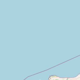
Map view of Tayrona National Natural Park

Use this park location map to pinpoint Tayrona National Natural Park in Colombia, understand its exact geographic position, and read its mapped placement within the surrounding landscape more clearly.

Pigeon | © OpenStreetMap contributors
Park atlas

Explore the regional context and compare other protected areas near Tayrona National Natural Park.

Explore Nearby Protected Areas and National Parks Surrounding Tayrona National Natural Park
Explore other national parks and protected areas located within Colombia's Caribbean region, tracing the diverse conservation landscapes surrounding Tayrona National Natural Park. Comparing these distinct protected areas offers valuable geographic context, revealing how varied ecosystems and conservation efforts connect across the broader regional atlas.
National parkMagdalena Department

Salamanca Island Road Park National Park: A UNESCO Biosphere Reserve of Coastal Wetlands and Mangroves

Explore its unique estuarine environment and abundant bird populations.

Salamanca Island Road Park, designated a National Park and UNESCO Biosphere Reserve, protects a crucial coastal wetland ecosystem in Colombia's Magdalena Department. Its landscape is defined by vast mangrove forests, tidal flats, and the unique meeting of the Magdalena River's fresh water with the Caribbean Sea's salinity. This park is a significant area for birdwatching, with hundreds of species inhabiting its estuarine environment, offering a key point of reference for understanding protected landscapes on the Caribbean coast.

Area
562 km²
Established
1964
IUCN
III
Relief
Lowland
Wildlife reserveColombia

Los Flamencos Sanctuary Wildlife Reserve: Geographic Context and Protected Landscape

Mapped boundaries within Colombia's natural geography.

Los Flamencos Sanctuary is a designated wildlife reserve contributing to the protected landscapes of Colombia. This entry provides a detailed look at its geographic setting and mapped features, crucial for understanding its ecological significance and atlas placement. Explore the protected area's context within the diverse geography of South America, offering a structured perspective for landscape discovery.

Area
0.077 km²
Established
1977
Relief
Lowland
Climate
Tropical
National parkColombia

Rosario and San Bernardo Corals National Natural Park: Colombia's National Natural Park Protected Landscape

Explore the mapped geography and protected natural areas of this Colombian national park.

Delve into the geographical details and protected landscape identity of Rosario and San Bernardo Corals National Natural Park, a significant national park within Colombia. This resource provides a structured atlas view of its mapped boundaries and natural terrain, contributing essential context to the broader Colombian geography and its protected areas.

Area
1,200 km²
Established
1977
IUCN
II
Visitors
318.5K annual
National parkVenezuela

Sierra de Perijá National Park: Protected Area in Venezuela's Geographic Atlas

Explore its national park boundaries and regional landscape context.

Sierra de Perijá National Park is a designated national park in Venezuela, representing a significant protected landscape within the country. This entry facilitates detailed atlas exploration, allowing users to understand the park's precise geographic scope, its mapped boundaries, and its connection to the surrounding regional geography. Discover the core identity of this protected area and its value for geographic study and mapped landscape analysis.

Area
2,952.88 km²
Established
1978
IUCN
II
Relief
Mountain
Watercolor painting of a beach with cacti, sandy shore, and coastal waters
National parkLa Guajira

Bahía Portete, Kaurrele National Natural Park: Mapped Protected Landscape in La Guajira

Explore National Park Geography and Boundaries

Bahía Portete, Kaurrele National Natural Park represents a key protected landscape entity within the La Guajira region of Colombia. This national park's defined geographic scope and mapped protected area status provide a solid foundation for atlas-driven exploration. Understand its role in the regional geography, trace its boundaries, and discover the unique landscape characteristics that define this significant protected territory through structured data.

Area
140.8 km²
Established
2014
Relief
Lowland
Climate
Arid
National parkLa Guajira

Serranía de Macuira National Park: Protected Landscape and Regional Geography Atlas

Explore mapped boundaries of Serranía de Macuira.

Delve into the geography and protected status of Serranía de Macuira National Park, situated in the La Guajira region. This entity offers insight into the mapped terrain and the distribution of protected lands within Colombia. Understand its unique landscape context and its role within a broader geographic atlas.

Area
250 km²
Relief
Mountain
Climate
Arid
Access
Moderate access
Natural monumentColombia

Los Estoraques Unique Natural Area: Colombian Natural Monument of Eroded Pillars

Geographic Context and Landscape Atlas

Los Estoraques Unique Natural Area stands as a distinctive protected landscape within Colombia's Norte de Santander Department. This natural monument is renowned for its striking geological formations of eroded brownstone columns and pedestals, a unique erosional terrain set within the Andean foothills. The area's mapped boundaries encompass a complex ecosystem, bridging dry forest and cloud forest zones, offering significant value for understanding regional geography and the distribution of protected lands in South America.

Area
562 km²
Established
1988
IUCN
III
Relief
Mountain
National parkVenezuela

Sierra La Culata National Park: Protected Landscape Atlas of the Venezuelan Andes

Explore the páramo ecosystems and mapped terrain of this Venezuelan national park.

Sierra La Culata National Park offers a profound look into the unique geography of the Venezuelan Andes. This protected national park is characterized by its expansive páramo ecosystems, dramatic mountain peaks, and glacial lagoons, creating a distinctive high-altitude wilderness. Use this atlas-focused entry to understand the park's mapped boundaries and its significant role within the region's natural landscape context.

Area
2,004 km²
Established
1989
IUCN
II
Relief
Mountain

Common questions about visiting, size, designation, and location context for Tayrona National Natural Park

Tayrona National Natural Park FAQs for park facts, access, geography, and protected area context
Find quick answers about Tayrona National Natural Park, including protected-area facts, park geography, trail and visitor context, and how the park fits into its surrounding country and regional landscape.
MoriAtlas Explorer

Continue Your Protected Areas Search Across the Global Atlas

Deepen your exploration by continuing the structured search for national parks and protected areas worldwide. Utilize the comprehensive filtering capabilities to compare different conservation landscapes and refine your understanding of global park geography. Discover more about the distribution and characteristics of protected natural areas.

Global natural geography