
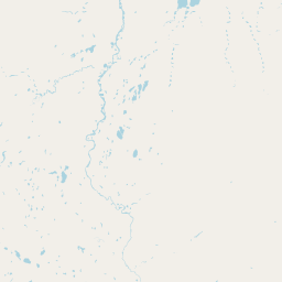
Streams
Park geography
Analyzing the physical features, land area, and environmental zones of this reserve
Comprehensive Geographic Profile and Mapped Terrain of Zugvogelschutzgebiet Banks Island No. 2
Zugvogelschutzgebiet Banks Island No. 2 covers 170 square kilometers of polar tundra and coastal wetlands within the Northwest Territories. The recorded geography includes river systems such as the Thomsen River and Muskox River, with elevations ranging from sea level to 350 meters.
Related tags
Arcticmigratory bird sanctuaryHigh Arctic tundrariver valleyestuary
A remote High Arctic sanctuary protecting a key lesser snow goose moulting ground on northern Banks Island.
Banks Island Migratory Bird Sanctuary No. 2
Banks Island Migratory Bird Sanctuary No. 2 is a federal Migratory Bird Sanctuary in the Canadian Northwest Territories, located on the northern part of Banks Island in the High Arctic. Covering roughly 170 square kilometres, it protects the lower 72 kilometres of the Thomsen River and its outlet into Castel Bay, along with a narrow strip of shoreline. The sanctuary was established in 1961 and sits within Aulavik National Park, which was created in 1992 to safeguard the surrounding tundra landscape. The sanctuary's primary ecological role centres on birds. It hosts one of the most important lesser snow goose moulting gatherings in the Arctic, with around 25,000 individuals of the subspecies Anser caerulescens caerulescens congregating here annually. It also serves as a breeding and feeding area for tundra-nesting waterbirds and shorebirds and as wintering range for muskoxen, one of the most important herds on the island. The protected area is part of the Thomsen River Important Bird Area recognized by BirdLife International, underscoring its value for Arctic avian biodiversity. Managed by the Canadian Wildlife Service, it represents a classical example of a remote, ecologically focused High Arctic sanctuary where protection targets waterfowl life cycles rather than recreation or tourism infrastructure.
- Location
- Canada
- Park type
- Wildlife reserve
- Established
- 1961
- Area
- 170 km²
- Highest point
- 350 m
Location overview
Regional administrative data and island status within Canada
Zugvogelschutzgebiet Banks Island No. 2 Geographic Context and Location Index
Recorded country and regional memberships place Zugvogelschutzgebiet Banks Island No. 2 within Canada and the Northwest Territories. Administrative listings verify coastal and island protected area status for this location.
- Countries
- Canada
- Regions
- Northwest Territories
- Primary location
- Northwest Territories
- Geographic setting
- Coastal · Island
Boundary and coordinates
Interactive spatial layout and calculated 170 square kilometer area metrics
Zugvogelschutzgebiet Banks Island No. 2 Boundary Map and Geographic Extent
Mapped boundary geometry provides clear spatial context for the protected territory. Accompanying measurement metrics outline recorded area size, coordinate limits, and geographic spans.
- Boundary area
- 179.1 km²
- Boundary perimeter
- 174.5 km
- Northernmost point
- 74.2305° N
- Southernmost point
- 73.6036° N
- Easternmost point
- 119.445° W
- Westernmost point
- 120.0909° W
- Geographic centre
- 73.9805° N, 119.7621° W
- North–south span
- 70 km
- East–west span
- 20 km
Elevation and terrain
Lowland relief spans and recorded natural features across protected terrain.
Terrain and Elevation Summary for Zugvogelschutzgebiet Banks Island No. 2
Recorded elevation records outline terrain elevation limits reaching up to 350 meters across the protected area. Associated natural feature cards detail streams, rivers, bays, and islands positioned within the landscape boundary.
- Minimum elevation
- 0 m
- Maximum elevation
- 350 m
- Highest point
- 350 m
Selected named natural features
Rivers
Muskox River
Streams
Muskox River
Bays
Castel Bay
Rivers
Thomsen River
Streams
Thomsen River
Environmental setting
Polar climate zones, lowland relief, and sparse forest cover across regional terrain
Environmental Classifications and Physical Geography of Zugvogelschutzgebiet Banks Island No. 2
Stored classifications combine to frame the physical setting of Zugvogelschutzgebiet Banks Island No. 2 through distinct polar, lowland, and coastal categories. Recorded attributes connect directly to relevant atlas destinations for regional comparison.
- Relief
- Lowland
- Climate
- Polar
- Water
- Major water bodies
- Forest cover
- Sparse forest
- Seasonality
- Seasonal
Landscape features
Rivers · Coast · Cliffs · Islands · Wetland
Habitat types
Tundra habitat · Wetland · Riverine habitat · Coastal habitat
Park atlas
Compare surrounding High Arctic tundra corridors and regional conservation areas
Other Protected Areas and Parks Near Zugvogelschutzgebiet Banks Island No. 2
Browsing related northern reserves provides deeper context for the wildlife habitats surrounding Zugvogelschutzgebiet Banks Island No. 2. Continuing through nearby protected landscapes reveals shared ecological patterns across the Canadian Arctic Archipelago.
National parkNorthwest Territories
Park boundaries overlap#1 closest
South

Aulavik National Park: Northwest Territories National Park Protected Landscape and Geographic Context
Explore the mapped boundaries and regional park geography.
Gain a clear understanding of Aulavik National Park's protected status and its placement within the Northwest Territories. This detail page offers focused atlas exploration of the park's geographic identity, mapped features, and its significance as a National Park within Canada's northern geography. Discover the unique landscape context of this protected area for in-depth geographic study and discovery.
- Area
- 12,200 km²
- Established
- 1992
- IUCN
- II
- Visitors
- 34 annual
National parkNorthwest Territories
443 km away#2 closest
South
Tuktut Nogait National Park: Northwest Territories Protected Landscape Atlas
Explore its mapped boundaries and regional geography.
Delve into Tuktut Nogait National Park, a protected national park situated within the vast geography of the Northwest Territories. This entry provides a focused view of the park's specific identity, its defined protected area boundaries, and its contribution to the regional landscape atlas. Understanding Tuktut Nogait National Park means grasping its geographic context and its role as a key natural landscape within the broader Canadian protected area network, ideal for detailed map-based study.
- Area
- 18,100 km²
- Established
- 1998
- IUCN
- II
- Visitors
- 12 annual
National parkNunavut
476 km away#3 closest
Northeast
Qausuittuq National Park: Explore Nunavut's Protected National Park Landscape and Geography
Mapped protected area boundaries and regional geographic context.
Delve into Qausuittuq National Park, a key protected area in Nunavut offering rich opportunities for geographic exploration. This destination provides detailed mapping of its protected boundaries and a comprehensive overview of its landscape context within the Arctic region. Discover how Qausuittuq National Park contributes to the mapped protected lands of Canada, ideal for users seeking structured geographic data and atlas-style discovery.
- Area
- 11,000 km²
- Established
- 2015
- IUCN
- II
- Relief
- Upland
National parkYukon
809 km away#4 closest
Southwest
Ivvavik National Park: Yukon National Park Protected Landscape and Geography
Explore mapped boundaries and regional context.
Ivvavik National Park is a designated national park within Yukon, representing a significant protected landscape. This page offers a focused exploration of its geographic identity, mapped boundaries, and its place within the broader atlas of Canada's natural areas. Understand Ivvavik National Park as a defined entity contributing to the regional geography and protected land distribution of Yukon.
- Area
- 10,168 km²
- Established
- 1984
- IUCN
- II
- Visitors
- 179 annual
National parkYukon
869 km away#5 closest
Southwest
Vuntut National Park: Yukon National Park Protected Area Map Exploration
Understanding its mapped protected boundaries and regional geography.
Delve into the specifics of Vuntut National Park, a designated national park situated within the Yukon region. This detail offers a focused look at its protected landscape identity, providing critical context for its geographic boundaries and role as a mapped natural area. Users can explore the core attributes of Vuntut National Park to enrich their understanding of its contribution to the protected lands atlas and regional geography.
- Area
- 4,345 km²
- Established
- 1995
- IUCN
- II
- Relief
- Lowland
National parkNunavut
About 1,194 km away#6 closest
East
Sirmilik National Park: Nunavut National Park Atlas and Protected Landscape Map
Explore the geographic boundaries and regional context of Sirmilik National Park.
This entry provides detailed insights into Sirmilik National Park, a designated national park situated in Nunavut, Canada. It serves as a focal point for understanding the park's specific geography, its mapped protected landscape, and its role within the regional atlas. Users can explore the park's defined boundaries and its contribution to the broader landscape context of Nunavut, making it an essential destination for detailed geographic discovery.
- Area
- 22,200 km²
- Established
- 2001
- IUCN
- II
- Visitors
- 6 annual
National parkNunavut
1,206 km away#7 closest
Northeast
Quttinirpaaq National Park: A Detailed Look at its Protected Landscape and Nunavut Geography
Mapped boundaries and regional context for this significant Arctic national park.
Gain a comprehensive understanding of Quttinirpaaq National Park, a protected national park located in the expansive region of Nunavut, Canada. This resource delves into the park's geographic identity, its mapped contours, and its position within the broader arctic landscape context. It is designed to support atlas-based exploration and a detailed appreciation of this protected area's unique setting within Northern Canada's geography.
- Area
- 37,775 km²
- Established
- 1988
- IUCN
- II
- Visitors
- 7 annual
National parkNorthwest Territories
1,223 km away#8 closest
South
Nááts'ihch'oh National Park Reserve: Mapped Protected Landscape in Northwest Territories
Explore its geographic boundaries and regional context.
Gain a structured understanding of Nááts'ihch'oh National Park Reserve, a significant protected national park within the Northwest Territories. This detail provides context for its geographical placement and the extent of its protected landscape, vital for anyone exploring the region's natural areas through maps and atlas data.
- Area
- 4,850 km²
- Established
- 2014
- IUCN
- II
- Visitors
- 109 annual
MoriAtlas Explorer
Continue Exploring the Zugvogelschutzgebiet Banks Island No. 2 Protected Landscape
Examine the precise boundaries and regional geographic context of Zugvogelschutzgebiet Banks Island No. 2. MoriAtlas provides detailed insight into this remote High Arctic sanctuary to support better understanding of protected tundra ecosystems and their role in regional conservation across the Northwest Territories.
Browse next
Global natural geography
Explore related park routes
Explore MoriAtlas Global ParksBrowse All MoriAtlas ParksGlobal Park Map DiscoveryMoriAtlas: Browse All CountriesBrowse All MoriAtlas ContinentsNational Park Environment AtlasGrand Canyon National Park AtlasYellowstone National Park AtlasYosemite National Park Atlas and GeographySerengeti National Park AtlasGalápagos National Park Protected LandscapeBanff National Park Geography and AtlasKruger National Park Atlas EntryUluṟu-Kata Tjuṯa National Park AtlasExplore Uluru-Kata Tjuta National Park GeographyPlitvice Lakes National Park AtlasFiordland National Park Protected LandscapeGreat Smoky Mountains National Park AtlasAfghanistan National Parks and Protected AreasAlbania National Parks and Protected AreasAlgeria National Parks and Protected AreasAmerican Samoa National Parks and Protected AreasAndorra National Parks and Protected AreasAngola National Parks and Protected AreasAntarctica National Parks and Protected AreasAntigua and Barbuda Park List