

Mori Atlas logo
Wildlife reserveZugvogelschutzgebiet Banks Island No. 2

Mapping the river valleys and tundra landscapes of this essential avian sanctuary

Zugvogelschutzgebiet Banks Island No. 2: A High Arctic Wildlife Reserve in Northwest Territories

(Banks Island Migratory Bird Sanctuary No. 2)

Zugvogelschutzgebiet Banks Island No. 2 serves as a vital protected landscape within the High Arctic, encompassing the lower Thomsen River and its outlet into Castel Bay. This wildlife reserve preserves critical riparian terrain and tundra habitats that support massive seasonal bird gatherings and overwintering muskoxen. Through its integration with the surrounding national park, this sanctuary stands as a benchmark for ecological conservation in the northern Canadian territory.

Arcticmigratory bird sanctuaryHigh Arctic tundrariver valleyestuarywaterfowl

Zugvogelschutzgebiet Banks Island No. 2

Wildlife reserve

Park overview

Structured park overview, official facts, and landscape profile for Banks Island Migratory Bird Sanctuary No. 2

Banks Island Migratory Bird Sanctuary No. 2 park facts, protected area profile, and essential visitor context

Review the core facts for Banks Island Migratory Bird Sanctuary No. 2, including designation, size, terrain, visitor scale, habitats, and operating context in one park-focused overview.

About Banks Island Migratory Bird Sanctuary No. 2

Banks Island Migratory Bird Sanctuary No. 2 is a High Arctic protected area dedicated to safeguarding critical habitat for migratory waterfowl and tundra wildlife. Located in the island's far north, the sanctuary follows the lower reaches of the Thomsen River, one of the major waterways that drains the Arctic tundra of northern Banks Island. The protected corridor extends roughly 72 kilometres upstream from the river's mouth and includes the estuary at Castel Bay, a sheltered inlet on the northern coast.

Beyond its wildlife focus, the sanctuary's significance is amplified by its location within Aulavik National Park, established in 1992 specifically to protect the northern Banks Island tundra. Together, the federal bird sanctuary and the surrounding national park form a layered protection regime, with strict conservation status applied to the river corridor and broader landscape protections covering the wider catchment. The area also qualifies formally as the Thomsen River Important Bird Area under BirdLife International's global network of key avian sites.

The sanctuary has no road access, no visitor infrastructure, and no permanent residents living within its boundaries. The closest settlement is Sachs Harbour, an Inuvialuit community on the southern coast roughly 270 kilometres from the protected area. Its remoteness is central to its ecological value: the tundra and river system remain essentially undisturbed by human activity beyond occasional monitoring and traditional land use.

Quick facts and research context for Banks Island Migratory Bird Sanctuary No. 2

Banks Island Migratory Bird Sanctuary No. 2 is a small but ecologically significant Canadian federal Migratory Bird Sanctuary, established in 1961 at 73°52′N, 119°47′W on northern Banks Island in the Northwest Territories. It spans about 170 square kilometres, with elevations ranging from sea level to roughly 350 metres, and falls within IUCN Category Ia (Strict Nature Reserve).

The sanctuary sits inside Aulavik National Park and overlaps with the Thomsen River Important Bird Area designated by BirdLife International. It is administratively managed by the Canadian Wildlife Service. The nearest community, Sachs Harbour, is located about 270 kilometres to the southwest along the southern coast of the island.

Protection and recognition

Examine terrestrial boundary parameters, formal recognition records, and global database identifiers.

Zugvogelschutzgebiet Banks Island No. 2 Protection Status and Protected Area Recognition

Terrestrial protection parameters and official database designations for Zugvogelschutzgebiet Banks Island No. 2 outline its recorded conservation framework. Documented records provide verified administrative identifiers and international status metrics without assuming management outcomes.

Protection details

Protection scope
Terrestrial
Transboundary protection
No
WDPA ID
18701
Park context

Deeper park guide and search-rich context for Banks Island Migratory Bird Sanctuary No. 2

Banks Island Migratory Bird Sanctuary No. 2 history, landscape, wildlife, and travel context

Explore Banks Island Migratory Bird Sanctuary No. 2 through its history, landscape character, ecosystems, wildlife, conservation priorities, cultural context, and seasonal travel timing in a structured park guide built for atlas discovery and search intent.

Why Banks Island Migratory Bird Sanctuary No. 2 stands out

Banks Island Migratory Bird Sanctuary No. 2 is best known as one of the principal lesser snow goose moulting sites in the Canadian Arctic. Each summer, an estimated 25,000 snow geese of the subspecies Anser caerulescens caerulescens, likely drawn from breeding colonies around Big River and Egg River on southern Banks Island, gather along the lower Thomsen River to undergo their annual moult, a period when they are flightless and especially vulnerable. The sanctuary is also recognized for its importance to Arctic-nesting waterbirds, raptors breeding on scattered cliff faces along the Thomsen and Muskox rivers, and one of the island's most significant overwintering grounds for muskoxen.

Banks Island Migratory Bird Sanctuary No. 2 history and protected-area timeline

Banks Island Migratory Bird Sanctuary No. 2 was formally established in 1961 as part of Canada's expanding network of federal Migratory Bird Sanctuaries created under the Migratory Birds Convention Act and administered by the Canadian Wildlife Service. Its creation reflected a growing scientific understanding of the importance of the Thomsen River valley as a summer concentration site for lesser snow geese, particularly during their flightless post-breeding moult.

In the decades that followed, the sanctuary's profile grew as Arctic ecological research expanded. The recognition of the area as the Thomsen River Important Bird Area by BirdLife International placed it within a global framework for the conservation of key avian sites. A major conservation milestone came in 1992, when the federal government established Aulavik National Park, enclosing the sanctuary and extending strict protections across the broader northern Banks Island landscape.

The sanctuary today represents one of the older components of Canada's modern High Arctic conservation system. It predates the national park by more than three decades, illustrating how species-specific bird protection has historically acted as a foundation for wider landscape-level conservation in the Canadian North.

Banks Island Migratory Bird Sanctuary No. 2 landscape and geographic character

The sanctuary's landscape is shaped almost entirely by the Thomsen River and its valley. The river cuts across flat to gently rolling High Arctic tundra, descending from interior Banks Island northward toward Castel Bay. Elevations within the sanctuary range from sea level at the coast to about 350 metres inland, reflecting the subdued relief typical of the western Canadian Arctic Archipelago.

The protected corridor hugs the river closely. Beyond the surface waters and estuary, the sanctuary consists essentially of narrow bands of riverside terrain, including silt, gravel, and low banks. The wider surrounding landscape, while not formally inside the sanctuary, transitions into the broader tundra, river valleys, and coastal lowlands protected by Aulavik National Park. The combination of river, estuary, tundra, and scattered rock outcrops defines the visual character of the sanctuary and supports a sharp ecological contrast between aquatic, riparian, and upland tundra habitats.

Banks Island Migratory Bird Sanctuary No. 2 ecosystems, habitats, and plant life

Ecologically, Banks Island Migratory Bird Sanctuary No. 2 is a tundra-dominated system organized around a single major river corridor. The mosaic of open tundra, riparian flats, river channels, freshwater margins, and coastal estuary defines a compact but ecologically layered environment. The river corridor provides food, cover, and open sightlines that differ from the surrounding open tundra, concentrating biological activity along its banks.

Wetland habitats along the Thomsen River are especially important. Shallow pools, vegetated margins, and the sheltered estuary at Castel Bay create nesting and feeding conditions for several Arctic-nesting waterbirds, including loons and shorebirds. The habitat structure supports not only waterfowl during summer but also a seasonal pulse of activity tied to the moult cycles of geese and the breeding season of smaller tundra birds.

The sanctuary's modest size is offset by the biological intensity of the habitats it encompasses. By protecting the full lower stretch of the river and its mouth, the sanctuary effectively captures the ecological gradient between the freshwater river system and the marine-influenced estuary, ensuring that the entire seasonal cycle of the Thomsen River remains intact for wildlife.

Banks Island Migratory Bird Sanctuary No. 2 wildlife and species highlights

The sanctuary's wildlife significance is dominated by birds. Its single most important feature is the annual concentration of lesser snow geese, with around 25,000 individuals of the subspecies Anser caerulescens caerulescens using the Thomsen River valley as a moulting area. These geese are believed to originate from the breeding colonies around Big River and Egg River further south, in the neighbouring Banks Island Migratory Bird Sanctuary No. 1. Brant geese also use the river valley for moulting and typically depart by early to mid-August.

A wide range of other bird species breed or feed within the sanctuary. Wetland habitats support Pacific loon, yellow-billed loon, glaucous gull, parasitic jaeger, and red phalarope. Scattered cliff faces along the Thomsen River and the nearby Muskox River provide nesting habitat for rough-legged hawks and peregrine falcons of the tundra subspecies, with two peregrine eyries documented in the area. Smaller-scale breeders and visitors include Lapland longspur, horned lark, snow bunting, Baird's sandpiper, buff-breasted sandpiper, and American golden-plover.

Mammals are also significant. The area is considered one of the most important grounds for muskoxen on Banks Island, with the animals observed year-round in the sanctuary and its surroundings. Peary caribou are encountered in the area only irregularly, reflecting the broader status of this High Arctic subspecies.

Banks Island Migratory Bird Sanctuary No. 2 conservation status and protection priorities

The sanctuary's conservation importance lies in its protection of a stage of the lesser snow goose life cycle that is otherwise highly vulnerable. During the moult, geese are flightless for several weeks and depend absolutely on secure, undisturbed habitat. By protecting the lower Thomsen River corridor, the sanctuary ensures that this critical period can proceed without anthropogenic disturbance, contributing to the long-term persistence of one of the largest snow goose moulting gatherings in the Canadian Arctic.

Layered protections add to its conservation weight. Inside Aulavik National Park, the sanctuary gains additional landscape-scale safeguards that buffer the river corridor from changes on the surrounding tundra. Its designation as the Thomsen River Important Bird Area places it within an international network tracking the conservation status of key sites for migratory birds.

The sanctuary's strict IUCN Category Ia status reinforces its high level of protection. Managed by the Canadian Wildlife Service, it functions primarily as a habitat-protection reserve rather than a recreational area, reflecting both its biological importance and its extreme remoteness.

Banks Island Migratory Bird Sanctuary No. 2 cultural meaning and human context

The surrounding region of Banks Island has a long human history tied to the Inuvialuit and earlier Inuit cultures, whose traditional use of the Arctic landscape ranged from seasonal hunting to permanent settlement. The only contemporary community associated with Banks Island is Sachs Harbour, an Inuvialuit hamlet on the southern coast and the nearest inhabited place to the sanctuary, located about 270 kilometres to the southwest. The sanctuary itself is uninhabited and without permanent infrastructure, consistent with the wider northern Banks Island environment, where traditional land use continues to coexist with modern conservation designations.

Top sights and standout views in Banks Island Migratory Bird Sanctuary No. 2

The sanctuary's standout qualities include its status as one of the foremost lesser snow goose moulting grounds in the Canadian Arctic, with roughly 25,000 birds gathering each summer along the Thomsen River valley. Equally significant is its position within Aulavik National Park and the broader Thomsen River Important Bird Area, layering international, national, and bird-specific protections over a single compact river corridor.

Its combination of wildlife importance, layered protection, and extreme remoteness makes it a benchmark example of High Arctic Migratory Bird Sanctuary design. Rather than protecting scenery for visitors, it preserves the ecological conditions necessary for vulnerable stages of Arctic waterfowl life cycles, while also supporting one of Banks Island's most important resident muskox herds.

Best time to visit Banks Island Migratory Bird Sanctuary No. 2

The sanctuary's ecological character is strongly seasonal. The most biologically intense period is the Arctic summer, roughly from June through August, when snow geese arrive to moult and tundra-nesting birds establish breeding territories along the Thomsen River. By early to mid-August, brant geese typically begin to leave the area, and the broader migratory season tapers as summer shortens.

For any form of visitation, the brief Arctic summer is the only practical window. The remainder of the year brings freezing temperatures, snow cover, and near-total biological dormancy, with limited daylight outside the late spring and summer months. The sanctuary is not oriented toward tourism, and any travel would be subject to the same strict protections that govern the area year-round.
Monthly climate preview

Long-term representative point measurements of monthly temperature and precipitation patterns

Zugvogelschutzgebiet Banks Island No. 2 Climate Normals and Temperature Rhythms

Representative coordinates record severe sub-zero winter temperatures alongside modest summer precipitation variations across the protected landscape. Examining the complete twelve-month climatology profile reveals precise monthly averages for temperature and precipitation totals.
Annual mean-14 °C
-30 °C6 °C
Jan-30°
Feb-30°
Mar-26°
Apr-17°
May-7°
Jun
Jul
Aug
Sep-4°
Oct-15°
Nov-23°
Dec-28°
Warmest month
July

5.9 °C

Coolest month
January

-30 °C

Wettest month
August

1.7 mm/day

Driest month
February

0.5 mm/day

Park location guide

Geography guide, regional context, and park location map for Banks Island Migratory Bird Sanctuary No. 2

Banks Island Migratory Bird Sanctuary No. 2 park geography, regions, and map view in Canada

Understand where Banks Island Migratory Bird Sanctuary No. 2 sits in Canada through a broader geographic reading of the surrounding landscape, nearby location context, and its mapped position within the national park landscape.

How Banks Island Migratory Bird Sanctuary No. 2 fits into Canada

Canada is a federal parliamentary constitutional monarchy spanning North America from the Atlantic to the Pacific and Arctic Oceans. With a population of over 41 million, it is officially bilingual in English and French at the federal level. The country gained independence from the United Kingdom through a gradual process culminating in 1982.

Wider geography shaping Banks Island Migratory Bird Sanctuary No. 2 in Canada

Canada occupies the northern portion of North America, sharing its longest international border with the United States. The country extends from the Atlantic Ocean to the Pacific Ocean and northward into the Arctic Ocean, giving it the longest coastline of any nation.

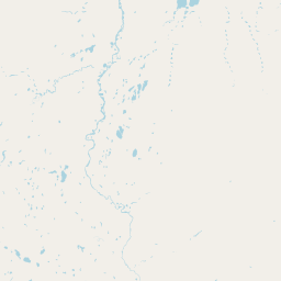
Map view of Banks Island Migratory Bird Sanctuary No. 2

Use this park location map to pinpoint Banks Island Migratory Bird Sanctuary No. 2 in Canada, understand its exact geographic position, and read its mapped placement within the surrounding landscape more clearly.

Pigeon | © OpenStreetMap contributors

Location context for Banks Island Migratory Bird Sanctuary No. 2

Northwest Territories
Natural feature types

View Geographic Features in Zugvogelschutzgebiet Banks Island No. 2

Investigate the physical terrain and named landscape features associated with Zugvogelschutzgebiet Banks Island No. 2. MoriAtlas provides a structured atlas perspective on the High Arctic river valleys and coastal zones, facilitating deeper geographic understanding of these protected natural environments.
Park atlas

Compare surrounding High Arctic tundra corridors and regional conservation areas

Other Protected Areas and Parks Near Zugvogelschutzgebiet Banks Island No. 2

Browsing related northern reserves provides deeper context for the wildlife habitats surrounding Zugvogelschutzgebiet Banks Island No. 2. Continuing through nearby protected landscapes reveals shared ecological patterns across the Canadian Arctic Archipelago.
National parkNorthwest Territories
Park boundaries overlap#1 closest

South

Aulavik National Park: Northwest Territories National Park Protected Landscape and Geographic Context

Explore the mapped boundaries and regional park geography.

Gain a clear understanding of Aulavik National Park's protected status and its placement within the Northwest Territories. This detail page offers focused atlas exploration of the park's geographic identity, mapped features, and its significance as a National Park within Canada's northern geography. Discover the unique landscape context of this protected area for in-depth geographic study and discovery.

Area
12,200 km²
Established
1992
IUCN
II
Visitors
34 annual
National parkNorthwest Territories
443 km away#2 closest

South

Tuktut Nogait National Park: Northwest Territories Protected Landscape Atlas

Explore its mapped boundaries and regional geography.

Delve into Tuktut Nogait National Park, a protected national park situated within the vast geography of the Northwest Territories. This entry provides a focused view of the park's specific identity, its defined protected area boundaries, and its contribution to the regional landscape atlas. Understanding Tuktut Nogait National Park means grasping its geographic context and its role as a key natural landscape within the broader Canadian protected area network, ideal for detailed map-based study.

Area
18,100 km²
Established
1998
IUCN
II
Visitors
12 annual
National parkNunavut
476 km away#3 closest

Northeast

Qausuittuq National Park: Explore Nunavut's Protected National Park Landscape and Geography

Mapped protected area boundaries and regional geographic context.

Delve into Qausuittuq National Park, a key protected area in Nunavut offering rich opportunities for geographic exploration. This destination provides detailed mapping of its protected boundaries and a comprehensive overview of its landscape context within the Arctic region. Discover how Qausuittuq National Park contributes to the mapped protected lands of Canada, ideal for users seeking structured geographic data and atlas-style discovery.

Area
11,000 km²
Established
2015
IUCN
II
Relief
Upland
National parkYukon
809 km away#4 closest

Southwest

Ivvavik National Park: Yukon National Park Protected Landscape and Geography

Explore mapped boundaries and regional context.

Ivvavik National Park is a designated national park within Yukon, representing a significant protected landscape. This page offers a focused exploration of its geographic identity, mapped boundaries, and its place within the broader atlas of Canada's natural areas. Understand Ivvavik National Park as a defined entity contributing to the regional geography and protected land distribution of Yukon.

Area
10,168 km²
Established
1984
IUCN
II
Visitors
179 annual
National parkYukon
869 km away#5 closest

Southwest

Vuntut National Park: Yukon National Park Protected Area Map Exploration

Understanding its mapped protected boundaries and regional geography.

Delve into the specifics of Vuntut National Park, a designated national park situated within the Yukon region. This detail offers a focused look at its protected landscape identity, providing critical context for its geographic boundaries and role as a mapped natural area. Users can explore the core attributes of Vuntut National Park to enrich their understanding of its contribution to the protected lands atlas and regional geography.

Area
4,345 km²
Established
1995
IUCN
II
Relief
Lowland
National parkNunavut
About 1,194 km away#6 closest

East

Sirmilik National Park: Nunavut National Park Atlas and Protected Landscape Map

Explore the geographic boundaries and regional context of Sirmilik National Park.

This entry provides detailed insights into Sirmilik National Park, a designated national park situated in Nunavut, Canada. It serves as a focal point for understanding the park's specific geography, its mapped protected landscape, and its role within the regional atlas. Users can explore the park's defined boundaries and its contribution to the broader landscape context of Nunavut, making it an essential destination for detailed geographic discovery.

Area
22,200 km²
Established
2001
IUCN
II
Visitors
6 annual
National parkNunavut
1,206 km away#7 closest

Northeast

Quttinirpaaq National Park: A Detailed Look at its Protected Landscape and Nunavut Geography

Mapped boundaries and regional context for this significant Arctic national park.

Gain a comprehensive understanding of Quttinirpaaq National Park, a protected national park located in the expansive region of Nunavut, Canada. This resource delves into the park's geographic identity, its mapped contours, and its position within the broader arctic landscape context. It is designed to support atlas-based exploration and a detailed appreciation of this protected area's unique setting within Northern Canada's geography.

Area
37,775 km²
Established
1988
IUCN
II
Visitors
7 annual
National parkNorthwest Territories
1,223 km away#8 closest

South

Nááts'ihch'oh National Park Reserve: Mapped Protected Landscape in Northwest Territories

Explore its geographic boundaries and regional context.

Gain a structured understanding of Nááts'ihch'oh National Park Reserve, a significant protected national park within the Northwest Territories. This detail provides context for its geographical placement and the extent of its protected landscape, vital for anyone exploring the region's natural areas through maps and atlas data.

Area
4,850 km²
Established
2014
IUCN
II
Visitors
109 annual

Common questions about visiting, size, designation, and location context for Banks Island Migratory Bird Sanctuary No. 2

Banks Island Migratory Bird Sanctuary No. 2 FAQs for park facts, access, geography, and protected area context

Find quick answers about Banks Island Migratory Bird Sanctuary No. 2, including protected-area facts, park geography, trail and visitor context, and how the park fits into its surrounding country and regional landscape.
MoriAtlas Explorer

Continue Your Protected Areas Search Across the Global Atlas

Deepen your exploration by continuing the structured search for national parks and protected areas worldwide. Utilize the comprehensive filtering capabilities to compare different conservation landscapes and refine your understanding of global park geography. Discover more about the distribution and characteristics of protected natural areas.

Global natural geography