Peaks
Çal Dağı
1,070 m

Detailed spatial analysis of regional location, terrain measurements, and natural features
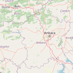
Examine the structured geographic data for Battle of Sakarya National Historic Park located in the Ankara region of Turkey. This profile provides an analysis of the total area, boundary span, and included natural formations, such as peaks and river systems, mapped within the designated historic landscape.
Related tags
Historic battlefield where Turkey's independence was secured
Battle of Sakarya National Historic Park is a protected area of national historic significance in central Anatolia, Turkey, commemorating one of the most decisive battles of the Turkish War of Independence. The park encompasses the actual battleground where the Battle of Sakarya took place in September 1921, a confrontation that proved pivotal in halting the Greek advance and ultimately reversing the course of the war. Located in the Polatlı and Haymana districts of Ankara Province, the site preserves tangible remnants of the conflict including trenches, defensive positions, and memorial areas that mark the locations where key engagements unfolded across the hilly terrain. The establishment of this national historic park in 2015 reflects Turkey's commitment to maintaining and commemorating the physical legacy of its struggle for independence, allowing visitors to walk the same ground where defining moments of national history occurred.
Regional placement and national positioning in Ankara, Turkey
Spatial footprint and regional extent covering over 130 square kilometers
Explore recorded peaks, streams, and rivers situated within the park boundaries
Peaks
1,070 m
Peaks
1,076 m
Peaks
1,409 m
Streams
Rivers
Peaks
1,070 m
Interpreting stored park terrain, habitat, and climate classification records
Explore the protected landscapes of Central Anatolia, tracing park geography and conservation efforts around Ankara
Northwest

Ancient forests, endemic botany, and dramatic mountain terrain.
Mount Sarıçalı National Park, located in Ankara Province, Turkey, is a testament to the nation's commitment to conservation. This protected area is celebrated for its ancient forests, with larch, Kasnak oak, and juniper trees dating back 700-800 years. Its position at the confluence of three phytogeographic zones supports a rich array of 139 endemic plant species. The park's landscape is further characterized by the striking Uyuzsuyu Waterfall and the imposing Mount Sarıçalı peak, offering a profound geographic context for atlas exploration.
North
Explore mapped boundaries and unique Anatolian geography.
Soğuksu National Park serves as a significant protected natural area in central Turkey, celebrated for its substantial coniferous forest ecosystem. This park showcases a transition zone between major geographic regions, offering a unique highland landscape shaped by volcanic geology. Discover its mapped protected boundaries and its role as a vital natural atlas point within the broader Turkish geography, featuring diverse terrain and important ecological elements.
Northwest
Bolu Province, Turkey | National Park | Mapped Landscape
Lake Abant National Park is a protected national park renowned for its stunning volcanic crater lake and surrounding alpine forests within Bolu Province. This detailed entry provides insight into the park's geographic context, its unique volcanic terrain, and its status as a protected landscape. Explore the mapped boundaries and understand the ecological significance of this distinctive natural area in northwestern Turkey.
North
Discover mapped terrain and unique natural park geography.
Yedigöller National Park presents a distinctive protected landscape within Bolu Province, notable for its chain of seven landslide-formed lakes and extensive, dense forests. This page serves as your entry point to understanding the park's geographic distribution, mapped boundaries, and the characteristic terrain that defines this important natural area. Explore the unique ecosystem and its place within the broader regional geography through structured atlas-style discovery.

Southwest
Mapped boundaries, alpine terrain, and unique cedar forests.
Kızıldağ National Park offers a detailed look into Turkey's protected natural heritage, specifically highlighting the dramatic mountainous terrain of the Taurus Ranges. This page provides atlas-level geographic information about its mapped boundaries, the significant Dedegöl Mountain, and the rare blue-leaf cedar forests unique to this region. Understand its role as a vital conservation area within Isparta Province and the broader Mediterranean mountain ecosystem.
Southwest
Protected Area preserving pivotal geography and military history.
Commander-in-Chief National Historic Park is a designated protected area in Turkey, preserving the historic terrain of the decisive Battle of Dumlupınar. This site offers a unique glimpse into the geography and landscape that were instrumental in a key moment of the Turkish War of Independence. Explore the mapped context of this significant battlefield, understanding its role within the broader Anatolian geography and its importance as a preserved historic site.

South
Discover the geography and mapped context of this national park in Konya.
Lake Beyşehir National Park is a major protected area in Turkey's Central Anatolia region, celebrated for its immense freshwater lake and diverse wetland habitats. The park's identity is strongly tied to its mapped boundaries that protect critical ecosystems, islands, and surrounding forested terrain. This page provides a detailed look at the park's geographic setting within Konya Province, serving as a valuable resource for atlas-based discovery of its unique natural and cultural landscape.
East
Explore the protected landscape of Turkey's original national park.
As Turkey's pioneering national park, Yozgat Pine Grove National Park offers a deep dive into a unique protected landscape. This site provides detailed geographic context for its ancient pine forest, set dramatically against the steppe terrain of Yozgat Province. Understand the park's mapped boundaries and its ecological significance as a historic conservation area. MoriAtlas facilitates a structured exploration of this important natural heritage site, highlighting its role in Turkish protected land history and its distinct regional geography.
Delve deeper into the mapped geography and protected landscape context of Battle of Sakarya National Historic Park. Understand how its terrain played a critical role in the historical events and how this national park fits within the broader regional atlas. Continue your discovery of Turkey's significant protected areas and their unique geographic identities.