Mori Atlas logo
National parkChristmas Island National Park

Understand the mapped boundaries and regional context of this significant Australian national park.

Christmas Island National Park: An Atlas of Protected Landscape Geography in Australia

Christmas Island National Park represents a distinct protected natural area within the geographic scope of Australia. This page serves as an entry point for exploring its specific mapped boundaries and the unique landscape context it provides. Delve into the regional geography to understand how this national park fits into the broader atlas of protected lands, offering a focused view of its identity as a significant conservation landscape.

Australian territory parkIndian Ocean islandsEndemic species sanctuaryRainforest protected areaRed crab migration siteSeabird breeding habitat

Christmas Island National Park

National park

Park overview

Structured park overview, official facts, and landscape profile for Christmas Island National Park

Christmas Island National Park park facts, protected area profile, and essential visitor context
Review the core facts for Christmas Island National Park, including designation, size, terrain, visitor scale, habitats, and operating context in one park-focused overview.

About Christmas Island National Park

Christmas Island National Park represents one of the most ecologically significant protected areas in the Indo-Pacific region. The park encompasses most of Christmas Island, an isolated landmass that rises dramatically from the deep ocean floor as an ancient volcanic seamount topped with uplifted limestone formations. The landscape features steep sea cliffs reaching heights of 60 meters, terraced step-like formations, and an extensive cave system carved into the limestone bedrock. The park protects the island's dense rainforest, which dominates the interior and supports an extraordinary concentration of endemic species. The marine environment surrounding the island also falls within park boundaries, extending to the low-water mark and protecting coastal ecosystems including rock platforms and tidal pools. The park's two Ramsar-listed wetlands, The Dales and Hosnies Spring, provide critical freshwater habitat and are among the island's most botanically diverse areas. The combination of terrestrial and marine protection makes Christmas Island National Park a comprehensive conservation unit for an island ecosystem that has evolved in almost complete isolation.

Quick facts and research context for Christmas Island National Park

Christmas Island National Park occupies most of Christmas Island, an Australian territory in the eastern Indian Ocean. The park was established in 1980 under the National Parks and Wildlife Conservation Act 1975, initially protecting the southwest corner before expanding to encompass the majority of the island's rainforest. The park boundary extends 50 meters beyond the low water line, with approximately 46 of the island's 73 kilometers of shoreline falling within park boundaries. Two Ramsar wetland sites, The Dales and Hosnies Spring, are contained within the park. The park is managed by the Director of National Parks with a staff of 17 operating from an office in Drumsite.

Park context

Deeper park guide and search-rich context for Christmas Island National Park

Christmas Island National Park history, landscape, wildlife, and travel context
Explore Christmas Island National Park through its history, landscape character, ecosystems, wildlife, conservation priorities, cultural context, and seasonal travel timing in a structured park guide built for atlas discovery and search intent.

Why Christmas Island National Park stands out

Christmas Island National Park is best known for two extraordinary natural phenomena. The first is the spectacular annual migration of the Christmas Island red crab, during which approximately 100 million bright red crabs traverse the island's terrain to reach the sea for spawning, creating one of the most visible animal migrations on Earth. The second is the park's exceptional significance as the sole nesting habitat for both the endangered Abbott's booby and the critically endangered Christmas Island frigatebird. These seabirds, found nowhere else in the world, depend entirely on the island's forest ecosystem for breeding, making the park irreplaceable for their survival.

Christmas Island National Park history and protected-area timeline

The establishment of Christmas Island National Park emerged from growing environmental concerns in the early 1970s regarding the impacts of phosphate mining on the island's unique flora and fauna. A particular catalyst was the precarious situation of Abbott's booby, which appeared to be heading toward extinction due to habitat loss and disturbance. In 1974, a governmental committee was convened to examine the environmental impact of mining and other commercial activities, recommending that portions of the island be set aside for conservation. These recommendations led to a series of protective measures culminating in the formal establishment of Christmas Island National Park on 21 February 1980 under the National Parks and Wildlife Conservation Act 1975. The park initially covered only the southwest corner of the island but was subsequently expanded in 1986 and 1989 to include the majority of the island's rainforest. Today the park encompasses approximately 85 square kilometers, representing about 63 percent of Christmas Island's land area.

Christmas Island National Park landscape and geographic character

Christmas Island presents a dramatic landscape defined by its geological origins as an uplifted limestone cap over ancient volcanic andesite bedrock. The island rises from an underwater mountain positioned roughly 500 kilometers southwest of Indonesia, and its isolation by the abyssal zone has been fundamental to the evolution of its unique biota. The coastline features approximately 46 kilometers within the park boundary, characterized by steep sea cliffs reaching up to 60 meters in height and forming a series of stepped terraces. Rock platforms along the shoreline collect wave splashes to create tidal rock pools, providing unique intertidal habitats. The interior of the island supports dense rainforest growing on generally poor soils, punctuated by dramatic limestone pinnacles. The limestone bedrock has been fractured by geological processes to create an extensive cave system, with both water-filled and dry caves providing additional habitat diversity. Two Ramsar-listed wetlands, The Dales and Hosnies Spring, represent rare freshwater areas on an otherwise arid island, with Hosnies Spring notably featuring a stand of mangrove species growing approximately 50 meters above sea level.

Christmas Island National Park ecosystems, habitats, and plant life

The ecological character of Christmas Island National Park is defined by extreme geographical isolation and the evolutionary consequences of millions of years of separation from continental landmasses. The park's dominant vegetation is tropical rainforest, home to approximately 200 species of native flowering plants. This forest ecosystem supports an extraordinarily high level of endemism, with many species found nowhere else on Earth. The marine environment surrounding the island also exhibits high biodiversity and endemism, a consequence of the island's position as an isolated seamount in the deep ocean. The park contains two Ramsar Convention wetlands, The Dales and Hosnies Spring, which provide critical habitat for various species and represent important hydrological features on an island with limited freshwater resources. The combination of terrestrial rainforest, coastal ecosystems, and marine environments creates a comprehensive protected area that preserves an entire island biota.

Christmas Island National Park wildlife and species highlights

Christmas Island National Park supports an extraordinary concentration of wildlife, with many species existing nowhere else on Earth. The most famous inhabitant is the Christmas Island red crab, whose annual breeding migration involves approximately 100 million individuals moving from the forest to the sea to spawn, creating one of the most dramatic wildlife spectacles observable from the air. The island also supports the world's largest population of coconut crabs, the world's largest land invertebrate, with estimated numbers reaching one million individuals. The park provides critical nesting habitat for Abbott's booby, the only place where this endangered seabird breeds, and the Christmas Island frigatebird, classified as critically endangered. The reptile fauna includes six native species, five of which are endemic, including the giant gecko, Christmas Island gecko, forest skink, blue-tailed skink, and Christmas Island blind snake. Bird diversity includes over 100 species, with ten being endemic to the island. Mammals include the critically endangered Christmas Island shrew, the endangered Christmas Island pipistrelle, and the Christmas Island flying fox. However, these native species face severe threats from invasive species, particularly the yellow crazy ant, which has been responsible for killing up to 30 million red crabs and threatening bird populations.

Christmas Island National Park conservation status and protection priorities

Christmas Island National Park holds exceptional conservation significance due to its extraordinary level of endemism and the presence of globally threatened species. The park represents the sole breeding location for both Abbott's booby and the Christmas Island frigatebird, making its protection absolutely critical for the survival of these species. All endemic bird species have been classified as critically endangered, reflecting the severe threats facing the island's unique fauna. The park's management prioritizes control of the invasive yellow crazy ant, which represents the most significant threat to native wildlife through direct predation and population disruption. The ant, accidentally introduced between 1915 and 1934, forms supercolonies without competition from native ant species and has devastated red crab populations. Conservation efforts also address introduced predators including black rats, house mice, feral cats, and dogs that predate on native wildlife. The inclusion of two Ramsar wetland sites demonstrates international recognition of the park's conservation value, while the park's marine boundaries protect coastal and near-shore ecosystems integral to the island's overall ecological integrity.

Christmas Island National Park cultural meaning and human context

Christmas Island's human history is distinct from its natural significance. The island was uninhabited when first discovered by European explorers in the 17th century, though it had been known to Arab traders in earlier centuries. The island became a British colony in 1888 and was subsequently administered by various colonial and federal authorities before becoming an Australian external territory. Phosphate mining dominated the island's economy from the late 19th century onward and was the driver of the environmental concerns that eventually led to the park's establishment. The current population consists primarily of Chinese and Malay communities, with the settlement of Flying Fish Cove serving as the administrative center. The park management operates from Drumsite, a small settlement on the northern side of the island.

Top sights and standout views in Christmas Island National Park

Christmas Island National Park offers extraordinary natural experiences centered on unique endemic species found nowhere else on Earth. The annual red crab migration represents one of the most spectacular wildlife phenomena, with millions of bright red crabs moving in synchronized mass movement across the island. The park provides critical protection for the only nesting grounds of Abbott's booby and Christmas Island frigatebird, two of the world's most threatened seabirds. The coconut crab population is the largest on the planet, offering opportunities to observe the world's largest land invertebrate in its natural habitat. The island's limestone landscape features dramatic sea cliffs, extensive cave systems, and tidal rock pools. Two Ramsar wetlands provide botanical diversity and freshwater habitat. The combination of terrestrial and marine protection creates a comprehensive conservation area representing one of Earth's most isolated and evolutionarily significant island ecosystems.

Best time to visit Christmas Island National Park

Christmas Island National Park can be visited year-round, though certain seasons offer particular advantages. The wet season typically runs from December to April, bringing higher humidity and more frequent rainfall but also greenest forest conditions. The dry season from May to November offers lower humidity and more comfortable temperatures for walking in the park. The famous red crab migration generally occurs following the onset of the wet season, typically between October and December, with the most intense activity often around the November full moon. This timing provides the best opportunity to witness the spectacular crab movement. Birdwatching opportunities exist throughout the year, though seabird breeding cycles influence observable behavior. The park's relatively small size and the fact that most of the island falls within protected boundaries mean that exploration can be spread across multiple visits. Regardless of season, visitors should be aware that Christmas Island is remote and access requires flights from mainland Australia or Indonesia.

Park location guide

Geography guide, regional context, and park location map for Christmas Island National Park

Christmas Island National Park park geography, regions, and map view in Australia
Understand where Christmas Island National Park sits in Australia through a broader geographic reading of the surrounding landscape, nearby location context, and its mapped position within the national park landscape.

How Christmas Island National Park fits into Australia

Australia is a constitutional monarchy and federal parliamentary democracy comprising six states and ten territories. With a population of nearly 28 million, it is one of the world's most urbanised countries, with most people concentrated on the eastern seaboard. The country has a high Human Development Index and is known for its cultural diversity, ancient Aboriginal heritage, and unique wildlife.

Wider geography shaping Christmas Island National Park in Australia

Australia occupies the entire Australian continent, the island of Tasmania, and numerous smaller islands. It is the world's flattest and driest inhabited continent, featuring vast deserts in the interior (the Outback), tropical rainforests along the eastern coast, and a coastline bordering the Indian and Pacific Oceans.

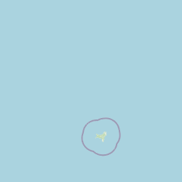
Map view of Christmas Island National Park

Use this park location map to pinpoint Christmas Island National Park in Australia, understand its exact geographic position, and read its mapped placement within the surrounding landscape more clearly.

Pigeon | © OpenStreetMap contributors

Location context for Christmas Island National Park

Christmas Island
Park atlas

Trace the regional context of protected landscapes and island geography, comparing areas in the Indian Ocean near Christmas Island National Park.

Explore Other Protected Areas and National Parks Near Christmas Island National Park
Continue your exploration from Christmas Island National Park by browsing other protected areas and national parks in its broad regional vicinity. This geographic view helps users compare distinct island ecosystems and diverse conservation landscapes, tracing interconnected protected zones across the Indian Ocean.
National parkBanten

Ujung Kulon National Park: Atlas of Java's Last Lowland Rainforest and Protected Landscapes

Explore the unique geography and critical conservation importance of this vital protected area.

Ujung Kulon National Park, located in Banten, Indonesia, is a crucial protected landscape recognized for its ecological significance. This national park represents the last substantial area of lowland rainforest remaining on Java, making it an indispensable sanctuary. It is globally recognized as the primary and final refuge for the Javan rhinoceros, a critically endangered species. The park's geography encompasses the Ujung Kulon peninsula and mountain ranges, alongside vital marine environments, contributing to its status as a UNESCO World Heritage Site and a cornerstone of regional conservation efforts.

Area
497.59 km²
Established
1992
IUCN
II
Visitors
12K annual
National parkSumatra

Bukit Barisan Selatan National Park: Sumatra's Critical Tropical Rainforest Corridor

Explore mapped boundaries and regional geography within this protected area.

Bukit Barisan Selatan National Park is a substantial national park located in Sumatra, Indonesia, designated as a protected landscape along the southern Bukit Barisan mountain range. Spanning a considerable area, it functions as a crucial corridor of tropical rainforest, playing a pivotal role in conservation efforts and the preservation of Sumatra's unique geographic identity. This page serves as a dedicated entry point for understanding the park's protected area status and its mapped presence within the broader regional geography of Indonesia.

Area
3,568 km²
Established
1982
IUCN
II
Relief
Mountain
National parkLampung

Way Kambas National Park: Mapped Lowland Rainforest and Wetland Ecosystems

Explore the geography and protected landscape of this Indonesian national park.

Way Kambas National Park in Lampung, Indonesia, is a significant protected area characterized by its extensive lowland rainforest and varied wetland habitats. The park's landscape features swamp forests, coastal fringes, and river systems, creating a unique ecological mosaic. It serves as a critical sanctuary for endangered species, offering a vital context for understanding Sumatra's remaining natural landscapes. Explore the mapped boundaries and geographic identity of this important conservation area.

Area
1,300 km²
Established
1989
IUCN
II
Visitors
2.6K annual
National parkEast Java

Bromo Tengger Semeru National Park: East Java National Park and Protected Landscape Atlas

Mapped terrain and protected area boundaries in Indonesia's East Java

Delve into the protected geography of Bromo Tengger Semeru National Park, a designated national park situated in East Java. This resource offers detailed insights into the park's mapped boundaries and its role as a protected landscape within the dynamic region. Understand its place in the atlas of Indonesian natural areas and explore its unique terrain through structured geographic data.

Area
502.76 km²
Established
1982
IUCN
II
Visitors
61.7K annual
National parkEast Java

Meru Betiri National Park: Mapped Protected Landscape in East Java

Discover the terrain and geography of this national park.

Meru Betiri National Park in East Java, Indonesia, offers a rich tapestry of mapped landscapes, from its distinctive sandy beaches and mangrove ecosystems along the southern coast to its interior volcanic highlands and tropical rainforests. This protected area is crucial for understanding the regional geography and the distribution of conservation lands across Java. Explore its topographic diversity and unique ecological settings that define this significant national park.

Area
580 km²
Established
1982
IUCN
II
Visitors
2.5K annual
National parkSumatra

Sembilang National Park: A Mapped Protected Landscape within Sumatra's Geography

Understanding its park boundaries and regional natural context.

Delve into the atlas-level details of Sembilang National Park, a protected national park situated on the island of Sumatra. This exploration focuses on its geographic footprint, mapped boundaries, and its significance as a component of Indonesia's broader protected natural landscapes. Discover how this park contributes to the regional geography and offers a distinct protected-area identity within the Indonesian archipelago.

Area
2,051 km²
Established
2001
IUCN
II
Relief
Lowland
National parkEast Java

Alas Purwo National Park: A Protected Landscape within East Java's Geography

Mapped natural terrain and national park status in East Java.

Delve into the atlas-specific details of Alas Purwo National Park, a key protected area located in the East Java region of Indonesia. This page focuses on its identity as a national park, highlighting its geographic significance and the value of its mapped landscape for structured discovery. Understand the context of this protected land within the broader geography of East Java, contributing to a comprehensive overview of Indonesia's conservation territories.

Area
434.2 km²
Established
1992
IUCN
II
Visitors
14.7K annual
National parkJambi

Bukit Duabelas National Park: Jambi's Protected Lowland Tropical Rainforest Landscape

Explore its mapped terrain and vital water catchment geography.

Bukit Duabelas National Park is a protected area in Jambi, Sumatra, safeguarding critical lowland tropical rainforest ecosystems. Its name reflects the hilly terrain that defines its landscape, acting as an essential water catchment for the Batang Hari River. This park offers an atlas-focused view of Sumatra's threatened forest heritage and its importance within regional geography, including unique timber species and the ancestral lands of the Orang Rimba people.

Area
605 km²
Established
2000
IUCN
II
Relief
Lowland

Common questions about visiting, size, designation, and location context for Christmas Island National Park

Christmas Island National Park FAQs for park facts, access, geography, and protected area context
Find quick answers about Christmas Island National Park, including protected-area facts, park geography, trail and visitor context, and how the park fits into its surrounding country and regional landscape.
MoriAtlas Explorer

Continue Your Protected Areas Search Across the Global Atlas

Deepen your exploration by continuing the structured search for national parks and protected areas worldwide. Utilize the comprehensive filtering capabilities to compare different conservation landscapes and refine your understanding of global park geography. Discover more about the distribution and characteristics of protected natural areas.

Global natural geography