
Viewpoints
Park geography
Detailed analysis of terrain, environmental zones, and mapped land features in Tasmania
Geographic Profile and Landscape Boundaries of Cradle Mountain–Lake St Clair National Park
Review the geographic framework of Cradle Mountain–Lake St Clair National Park, covering its total land area of 1614.43 square kilometers and a perimeter span of 357.44 kilometers. This profile details the mountain-dominated terrain, temperate climate zones, and significant natural features including Mount Ossa, Cradle Mountain, and surrounding valleys.
Related tags
Alpine EnvironmentTemperate RainforestWorld Heritage AreaWilderness HikingEndemic Wildlife
Tasmanian wilderness sanctuary of alpine peaks, ancient rainforests and the famous Overland Track
Cradle Mountain, Lake St Clair National Park
Cradle Mountain–Lake St Clair National Park is a sprawling protected wilderness area in the Central Highlands of Tasmania, Australia, situated approximately 165 kilometres northwest of Hobart. The park encompasses a dramatic landscape of rugged mountain ranges, ancient rainforests, pristine glacial lakes, and alpine heaths, forming a vital component of the larger Tasmanian Wilderness World Heritage Area. At its heart lie iconic peaks including Cradle Mountain, Barn Bluff, Mount Ossa (Tasmania's highest point), and the Pelion range, while Lake St Clair occupies the southern extremity of the park as Australia's deepest freshwater lake. The park is internationally renowned as the starting point for the Overland Track, one of Australia's premier multi-day wilderness hikes, which traverses 65 kilometres through some of the most spectacular terrain in the southern hemisphere. Established initially as a scenic reserve in 1922 following decades of advocacy by early conservationists, the park protects exceptional biodiversity with significant populations of endemic Tasmanian wildlife including the Tasmanian devil, quoll, pademelon, and numerous bird species.
- Location
- Australia
- Park type
- National park
- Established
- 1922
- Area
- 1,614.4 km²
Location overview
Regional placement and sovereign territory within Tasmania, Australia
Geography of Cradle Mountain, Lake St Clair National Park in Australia
Cradle Mountain, Lake St Clair National Park lies within the Tasmanian region of Australia. Geographic records document its domestic boundary relationships as a single-country protected area.
- Countries
- Australia
- Regions
- Tasmania
- Primary location
- Tasmania
Boundary and coordinates
Spatial extent and boundary measurements of the protected Tasmanian reserve
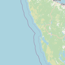
Cradle Mountain, Lake St Clair National Park Geographic Boundary Map
Interactive boundary geometry outlines the spatial footprint of Cradle Mountain, Lake St Clair National Park. Derived calculations define its 1614.43 square kilometers of territory alongside geographic center and coordinate limits.
- Boundary area
- 1,616.8 km²
- Boundary perimeter
- 357.4 km
- Northernmost point
- 41.5754° S
- Southernmost point
- 42.1587° S
- Easternmost point
- 146.2526° E
- Westernmost point
- 145.6693° E
- Geographic centre
- 41.8636° S, 145.9556° E
- North–south span
- 64.8 km
- East–west span
- 48.4 km
Terrain and natural features
Explore recorded mountain classifications, peaks, streams, and waterfalls
Cradle Mountain Lake St Clair National Park Terrain and Named Features
Mountain park classifications organize the terrain features located within the protected boundary. Individual cards detail the names, types, and spatial relationships of recorded natural features.
Selected named natural features
Peaks
Mount Achilles
1,363 m
Peaks
Coal Hill
1,190 m
Peaks
Mount Ossa
1,617 m
Waterfalls
Innes Falls
Peaks
The Minotaur
1,350 m
Environmental setting
Temperate climate zones, mountain relief, and recorded habitat types
Cradle Mountain Lake St Clair National Park Environmental and Landscape Classifications
Recorded landscape features and habitat types serve as interpretive categories for the physical setting of Cradle Mountain Lake St Clair National Park. Structured environmental classifications connect individual terrain records to relevant atlas destinations where available.
- Relief
- Mountain
- Climate
- Temperate
- Water
- Major water bodies
- Forest cover
- Partial forest
- Seasonality
- Seasonal
Landscape features
Mountains · Valleys · Lakes · Rivers · Forest
Habitat types
Alpine meadow · Montane forest · Temperate broadleaf forest · Wetland
Park atlas
Trace the regional geography of Tasmania's protected landscapes and discover adjacent wilderness areas.
Explore National Parks and Protected Areas Near Cradle Mountain–Lake St Clair National Park
Continue your exploration from Cradle Mountain–Lake St Clair National Park by browsing other national parks and protected areas across Tasmania, including those within the expansive Tasmanian Wilderness World Heritage Area. This allows for direct geographic comparison, tracing similar alpine environments, glacial lakes, and temperate rainforests across the state's diverse conservation landscapes.
National parkTasmania
Park boundaries overlap#1 closest
East

Walls of Jerusalem National Park: A Mapped Alpine Wilderness in Tasmania
Explore protected landscapes with biblical place names.
Walls of Jerusalem National Park in Tasmania is a distinguished national park characterized by its rugged alpine terrain and dramatic quartzite formations, most notably King Davids Peak. The park's landscape is further distinguished by a unique series of features named after biblical locations, offering an evocative exploration for those interested in geographic discovery. As a protected wilderness area within the Tasmanian Wilderness World Heritage Area, it provides valuable insight into Australia's significant natural landscapes and their mapped representation.
- Area
- 518 km²
- Established
- 1978
- IUCN
- II
- Relief
- Mountain
National parkTasmania
9 km away#2 closest
Northeast
Mole Creek Karst National Park: Mapped Protected Area and Tasmanian Landscape Atlas
Explore the geography and park boundaries within Tasmania's protected lands.
Mole Creek Karst National Park stands as a key protected area within Tasmania, offering a unique glimpse into the island state's natural geography. This resource facilitates an atlas-style discovery of the park's mapped landscape, its protected boundaries, and its significance within the broader context of Australian protected lands. Understand the park's terrain and its role in the region's conservation heritage.
- Area
- 13.45 km²
- Established
- 1996
- IUCN
- II
- Relief
- Mountain
National parkTasmania
About 29 km away#3 closest
South
Franklin, Gordon Wild Rivers National Park: Mapped Protected Landscape Identity in Tasmania's Geography
Explore the mapped boundaries of this Tasmanian National Park.
Franklin, Gordon Wild Rivers National Park stands as a testament to Tasmania's commitment to preserving its natural heritage. This national park provides a unique opportunity to examine protected land boundaries and understand its specific geographic setting within the Australian state. Its landscape context is integral to the regional atlas, offering a clear representation of conservation priorities and natural geographic features for detailed study.
- Area
- 4,463.42 km²
- Established
- 1908
- Relief
- Mountain
- Climate
- Temperate
National parkTasmania
38 km away#4 closest
Northwest
Savage River National Park: Discover Tasmania's Protected Landscape Geography
Explore mapped boundaries and regional park context.
Savage River National Park represents a distinct protected area within Tasmania, Australia, offering valuable insights into the island's natural geography and conservation landscape. As a designated national park, its mapped territory contributes to the understanding of regional protected areas and their distribution across Tasmania. This entity serves as a crucial point for atlas-based exploration, allowing users to grasp its geographic identity and its place within a broader map of Australian natural territories.
- Area
- 179.8 km²
- Established
- 1999
- IUCN
- II
- Climate
- Temperate
National parkTasmania
50 km away#5 closest
Southeast
Mount Field National Park: Explore Tasmania's Protected Landscape and Geographic Identity
Mapped terrain and regional atlas context for this Australian national park.
Mount Field National Park serves as a cornerstone of protected natural landscapes in Tasmania, Australia. This entry provides detailed geographic context, focusing on its mapped boundaries and distinct environmental setting. Users can explore its identity as a national park, understand its regional placement within Tasmania, and gain insight into the mapped terrain that defines this significant protected area. It is designed for atlas-based discovery of the park's landscape characteristics.
- Area
- 162.65 km²
- Established
- 1916
- IUCN
- II
- Relief
- Mountain
Nature reserveTasmania
About 53 km away#6 closest
East
Liffey Valley Reserve: Geographic Overview of a Tasmania Nature Reserve and Landscape
Protected sclerophyll forest and temperate rainforest sequences
Liffey Valley Reserve in Tasmania provides a focused look at how protected land boundaries align with natural elevation gradients. Its four component parcels protect a complete sequence of Tasmanian vegetation, spanning from ridge-top alpine heath to mossy rainforest depressions. This site acts as a key reference for understanding private conservation geography and the rugged terrain characterizing the eastern edge of the central highlands.
- Area
- 2.75 km²
- Established
- 1991
- Water
- Major water bodies
- Season
- Year-round
National parkTasmania
59 km away#7 closest
South
Southwest National Park: Tasmania's Core Wilderness National Park and World Heritage Landscape
Mapping the remote buttongrass moorlands and rugged terrain of this expansive park.
Southwest National Park represents a significant protected area in Tasmania, Australia, spanning over 6,183 square kilometers. As the heart of the Tasmanian Wilderness World Heritage Area, it showcases an extraordinary landscape characterized by vast buttongrass moorlands, ancient temperate rainforests, and dramatic mountainous terrain. This park is vital for its wilderness character and conservation significance, offering a unique opportunity to explore one of the Southern Hemisphere's last remaining untouched temperate wildernesses through its mapped geography and protected boundaries.
- Area
- 6,182.67 km²
- Established
- 1968
- IUCN
- II
- Relief
- Mountain
National parkTasmania
62 km away#8 closest
Northeast
Narawntapu National Park: Tasmania's Coastal Protected Landscape and Wildlife Atlas
Explore mapped boundaries, heathland, woodland, and intertidal bird habitats.
Narawntapu National Park showcases a remarkable protected coastal landscape on Tasmania's north coast, renowned for its exceptional density of marsupial wildlife and significant intertidal bird populations. Its diverse terrain, including heathland, woodland, and extensive mudflats, offers unique opportunities for geographic discovery and understanding the park's ecological importance. Examine its mapped natural features and protected status within the broader atlas of Australian reserves.
- Area
- 43.49 km²
- Established
- 1976
- IUCN
- II
- Visitors
- 10.1K annual
MoriAtlas Explorer
Continue Exploring Cradle Mountain–Lake St Clair National Park's Protected Landscape and Geography
Delve deeper into the specific mapped boundaries and natural terrain of Cradle Mountain–Lake St Clair National Park. Understanding this key protected area in Tasmania enhances your grasp of regional Australian geography and conservation landscapes. Use this entry to build a structured map-based appreciation for this significant national park.
Browse next
Global natural geography
Explore related park routes
Explore MoriAtlas Global ParksBrowse All MoriAtlas ParksGlobal Park Map DiscoveryMoriAtlas: Browse All CountriesBrowse All MoriAtlas ContinentsNational Park Environment AtlasGrand Canyon National Park AtlasYellowstone National Park AtlasYosemite National Park Atlas and GeographySerengeti National Park AtlasGalápagos National Park Protected LandscapeBanff National Park Geography and AtlasKruger National Park Atlas EntryUluṟu-Kata Tjuṯa National Park AtlasExplore Uluru-Kata Tjuta National Park GeographyPlitvice Lakes National Park AtlasFiordland National Park Protected LandscapeGreat Smoky Mountains National Park AtlasAfghanistan National Parks and Protected AreasAlbania National Parks and Protected AreasAlgeria National Parks and Protected AreasAmerican Samoa National Parks and Protected AreasAndorra National Parks and Protected AreasAngola National Parks and Protected AreasAntarctica National Parks and Protected AreasAntigua and Barbuda Park List