
Lakes
Park geography
A detailed analysis of the lowland island landscape and aquatic geography in Kherson Oblast
Dzharylhach National Nature Park Geography: Mapped Boundaries, Terrain, and Coastal Features
This geographic profile details the physical characteristics of Dzharylhach National Nature Park, including its 100 square kilometer boundary and lowland coastal setting. The analysis covers the regional distribution of islands, beaches, lakes, and wetland habitats within the protected area across the Kherson Oblast region.
Ukraine's largest Black Sea island with sandy beaches, coastal wetlands, and exceptional biodiversity
Dzharylhach National Nature Park
Dzharylhach National Nature Park is a protected area in southern Ukraine that encompasses Dzharylhach Island, the largest island in the Black Sea, together with the adjacent Karkinit Bay and a coastal strip between Skadovsk and Lazurne. Established in 2009, the park protects a representative example of the north Black Sea coast's natural environments, including sandy beaches, shallow coastal waters, salt marshes, coastal meadows, and seaside steppe habitats. The island forms a long, thin strip of sand and shoals running west-to-east in Karkinit Bay, separated from the Crimean Peninsula to the south by relatively shallow waters typically less than one meter deep. The park holds Ramsar site status as part of the Karkinitska and Dzharylgatska Bays wetland system, which serves as a critical staging area for migratory waterfowl. During the Russian invasion of Ukraine, the park suffered severe damage from military activities and was reported destroyed in November 2023.
- Location
- Ukraine
- Park type
- National park
- Established
- 2009
- Area
- 100 km²
Location overview
Coastal and island marine protected areas within Kherson Oblast
Geography of Dzharylhach National Nature Park in Ukraine
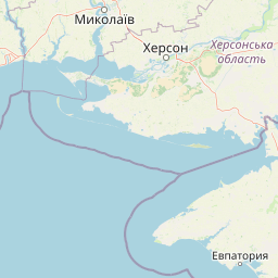
Located in Ukraine, Dzharylhach National Nature Park sits within Kherson Oblast and Skadovsk Raion. National records classify the site as an island, coastal, and marine protected area.
- Countries
- Ukraine
- Regions
- Kherson Oblast, Skadovsk Raion
- Primary location
- Kherson Oblast
- Geographic setting
- Coastal · Island · Marine
Boundary and coordinates
Exploring the 100 square kilometer geographic footprint and coordinate span
Dzharylhach National Nature Park Boundary Map and Geographic Extent
Mapped boundary lines illustrate the spatial limits of Dzharylhach National Nature Park. Regional datasets supplement the outline with calculated metrics for total area, coordinate spans, and centre points.
- Boundary area
- 98 km²
- Boundary perimeter
- 172.1 km
- Northernmost point
- 46.1295° N
- Southernmost point
- 46.007° N
- Easternmost point
- 33.0829° E
- Westernmost point
- 32.4838° E
- Geographic centre
- 46.0472° N, 32.8609° E
- North–south span
- 13.6 km
- East–west span
- 46.3 km
Terrain and natural features
Lowland terrain classifications and recorded natural features
Dzharylhach National Nature Park Terrain and Named Features
Explore the lowland relief classification mapped across Dzharylhach National Nature Park alongside recorded lakes, beaches, capes, and islands. Linked feature cards supply names, types, measurements, and spatial relationships for each recorded natural landmark.
Selected named natural features
Beaches
Дикий Пляж
Beaches
Гусячий пляж
Capes
мис Джарилгацький
Beaches
Дійсний нудистський пляж
Islands
Dzharylhach
2 m
Environmental setting
Temperate lowland terrain, coastal habitats, and water classifications
Dzharylhach National Nature Park Environmental Setting and Classification Data
Recorded landscape features, habitat types, and climate classifications provide complementary ways to read physical settings. Recorded categories connect directly to relevant atlas destinations across maritime and wetland zones.
- Relief
- Lowland
- Climate
- Temperate
- Water
- Major water bodies
- Forest cover
- Sparse forest
- Seasonality
- Seasonal
Landscape features
Islands · Coast · Beach · Dunes · Wetland · Lakes
Habitat types
Grassland · Wetland · Dune habitat · Coastal habitat · Marine habitat
Park atlas
Trace the regional protected landscapes and coastal ecosystems spanning Kherson Oblast, identifying comparable Black Sea conservation areas.
Compare National Parks and Protected Areas Near Dzharylhach National Nature Park
After exploring Dzharylhach National Nature Park, browse other national parks and protected areas across the broader Kherson Oblast region and along the Black Sea coast. This allows for detailed geographic comparison of shared coastal ecosystems, wetland features, and distinct regional conservation landscapes.
National parkKherson Oblast
About 47 km away#1 closest
North

Oleshky Sands National Nature Park: Mapping Ukraine's Distinctive Semi-Arid Dune Landscape
Explore protected sandy steppe, dunes, and conservation areas in Kherson Oblast.
Oleshky Sands National Nature Park is a critical protected landscape in Kherson Oblast, Ukraine, renowned for its unusual semi-arid terrain dominated by expansive sand dunes and sandy steppe. This page provides detailed geographic context for the park, highlighting its unique mapped boundaries, the contrast between its Radensk and Burkut zones, and its ecological importance as part of the Pontic-Caspian steppe. Understand the specific landscape features and regional geography that make this national park a significant natural asset within Ukraine's protected area network.
- Area
- 80.2 km²
- Established
- 2010
- IUCN
- II
- Relief
- Mixed relief
National parkAutonomous Republic of Crimea
About 59 km away#2 closest
South
Charming Harbor National Nature Park: National Park Map and Protected Landscape Identity
Explore its mapped boundaries and regional geography.
Charming Harbor National Nature Park is a key protected area contributing to the natural landscape of the Autonomous Republic of Crimea. This page details its specific geographic scope and mapped boundaries, functioning as an atlas entry to understand its role within regional conservation efforts. Discover the park's distinct protected land context and its contribution to the mapped terrain of Ukraine.
- Area
- 109 km²
- Established
- 2009
- IUCN
- II
- Relief
- Lowland
National parkMykolaiv Oblast
About 86 km away#3 closest
Northwest
Ivory Coast of Sviatoslav National Nature Park: National Park Identity and Regional Geography
Mapped protected area in Mykolaiv Oblast, Ukraine.
Gain a structured understanding of Ivory Coast of Sviatoslav National Nature Park, a designated national park in the Mykolaiv Oblast region of Ukraine. This entry focuses on its protected landscape identity and its position within the broader regional geography. Explore the mapped outlines and discover its significance as a key protected territory for atlas-based research and geographic context.
- Area
- 352 km²
- Established
- 2009
- IUCN
- II
- Relief
- Lowland
National parkUkraine
About 155 km away#4 closest
East
Azov, Syvash National Nature Park: National Park Protected Landscape and Geography
Explore mapped boundaries and regional landscape context.
Azov, Syvash National Nature Park stands as a notable protected area, offering a distinct geographic identity within Ukraine's atlas of natural landscapes. This national park's mapped boundaries provide a foundation for understanding its landscape context and regional significance. MoriAtlas enables detailed exploration of its protected terrain and its place within the country's conservation geography, serving as a gateway to structured geographic information and detailed park data for researchers and explorers.
- Area
- 525.8 km²
- Established
- 1993
- IUCN
- II
- Relief
- Lowland
National parkOdesa Oblast
About 179 km away#5 closest
West
Lower Dniester National Nature Park: National Park Map and Protected Landscape Atlas
Explore Odesa Oblast's protected natural geography and park boundaries.
The Lower Dniester National Nature Park is a vital component of Ukraine's protected lands, situated within the expansive Odesa Oblast. This page offers detailed geographic context, focusing on the park's mapped boundaries and its contribution to the regional landscape. Dive into an atlas-style exploration that highlights the park's protected terrain and its significance within the natural geography of southwestern Ukraine, offering structured discovery beyond basic park facts.
- Area
- 213 km²
- Established
- 2008
- IUCN
- II
- Relief
- Lowland
Nature reserveUkraine
About 180 km away#6 closest
Southeast
Crimean Nature Reserve: Nature Reserve with Mountain Forests and Karst Geography
Explore protected area landscapes and terrain.
The Crimean Nature Reserve is a key protected area within the Crimean Mountains, recognized for its significant mountain forests and unique karst landscapes. This nature reserve encompasses a critical span of the peninsula's rugged terrain, from high mountain ridges to dramatic southern slopes. Its designation as a protected area highlights its ecological importance and its role in preserving diverse natural habitats and geological features within a regional geographic context, making it a notable destination for landscape exploration.
- Area
- 442 km²
- Established
- 1991
- IUCN
- Ia
- Relief
- Mountain
National parkBilhorod-Dnistrovskyi Raion
About 196 km away#7 closest
West
Tuzly Lagoons National Nature Park: National Park Atlas and Geographic Context
Mapped protected landscape within Bilhorod-Dnistrovskyi Raion, Ukraine.
Navigate the protected landscape of Tuzly Lagoons National Nature Park through a detailed geographic lens. This national park entry within MoriAtlas provides structured information on its mapped boundaries and regional context within Bilhorod-Dnistrovskyi Raion, part of Ukraine's Bessarabia region. Understand its position and significance as a protected natural area, facilitating a deeper exploration of its geographical attributes and its place in the broader atlas of Ukrainian protected lands.
- Area
- 278.65 km²
- Established
- 2010
- IUCN
- II
- Relief
- Lowland
National parkZaporizhzhia Oblast
About 197 km away#8 closest
Northeast
Pryazovia National Nature Park: National Park Protected Landscape Atlas
Explore the mapped boundaries and regional geography of Pryazovia National Nature Park.
Pryazovia National Nature Park represents a key protected area within Zaporizhzhia Oblast, Ukraine. This MoriAtlas entry provides detailed atlas-style information, emphasizing the park's mapped boundaries and its integration into the regional geography. Understand the park's character as a protected natural landscape situated in the southeastern Ukrainian coastal zone near the Sea of Azov, offering valuable context for geographic exploration.
- Area
- 781 km²
- Established
- 2010
- IUCN
- II
- Relief
- Lowland
MoriAtlas Explorer
Continue Exploring Dzharylhach National Nature Park's Geographic and Protected Landscape Context
Deepen your understanding of Dzharylhach National Nature Park by exploring its specific geographic features and protected landscape identity. This platform facilitates a structured approach to discovering protected areas, allowing you to trace its mapped boundaries and understand its regional context within Kherson Oblast. Continue your atlas journey by examining the detailed geographic information available for this significant national park.
Browse next
Global natural geography
Explore related park routes
Explore MoriAtlas Global ParksBrowse All MoriAtlas ParksGlobal Park Map DiscoveryMoriAtlas: Browse All CountriesBrowse All MoriAtlas ContinentsNational Park Environment AtlasGrand Canyon National Park AtlasYellowstone National Park AtlasYosemite National Park Atlas and GeographySerengeti National Park AtlasGalápagos National Park Protected LandscapeBanff National Park Geography and AtlasKruger National Park Atlas EntryUluṟu-Kata Tjuṯa National Park AtlasExplore Uluru-Kata Tjuta National Park GeographyPlitvice Lakes National Park AtlasFiordland National Park Protected LandscapeGreat Smoky Mountains National Park AtlasAfghanistan National Parks and Protected AreasAlbania National Parks and Protected AreasAlgeria National Parks and Protected AreasAmerican Samoa National Parks and Protected AreasAndorra National Parks and Protected AreasAngola National Parks and Protected AreasAntarctica National Parks and Protected AreasAntigua and Barbuda Park List