Mori Atlas logo
National parkEl Leoncito National Park

Discover the mapped boundaries and unique ecological context of this Argentine national park.

El Leoncito National Park: Protected Landscape and High-Altitude Andean Geography

(Parque Nacional El Leoncito)

El Leoncito National Park, situated in the Calingasta Department of San Juan Province, Argentina, represents a significant protected area within the Cuyo region. Covering approximately 89,706 hectares, this national park safeguards a representative sample of Central Andean Puna and Southern Andean steppe ecosystems. Its high-altitude terrain, extending from valley floors to peaks over 6,000 meters, is characterized by arid conditions and stark mountain scenery, offering a distinct geographic identity.

Andean PunaHigh Altitude Protected AreaAstronomical ObservatoriesMountain WildernessInca Archaeological SiteArgentine National Parks

El Leoncito National Park

National park

Park overview

Structured park overview, official facts, and landscape profile for El Leoncito National Park

El Leoncito National Park park facts, protected area profile, and essential visitor context
Review the core facts for El Leoncito National Park, including designation, size, terrain, visitor scale, habitats, and operating context in one park-focused overview.

About El Leoncito National Park

El Leoncito National Park occupies a remarkable position in Argentina's protected area network, combining ecological, archaeological, and scientific values within a single protected landscape. Located on the western slopes of the Sierra del Tontal in the southern portion of Calingasta Department, the park spans elevations from the valley floors to the permanent snow line of the high Andes. The park's establishment followed decades of effort to protect both the astronomical quality of the skies and the ecological integrity of the surrounding landscape. Originally part of the Leoncito Astronomical Complex administered by the Ministry of Science, the area was designated as a strict natural reserve in 1994 before achieving national park status in 2002 through national law 25656, which accepted the transfer of jurisdiction from San Juan Province to the federal state. The park preserves three distinct phytogeographic regions within its boundaries: the Monte de Sierras y Bolsones, the Puna, and the Altos Andes, each supporting characteristic plant communities and associated wildlife.

Quick facts and research context for El Leoncito National Park

El Leoncito National Park covers 89,706 hectares in the Calingasta Department of San Juan Province, Argentina, situated at elevations ranging from approximately 2,400 meters to over 6,000 meters near Cerro Mercedario. The park lies 34 kilometers from the town of Barreal and sits at the boundary between San Juan and Mendoza provinces. It contains portions of the Inca road system, representing significant archaeological heritage. The area is home to two major astronomical observatories: the Leoncito Astronomical Complex (CASLEO) and the Félix Aguilar Observatory, both operating at over 2,500 meters elevation. Annual rainfall averages just 200 millimeters, creating an arid to semi-arid environment typical of the Andean puna.

Park context

Deeper park guide and search-rich context for El Leoncito National Park

El Leoncito National Park history, landscape, wildlife, and travel context
Explore El Leoncito National Park through its history, landscape character, ecosystems, wildlife, conservation priorities, cultural context, and seasonal travel timing in a structured park guide built for atlas discovery and search intent.

Why El Leoncito National Park stands out

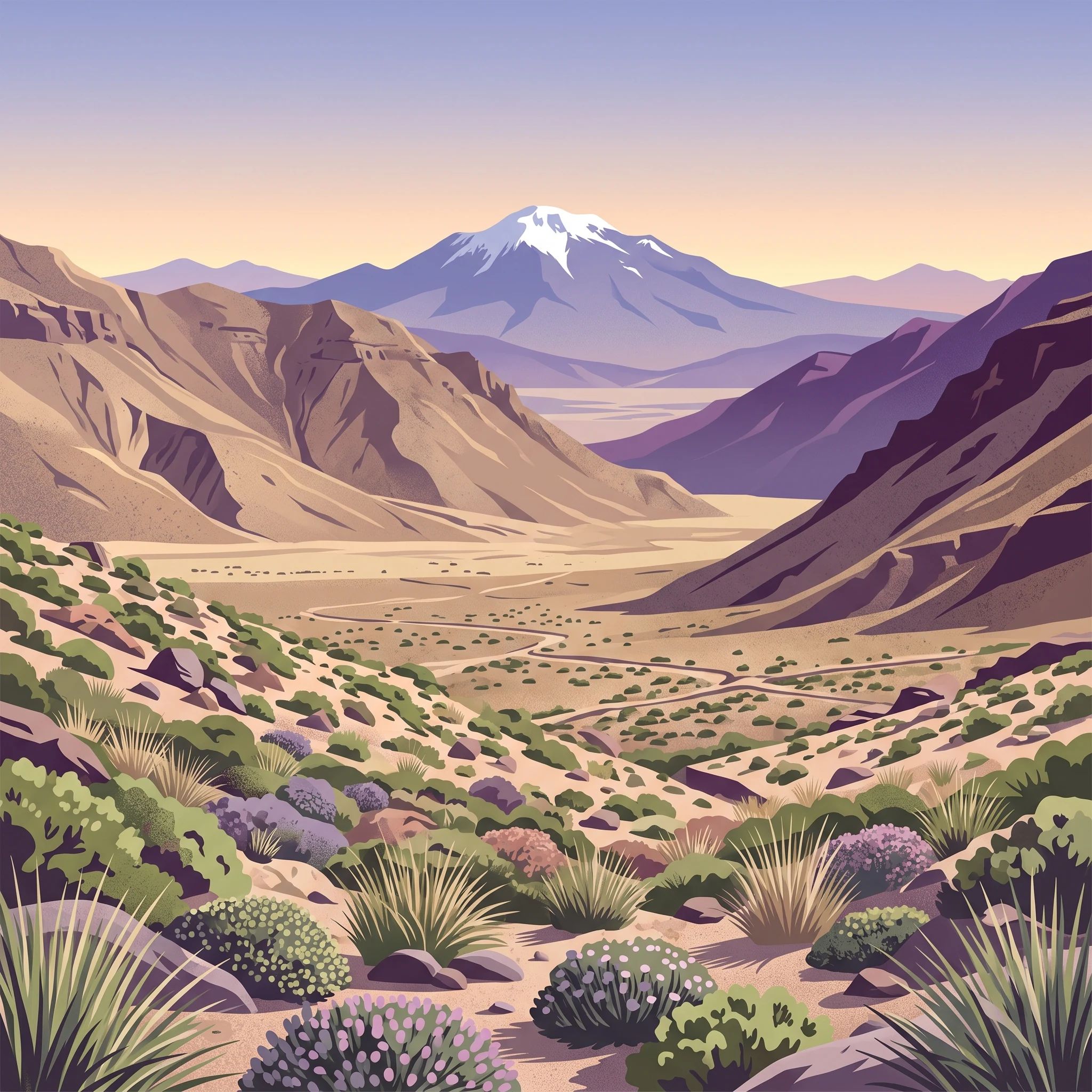
El Leoncito is best known for its exceptional astronomical conditions, with at least 300 days of cloudless skies per year making it suitable for world-class research observatories. The park also protects critical high-altitude puna and Andean steppe ecosystems that support specialized flora and fauna adapted to extreme environmental conditions. The presence of the Inca road system passing through the park adds significant cultural and historical importance. The dramatic backdrop of Cerro Mercedario, the highest peak in San Juan Province, provides spectacular mountain scenery typical of the Argentine Andes.

El Leoncito National Park history and protected-area timeline

The protection of El Leoncito's territory has origins tied directly to the establishment of astronomical facilities in the area. In April 1978, Argentina's Secretary of Science and Technology signed an agreement with San Juan Province to expropriate the Leoncito de Arriba field to preserve optimal sky clarity for astronomical observation. The provincial government enacted law 4525 in February 1979 to authorize the expropriation. In 1987, San Juan Province passed law 5771 specifically to protect sky quality around the astronomical complex, prohibiting activities that could create light pollution, air pollution, or electromagnetic interference. The national decree 46/1994 created the Strict Natural Reserve El Leoncito under the National Parks Administration. In 1996, provincial law 6764 ceded jurisdiction to the national government for transformation into a national park. National law 25656 on September 18, 2002 formally established El Leoncito National Park. Survey work in 2008 confirmed the final area at 89,706 hectares, and a management plan was approved in 2009.

El Leoncito National Park landscape and geographic character

The landscape of El Leoncito National Park ranges from valley floors at approximately 2,400 meters elevation to the snow-capped peaks exceeding 6,000 meters, with Cerro Mercedario standing as the most prominent summit at 6,720 meters. The Sierra del Tontal forms the eastern boundary of the park, while the western reaches blend into the pre-Cordillera mountain systems. The terrain is characterized by arid to semi-arid conditions typical of the Andean puna, with sparse vegetation covering rocky slopes and alluvial fans. The Pampa del Leoncito represents one of the more notable flatland areas within the park, while numerous water streams and waterfalls provide focal points of higher moisture in the otherwise dry environment. The combination of high elevation, extreme aridity, and dramatic mountain topography creates a landscape of stark beauty and ecological distinctiveness.

El Leoncito National Park ecosystems, habitats, and plant life

The ecological character of El Leoncito is defined by its position at the intersection of three major phytogeographic regions. The Monte de Sierras y Bolsones district occupies the lower elevations, characterized by xerophytic shrub communities adapted to arid conditions. The Puna province covers the middle elevations, featuring sparse vegetation adapted to extreme aridity, large temperature fluctuations, and thin atmosphere. The Altos Andes district occupies the highest reaches above approximately 4,000 meters, where permanent snow and ice create extremely harsh conditions for life. The park records 75 plant families containing 602 distinct entities, representing the diverse adaptations of Andean flora to this challenging environment. The biodiversity extends to 166 vertebrate species documented within the park boundaries, including 26 mammal species, 123 bird species, 13 reptile species, 2 amphibian species, and 2 fish species.

El Leoncito National Park wildlife and species highlights

The wildlife community of El Leoncito reflects the adaptations required for survival in high-altitude Andean environments. Guanacos roam the park's grasslands and shrublands, representing one of the flagship mammal species of the Argentine Andes. Birds of prey, particularly the peregrine falcon, utilize the open terrain for hunting. The park also protects the suri cordillerano (Andean condor), a species of significant conservation concern. The diverse bird community of 123 species includes both resident and migratory species adapted to the puna environment. Documentation of 26 mammal species, 13 reptile species, 2 amphibian species, and 2 fish species indicates a surprisingly rich vertebrate fauna given the harsh environmental conditions. Several species face varying degrees of threat, making the park's protective function particularly important for regional biodiversity conservation.

El Leoncito National Park conservation status and protection priorities

El Leoncito National Park serves multiple conservation functions within Argentina's protected area system. The park preserves representative samples of two major ecoregions, the Central Andean Puna and the Southern Andean steppe, both of which have experienced significant human modification across their ranges. The protection of three phytogeographic districts within a single park creates a vertical ecological gradient that maintains connectivity between different habitat types. Several species of conservation concern find refuge within the park boundaries, including the guanaco and suri cordillerano. The park's creation from an astronomical reserve demonstrates a successful model for integrating scientific research with biodiversity protection, as the same conditions that make the location ideal for observatories also create the isolation and minimal human disturbance that benefit wildlife. The zoning system places over 98% of the park area in an intangible zone, maintaining strict protection for the majority of the territory.

El Leoncito National Park cultural meaning and human context

The cultural heritage of El Leoncito includes significant archaeological resources related to the Inca Empire. A segment of the Camino del Inca, the extensive road system built by the Inca civilization, passes through the park territory, representing tangible evidence of pre-Columbian human presence in the high Andes. Historical structures include the casco of the former Estancia El Leoncito, a ranching establishment that represents more recent human activity in the region. The combination of Inca-era road infrastructure and later colonial-period ranching illustrates the long history of human interaction with this high-altitude landscape. The park's management plan recognizes these cultural resources as values to be conserved alongside the ecological and scientific features of the area.

Top sights and standout views in El Leoncito National Park

El Leoncito National Park offers a combination of features found in few other protected areas. The astronomical observatories, including the Leoncito Astronomical Complex and Félix Aguilar Observatory, represent world-class research facilities operating in exceptional sky conditions. The presence of Inca trail segments provides tangible connection to pre-Columbian civilization. The dramatic backdrop of Cerro Mercedario creates iconic mountain scenery. The protected ecosystems include representative samples of the Central Andean Puna and Southern Andean steppe, both of high conservation importance. The opportunity to camp beneath some of the clearest skies in the Southern Hemisphere, with access to astronomical facilities, creates a visitor experience that blends wilderness appreciation with scientific exploration.

Best time to visit El Leoncito National Park

The park can be visited throughout the year, though the high-altitude cold climate dictates visitor preparation. Summer months (December to March) offer warmer daytime temperatures but still require warm clothing for evenings and higher elevations. Winter brings colder conditions with snow possible at higher elevations. The dry climate means rainfall is uncommon in any season, making clear skies the norm rather than the exception. The astronomical observatories operate year-round, and clear skies are most reliable during the austral autumn and winter months (April through September). Visitors should note that the park has minimal tourist infrastructure, requiring self-sufficiency for supplies and camping equipment. The free camping area includes basic facilities including hot showers, but visitors should plan accordingly.
Park location guide

Geography guide, regional context, and park location map for El Leoncito National Park

El Leoncito National Park park geography, regions, and map view in Argentina
Understand where El Leoncito National Park sits in Argentina through a broader geographic reading of the surrounding landscape, nearby location context, and its mapped position within the national park landscape.

How El Leoncito National Park fits into Argentina

Argentina is a federal republic located in the southern cone of South America, bordering Chile, Bolivia, Paraguay, Brazil, Uruguay, and the Atlantic Ocean. With an area of 2,780,085 km², it is the second-largest country in South America and the eighth-largest globally. The capital and largest city is Buenos Aires, and the official language is Spanish. The country claims sovereignty over the Falkland Islands, South Georgia and the South Sandwich Islands, and a portion of Antarctica.

Wider geography shaping El Leoncito National Park in Argentina

Argentina occupies the southern portion of South America, sharing the Southern Cone region with Chile to the west. The country borders Bolivia and Paraguay to the north, Brazil to the northeast, Uruguay and the South Atlantic Ocean to the east, and the Drake Passage to the south. The Andes mountain range runs along the western border, while the Pampas plains dominate the central region. Argentina also claims territories in Antarctica.

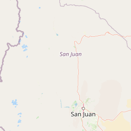
Map view of El Leoncito National Park

Use this park location map to pinpoint El Leoncito National Park in Argentina, understand its exact geographic position, and read its mapped placement within the surrounding landscape more clearly.

Pigeon | © OpenStreetMap contributors
Park atlas

Compare surrounding high-altitude Andean parks and protected landscapes within the Cuyo region of Argentina.

Discover Other Protected Areas and National Parks Near El Leoncito National Park, Argentina
Browse additional national parks and protected areas surrounding El Leoncito National Park, offering diverse high-altitude Andean landscapes and specific conservation zones within the Cuyo region. Comparing these protected areas provides valuable geographic context for understanding regional conservation efforts and the varied mountain terrain of Argentina.
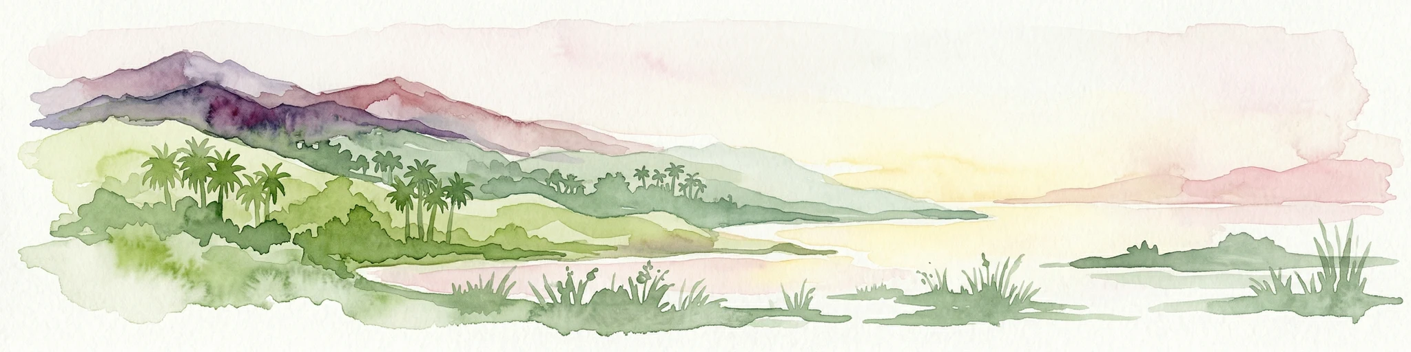
Watercolor painting of a coastal landscape featuring palm trees, mountains, and a body of water
National parkValparaíso Region

La Campana National Park: Protected Landscape of Chilean Wine Palms

Explore its mapped terrain and regional geographic context.

La Campana National Park represents a significant protected landscape within Chile, celebrated for its exceptional concentration of Chilean Wine Palms (Jubaea chilensis). As a national park situated in the Valparaíso Region, it showcases a diverse range of Mediterranean ecosystems and dramatic coastal mountain terrain. This page provides detailed atlas-style context, highlighting the park's unique botanical heritage, its distinct geographic setting, and its importance as a mapped natural area for regional landscape studies.

Area
80 km²
Established
1967
IUCN
II
Visitors
39.6K annual
National park

Sierra de las Quijadas National Park: Protected Landscape & Geographic Atlas in Argentina

Explore the unique Chaco-Monte ecotone and dramatic sandstone terrain.

Sierra de las Quijadas National Park in San Luis Province, Argentina, is a protected area recognized for its critical role as a biodiversity bridge between the Semiarid Chaco and High Monte ecoregions. Its landscape is marked by rugged mountains, vivid red sandstone cliffs, and significant paleontological sites, offering a unique look at Cretaceous-era geology. This park provides a rich opportunity for atlas exploration, allowing discovery of its distinctive protected landscape and the regional geography it inhabits.

Area
735.33 km²
Established
1991
IUCN
II
Relief
Mountain
Watercolor illustration of a river winding through a valley with rolling hills and green vegetation in the foreground.
National parkCoquimbo Region

Bosque de Fray Jorge National Park: National Park Protected Landscape & Geographic Atlas

Explore mapped boundaries and regional natural landscape context.

Bosque de Fray Jorge National Park is a key protected area offering unique insights into Chile's natural landscapes. This entry provides detailed geographic context, focusing on its status as a national park and its mapped boundaries within the Coquimbo Region. Discover its place in the regional atlas and understand its protected landscape identity for focused geographic exploration.

Area
100 km²
Established
1941
IUCN
II
Visitors
13.1K annual
Watercolor illustration of mountain ranges with green and yellow hills, a central dark peak, and pinkish foreground
National park

San Guillermo National Park: High Andes Protected Landscape & Vicuña Conservation Area

Explore its rugged terrain and arid mountain ecosystem.

San Guillermo National Park, a key national park in Argentina's San Juan Province, protects over 166,000 hectares of high-altitude Andean wilderness. Its landscape is defined by arid mountain ranges and expansive puna grasslands, serving as a critical sanctuary for vicuñas and other high-Andean wildlife. This page offers detailed geographic context for understanding the park's protected boundaries, unique terrain, and its importance as a mapped conservation area.

Area
1,660 km²
Established
1998
IUCN
II
Relief
Mountain
National parkLa Rioja Province

Talampaya National Park: Argentinian National Park with Dramatic Desert Canyons

Explore protected landscape and mapped geography in La Rioja Province.

Talampaya National Park, a significant national park in Argentina's La Rioja Province, offers a profound exploration of a dramatic desert canyon environment. This protected area is renowned for its rich paleontological sites, yielding crucial dinosaur fossils, and for its well-preserved indigenous petroglyphs carved into ancient rock formations. Understanding Talampaya National Park provides vital context for the region's geography and its place within Argentinian protected lands and mapped natural landscapes.

Area
2,150 km²
Established
1997
IUCN
II
Relief
Mountain
National parkLibertador General Bernardo O'Higgins Region

Las Palmas de Cocalán National Park: Chile's National Park Protected Landscape Atlas

Explore geographic boundaries and regional context.

Delve into the protected landscape identity of Las Palmas de Cocalán National Park, situated within the Libertador General Bernardo O'Higgins Region. This page provides detailed atlas-style information, focusing on the park's geographic features and its role as a national park. Understand the mapped natural terrain and the regional importance of this conserved area for comprehensive geographic discovery.

Area
3.709 km²
Established
1971
IUCN
II
Relief
Mixed relief
National parkAtacama Region

Llanos de Challe National Park: Unique Coastal Desert and Lomas Ecosystem

Atacama Region National Park with Dramatic Terrain and Wildlife

Llanos de Challe National Park presents a rare protected coastal desert environment within the Atacama Region. Its unique lomas ecosystem, sustained by coastal fog, supports a surprising diversity of life. The park encompasses striking geographic features, from unspoiled white-sand beaches to rugged mountainous terrain, offering a clear example of a vital protected landscape with significant guanaco populations and unique flora, all mapped within its regional context.

IUCN
II
Relief
Mixed relief
Climate
Arid
Scope
Mixed
National parkCórdoba Province

Quebrada del Condorito National Park: Mapped Protected Landscape and Biological Island Ecosystem

Argentina National Park in Córdoba Province

Quebrada del Condorito National Park is a federally protected area in Argentina's Córdoba Province, established to safeguard a significant portion of the Sierras Pampeanas mountain ecosystem. The park's rugged terrain, including deep gorges and high-altitude plateaus, creates a distinct biological island environment supporting a wealth of endemic species. Its geographic isolation and dramatic landscape make it a unique focus for protected-area discovery and understanding Argentina's natural geography.

Area
373.44 km²
Established
1996
IUCN
II
Relief
Mountain

Common questions about visiting, size, designation, and location context for El Leoncito National Park

El Leoncito National Park FAQs for park facts, access, geography, and protected area context
Find quick answers about El Leoncito National Park, including protected-area facts, park geography, trail and visitor context, and how the park fits into its surrounding country and regional landscape.
MoriAtlas Explorer

Continue Your Protected Areas Search Across the Global Atlas

Deepen your exploration by continuing the structured search for national parks and protected areas worldwide. Utilize the comprehensive filtering capabilities to compare different conservation landscapes and refine your understanding of global park geography. Discover more about the distribution and characteristics of protected natural areas.

Global natural geography