Mori Atlas logo
National parkSan Guillermo National Park

Discover the arid mountain ranges, puna grasslands, and critical vicuña habitat of this Argentine national park.

San Guillermo National Park: Protected Landscape & Map Exploration in Argentina's High Andes

(Parque Nacional San Guillermo)

San Guillermo National Park represents a significant protected landscape within the high Andes of Argentina. Encompassing rugged mountain terrain, arid puna grasslands, and scattered wetlands across a vast elevation range, this national park is central to vicuña conservation efforts. Users exploring this page gain insight into the park's unique geographic setting, its mapped boundaries, and its role as a vital wildlife refuge, offering a detailed view for atlas-driven geographic discovery.

National ParkArgentinaAndes MountainsVicuna ConservationHigh AltitudePuna Grassland
Illustration showing mountains, river, and plains with vegetation

San Guillermo National Park

National park

Park overview

Structured park overview, official facts, and landscape profile for San Guillermo National Park

San Guillermo National Park park facts, protected area profile, and essential visitor context
Review the core facts for San Guillermo National Park, including designation, size, terrain, visitor scale, habitats, and operating context in one park-focused overview.

About San Guillermo National Park

San Guillermo National Park occupies a dramatic portion of the Argentine Andes in San Juan Province, representing one of the country's most important high-altitude protected ecosystems. The park sits within the larger San Guillermo Biosphere Reserve, which spans nearly 981,000 hectares and serves as a managed landscape for both conservation and sustainable land use. The national park's establishment in 1998 marked the culmination of decades of protective measures that began with provincial reserve status in 1972. The primary conservation objective centers on protecting vicuña populations, which have historically been threatened by overhunting for their valuable wool. Beyond this flagship species, the park safeguards the broader mountain ecosystem including representative samples of Andean puna grassland, desert scrub, and wetland habitats that support diverse fauna. The arid nature of the landscape, with its rocky soils and absence of permanent water courses, creates a challenging environment where specialized species have evolved remarkable adaptations for survival.

Quick facts and research context for San Guillermo National Park

San Guillermo National Park lies in the Iglesia Department of San Juan Province, Argentina, at elevations between 2,100 and 6,380 metres above sea level. The 166,000-hectare protected area was established in 1998 and forms the core of the larger 981,000-hectare San Guillermo Biosphere Reserve. The terrain is characterized by arid mountain ranges, puna grasslands, and limited wetland areas in the high Andes. The park was originally designated as a provincial reserve in 1972 before becoming a biosphere reserve in 1980 and finally a national park in 1998/1999.

Park context

Deeper park guide and search-rich context for San Guillermo National Park

San Guillermo National Park history, landscape, wildlife, and travel context
Explore San Guillermo National Park through its history, landscape character, ecosystems, wildlife, conservation priorities, cultural context, and seasonal travel timing in a structured park guide built for atlas discovery and search intent.

Why San Guillermo National Park stands out

San Guillermo National Park is best known as a premier vicuña conservation area in Argentina. The species, prized for its fine wool, prompted the establishment of the broader biosphere reserve in 1980, making wildlife protection the central mission of this high-altitude protected area. The park's Andean condor population, cougar ecosystem, and the presence of the rare Andean mountain cat further distinguish it as a significant conservation landscape in the southern Andes.

Circular emblem showing two vicuñas standing on dry terrain with mountains in background. Text around the emblem reads 'PARQUE NACIONAL SAN GUILLERMO', 'ADMINISTRACIÓN DE PARQUES NACIONALES', and 'ARGENTINA'
Official emblem of San Guillermo National Park featuring vicuñas and Andean landscape

San Guillermo National Park history and protected-area timeline

The protection of San Guillermo began in 1972 when the area received provincial reserve status, recognizing the ecological importance of the vicuña populations in the high Andes of San Juan Province. In 1980, the region was elevated to biosphere reserve status under the UNESCO Man and the Biosphere Programme, expanding the conservation framework to include the broader landscape and its ecological processes. The national park designation followed in 1998 (officially established January 13, 1999), providing the highest level of legal protection for the core conservation area. This progression from provincial reserve to biosphere reserve to national park reflects Argentina's commitment to preserving this distinctive Andean ecosystem while also enabling ongoing research and monitoring activities.

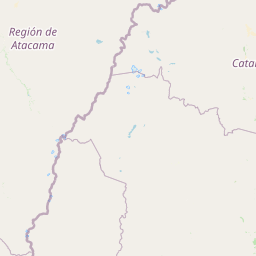
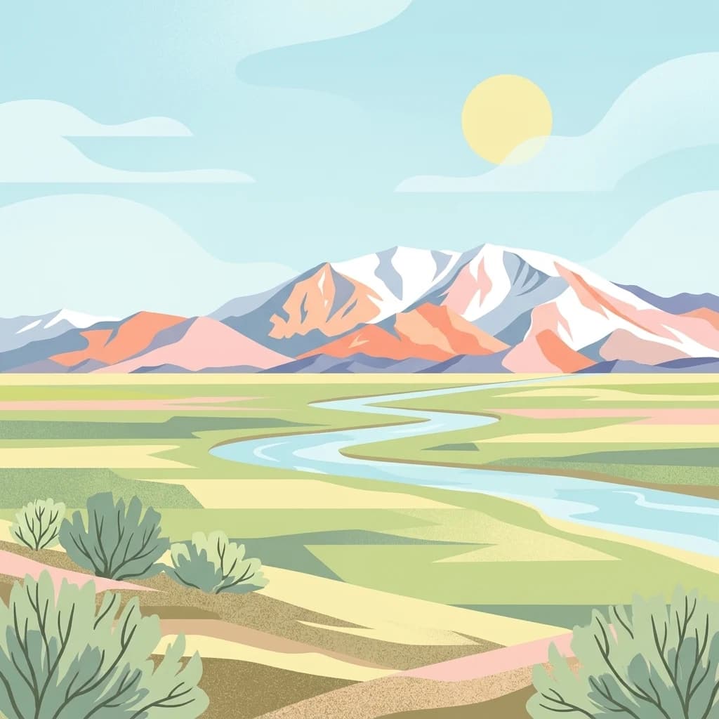
San Guillermo National Park landscape and geographic character

The terrain of San Guillermo National Park exemplifies the harsh beauty of the high Andes. Arid mountain ranges dominate the landscape, characterized by rocky, coarse soils and the absence of permanent water courses. Above approximately 3,500 metres, the terrain supports puna grassland ecosystems where steppe vegetation creates patches of green amid the otherwise barren desert environment. The elevation range from 2,100 to 6,380 metres encompasses multiple ecological zones, from lower grassland communities to alpine terrain near the summits. Scattered wetlands, though limited in extent, provide crucial habitat islands within the otherwise dry landscape. The combination of extreme elevation, aridity, and rugged topography defines this distinctive mountain environment.

San Guillermo National Park ecosystems, habitats, and plant life

The ecological character of San Guillermo reflects the harsh conditions of the high-altitude Andes. Vegetation consists primarily of scattered dwarf shrubs interspersed with coarse grasses and herbaceous plants, leaving much of the ground bare. Key shrub species include Adesmia, Parastrephia, Fabiana, Azorella, and Ephedra, while prominent grasses include Stipa, Calamagrostis, and Festuca. Flowering plants such as Astragalus, Tropaeolum, Phacelia, and Glandularia add seasonal color to the landscape. The puna grassland ecosystem represents a specialized habitat adapted to cold, dry conditions, strong winds, and intense solar radiation at high elevation.

San Guillermo National Park wildlife and species highlights

San Guillermo National Park supports a remarkable assembly of Andean wildlife, anchored by the vicuña which was the primary catalyst for conservation in the region. Guanaco populations share the grasslands with their smaller relative, while the predator guild includes culpeo foxes, Andean mountain cats, and cougars as the top predator. The Andean condor soars above the mountain landscape, while other mammals include southern viscacha and the endangered short-tailed chinchilla. Birdlife features Darwin's rhea along with various ducks and geese that utilize the wetland areas. This high-altitude fauna community represents one of the most intact Andean ecosystems in Argentina.

San Guillermo National Park conservation status and protection priorities

The establishment of San Guillermo as a national park and biosphere reserve reflects its exceptional conservation significance, particularly for vicuña protection. The species was historically decimated by hunting for its wool, and the creation of protected areas provided essential refuge populations. The biosphere reserve model enables conservation while allowing for sustainable use of surrounding lands, creating a buffer zone that benefits both wildlife and local communities. Ongoing research using GPS radio collars on cougars and vicuñas provides valuable ecological data about predator-prey dynamics and how vegetation communities respond to grazing pressure and predator activity. Plans to collar Andean condors will further enhance understanding of ecosystem processes.

San Guillermo National Park cultural meaning and human context

While the primary focus of San Guillermo National Park is natural heritage, the protected area exists within a broader landscape where local communities in San Juan Province maintain traditional relationships with the land. The high Andes have long supported pastoral activities, and the establishment of the park and biosphere reserve has helped regulate land use while preserving both ecological and cultural values of the region.

Top sights and standout views in San Guillermo National Park

San Guillermo National Park offers exceptional opportunities to observe vicuñas in their natural high-altitude habitat, one of the few places in Argentina where these graceful animals thrive under full protection. The presence of cougars as top predators, studied through ongoing radio-collar research, makes the park significant for understanding Andean predator-prey dynamics. The landscape of rugged peaks, puna grasslands, and scattered wetlands against the stark Andean backdrop creates a distinctive wilderness experience. The park's role within the larger biosphere reserve provides a model for integrated conservation that extends protection beyond the core national park boundaries.

Best time to visit San Guillermo National Park

The high-altitude location of San Guillermo means visitors should be prepared for significant temperature variations and harsh conditions regardless of season. Summer months in the Southern Hemisphere (December to March) offer the warmest conditions but also correspond to the rainy season in this region. The dry winter months (June to August) bring clearer skies but colder temperatures at these elevations. The park's remote location and limited infrastructure mean that visits require careful planning and awareness of the challenging Andean environment.

Park location guide

Geography guide, regional context, and park location map for San Guillermo National Park

San Guillermo National Park park geography, regions, and map view in Argentina
Understand where San Guillermo National Park sits in Argentina through a broader geographic reading of the surrounding landscape, nearby location context, and its mapped position within the national park landscape.

How San Guillermo National Park fits into Argentina

Argentina is a federal republic located in the southern cone of South America, bordering Chile, Bolivia, Paraguay, Brazil, Uruguay, and the Atlantic Ocean. With an area of 2,780,085 km², it is the second-largest country in South America and the eighth-largest globally. The capital and largest city is Buenos Aires, and the official language is Spanish. The country claims sovereignty over the Falkland Islands, South Georgia and the South Sandwich Islands, and a portion of Antarctica.

Wider geography shaping San Guillermo National Park in Argentina

Argentina occupies the southern portion of South America, sharing the Southern Cone region with Chile to the west. The country borders Bolivia and Paraguay to the north, Brazil to the northeast, Uruguay and the South Atlantic Ocean to the east, and the Drake Passage to the south. The Andes mountain range runs along the western border, while the Pampas plains dominate the central region. Argentina also claims territories in Antarctica.

Map view of San Guillermo National Park

Use this park location map to pinpoint San Guillermo National Park in Argentina, understand its exact geographic position, and read its mapped placement within the surrounding landscape more clearly.

Pigeon | © OpenStreetMap contributors

Explore park photography detailing the rugged Andean terrain, puna grasslands, and critical high-altitude wildlife habitats in this Argentine protected area.

San Guillermo National Park Images: Visual Guide to Andean Landscapes and Protected-Area Scenery
Visual exploration of San Guillermo National Park imagery provides essential insights into its distinct Andean landscapes, from arid mountain ranges to puna grasslands and scattered wetlands. These detailed views help users grasp the park's rugged topography, unique high-altitude habitats, and critical role as a vicuña conservation area in Argentina.

Circular emblem showing two vicuñas standing on dry terrain with mountains in background. Text around the emblem reads 'PARQUE NACIONAL SAN GUILLERMO', 'ADMINISTRACIÓN DE PARQUES NACIONALES', and 'ARGENTINA'

Desert plain with sparse vegetation and snow-covered mountains under a clear blue sky

Park atlas

Compare high-altitude conservation landscapes and explore mapped protected areas across the surrounding Andean region.

Discover Other Protected Areas and National Parks Near San Guillermo National Park
Continue your exploration beyond San Guillermo National Park, browsing nearby national parks and protected areas across Argentina's high Andean region. Compare these distinct conservation landscapes, trace their mapped geography, and understand the regional context of protected terrains in the Southern Andes.
National parkLa Rioja Province

Talampaya National Park: Argentinian National Park with Dramatic Desert Canyons

Explore protected landscape and mapped geography in La Rioja Province.

Talampaya National Park, a significant national park in Argentina's La Rioja Province, offers a profound exploration of a dramatic desert canyon environment. This protected area is renowned for its rich paleontological sites, yielding crucial dinosaur fossils, and for its well-preserved indigenous petroglyphs carved into ancient rock formations. Understanding Talampaya National Park provides vital context for the region's geography and its place within Argentinian protected lands and mapped natural landscapes.

Area
2,150 km²
Established
1997
IUCN
II
Relief
Mountain
National parkAtacama Region

Llanos de Challe National Park: Unique Coastal Desert and Lomas Ecosystem

Atacama Region National Park with Dramatic Terrain and Wildlife

Llanos de Challe National Park presents a rare protected coastal desert environment within the Atacama Region. Its unique lomas ecosystem, sustained by coastal fog, supports a surprising diversity of life. The park encompasses striking geographic features, from unspoiled white-sand beaches to rugged mountainous terrain, offering a clear example of a vital protected landscape with significant guanaco populations and unique flora, all mapped within its regional context.

IUCN
II
Relief
Mixed relief
Climate
Arid
Scope
Mixed
National parkAtacama Region

Nevado Tres Cruces National Park: National Park in Atacama Region's Mapped Geography

Explore protected landscapes and regional park context.

Nevado Tres Cruces National Park is a significant protected national park situated within the Atacama Region of Chile. This entry provides essential geographic context, detailing the park's mapped boundaries and its contribution to the region's conservation landscape. Understand its place within the broader atlas of protected areas, focusing on the natural terrain and the distinct geography that characterize this important national park.

Area
591 km²
IUCN
II
Relief
Mountain
Climate
Alpine
National park

El Leoncito National Park: High-Altitude Andean Puna and Steppe Protected Landscape

Explore mapped boundaries and unique geographic context in San Juan Province.

El Leoncito National Park in Argentina's San Juan Province preserves critical high-altitude ecosystems, including the Central Andean Puna and Southern Andean steppe. This protected landscape spans dramatic mountain terrain, with elevations reaching over 6,000 meters, providing a unique geographic setting. The park's conservation value is underscored by its representative ecological samples and stark natural beauty, offering a distinct regional geography for exploration.

Area
897.06 km²
Established
2002
IUCN
II
Relief
Mountain
Watercolor illustration of a river winding through a valley with rolling hills and green vegetation in the foreground.
National parkCoquimbo Region

Bosque de Fray Jorge National Park: National Park Protected Landscape & Geographic Atlas

Explore mapped boundaries and regional natural landscape context.

Bosque de Fray Jorge National Park is a key protected area offering unique insights into Chile's natural landscapes. This entry provides detailed geographic context, focusing on its status as a national park and its mapped boundaries within the Coquimbo Region. Discover its place in the regional atlas and understand its protected landscape identity for focused geographic exploration.

Area
100 km²
Established
1941
IUCN
II
Visitors
13.1K annual
National parkChile

Pan de Azúcar National Park: Chile's Protected Natural Landscape and Atlas Context

Discover mapped boundaries and regional geography for this national park.

Pan de Azúcar National Park is a protected area situated within Chile's diverse geography. This page provides detailed information on its status as a national park, focusing on its mapped boundaries and its contribution to the regional landscape context. Users can explore its geographic significance and understand its place within the broader atlas of protected areas.

Area
437.54 km²
Established
1985
IUCN
II
Relief
Mixed relief
National parkTucumán Province

Aconquija National Park: Southern Andean Yungas Protected Landscape in Tucumán Province

Explore its montane forest and mapped geographic context.

Aconquija National Park is a significant federal protected area located in Tucumán Province, Argentina. This national park is dedicated to conserving the diverse Southern Andean Yungas montane forest ecosystem, characterized by a dramatic elevational gradient. Its landscapes transition from cloud forest to high alpine terrain, offering a unique opportunity to study and appreciate a well-preserved montane environment within a critical geographic region. Discover the mapped extent and ecological importance of this protected area.

Area
700 km²
Established
1995
IUCN
II
Relief
Mountain
National park

Sierra de las Quijadas National Park: Protected Landscape & Geographic Atlas in Argentina

Explore the unique Chaco-Monte ecotone and dramatic sandstone terrain.

Sierra de las Quijadas National Park in San Luis Province, Argentina, is a protected area recognized for its critical role as a biodiversity bridge between the Semiarid Chaco and High Monte ecoregions. Its landscape is marked by rugged mountains, vivid red sandstone cliffs, and significant paleontological sites, offering a unique look at Cretaceous-era geology. This park provides a rich opportunity for atlas exploration, allowing discovery of its distinctive protected landscape and the regional geography it inhabits.

Area
735.33 km²
Established
1991
IUCN
II
Relief
Mountain

Common questions about visiting, size, designation, and location context for San Guillermo National Park

San Guillermo National Park FAQs for park facts, access, geography, and protected area context
Find quick answers about San Guillermo National Park, including protected-area facts, park geography, trail and visitor context, and how the park fits into its surrounding country and regional landscape.
MoriAtlas Explorer

Continue Your Protected Areas Search Across the Global Atlas

Deepen your exploration by continuing the structured search for national parks and protected areas worldwide. Utilize the comprehensive filtering capabilities to compare different conservation landscapes and refine your understanding of global park geography. Discover more about the distribution and characteristics of protected natural areas.

Global natural geography