Why Pan de Azúcar National Park stands out
Pan de Azúcar National Park is best known for its remarkable concentration of Humboldt penguins that nest on Isla Pan de Azúcar, the park's offshore island. The park is also renowned for its exceptional cactus diversity, with over 20 species of Copiapoa cacti thriving in the fog-supported microenvironments of the coastal desert. The Caleta Pan de Azúcar cove represents another distinctive feature, offering a glimpse into the region's mining heritage while serving as a gateway to explore the park's coastal and island environments. The dramatic geological formations along the road northward from the cove add to the park's visual appeal, with the landscape transitions from coastal shoreline to interior desert representing a unique ecological interface.
Pan de Azúcar National Park history and protected-area timeline
Pan de Azúcar National Park was established in 1985 through the designation of existing desert landscapes and coastal territories as a protected national park. The creation of the park reflected Chile's growing recognition of the ecological importance of its northern coastal desert regions, which had long been considered too arid to warrant significant conservation attention. The park's territory includes areas that had historical uses related to copper mining, particularly around Caleta Pan de Azúcar, where copper ore was processed and shipped by boat from small harbor facilities. The remnants of this industrial past remain visible beneath the waters at the cove, where divers can still explore portions of the old wharf and loading crane. The establishment of the park provided formal protection for the diverse ecosystems found within its boundaries, including the critical penguin breeding habitat on Isla Pan de Azúcar and the unique fog-dependent vegetation communities of the coastal desert.
Pan de Azúcar National Park landscape and geographic character
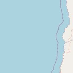
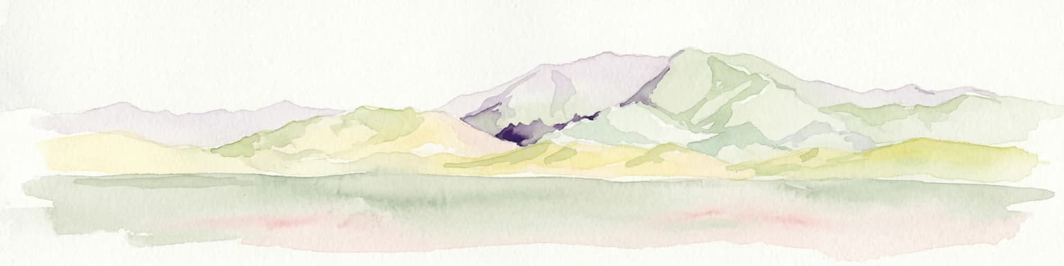
The landscape of Pan de Azúcar National Park presents a dramatic contrast between coastal formations and interior desert environments. The park's coastline features rugged cliffs, rocky coves, and the prominent Isla Pan de Azúcar, which rises dramatically from the Pacific Ocean approximately 24 kilometers offshore from the mainland portion of the park. The coastal terrain gives way inland to the arid steppe of the Sierra Vicuña Mackenna, a mountain range that forms the backdrop to the coastal plain. Along the road that extends northward from Caleta Pan de Azúcar toward the Pan-American Highway, numerous geological formations create a visually striking landscape of eroded rock and desert terrain. The park's two primary ecological zones reflect this topographical transition: the coastal desert of Taltal along the immediate shoreline, and the drier steppe desert of the interior mountains. Despite the apparent harshness of this environment, the landscape supports remarkable biological productivity in areas where coastal fog provides essential moisture.
Pan de Azúcar National Park ecosystems, habitats, and plant life
The ecological character of Pan de Azúcar National Park is defined by its location at the intersection of two distinct desert ecosystems and the influence of coastal fog on biological productivity. The coastal desert of Taltal occupies the western portion of the park, where proximity to the ocean and the regular presence of camanchaca fog create conditions that support a surprising diversity of plant life. More than 20 species of cacti have been documented within the park, with the genus Copiapoa being particularly well represented. These cacti have adapted to absorb moisture directly from the fog that rolls in from the Pacific, developing specialized root systems and growth forms that maximize water capture. The steppe desert of the Sierra Vicuña Mackenna occupies the inland portion of the park, where conditions are even more arid and vegetation is correspondingly sparse. The fog system represents the critical ecological factor that distinguishes this park from typical desert protected areas, creating microhabitats that support species found nowhere else in the Atacama Desert.
Pan de Azúcar National Park wildlife and species highlights
The wildlife of Pan de Azúcar National Park reflects the park's unique position between marine and terrestrial ecosystems. The guanaco serves as the park's primary terrestrial mammal species, herds of which can be observed moving across the desert terrain in search of vegetation that persists in fog-supported areas. Smaller mammals include the culpeo fox and the chilla fox, both of which have adapted to the challenges of surviving in the arid environment. The European hare has also established populations within the park. The marine environment along the park's coastline supports additional wildlife, including the marine otter and the South American sea lion, both of which can be observed along the rocky shores and near the offshore islands. The avian fauna includes the Humboldt penguin, which breeds in significant numbers on Isla Pan de Azúcar, and the Peruvian pelican, which frequents the coastal waters and shoreline areas. Reptile species from the genera Tropidurus and Callopistes round out the vertebrate fauna found within the park.
Pan de Azúcar National Park conservation status and protection priorities
Pan de Azúcar National Park holds significant conservation value as one of the few protected areas in Chile's hyperarid north that preserves both coastal and desert ecosystems within a single boundary. The park's designation as an IUCN Category II protected area reflects its role in maintaining natural processes and species populations while allowing for compatible visitor use. The protection of Isla Pan de Azúcar is particularly important given its role as a breeding site for Humboldt penguins, a species that faces significant conservation pressures throughout its range. The park's cactus populations represent another conservation priority, with multiple species of Copiapoa cacti requiring protection from habitat degradation and illegal collection. The CONAF-managed park includes a cactarium facility near the entrance that provides educational opportunities while supporting conservation awareness. The fog-dependent ecosystems found within the park represent unique biological communities that exist at the edge of survival, making their protection through national park status particularly meaningful.
Pan de Azúcar National Park cultural meaning and human context
The cultural context of Pan de Azúcar National Park includes elements of Chile's mining heritage and the traditional relationship between coastal communities and the sea. Caleta Pan de Azúcar represents a settlement where fishing and copper mining converged, with the small cove serving as a harbor for vessels loading copper ore transported from inland mines. The underwater remains of the old loading facilities serve as tangible reminders of this industrial past, now repurposed as attractions for diving visitors. The ongoing use of the cove by local fishing families maintains connections to traditional maritime livelihoods that predate the park's establishment. The park's landscape has also been shaped by the broader human history of the Atacama coast, where communities have long adapted to the challenges of surviving in one of the world's driest environments by relying on fog water and marine resources.
Top sights and standout views in Pan de Azúcar National Park
Pan de Azúcar National Park offers visitors a rare opportunity to experience the biodiversity of Chile's coastal desert, supported by the remarkable fog system that sustains life in an environment otherwise devoid of moisture. The boat trip to Isla Pan de Azúcar provides close encounters with breeding Humboldt penguins, while the mainland portions of the park reveal the intricate adaptations that allow cacti and other desert species to thrive on fog moisture alone. The Caleta Pan de Azúcar cove serves as a base for exploring the park, with opportunities to observe marine mammals along the coastline and to dive among the historical remnants of the copper shipping operations. The dramatic geology along the northern road provides additional visual interest, with eroded formations creating a landscape of sculptural rock formations against the desert backdrop.
Best time to visit Pan de Azúcar National Park
The optimal time to visit Pan de Azúcar National Park generally corresponds to the austral summer months from December through March, when warmer temperatures and clearer skies provide the most comfortable conditions for exploring the desert landscape. However, the park's desert environment means that visiting is possible year-round, with each season offering different atmospheric conditions. The winter months may bring more frequent fog events, which while creating cooler conditions, also enhance the visual drama of the landscape as moisture blankets the coastal terrain. Wildlife viewing opportunities remain consistent throughout the year, though penguin activity on the island may vary with seasonal breeding cycles. Visitors should be prepared for the extreme dryness of the environment regardless of when they visit, and should consider the park's remote location when planning logistics.