
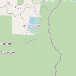
Rivers
Park geography
A comprehensive analysis of forest coverage, river systems, and protected mountain landscapes within French Guiana
Guiana Amazonian Park Geographic Profile: Mapped Boundaries, Terrain, and Natural Features
This structured geographic analysis examines the 20,300 square kilometer extent of Guiana Amazonian Park. The profile identifies core regional features including dominant tropical forest coverage, riverine systems, and distinct mountain peaks such as the Saint-Marcel and Roche Touatou formations. Mapped data illustrates the regional topography and landscape characteristics within this protected area.

The largest national park in France and the European Union, protecting vast Amazonian rainforest in French Guiana
Guiana Amazonian Park
Guiana Amazonian Park is the largest national park in France and the European Union, encompassing approximately 33,900 square kilometers of pristine Amazonian rainforest in the overseas department of French Guiana. Established by decree in February 2007, the park protects roughly 41% of French Guiana's territory, making it one of the most significant protected areas in the world. The park occupies a core zone of 20,300 square kilometers where maximal protection is enforced, alongside a secondary adhesion area of 13,600 square kilometers. Located in the heart of the Guianan Amazon, the park is virtually inaccessible from the coast, reachable only by light aircraft or traditional pirogue canoes along the Maroni and Oyapock rivers. This remoteness has helped preserve extraordinary biodiversity, with the park serving as a critical corridor connecting to adjacent protected areas in Brazil, particularly Tumucumaque National Park, together forming the largest tropical forest protected area on Earth. The park encompasses territories belonging to five communes: Camopi, Maripasoula, Papaïchton, Saint-Élie, and Saül, with Montagne Bellevue as its highest point. Its establishment followed more than a decade of negotiation, including the Twenké agreement of 1998 that recognized the rights of indigenous Amerindian and Maroon communities residing within the park's boundaries.
- Location
- France
- Park type
- National park
- Established
- 2007
- Area
- 20,300 km²
Location overview
Administrative boundaries and regional alignment within France
Geographic Positioning of Guiana Amazonian Park in French Guiana
Guiana Amazonian Park is situated within the region of French Guiana under the national jurisdiction of France. It exists entirely as an inland, non-transboundary protected area with no marine or coastal boundaries.
- Countries
- France, French Guiana
- Regions
- French Guiana
- Primary location
- French Guiana
- Geographic setting
- Inland
Boundary and coordinates
Analyzing geographic dimensions across twenty thousand square kilometers
Guiana Amazonian Park Geographic Boundary Map and Spatial Limits
Interactive boundary visualizations offer essential spatial context for the protected wilderness territory. Key measurements define calculated surface area, center coordinates, and spatial spans to assist geographic analysis.
- Boundary area
- 20,185.5 km²
- Boundary perimeter
- 1,863.8 km
- Northernmost point
- 4.4674° N
- Southernmost point
- 2.1109° N
- Easternmost point
- 52.0588° W
- Westernmost point
- 54.6027° W
- Geographic centre
- 2.9675° N, 53.2646° W
- North–south span
- 260.6 km
- East–west span
- 282.7 km
Terrain and natural features
Stored lowland terrain classifications and recorded hydrological features
Guiana Amazonian Park Terrain and Named Natural Features
Guiana Amazonian Park exhibits a lowland terrain classification across its protected landscape. Linked feature cards supply recorded names, types, and spatial relationships for interior waters and peaks.
Selected named natural features
Rivers
Crique Alice
Streams
Walawalalɨ
Waterfalls
Saut Parasol
Peaks
Montagne Calcul
311 m
Rivers
Crique Jalbot
Environmental setting
Tropical forest zones, river networks, and lowland relief profiles
Guiana Amazonian Park Environmental Setting and Physical Classifications
Recorded tropical forest habitats, major water presences, and dominant canopy covers outline the physical setting of Guiana Amazonian Park. Stored environmental categories link directly to related protected area destinations across the regional atlas.
- Relief
- Lowland
- Climate
- Tropical
- Water
- Major water bodies
- Forest cover
- Dense forest cover
- Seasonality
- Year-round
Landscape features
Forest · Rivers · Waterfalls · Mountains
Habitat types
Tropical forest · Riverine habitat · Montane forest
Park atlas
Browse adjacent protected landscapes and trace the regional spread of conserved Amazonian terrain.
Discover Other Protected Areas Near Guiana Amazonian Park and French Guiana's Vast Rainforests
Explore national parks and protected areas adjacent to Guiana Amazonian Park, tracing the broader geography of conservation efforts across French Guiana and the Guianan Amazon. Compare surrounding protected landscapes to understand regional park distribution and how these vital territories connect within the Guiana Shield's diverse Amazonian ecosystems.
Nature reserveFrench Guiana
About 15 km away#1 closest
North

La Trinité National Nature Reserve: French Guiana Protected Landscape & Nature Reserve Atlas
Mapping the natural terrain and protected boundaries.
Delve into the protected landscape of La Trinité National Nature Reserve, an integral part of French Guiana's extensive natural terrain. This explorer view provides specific insights into the reserve's mapped boundaries and its geographic context within the South American region. Understand its identity as a designated nature reserve and its contribution to the broader protected areas atlas for French Guiana.
- Area
- 769.03 km²
- Established
- 1996
- IUCN
- IV
- Relief
- Mountain
Nature reserveFrench Guiana
About 31 km away#2 closest
Northeast
Nouragues Nature Reserve: Protected Nature Reserve Landscape within French Guiana's Amazon
Mapped geography featuring a distinct inselberg formation.
Nouragues Nature Reserve stands as a critical protected area within French Guiana, safeguarding a significant expanse of pristine lowland tropical rainforest. Its most defining characteristic is the Nouragues Inselberg, a colossal granite formation that dramatically punctuates the dense forest canopy. This reserve is not only a testament to conservation efforts but also a globally recognized hub for tropical forest ecology research. Exploring Nouragues Nature Reserve offers a unique lens into the natural processes and geological features of the Guiana Shield ecosystems.
- Area
- 1,000 km²
- Established
- 1995
- IUCN
- IV
- Relief
- Mixed relief
Nature reserveFrench Guiana
89 km away#3 closest
Northeast
Kaw-Roura Marshland Nature Reserve: A Protected Marshland Landscape in French Guiana
Explore its mapped terrain and regional geographic context.
Kaw-Roura Marshland Nature Reserve represents a distinct protected landscape within the tropical rainforests of French Guiana. This nature reserve offers detailed insights into marshland geography and terrain, contributing vital data for map-based exploration and understanding regional conservation patterns. Discover the specific protected boundaries and landscape character that define this important natural area, anchoring its identity within the larger geographic context of French Guiana.
- Area
- 947 km²
- Established
- 1998
- IUCN
- IV
Nature reserveFrench Guiana
About 91 km away#4 closest
Northeast
Trésor Regional Nature Reserve: Protected Nature Reserve in French Guiana's Guianas Region
Mapped Protected Landscape and Regional Geography
Investigate Trésor Regional Nature Reserve, a vital protected nature reserve located in French Guiana. This reserve is mapped as a significant component of the region's protected areas, contributing to the understanding of its unique tropical rainforest geography. Its designation underscores its importance for atlas exploration, offering structured insights into the natural landscapes that characterize this South American territory.
- Area
- 24.64 km²
- Established
- 2010
- IUCN
- IV
- Relief
- Mountain
Nature reserveFrench Guiana
About 102 km away#5 closest
Northeast
Mont Grand Matoury Nature Reserve: French Guiana's Protected Landscape and Mapped Geography
Explore its protected boundaries and regional terrain.
Mont Grand Matoury Nature Reserve is an integral part of the protected areas network in French Guiana, offering a specific focus on its natural landscape and geographic setting. This entry provides a structured overview of the reserve, detailing its mapped extent and its contribution to the regional geography. Users can delve into the specifics of this protected land, understanding its character and location within the wider context of France's overseas territories and the Amazonian biome.
- Area
- 21.23 km²
- Established
- 2006
- IUCN
- IV
- Relief
- Mixed relief

Nature reserveFrench Guiana
About 135 km away#6 closest
Northeast

Île du Grand Connétable National Nature Reserve: A Vital Seabird Colony and Marine Protected Landscape in French Guiana
Discover its stark granite islands and rich avian life off French Guiana.
Explore the Île du Grand Connétable National Nature Reserve, French Guiana's first nature reserve, focusing on its role as a crucial breeding habitat for seabirds like the Magnificent Frigatebird. This protected area encompasses dramatic, treeless granite islands and a five-kilometer marine perimeter, highlighting a distinctive coastal landscape and its integrated ecosystem supporting marine life and offering significant geographic context for the region's protected lands.
- Area
- 78.5 km²
- Established
- 1992
- IUCN
- IV
- Relief
- Lowland
National parkSuriname
About 156 km away#7 closest
Northwest

Brownsberg Nature Park: Suriname National Park with Tropical Forest and Waterfall Landscapes
Mapped geography and protected landscape context.
Brownsberg Nature Park stands as a vital protected landscape within Suriname, distinguished by its central mountain, tropical forest ecosystems, and scenic waterfalls such as Leo Waterfall. The park's location overlooking the vast Brokopondo Reservoir provides a unique geographic setting, making it an important destination for atlas and map-based exploration of Suriname's natural heritage. Understanding Brownsberg Nature Park offers insight into the Neotropical biodiversity and terrain characteristic of the Guianan moist forests.
- Area
- 122 km²
- Established
- 1969
- IUCN
- II
- Visitors
- 20K annual
Nature reserveFrench Guiana
About 156 km away#8 closest
North
Amana Nature Reserve Nature Reserve: French Guiana's Mapped Protected Landscape
Explore the geographic context and protected area identity.
Amana Nature Reserve is a vital protected area situated in French Guiana, a region renowned for its extensive tropical rainforests. As a nature reserve, it contributes significantly to the atlas of protected lands in South America, offering a distinct geographic identity. Understanding Amana Nature Reserve involves exploring its mapped boundaries and its place within the unique natural terrain of the Guianas, providing essential context for geographic discovery.
- Area
- 148 km²
- Established
- 1998
- IUCN
- IV
- Relief
- Lowland
MoriAtlas Explorer
Continue Your Geographic Exploration of Guiana Amazonian Park's Protected Landscape
Delve deeper into the mapped terrain and regional geography surrounding Guiana Amazonian Park. Understanding this immense protected area provides critical insight into the broader Amazonian landscape and its conservation significance. MoriAtlas facilitates a structured approach to exploring such vital natural territories, helping you connect this park's geographic identity to surrounding protected lands and continental context.
Browse next
Global natural geography
Explore related park routes
Explore MoriAtlas Global ParksBrowse All MoriAtlas ParksGlobal Park Map DiscoveryMoriAtlas: Browse All CountriesBrowse All MoriAtlas ContinentsNational Park Environment AtlasGrand Canyon National Park AtlasYellowstone National Park AtlasYosemite National Park Atlas and GeographySerengeti National Park AtlasGalápagos National Park Protected LandscapeBanff National Park Geography and AtlasKruger National Park Atlas EntryUluṟu-Kata Tjuṯa National Park AtlasExplore Uluru-Kata Tjuta National Park GeographyPlitvice Lakes National Park AtlasFiordland National Park Protected LandscapeGreat Smoky Mountains National Park AtlasAfghanistan National Parks and Protected AreasAlbania National Parks and Protected AreasAlgeria National Parks and Protected AreasAmerican Samoa National Parks and Protected AreasAndorra National Parks and Protected AreasAngola National Parks and Protected AreasAntarctica National Parks and Protected AreasAntigua and Barbuda Park List