Peaks
Serra Comeamalulo
879 m

A detailed look at regional boundaries, elevation ranges, and complex natural landscapes
Iona National Park occupies a sprawling 15,200 square kilometer region within Angola, defined by diverse arid landscapes ranging from coastal beaches to desert mountain terrain. This profile maps the internal geography, identifying key peaks such as Monte Preto and Serra Ongomule alongside a mix of wetland and marine environments.
Related tags
Ancient desert wilderness on the Skeleton Coast
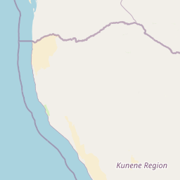
Iona National Park is the largest and oldest national park in Angola, encompassing a vast stretch of the Namib Desert along the country's southwestern Atlantic coast in Namibe Province. The park covers approximately 15,200 square kilometres and represents one of the most significant protected desert ecosystems in Africa. Established as a reserve in 1937 and upgraded to national park status in 1964, Iona holds the distinction of being Angola's premier conservation area, though its history has been marked by significant disruption during the Angolan Civil War and subsequent rehabilitation efforts. The park occupies a remarkable geographic position where the cold Benguela Current creates dense coastal fogs that sustain unique life forms in this extreme environment. To the east, the landscape rises toward the Great Escarpment, while the Curoca and Cunene Rivers define the park's northern and southern boundaries. This transitional zone between ocean and interior plateau supports exceptional biodiversity, including the legendary Welwitschia mirabilis, a living fossil plant that derives moisture from sea fog. The park forms a continuous protected corridor with Namibia's Skeleton Coast and Namib-Naukluft parks, creating a transfrontier conservation area spanning roughly 50,000 square kilometres of pristine desert coastline.
Coastal and Marine Protected Area Status in Namibe Province
Mapped dimensions and coordinates spanning 15,200 square kilometers
Mixed relief profiles and recorded internal natural features
Peaks
879 m
Peaks
Peaks
1,130 m
Peaks
1,740 m
Peaks
772 m
Straits
Arid climate zones, mixed relief, and sparse forest cover profiles
Dunes · Grassland · Mountains · Cliffs · Coast · Beach · Rivers · Lakes · Wetland · Desert
Desert habitat · Coastal habitat · Marine habitat · Dune habitat · Grassland · Shrubland · Wetland · Riverine habitat · Lacustrine habitat
Browse the geographic context of protected areas, tracing interconnected desert and coastal conservation landscapes near Iona National Park.
South

Mapped landscape, shipwrecks, and profound geographic isolation.
Delve into the Skeleton Coast National Park, a monumental protected area in Namibia defined by its stark desert and ocean interface. This page provides detailed geographic context for the park's vast expanse, highlighting its characteristic shipwrecks and the dramatic landscape where towering sand dunes confront the cold Atlantic. Understand the unique protected-area identity of this legendary coastal wilderness through its mapped features and remote setting.
North

Southwestern Angola Wildlife Reserve Geography
Namibe Partial Reserve encompasses vast desert dunes and unique arid plains in southwestern Angola. The protected area offers a look at the ecological character of the Kaokoveld Desert, highlighting the natural geography and boundary context of this significant wildlife reserve within the region.
Southeast
Discover its protected boundaries and geographic context.
Gain a structured understanding of Etosha National Park, a prominent national park within Namibia's Kunene Region. This entry focuses on the park's protected landscape identity, detailing its mapped boundaries and geographic significance. Explore Etosha National Park through the lens of atlas-driven discovery, appreciating its role as a key protected area and its contribution to the regional geography of the surrounding landscape.
Northeast
Mapped boundaries and geographic context for Bicuar National Park.
Bicuar National Park represents a distinct protected area within Angola, offering valuable insights into the nation's natural geography. As a designated national park, its mapped boundaries are crucial for understanding its spatial extent and ecological significance. This resource supports detailed atlas exploration, allowing for a deeper appreciation of the park's landscape and its role within the regional context of Southern Africa.
Northeast
Explore its mapped geographic boundaries and regional terrain.
Bicuari National Park represents a vital component of Africa's protected lands network. This national park offers a specific focus on its unique geographic setting and the mapped extent of its protected boundaries. As an atlas entry, it provides critical context for understanding the park's landscape within the broader regional geography of the African continent, ideal for detailed geographic exploration.
East
Discover the mapped terrain and boundaries in Cunene Province.
Mupa National Park is a vital protected area within Cunene Province, Angola, serving as a key component of the region's conservation atlas. This national park represents a distinct geographic entity, offering detailed insights into its mapped landscape and protected boundaries. Users can explore Mupa National Park to understand its specific contribution to the protected lands of southern Angola and to appreciate its unique position within the broader regional geography and natural terrain.
Southeast
A complex network of drainage channels and savanna grasslands
The Oshana-System functions as an expansive inland wetland complex, defined by its flat, sandy terrain and cyclic flooding. This wildlife reserve spans significant portions of north-central Namibia, offering a distinct study in low-gradient hydrology and savanna-wetland transitions characterized by mopane woodland and makalani palms.
South
Explore mapped landscapes and regional geography.
Dorob National Park is a prime example of a protected coastal desert landscape, stretching along Namibia's Atlantic coast. This national park is renowned for its significant bird populations, making it an Important Bird Area with extensive mapped habitats supporting diverse species. Understand the park's geographic context, from its dramatic dunes to its ephemeral river systems, and its role as a key conservation area within the region.
Deepen your understanding of Iona National Park's protected landscape and its place within the atlas of Angolan conservation areas. By examining its mapped boundaries and regional context, you can gain valuable insights into its geographic significance and the broader patterns of protected lands in Namibe Province. This exploration facilitates a structured approach to understanding natural environments.