Mori Atlas logo
National parkKörös-Maros National Park

Mapping Hungary's Southern Great Plain through vital floodplains, steppes, and bird habitats.

Körös-Maros National Park: National Park and Wetland Protected Landscape in Békés County

(Körös-Maros Nemzeti Park)

Körös-Maros National Park represents a crucial protected landscape within Hungary's Békés County, safeguarding extensive floodplain and steppe grassland ecosystems along the Körös and Maros river systems. This national park is pivotal for understanding the geography of the Southern Great Plain, featuring significant wetland habitats, fishponds, and avian migration corridors. Explore the mapped boundaries and unique regional context of this important protected area.

national parkwetlandfloodplainbirdwatchingpusztasteppe grassland
Illustration of a river flanked by green trees with small red and green markers floating on the water

Körös-Maros National Park

National park

Park overview

Structured park overview, official facts, and landscape profile for Körös-Maros National Park

Körös-Maros National Park park facts, protected area profile, and essential visitor context
Review the core facts for Körös-Maros National Park, including designation, size, terrain, visitor scale, habitats, and operating context in one park-focused overview.

About Körös-Maros National Park

Körös-Maros National Park occupies a distinctive position in Hungary's protected area network as the nation's primary conservation designation for the floodplain and steppe ecosystems of the Alföld (Great Hungarian Plain). The park's creation in 1997 reflected growing recognition that the extensive wetland and grassland complexes of the Körös-Maros river system held irreplaceable ecological value despite centuries of agricultural modification. The park encompasses a remarkable mosaic of habitats that have formed through the interaction of the Körös and Maros river systems with the loess-covered lowland plain. The hydrological character of the region has been shaped significantly by river regulation works, which transformed much of the former floodplain but also created the fishpond systems that now serve as artificial wetlands of major importance. The park's administrative territory extends beyond its core protected zones to include areas in Csongrád-Csanád county east of the Tisza River and portions of the Körös floodplain in Jász-Nagykun-Szolnok county. Within this extensive area, the park manages a network of distinct regional units, each with unique ecological character. The conservation focus extends beyond birds to encompass the broader wetland and steppe ecosystems, with particular emphasis on maintaining the plant and invertebrate communities associated with these increasingly rare habitat types in Central Europe.

Quick facts and research context for Körös-Maros National Park

Körös-Maros National Park lies in southeastern Hungary within Békés county on the Southern Great Plain, spanning approximately 501 km² along the Körös and Maros river systems. The park was established in 1997, making it one of Hungary's younger national parks, though conservation in the region dates to a 1975 bustard reserve at Dévaványa. The protected area encompasses diverse habitats including floodplain forests, fishpond complexes, marshlands, and the characteristic Hungarian puszta grassland. The park administration is based in Szarvas, with the territory divided into two main landscape zones: the Körös region and the Békés-Csanádi loess upland. The park holds Ramsar Convention designation for several wetland sites and forms part of Hungary's network of Important Bird Areas.

Park context

Deeper park guide and search-rich context for Körös-Maros National Park

Körös-Maros National Park history, landscape, wildlife, and travel context
Explore Körös-Maros National Park through its history, landscape character, ecosystems, wildlife, conservation priorities, cultural context, and seasonal travel timing in a structured park guide built for atlas discovery and search intent.

Why Körös-Maros National Park stands out

Körös-Maros National Park is best known as Hungary's premier destination for birdwatching and steppe bird conservation. The park protects one of Europe's most significant populations of the great bustard, the 'emblematic animal' of the park, which nests in the Dévaványa reserve established specifically for its protection. The Kardoskúti Fehér-tó (Lake Fehér) serves as a major autumn migration staging area where tens of thousands of plovers, cranes, and wild ducks rest and feed. The Biharugrai fishpond complex, Hungary's second-largest such system at nearly 1,900 hectares, provides critical habitat for breeding, migrating, and wintering waterbirds and has been a Ramsar site since 1997. The park also preserves the Erdályi hérics (Transylvanian rose) and bókoló zsálya (nodding sage), plant species found nowhere else in Hungary.

Calm river reflecting green trees, red buoys floating on water, tree-lined banks under clear blue sky
Kettős-Körös River flowing through Körös-Maros National Park with tree-lined banks under clear blue skies

Körös-Maros National Park history and protected-area timeline

Körös-Maros National Park was established in 1997 as part of Hungary's expansion of its national park system during the 1990s. The park's creation represented the formal protection of a region that had already gained conservation recognition through earlier designations. The Dévaványa bustard reserve, established in 1975, provided the foundation for avian protection in the region and remains the park's most celebrated conservation achievement. The establishment of the national park consolidated protection for multiple significant areas that had been managed under different designations, including the Biharugrai fishpond complex and the various puszta reserves scattered across the region. The park's management body, the Körös-Maros National Park Directorate (Körös–Maros Nemzeti Park Igazgatóság), operates from headquarters in Szarvas and coordinates conservation activities across the multi-county territory. The park's relatively recent establishment means that many of its ecosystems remain under active restoration management, with efforts focused on maintaining the hydrological conditions that sustain wetland habitats and managing grassland areas to support ground-nesting bird populations.

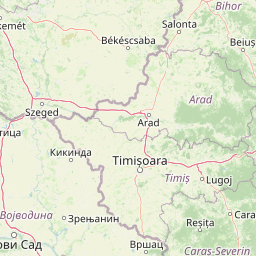
Körös-Maros National Park landscape and geographic character

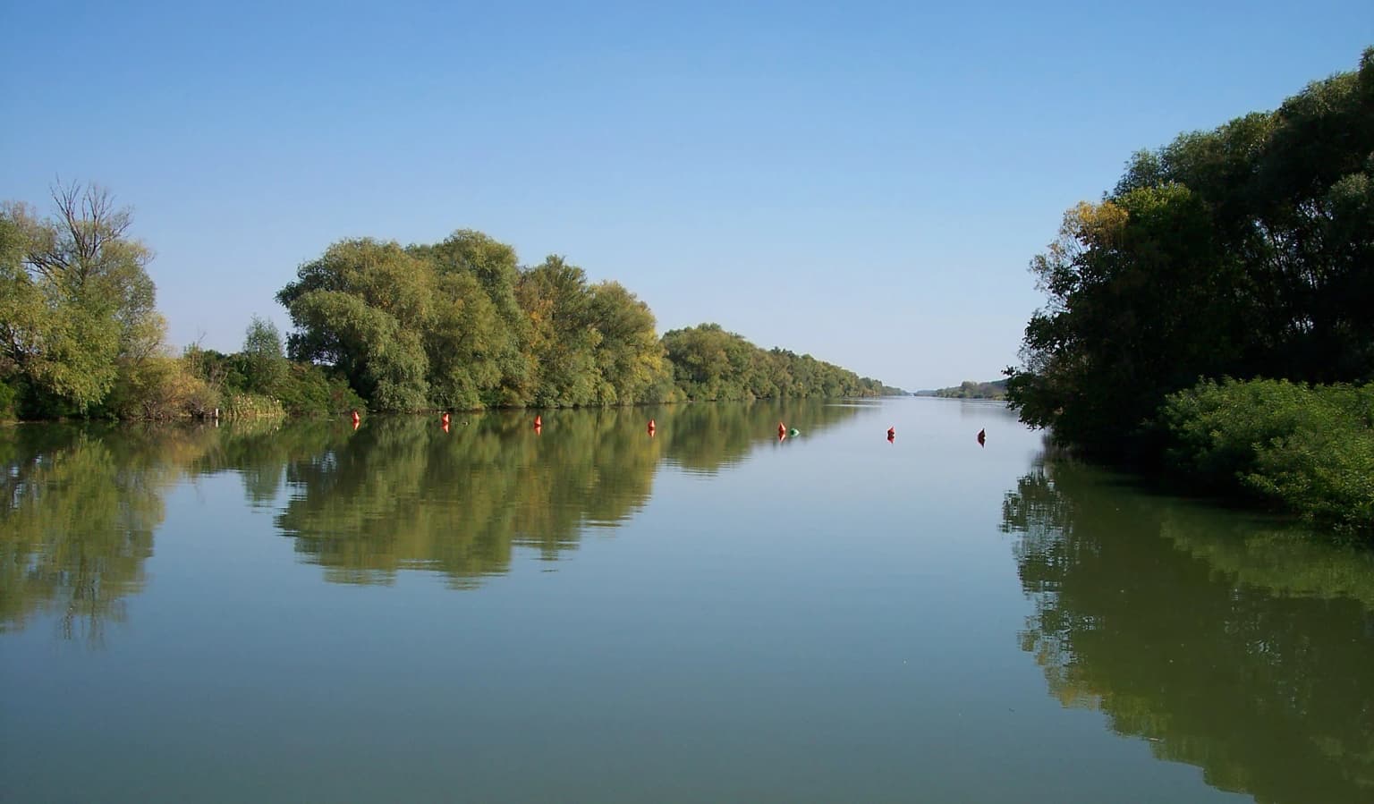
The landscape of Körös-Maros National Park represents the flat to gently undulating terrain characteristic of the Alföld, Hungary's great lowland plain. The park encompasses two broadly distinct landscape zones: the Körös floodplain region and the Békés-Csanádi loess upland. The floodplain areas feature the abandoned channels, oxbow lakes, and marshy depressions left by the Körös River system as it has shifted across the plain over geological time. The fishpond complexes, particularly the extensive Biharugrai system, create artificial wetland habitats that now form the backbone of the park's waterbird conservation value. The puszta areas consist of grassland steppe on loess soils, interspersed with kurgán (ancient burial mounds) that break the horizon and provide microhabitats for specialized plant communities. The river corridors are lined with gallery forests of willow and poplar, contrasting with the open grassland. The landscape lacks significant elevation changes, with the most prominent features being the river embankments, the kurgán mounds rising above the plain, and the water surfaces of lakes and fishponds.

European otter lying on grass among white daisies
European otter (Lutra lutra) resting on grass among white daisies

Körös-Maros National Park ecosystems, habitats, and plant life

The ecological character of Körös-Maros National Park is defined by its position at the intersection of Central Europe's remaining floodplain wetlands and the continental steppe grassland that once covered much of the Hungarian plain. The park protects Hungary's most extensive remaining wetland complexes outside the Hortobágy, including the remnants of the Nagy-Sárrét (Great Marsh) that was historically created by floods from the Berettyó River. The floodplain forests along the Körös and Maros rivers contain characteristic species including goat willow, crack willow, and white poplar, with understory communities featuring Danube hawthorn and buckthorn. The fishpond systems support diverse aquatic vegetation including yellow water-lily, water chestnut, and floating water-primrose. The puszta grasslands, particularly on the loess soils of the Békés-Csanádi region, contain specialized steppe vegetation including feather grasses and steppe forbs. The park's plant conservation priorities focus on the Transylvanian rose (Erdélyi hérics) and nodding sage (bókoló zsálya), species whose only Hungarian populations occur within the park's boundaries.

Körös-Maros National Park wildlife and species highlights

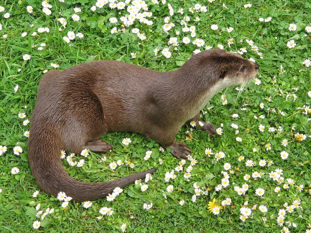
Körös-Maros National Park supports exceptional bird diversity, with approximately two-thirds of all bird species recorded in Hungary occurring within the park. The great bustard remains the park's flagship species, with the Dévaványa reserve providing dedicated protection for this large ground-nesting steppe bird. The autumn migration at Kardoskúti Fehér-tó draws tens of thousands of waterbirds including plovers, cranes, and ducks, with individual years recording 40-50 thousand migrating wild geese and 120 thousand ducks. The fishpond complexes provide breeding habitat for herons, egrets, bitterns, and spoonbills, with colonies established on islands within the pond systems. Raptors including the saker falcon, eastern imperial eagle, and booted eagle hunt across the open grasslands. The mammalian fauna includes European otter in the waterways, the endangered European ground squirrel in grassland areas, and Roe deer and fallow deer in the forest patches. The fishponds support populations of northern pike, carp, and the critically endangered mudminnow.

Körös-Maros National Park conservation status and protection priorities

Körös-Maros National Park serves as a critical node in Hungary's conservation network, protecting the largest remaining wetland and steppe habitats in the eastern portion of the country. The park's designation as an Important Bird Area and its multiple Ramsar-listed sites reflect international recognition of its significance for migratory waterbirds and breeding steppe species. Conservation within the park faces the challenge of maintaining habitat in a landscape where agriculture remains the dominant land use, requiring careful management to balance farming activities with wildlife protection. The bustard conservation program has involved modifying agricultural practices in key breeding areas to reduce nest destruction, with farmers compensated for leaving fields fallow during the critical nesting period. The fishpond management maintains water levels and creates island habitats suitable for colonial nesting birds. The park also participates in broader European conservation frameworks, with its wetland components contributing to the network of sites protecting migratory bird populations across the continent.

Körös-Maros National Park cultural meaning and human context

The Csanádi puszták section of the park contains evidence of continuous human habitation stretching back approximately 7,000 years, reflecting the long history of pastoral use that shaped the puszta landscape. The Tatársánci ősgyep (Tatársánc Ancient Meadow) contains a Bronze Age fortified settlement dating to roughly the 8th-5th centuries BCE, with the double earthwork and moat system representing defensive architecture of that era. The kurgán burial mounds scattered across the puszta represent ancient funeral practices and have become significant for their preserved fragments of original steppe vegetation growing on their slopes. The historical pattern of pastoral use, with sheep and cattle grazing maintaining the open grassland, created the habitat conditions that now support the park's steppe bird communities. The traditional agricultural landscape, with its farmsteads and managed pastures, remains integral to the park's character even as conservation designation has modified some practices.

Top sights and standout views in Körös-Maros National Park

Körös-Maros National Park stands out as Hungary's premier location for witnessing spectacular autumn bird migrations, with the Kardoskúti Fehér-tó hosting gatherings of 40-50 thousand wild geese and 120 thousand ducks in a single season. The park protects Hungary's only populations of the Transylvanian rose and nodding sage, botanical endemics of significant conservation value. The Dévaványa bustard reserve offers the best opportunity in Hungary for observing the great bustard in its characteristic steppe habitat. The Biharugrai fishpond complex, spanning nearly 1,900 hectares, provides the second-largest artificial wetland in Hungary and supports internationally significant waterbird populations. The Tatársánci ősgyep preserves a rare fragment of original loess steppe vegetation alongside Bronze Age archaeological remains.

Best time to visit Körös-Maros National Park

The optimal time to visit Körös-Maros National Park depends on specific interests, though autumn migration season (September through November) offers the most spectacular bird concentrations at Lake Fehér and the fishpond complexes. Spring migration (March through May) provides excellent opportunities for observing returning waterbirds and the commencement of breeding activity among steppe birds. The summer months (June through August) are suitable for observing breeding birds including the bustards and for experiencing the full growth of wetland vegetation. Winter, while offering fewer birds, provides a different character to the landscape with frozen wetlands and fewer visitors. The park is accessible year-round, though the best wildlife viewing coincides with the migration periods when bird concentrations are highest.

Park location guide

Geography guide, regional context, and park location map for Körös-Maros National Park

Körös-Maros National Park park geography, regions, and map view in Hungary
Understand where Körös-Maros National Park sits in Hungary through a broader geographic reading of the surrounding landscape, nearby location context, and its mapped position within the national park landscape.

How Körös-Maros National Park fits into Hungary

Hungary is a landlocked Central European country occupying the Carpathian Basin, also known as the Pannonian Basin. It borders Slovakia, Ukraine, Romania, Serbia, Croatia, Slovenia, and Austria. Budapest serves as both the capital and largest city. The population is predominantly ethnic Hungarians (Magyars), with Hungarian as the official language.

Wider geography shaping Körös-Maros National Park in Hungary

Hungary occupies the Carpathian Basin in Central Europe, a large lowland plain surrounded by the Carpathian Mountains. It is bordered by Slovakia to the north, Ukraine to the northeast, Romania to the east and southeast, Serbia to the south, Croatia and Slovenia to the southwest, and Austria to the west. The Danube River flows through the country, providing its primary drainage.

Map view of Körös-Maros National Park

Use this park location map to pinpoint Körös-Maros National Park in Hungary, understand its exact geographic position, and read its mapped placement within the surrounding landscape more clearly.

Pigeon | © OpenStreetMap contributors

Location context for Körös-Maros National Park

Békés County

Discover the Unique Scenery, Diverse Bird Habitats, and Protected Floodplain Environment of this Hungarian National Park

Körös-Maros National Park Photos: Explore Hungary's Wetland and Steppe Landscapes
Visually explore the expansive puszta grasslands, vital wetland ecosystems, and tranquil oxbow lakes that define Körös-Maros National Park. Examine detailed park images to understand the diverse bird habitats, flat terrain, and unique protected-area character of Hungary's Southern Great Plain. See the distinct beauty of its floodplains, fishponds, and steppe, crucial for conservation.

Calm river reflecting green trees, red buoys floating on water, tree-lined banks under clear blue sky

Saker Falcon (Falco cherrug) facing forward, showing speckled brown and white plumage, yellow cere, and sharp beak

European otter lying on grass among white daisies

Park atlas

Trace the broader protected landscapes and regional park geography spanning Hungary's southeastern lowlands, offering rich comparison value.

Explore Nearby National Parks and Protected Areas Surrounding Körös-Maros National Park
Browse other national parks and diverse protected areas across Hungary's Southern Great Plain, similar to the bird-rich wetlands and steppe grasslands of Körös-Maros National Park. Compare their distinct conservation landscapes, mapped geography, and ecological features within the broader regional context.
Watercolor painting of a wetland with a calm lake, reeds, and distant forested hills
Protected landscapeBihor County

Cefa Natural Park Protected Landscape: Atlas and Geographic Context

Mapped wetland habitats and European bird migration routes.

Cefa Natural Park, designated as a protected landscape in Bihor County, Romania, offers significant insight into European wetland ecosystems and migratory bird patterns. Spanning 5,002 hectares, it features critical habitats such as marshes, floodplains, and the Rădvani Forest, positioned directly on the Pannonian, Bulgarian migration corridor. This park is a landmark for understanding regional geography and conservation efforts focused on migratory waterfowl and specialized halophytic vegetation. MoriAtlas provides the structured geographic data and mapped context necessary for detailed atlas-based discovery of this important protected area.

Area
50.02 km²
Established
2010
IUCN
V
Relief
Lowland
National park

Hortobágy National Park: A UNESCO Protected Steppe Landscape in Eastern Hungary

Explore the unique geography and mapped park boundaries of Hungary's first national park.

Hortobágy National Park is a monumental protected area in Eastern Hungary, recognized globally as the first national park established in the country and a UNESCO World Heritage site. This vast expanse of semi-natural grassland, known as the puszta, stretches across approximately 74,820 hectares, embodying over four millennia of pastoral traditions. The park's landscape is characterized by alkaline soils and sweeping horizons, offering a unique ecosystem with significant avian populations and preserved cultural landmarks. MoriAtlas provides structured geographic context and mapped details to understand this exceptional protected landscape.

Area
748.2 km²
Established
1973
Relief
Lowland
Climate
Temperate
Watercolor illustration of a winding river through grassy fields with wildflowers and distant hills
Protected landscape

Subotička Peščara Protected Landscape: A Mapped Inland Dune System in Serbia

Explore unique Pannonian Plain geography and rare habitats.

Subotička Peščara Protected Landscape offers a deep dive into an exceptional inland dune ecosystem, a key feature of Serbia's Pannonian Plain geography. This protected area's mapped terrain includes a mosaic of forest, steppe, and wetland habitats, supporting rare flora and fauna. Discover the unique contours of this aeolian landscape and its significance within the regional geographic context.

Area
53.7 km²
Established
2002
Relief
Lowland
Climate
Temperate
Protected areaSerbia

Lake Palić Protected Area: Serbia's Mapped Landscape and Regional Geography Exploration

Understand the protected landscape and park boundaries of Lake Palić.

Delve into the specifics of Lake Palić, a designated protected area in Serbia. This resource offers a deep dive into the park's mapped landscape, helping to illustrate its protected boundaries and geographic significance. Gain a clear understanding of its regional context and its contribution to the atlas of protected natural areas within Serbia.

Watercolor painting showing a landscape with rolling hills, forests, and mountains in soft pastel colors.
Protected landscape

Apuseni Natural Park: Protected Landscape Identity and Geographic Map Exploration

Romania's protected area mapped in its regional geography.

Apuseni Natural Park stands as a protected landscape offering significant value for geographic discovery. This entry provides a detailed look at its protected-area status and mapped landscape context within Romania. Users can explore its boundaries, understand its relation to surrounding terrain, and utilize this information for a structured atlas-based approach to natural landscape research.

Area
757.84 km²
Established
1990
IUCN
V
Relief
Mountain
Protected area

Jegrička Nature Park: Mapped Protected Area with Riverine Wetland Ecosystems

Explore the geography and protected landscape of Jegrička Nature Park.

Jegrička Nature Park is a designated protected area recognized for its significant riverine wetland character within the Pannonian Plain of northern Serbia. The park's landscape is defined by the meandering Jegrička river, extensive marshlands, and riparian vegetation, serving as crucial freshwater habitat for diverse waterfowl and migratory bird populations. This page offers detailed geographic context and atlas-level exploration of its protected boundaries and ecological importance within Eastern Europe's broader natural heritage.

Relief
Lowland
Scope
Mixed
Water
Major water bodies
Watercolor illustration depicting a landscape with mountains, a winding river, and grassy fields
Protected landscape

Vršac Mountains Protected Landscape: A Unique Pannonian Island Mountain Range in Serbia

Explore distinct geological formations and rich avian habitats.

The Vršac Mountains Protected Landscape offers a unique geographic perspective as one of Serbia's Pannonian island mountains, emerging dramatically from the surrounding plains. This protected area is recognized for its striking gneiss and schist formations, its status as Vojvodina's highest elevation, and its exceptional importance for birdwatching, hosting over 120 species. Delve into the mapped terrain and geological character that distinguish this vital natural region.

Area
170 km²
Established
1982
Relief
Mountain
Climate
Temperate
Watercolor illustration of a river landscape with grassy banks, trees, and hills in the background
National park

Danube-Drava National Park: Hungary's Premier Riverine Protected Area and Floodplain Landscape

Mapping the protected river corridors and vital wetland ecosystems

Danube-Drava National Park showcases the dynamic geography of Central Europe's largest riverine protected area, integrating floodplains, riparian woodlands, and extensive marshes along the Danube and Drava rivers. As a National Park and a Ramsar site, it protects crucial habitats like the Gemenc forest and supports exceptional biodiversity, including significant populations of white-tailed eagles. This page provides a structured overview of its mapped boundaries and ecological importance within the European protected lands atlas.

Area
490 km²
Established
1996
Relief
Lowland
Climate
Temperate

Common questions about visiting, size, designation, and location context for Körös-Maros National Park

Körös-Maros National Park FAQs for park facts, access, geography, and protected area context
Find quick answers about Körös-Maros National Park, including protected-area facts, park geography, trail and visitor context, and how the park fits into its surrounding country and regional landscape.
MoriAtlas Explorer

Continue Your Protected Areas Search Across the Global Atlas

Deepen your exploration by continuing the structured search for national parks and protected areas worldwide. Utilize the comprehensive filtering capabilities to compare different conservation landscapes and refine your understanding of global park geography. Discover more about the distribution and characteristics of protected natural areas.

Global natural geography