
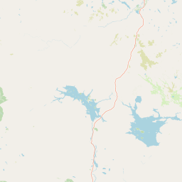
Streams
Park geography
Analyzing the physical terrain, natural features, and regional landscape of this protected area.
Comprehensive Geographic Profile and Mapped Boundaries of Lemmenjoki National Park in Finland
This geographic profile examines the spatial extent of Lemmenjoki National Park, covering its 2850 square kilometer boundary across the Lapland region of Finland. The dataset details the park's subpolar environment, including its boreal forest cover, extensive water systems, and notable interior features like the Ravadasköngäs waterfall and various prominent mountain peaks.
Finland's largest wilderness park in the heart of Lapland
Lemmenjoki National Park
Lemmenjoki National Park is Finland's largest national park and one of the most extensive wilderness areas in Europe, encompassing 2,850 square kilometres of pristine Arctic landscape in the northern Lapland region. Established in 1956 and subsequently expanded, the park occupies a vast territory straddling the municipalities of Inari and Kittilä, situated well above the Arctic Circle at approximately 68.5°N latitude. The park takes its name from the Lemmenjoki River, an 80-kilometre waterway that carves through the protected terrain, serving as both a geographical landmark and a thread linking the region's ecological and cultural heritage. The protected area represents a critical component of Finland's wilderness preservation network, designated under IUCN Category Ib as a true wilderness area where natural processes continue with minimal human intervention.
- Location
- Finland
- Park type
- National park
- Established
- 1956
- Area
- 2,850 km²
Location overview
Regional placement and transboundary classification in Lapland
Geographic Profile of Lemmenjoki National Park in Finland
Lemmenjoki National Park is located within the Lapland region of Finland. Geographic records define the park as a transboundary protected area with distinct regional relationships.
- Countries
- Finland
- Regions
- Lapland
- Primary location
- Finland
- Geographic setting
- Transboundary · Inland
Boundary and coordinates
Geographic boundaries and area measurements spanning 2850 square kilometers
Lemmenjoki National Park Boundary Map and Spatial Extent
Interactive boundary geometry defines the mapped spatial context for this protected territory. Derived measurements provide coordinate limits, centre points, and total area statistics.
- Boundary area
- 2,870 km²
- Boundary perimeter
- 296.4 km
- Northernmost point
- 68.9395° N
- Southernmost point
- 68.2568° N
- Easternmost point
- 26.4323° E
- Westernmost point
- 24.9031° E
- Geographic centre
- 68.5994° N, 25.6081° E
- North–south span
- 76.1 km
- East–west span
- 62.3 km
Terrain and natural features
Mixed relief classifications and recorded landscape features within the park
Lemmenjoki National Park Terrain Geography and Named Natural Features
Recorded terrain classifications and mixed relief profiles define the protected landscape within Lemmenjoki National Park. Linked feature cards supply names, types, measurements, and spatial relationships for each mapped element.
Selected named natural features
Peaks
Keskilaki
Lakes
Laiskasjärvi
Streams
Hirvihaara
Lakes
Ahvenjärvi
172.1 m
Lakes
Rotkojärvi
355.3 m
Environmental setting
Boreal forest habitats, subpolar climate zones, and mixed valley relief
Lemmenjoki National Park Environmental Setting and Physical Classifications
Stored landscape features and habitat classifications outline the diverse physical setting of the northern terrain. Recorded categories connect directly to related protected area destinations within the regional atlas.
- Relief
- Mixed relief
- Climate
- Subpolar
- Water
- Major water bodies
- Forest cover
- Mostly forested
- Seasonality
- Year-round
Landscape features
Forest · Rivers · Valleys
Habitat types
Boreal forest
Park atlas
Trace the vast Arctic landscapes and connected protected areas surrounding Lemmenjoki National Park in Finland's Lapland region.
Discover More National Parks Near Lemmenjoki, Exploring Northern Finland's Protected Wilderness
Continue your exploration beyond Lemmenjoki National Park by browsing other nearby protected areas and national parks across Finland's northern Lapland. Comparing regional park geography helps reveal the wider spread of Arctic wilderness, boreal forests, and unique conservation landscapes in this expansive sub-Arctic territory.
National parkKarasjok Municipality
About 15 km away#1 closest
Northwest

Anárjohka National Park: Mapped Subarctic Wilderness and Protected Landscape
Explore Norway's Finnmarksvidda plateau geography.
Anárjohka National Park, a protected area in Norway's Finnmark region, offers a compelling atlas-level view of subarctic wilderness. The park's landscape is defined by its location on the Finnmarksvidda plateau, featuring rolling birch woodlands, open pine barrens, and extensive wetlands, all mapped within its protected boundaries. This park provides a crucial point of discovery for understanding regional geography, natural terrain, and the interconnectedness of protected lands across northern Europe.
- Area
- 1,409 km²
- Established
- 1976
- IUCN
- II
- Relief
- Mixed relief
National parkLapland
43 km away#2 closest
Southwest

Pallas-Yllästunturi National Park: Lapland's Premier Protected Fell Landscape for Atlas Exploration
Explore its ancient mountain geography and mapped protected area.
Pallas-Yllästunturi National Park presents a unique atlas of Lapland's ancient geography, characterized by a vast chain of rounded fells that are the remnants of three-billion-year-old mountains. As Finland's most popular national park, it offers a deep dive into protected landscape discovery, showcasing diverse boreal forests, mires, and exceptional fell terrain. Understand its geographic scope and protected boundaries for comprehensive map-based exploration.
- Area
- 1,020 km²
- Established
- 2005
- IUCN
- II
- Visitors
- 598.8K annual
National parkLapland
51 km away#3 closest
East
Urho Kekkonen National Park: Detailed Map and Protected Landscape Exploration in Lapland
Discover Finland's expansive Arctic wilderness and fell terrain.
Urho Kekkonen National Park represents a significant portion of Finland's protected Arctic landscape, offering a rich opportunity for geographic and atlas-based discovery. This national park in Lapland showcases dramatic fell formations, boreal forests, and extensive wetlands, with mapped boundaries that define its wild eastern reaches and more accessible western trails. Users can explore the unique terrain and understand its place within the broader regional geography, appreciating the vastness of this protected natural area.
- Area
- 2,550 km²
- Established
- 1983
- IUCN
- II
- Visitors
- 435.9K annual
National parkNorway
About 98 km away#4 closest
Northeast
Øvre Pasvik National Park: Norway's Pristine Siberian Taiga & Mapped Boreal Geography
Explore ancient forests, wetlands, and transboundary protected landscapes.
Øvre Pasvik National Park is a landmark protected area in Northern Norway, showcasing a remarkably intact Siberian taiga ecosystem characterized by ancient Scots pine forests and extensive wetlands. This national park offers a unique geographic perspective with its notably flat terrain, distinguishing it within the broader Norwegian atlas. As part of the Pasvik, Inari Trilateral Park, it highlights significant transboundary conservation efforts and provides a valuable mapped resource for understanding European boreal landscapes and their unique wildlife habitats.
- Area
- 119 km²
- Established
- 1970
- IUCN
- II
- Relief
- Lowland
National parkNorway
109 km away#5 closest
North
Stabbursdalen National Park: Protected Arctic Landscape and Northernmost Pine Forest Atlas
Explore Finnmark's unique geography and protected terrain.
Stabbursdalen National Park preserves a remarkable ecological boundary, featuring the planet's northernmost Scots pine woodland within a dramatic Arctic landscape. This protected area offers a deep dive into rugged mountain terrain, river valley formations, and vital wetland habitats. As a key component of Norway's protected lands, it provides essential context for understanding regional geography and the limits of forest ecosystems on the mapped landscape.
- Area
- 747 km²
- Established
- 1970
- IUCN
- II
- Relief
- Mixed relief
National parkLapland
123 km away#6 closest
South
Pyhä-Luosto National Park: Ancient Geological Heritage and Fell Landscape
Explore Lapland's southernmost large fell system and deep gorges.
Pyhä-Luosto National Park offers a unique window into Finland's deep geological past and its boreal ecosystems. As a protected area, it encompasses a prominent chain of twelve fells composed of two-billion-year-old quartzite, showcasing the southernmost large fell system in the country. The park's landscape is further defined by features like Isokuru, Finland's deepest gorge, and extensive old-growth forests, providing rich context for map-based discovery and regional geographic understanding within Lapland.
- Area
- 142 km²
- Established
- 2005
- IUCN
- II
- Visitors
- 198.9K annual
National parkTroms
About 135 km away#7 closest
Northwest
Reisa National Park: Dramatic River Valley and Protected Landscape Atlas
Subarctic terrain and geographic context in Troms, Norway.
MoriAtlas offers detailed geographic context for Reisa National Park, a protected landscape in Norway's Troms county. Explore the park's identity as a significant subarctic river valley, carved by the Reisa River into a dramatic canyon system. This page provides insights into its mapped natural features, regional landscape setting, and its importance within the broader atlas of protected areas. Understand the park's protected boundaries and terrain for structured geographic discovery.
- Area
- 803 km²
- Established
- 1986
- IUCN
- II
- Relief
- Mixed relief
National parkFinnmark
179 km away#8 closest
North
Seiland National Park: Arctic Island Landscape and Northernmost Scandinavian Glaciers
Mapped boundaries of protected terrain in Finnmark
Seiland National Park offers a distinct glimpse into Arctic island geography, renowned for protecting Scandinavia's northernmost glaciers. This protected area in Finnmark features a dramatic landscape shaped by glaciated mountains, deep coastal fjords, and alpine terrain, making it a key destination for understanding Nordic natural environments. MoriAtlas facilitates exploration of its mapped boundaries and the unique combination of glacial and marine ecosystems present.
- Area
- 316 km²
- Established
- 2006
- IUCN
- II
- Relief
- Mountain
MoriAtlas Explorer
Continue Exploring Lemmenjoki National Park's Geographic Context and Map Details
Delve deeper into the structured geographic information surrounding Lemmenjoki National Park. Understanding this protected landscape's boundaries and its place within Finland's atlas provides essential context for broader regional exploration and analysis of Northern European natural areas. MoriAtlas enables detailed discovery of these vital protected territories.
Browse next
Global natural geography
Explore related park routes
Explore MoriAtlas Global ParksBrowse All MoriAtlas ParksGlobal Park Map DiscoveryMoriAtlas: Browse All CountriesBrowse All MoriAtlas ContinentsNational Park Environment AtlasGrand Canyon National Park AtlasYellowstone National Park AtlasYosemite National Park Atlas and GeographySerengeti National Park AtlasGalápagos National Park Protected LandscapeBanff National Park Geography and AtlasKruger National Park Atlas EntryUluṟu-Kata Tjuṯa National Park AtlasExplore Uluru-Kata Tjuta National Park GeographyPlitvice Lakes National Park AtlasFiordland National Park Protected LandscapeGreat Smoky Mountains National Park AtlasAfghanistan National Parks and Protected AreasAlbania National Parks and Protected AreasAlgeria National Parks and Protected AreasAmerican Samoa National Parks and Protected AreasAndorra National Parks and Protected AreasAngola National Parks and Protected AreasAntarctica National Parks and Protected AreasAntigua and Barbuda Park List