
Waterfalls
Park geography
Analyzing the terrain, coastal distribution, and environmental landscape features
Comprehensive Geographic Profile and Mapped Boundaries of Mu Ko Lanta National Park
This geographic profile details the physical characteristics of Mu Ko Lanta National Park, covering 134 square kilometers across Thailand. The documentation explores its varied mountain terrain, coastal islands, and marine environments, providing a structured overview of its elevation range and internal natural features.
Related tags
Island archipelagoMarine protected areaMountainous terrainTropical rainforestMangrove forest
Island archipelago sanctuary in southern Krabi Province with mountainous terrain, coral reefs, and Chao Ley sea gypsy heritage
Mu Ko Lanta National Park
Mu Ko Lanta National Park is a marine-protected national park encompassing a scattered archipelago in the southern part of Krabi Province, Thailand. The park was established on 15 August 1990 and covers approximately 134 square kilometres across multiple islands, the two largest being Ko Lanta Noi and Ko Lanta Yai. Both islands are inhabited, though Ko Lanta Yai serves as the primary tourist destination. The park's terrain is predominantly mountainous, particularly toward the southern tip of the main islands, with elevations reaching 488 meters at the tallest peak. The area features significant ecological diversity, including tropical rainforest covering portions of Ko Lanta Yai, mangrove forests on several smaller islands, and beach forest ecosystems. The park also protects important coral reef systems and marine habitats in the surrounding waters. A clan of Chao Ley, traditionally known as sea gypsies, continues to reside on Ko Lanta Yai, maintaining ancient customs and ceremonies that reflect the deep cultural heritage of this island landscape.
- Location
- Thailand
- Park type
- National park
- Established
- 1990
- Area
- 134 km²
- Highest point
- 488 m
Location overview
Provincial borders and coastal marine island classifications
Geographic Profile of Mu Ko Lanta National Park in Thailand
Mu Ko Lanta National Park is situated within Thailand and American Samoa, specifically in Krabi Province. The protected territory holds official classifications as an island, coastal, and marine park.
- Countries
- Thailand
- Regions
- Krabi Province
- Primary location
- Thailand
- Geographic setting
- Coastal · Island · Marine
Boundary and coordinates
Mapped spatial outline and derived spatial measurements
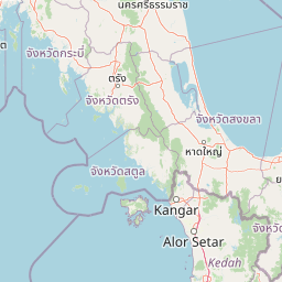
Mu Ko Lanta National Park Boundary Map and Geographic Extent
Interactive boundary geometry provides spatial context for the protected territory across coastal terrain. Accompanying measurements detail total area coverage alongside coordinate limits, geographic span, and center points.
- Boundary area
- 148.6 km²
- Boundary perimeter
- 152 km
- Northernmost point
- 7.7511° N
- Southernmost point
- 7.1414° N
- Easternmost point
- 99.2311° E
- Westernmost point
- 98.8168° E
- Geographic centre
- 7.4472° N, 99.1075° E
- North–south span
- 67.4 km
- East–west span
- 45.7 km
Elevation and terrain
Mountain relief summary and recorded physical features
Mu Ko Lanta National Park Elevation and Terrain Geography
Recorded elevation ranges span from sea level to 488 meters across the mountainous park landscape. Linked feature cards document specific islands, caves, and beaches located within the protected boundary.
- Minimum elevation
- 0 m
- Maximum elevation
- 488 m
- Highest point
- 488 m
Selected named natural features
Cave entrances
Khao Mai Kaew Cave
Streams
คลองจาก
Cave entrances
Tiger Cave
Forests
หมูเกาะตุ๊กนาลิมา
Islands
Ko Mai Ngam Tai
Environmental setting
Tropical marine, mountain, and coastal habitat classifications across stored park records
Mu Ko Lanta National Park Environmental Classification Settings and Physical Geography
Recorded landscape features, tropical climate zones, and seasonal classifications function as complementary frameworks to read the physical setting of Mu Ko Lanta National Park. Stored categories connect directly to related atlas destinations to trace broader environmental patterns.
- Relief
- Mountain
- Climate
- Tropical
- Water
- Water-dominated
- Forest cover
- Partial forest
- Seasonality
- Seasonal
Landscape features
Mountains · Forest · Wetland · Coast · Beach · Islands · Reefs · Cave
Habitat types
Tropical forest · Wetland · Coastal habitat · Marine habitat
Park atlas
Compare marine and island protected landscapes across Thailand's Andaman Sea region
Explore Nearby National Parks and Protected Areas Beyond Mu Ko Lanta National Park
Continue your park discovery from Mu Ko Lanta National Park by exploring other protected areas within Thailand's Andaman Sea region. Trace the geographic spread of marine reserves, island archipelagos, and mountainous coastal terrain to compare diverse conservation landscapes.
National parkTrang Province
About 11 km away#1 closest
East

Hat Chao Mai National Park: National Park Protected Landscape and Geographic Context
Explore Trang Province's mapped protected areas and natural terrain.
Hat Chao Mai National Park serves as a focal point for understanding protected lands in Trang Province, Thailand. This entry offers insights into the park's specific geographic attributes and its designation as a national park. Users can explore the mapped boundaries and the surrounding regional geography, gaining a clear picture of this protected landscape within the MoriAtlas geographic framework. Understanding Hat Chao Mai National Park provides essential context for regional park exploration and mapped conservation areas.
- Area
- 231 km²
- Established
- 1981
- IUCN
- II
- Visitors
- 83K annual
National parkKrabi Province
About 35 km away#2 closest
Northwest
Hat Noppharat Thara, Mu Ko Phi Phi National Park: Protected Landscape and Geographic Identity
Explore mapped terrain and protected natural areas in Krabi Province.
Hat Noppharat Thara, Mu Ko Phi Phi National Park stands as a distinct protected natural landscape, offering a unique geographic perspective within Krabi Province. This page delves into its role as a national park, highlighting its mapped boundaries and contribution to the regional atlas. Users can explore the park's specific natural terrain and understand its significance as a conservation area, providing a foundation for broader geographic discovery.
- Area
- 388 km²
- Established
- 1983
- IUCN
- II
- Visitors
- 1.1M annual
National parkKrabi Province
55 km away#3 closest
North
Khao Phanom Bencha National Park: Protected Mountainous Rainforest and Waterfall Landscapes
Explore Krabi Province's unique protected area and its dramatic geographic features.
Khao Phanom Bencha National Park represents a core protected landscape within Krabi Province, Thailand. Dominated by the imposing Khao Phanom Bencha mountain range, its terrain includes steep, forested slopes and intricate valley systems that give rise to impressive waterfalls. This national park is an essential component of the region's protected natural areas, offering a detailed look at its unique ecosystem and geographic character through mapped landscape context and atlas exploration.
- Area
- 50 km²
- Established
- 1981
- IUCN
- II
- Visitors
- 17.3K annual
National parkThailand
About 62 km away#4 closest
Southeast
Mu Ko Phetra National Park: Thailand National Park Mapped Geography and Protected Landscape
Explore its mapped boundaries and regional atlas context.
Mu Ko Phetra National Park stands as a distinct protected area within Thailand, offering insights into its unique geographic setting. This detailed entry focuses on the park's mapped boundaries, its protected landscape characteristics, and its regional geography. Users can explore its placement within Thailand for a comprehensive understanding of its atlas significance and natural context.
- Area
- 494 km²
- Established
- 1984
- IUCN
- II
- Visitors
- 129.9K annual
National parkThailand
69 km away#5 closest
Northwest
Ao Phang Nga National Park: A Protected National Park in Thailand's Geographic Atlas
Explore the mapped landscape and protected area identity.
Ao Phang Nga National Park offers a distinct protected landscape within Thailand, serving as a key entry in the national park atlas. This page focuses on delineating its geographic boundaries and understanding its specific characteristics as a national park. Users can discover the mapped context and regional setting, providing valuable insights into Thailand's protected natural areas and their conservation significance.
- Area
- 400 km²
- Established
- 1981
- IUCN
- II
- Visitors
- 999K annual
National parkThailand
About 69 km away#6 closest
Northeast
Khao Pu, Khao Ya National Park: Explore Protected Boundaries and Thailand Geography
A key national park for understanding regional landscape context.
Khao Pu, Khao Ya National Park stands as a vital protected area in Thailand, offering rich geographic details for atlas exploration. This page details its specific mapped boundaries and its identity as a national park, providing essential context for understanding natural landscapes within Southeast Asia. Users can gain insights into its regional significance and its contribution to the country's protected land network.
- Area
- 694 km²
- Established
- 1982
- IUCN
- II
- Visitors
- 167.3K annual
National parkSatun Province
About 90 km away#7 closest
Southeast
Tarutao National Park: National Park Exploration and Geographic Context in Satun Province
Mapped boundaries and regional landscape details await discovery.
Tarutao National Park stands as a protected national park entity, offering a specific focal point for exploring Thailand's natural landscapes within Satun Province. This page provides access to its protected-area identity and geographic mapping, essential for understanding its placement within the broader regional atlas. Investigate the park's distinct landscape features and its contribution to the protected areas of the Andaman Sea coast.
- Area
- 1,490 km²
- Established
- 1974
- IUCN
- II
- Visitors
- 238.4K annual
National parkPhuket Province
About 96 km away#8 closest
Northwest
Sirinat National Park: Phuket Province Protected Coastal Landscape and Marine Atlas
Mapped boundaries, beach forests, and sea turtle nesting sites.
Sirinat National Park offers a unique opportunity to explore a protected coastal geography on Phuket Island. This national park preserves critical beach forest ecosystems, extensive shorelines like Hat Mai Khao, vital sea turtle nesting grounds, and surrounding marine environments including coral reefs and mangrove habitats. Its designation as a protected area provides essential context for understanding the natural landscape and its ecological significance within Thailand's regional geography.
- Area
- 90 km²
- Established
- 1981
- IUCN
- II
- Visitors
- 51.2K annual
MoriAtlas Explorer
Continue Exploring Mu Ko Lanta National Park's Mapped Landscape and Protected Area Geography
Deepen your understanding of Mu Ko Lanta National Park by examining its specific geographic profile and protected landscape status. This detailed exploration helps situate the park within Thailand's broader atlas, highlighting the atlas value of its mapped terrain and regional context for a more structured understanding of protected areas.
Browse next
Global natural geography
Explore related park routes
Explore MoriAtlas Global ParksBrowse All MoriAtlas ParksGlobal Park Map DiscoveryMoriAtlas: Browse All CountriesBrowse All MoriAtlas ContinentsNational Park Environment AtlasGrand Canyon National Park AtlasYellowstone National Park AtlasYosemite National Park Atlas and GeographySerengeti National Park AtlasGalápagos National Park Protected LandscapeBanff National Park Geography and AtlasKruger National Park Atlas EntryUluṟu-Kata Tjuṯa National Park AtlasExplore Uluru-Kata Tjuta National Park GeographyPlitvice Lakes National Park AtlasFiordland National Park Protected LandscapeGreat Smoky Mountains National Park AtlasAfghanistan National Parks and Protected AreasAlbania National Parks and Protected AreasAlgeria National Parks and Protected AreasAmerican Samoa National Parks and Protected AreasAndorra National Parks and Protected AreasAngola National Parks and Protected AreasAntarctica National Parks and Protected AreasAntigua and Barbuda Park List