Mori Atlas logo
Park earthquake history

A structured repository of earthquake records mapped by proximity to this coastal reserve

Recorded Historical Seismic Events Near Réserve naturelle nationale de la baie de Canche

This historical catalogue aggregates recorded seismic activity situated within the broader geographic vicinity of the Réserve naturelle nationale de la baie de Canche. Each entry provides standardized data including event dates, magnitude ratings, depth metrics, and distance calculations from the protected area boundaries. The data offers an objective overview of past regional seismic events as documented by geological sources, serving as a reference for regional geography and historical activity patterns near this Opal Coast environment.

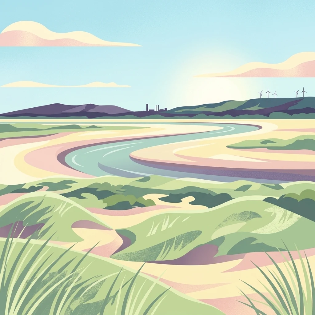
A stylized digital illustration of an estuarine landscape with rolling green sand dunes in the foreground; a winding river channel in the middle; and a distant horizon with hills, a small industrial silhouette, and wind turbines under a soft sky.

A coastal national nature reserve protecting a Picardy estuary, dunes, and a key migratory bird corridor on the Opal Coast.

Réserve naturelle nationale de la baie de Canche

The Réserve naturelle nationale de la baie de Canche is a French national nature reserve located on the northern coast of the Hauts-de-France region, in the southwestern part of the Pas-de-Calais department. Established in 1987, the reserve covers the right bank of the Canche estuary, including a significant portion of the public maritime domain, and forms an important link in the Opal Coast landscape between the Parc naturel régional des Caps et Marais d'Opale and the broader Three Estuaries Marine Park area. The reserve protects a transitional environment where marine and freshwater systems meet. Vast tidal mudflats, salt marshes, drifting and fixed dunes, and chalk cliffs underlie a varied coastal ecosystem shaped by tides, salinity gradients, and longshore sediment transport. The Canche estuary is recognized as a site of pan-European importance for coastal bird migration, hosting nesting, feeding, and stopover habitats for a wide range of waterbirds and shorebirds. Beyond its ecological value, the reserve carries a layered human history. Its landscape was shaped by medieval marine submersion, World War I military installations, and a long-standing tradition of hunting on tidal mudflats, all of which influenced its eventual designation as a protected area. Today it serves as a sanctuary for fragile dune habitats, feeding grounds for migratory birds, and a venue for ongoing conservation and scientific study.

Location
France
Park type
Nature reserve
Established
1987
Area
5.1 km²
Réserve naturelle nationale de la baie de Canche Protected Landscapes

Review Réserve naturelle nationale de la baie de Canche records by distance

Browse earthquakes near Réserve naturelle nationale de la baie de Canche

Réserve naturelle nationale de la baie de Canche protects 5.05 km² of French lowland coast, beach, dunes, wetlands, rivers, and forest under mixed protection. Review nearby earthquakes through their own reported facts and distances rather than inferring coastal impact, current risk, or recurrence.

Sort by
Magnitude
Location

This page describes catalogued earthquakes associated with the park by epicentre location and distance. It does not establish causation, assess current danger, or predict future earthquakes.

No earthquake records match the current filters

Park atlas

Beyond Réserve naturelle nationale de la baie de Canche earthquake data

More parks after Réserve naturelle nationale de la baie de Canche

Réserve naturelle nationale de la baie de Canche earthquake data transitions to an independent park group. No shared bays, reserve designation, geology, seismic conditions, geographic closeness, hazard, risk, or consistent sources should be inferred.
A soft watercolor illustration showing a low-lying landscape with gentle rolling hills, grassy foreground vegetation, and light, hazy atmospheric tones.
Nature reserveHauts-de-France
8.2 km away#1 closest

North

Réserve naturelle régionale du marais de Condette: Wetland Geography and Protected Landscape

A vital ecological corridor within the Hauts-de-France region

Spanning 35 hectares, the Réserve naturelle régionale du marais de Condette protects a unique mosaic of marshland, peat-forming habitats, and forested massifs. This wetland reserve near the Opal Coast acts as an essential green infrastructure link, providing critical sanctuary for flora and fauna while maintaining hydrological balance in a heavily transformed northern French landscape.

Area
0.35 km²
Established
2009
IUCN
IV
Relief
Lowland
A watercolor painting of a rolling rural landscape with bare trees, grassy hills, and distant purple and red hills against a pale sky.
Nature reserveHauts-de-France
14 km away#2 closest

Northeast

Réserve naturelle régionale du Molinet: Protected Calcareous Woodlands and Grassland Mosaic

Geographic and Habitat Analysis of a Pas-de-Calais Nature Reserve

Located in the Boulonnais landscape of northern France, this protected area serves as a vital refuge for calcareous flora. The reserve preserves a rare mosaic of limestone woodlands and grasslands, serving a dual role in both ecological conservation and water catchment protection within the Hauts-de-France administrative region.

Area
0.067 km²
Established
1987
IUCN
IV
Relief
Lowland
A soft watercolor illustration showing a landscape with sparse trees, a sunlit clearing, and rolling hills in the background, set against a plain white background.
Nature reserveHauts-de-France
About 26 km away#3 closest

South

Réserve naturelle régionale du bois des Agneux: Protected Nature Reserve Landscape

Wetland habitat and acidiphile woodland in Hauts-de-France

Examine the geography of Réserve naturelle régionale du bois des Agneux, a nature reserve in the Somme department of Hauts-de-France. This protected area stands out for its mosaic of acidiphile oak woodland, seasonal pools, and sandy micro-relief, serving as a critical refuge for specialized flora and fauna on the Picardy coast.

Area
0.256 km²
Established
2015
IUCN
IV
Relief
Lowland
Nature reserveHauts-de-France
About 27 km away#4 closest

North

Réserve naturelle régionale du pré communal d'Ambleteuse: Regional Nature Reserve Geography

Coastal dune relics and protected marshland in Hauts-de-France.

This protected area provides an essential look at the coastal geography of the Opal Coast. Featuring a complex mosaic of ancient dune turf, dry heath, and wet meadows, the reserve stands as a landmark for biodiversity and traditional land management in northern France.

Area
0.605 km²
Established
1991
IUCN
IV
Relief
Lowland
Watercolor painting of a coastal salt marsh with winding tidal channels, grassy banks, and soft green and purple tones.
Nature reserveSomme
About 32 km away#5 closest

South

Reserve naturelle nationale de la baie de Somme: Estuarine Geography and Protected Boundaries

Coastal mapping of the Somme estuary in northern France

Covering a wide range of tidal environments, the Reserve naturelle nationale de la baie de Somme represents one of France's most significant protected estuarine systems. This overview focuses on the interplay of river and tide, showcasing the expansive mudflats, salt marshes, and dune habitats that support immense bird populations and harbor seals along the Picardy shoreline.

Area
34.209 km²
Established
1994
IUCN
IV
Relief
Lowland
Nature reserveHauts-de-France
About 34 km away#6 closest

North

Réserve naturelle régionale de la forteresse de Mimoyecques: Regional Nature Reserve Geography

Protected subterranean habitat and wartime heritage in Hauts-de-France.

Located in the rolling lowlands of the Pas-de-Calais, the Réserve naturelle régionale de la forteresse de Mimoyecques is a uniquely managed protected area. Its landscape integrates historical military architecture with modern biodiversity conservation, focusing on the protection of rare underground roosting environments for diverse bat species within the regional Hauts-de-France terrain.

Area
0.016 km²
Established
2012
Relief
Lowland
Climate
Temperate
A horizontal watercolor painting showing a soft landscape with green vegetation, pink accents, and a winding body of water leading towards distant hills.
Nature reserveFrance
About 35 km away#7 closest

North

Réserve naturelle régionale du mont de Couple: Protected Chalk Escarpment and Coastal Viewpoint

A limestone ridge sanctuary in the northern French Boulonnais region

Spanning a rare chalk cuesta in northern France, this protected area balances ecological conservation with distinct geological features. The reserve provides critical habitat for orchids and protected flora while serving as a strategic viewpoint across the Straits of Dover and the surrounding Opal Coast terrain.

Area
0.136 km²
Established
1997
Relief
Upland
Climate
Temperate
Nature reservePas-de-Calais
About 37 km away#8 closest

Southeast

Réserve naturelle régionale du marais de la Grenouillère: Wetland Geography and Map

Protected alluvial floodplain in the Pas-de-Calais region

This regional nature reserve encompasses sixteen hectares of high-density wetland habitats along the Ternoise river. Its flat topography sustains a delicate mosaic of alkaline marshes, wet meadows, and riparian alder woodlands that serve as a critical ecological buffer within the broader landscape of northern France.

Area
0.166 km²
Established
2000
IUCN
IV
Relief
Lowland
MoriAtlas Explorer

Analyze the Geography of Réserve naturelle nationale de la baie de Canche

Continue your study of the French coastline by mapping the estuarine features and protected dune boundaries of Réserve naturelle nationale de la baie de Canche. Our data provides a clear look at this Pas-de-Calais landmark, helping you understand its role as a migratory hub and geomorphological site within the wider MoriAtlas collection of protected areas.