
Mori Atlas logo
Nature reserveRéserve naturelle nationale de la baie de Canche

A dynamic estuarine terrain defining the Opal Coast in the Pas-de-Calais department of France

Réserve naturelle nationale de la baie de Canche: Mapped Coastal and Estuary Protected Landscapes

The Réserve naturelle nationale de la baie de Canche sits as a critical protected landscape on the northern coast of France. This nature reserve maps the intersection of the Canche river with the English Channel, showcasing a complex interplay of macrotidal mudflats, salt marshes, and unique plaqued dunes that climb over ancient chalk cliffs. Visitors can study the shifting longshore drift dynamics that define this asymmetrical estuarine environment, providing essential habitat for migratory waterbirds and coastal ecosystems.

estuarytidal mudflatssalt marshescoastal duneschalk cliffsOpal Coast
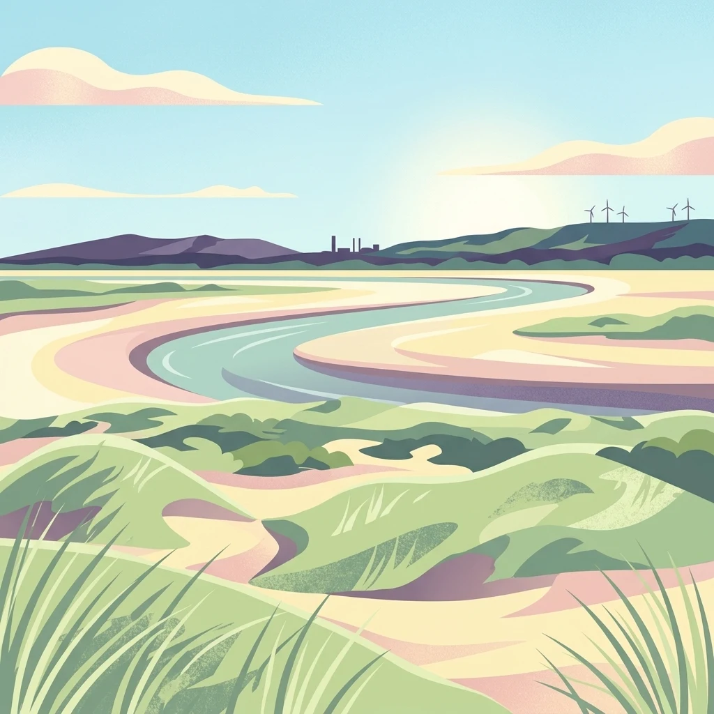
A stylized digital illustration of an estuarine landscape with rolling green sand dunes in the foreground; a winding river channel in the middle; and a distant horizon with hills, a small industrial silhouette, and wind turbines under a soft sky.

Réserve naturelle nationale de la baie de Canche

Nature reserve

Park overview

Structured park overview, official facts, and landscape profile for Réserve naturelle nationale de la baie de Canche

Réserve naturelle nationale de la baie de Canche park facts, protected area profile, and essential visitor context

Review the core facts for Réserve naturelle nationale de la baie de Canche, including designation, size, terrain, visitor scale, habitats, and operating context in one park-focused overview.

About Réserve naturelle nationale de la baie de Canche

The Réserve naturelle nationale de la baie de Canche sits on the Opal Coast of northern France, in the southwestern Pas-de-Calais, and constitutes one of the principal estuarine protected areas of the Hauts-de-France region. It lies just south of the Parc naturel régional des Caps et Marais d'Opale and is expected to be incorporated into the future Parc naturel marin des trois estuaires, alongside the estuaries of the Authie and the Somme. The reserve's territory spans the communes of Étaples, Camiers, and Lefaux, with the historic port of Étaples serving as the nearest urban center.

Geographically, the reserve covers the right bank of the Canche estuary, including a substantial share of the public maritime domain. The landscape is defined by a continuum of coastal habitats: tidal mudflats exposed at low tide, salt marshes (locally called schorres or mollières) colonized by halophytic plants such as glasswort and sea purslane, fixed and drifting dune systems, and inland scrub and grassland communities. The setting is shaped by two powerful forces: tidal cycles that pulse marine and brackish water twice a day through the estuary, and longshore drift that continuously redistributes sand and sediments along the coastline.

Ecologically, the reserve belongs to the small group of European sites where 'plaqued dunes' occur, where windblown sand accumulates against an old chalk cliff to create a distinctive dune-on-cliff morphology. The estuary is also a feeding ground, nursery, and stopover for many migratory waterbirds, supporting both nesting species and seasonal visitors. These qualities, combined with a long history of shorebird hunting on the mudflats, made the site a focal point for conservationists seeking legal protection, ultimately leading to its classification as a national nature reserve in 1987. The reserve continues to be a place of active scientific monitoring, including long-running studies of benthic fauna, dune vegetation, and mammalian predators.

Quick facts and research context for Réserve naturelle nationale de la baie de Canche

The Réserve naturelle nationale de la baie de Canche is a national nature reserve located in the Hauts-de-France region, on the Opal Coast of northern France. It covers approximately 505 hectares, of which a large portion lies on the public maritime domain, and centers on the right bank of the Canche estuary near the town of Étaples.

It was formally classified by decree on 16 July 1987 and is managed by Eden 62, the syndicat mixte created by the Conseil général du Pas-de-Calais for the department's sensitive natural areas. The reserve also overlaps with broader designations, including a Natura 2000 Special Protection Zone covering the marine portion of the estuary and a ZNIEFF type I classification for the dunes of Camiers and the Bay of Canche.

Protection and recognition

Documented protection scope and official administrative designation records

Réserve naturelle nationale de la baie de Canche Protection Status and Recognition

Protected area records for Réserve naturelle nationale de la baie de Canche outline documented mixed protection status and administrative management scope. Structured conservation data provides reliable reference points for international protected area databases and registry matching.

Protection details

Protection scope
Mixed
Transboundary protection
No
WDPA ID
39798
Park context

Deeper park guide and search-rich context for Réserve naturelle nationale de la baie de Canche

Réserve naturelle nationale de la baie de Canche history, landscape, wildlife, and travel context

Explore Réserve naturelle nationale de la baie de Canche through its history, landscape character, ecosystems, wildlife, conservation priorities, cultural context, and seasonal travel timing in a structured park guide built for atlas discovery and search intent.

Why Réserve naturelle nationale de la baie de Canche stands out

The reserve is best known for its exceptional dune system, including rare examples of 'plaqued dunes' where wind-driven sand clings to chalk cliffs, a phenomenon otherwise documented only in a single location in southern Portugal in Europe. It is equally recognized as a critical node for coastal bird migration along the eastern English Channel. Its stretch of tidal mudflats, salt marshes, and shifting sands is fed by the Canche river and shaped by a clear longshore-drift dynamic that erodes the northern bank while accreting the southern side. The combination of intact dune habitats, brackish estuary waters, and traditional shorebird hunting grounds gives the reserve a distinctive ecological and cultural character within France's network of estuarine protected areas.
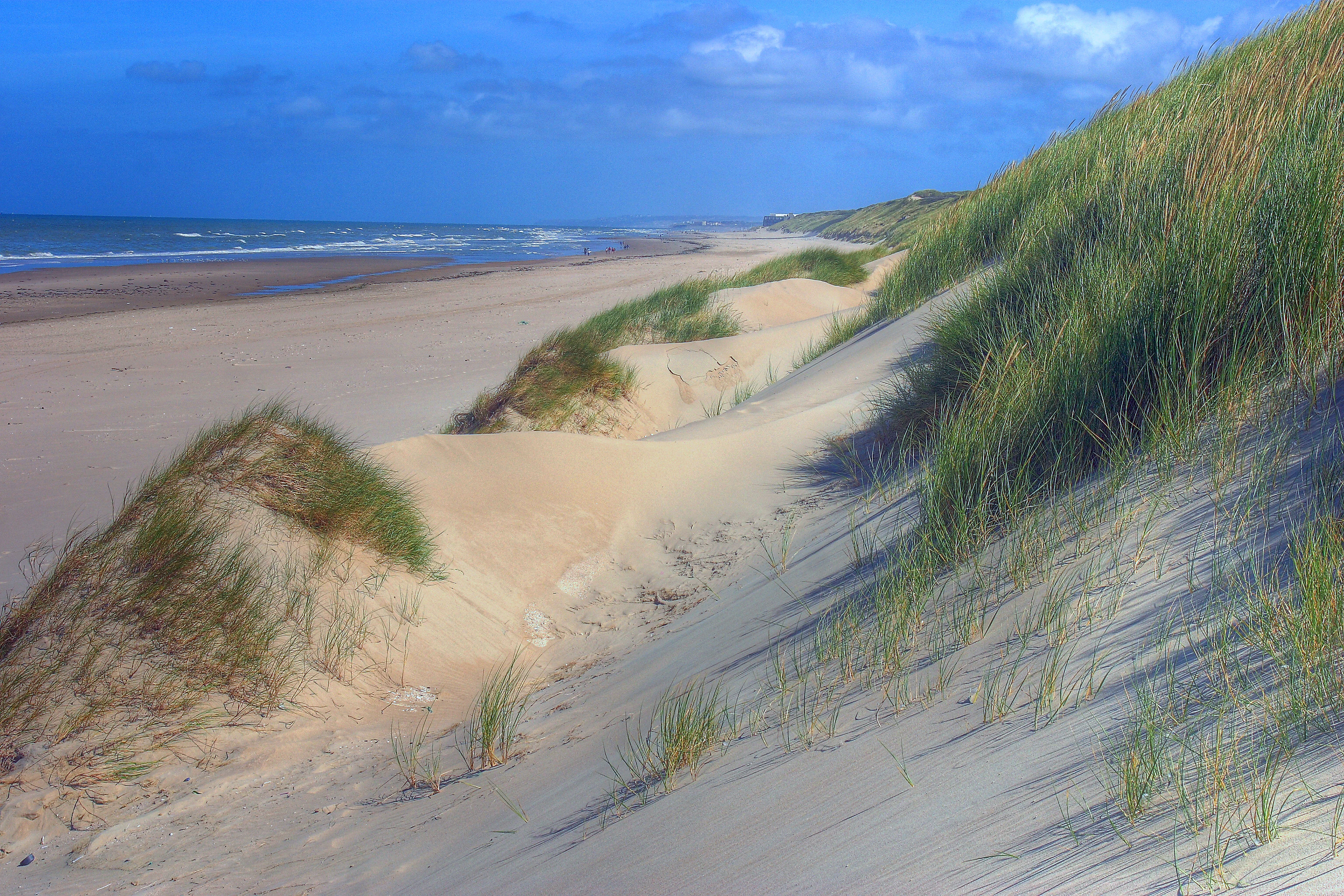
A wide angle view of sandy dunes covered in marram grass leading down to a wide, flat beach and the ocean under a blue sky.
Sand dunes along the beach in the Canche estuary nature reserve.

Réserve naturelle nationale de la baie de Canche history and protected-area timeline

The Bay of Canche has a layered human past that is directly visible in its present environment. During the Carolingian era, the site was submerged by the sea during a phase of higher water levels around the year 800; this transgression left relict chalk cliffs beneath what are now dunes. The estuary also bears heavy traces of the First World War, when the British army established a large camp at Étaples, capable of holding tens of thousands of troops, to train English-speaking soldiers, prepare machine guns, and operate a military hospital on the dune edge. Near the end of the war, this hospital was bombed.

In the latter twentieth century, the site faced a major development threat when a dam project was proposed to capture freshwater and supply the Lille region. Opposition from regional biologists and naturalists gave rise to the federation 'Nord Nature', which became a leading voice for the protection of the estuary. The Canche was also recognized as one of several Picardy rivers once rich in salmon, sea trout, and European eel, which justified its classification among first-category rivers for migratory fish.

These ecological pressures and human stakes culminated in the formal classification of the reserve on 16 July 1987 by decree, with the explicit aim of protecting the dune environment, the estuarine hunting grounds, and the coastal landscape from urbanization. Since then, the area has been progressively strengthened through complementary protections, including the acquisition of nearby coastal sites (Lornel, Stella dunes, Mayville dunes) by the Conservatoire du littoral, the designation of a Natura 2000 Special Protection Zone covering the marine estuary, and plans for Ramsar recognition and integration into the Three Estuaries Marine Park.

Réserve naturelle nationale de la baie de Canche landscape and geographic character

The reserve's landscape is a textbook example of a macrotidal estuary meeting a chalk-cliff coastline. The Canche river carves a small but dynamic valley that opens onto the English Channel at Étaples, where freshwater flows, tidal currents, and marine inputs combine to create a constantly shifting interface between sea and land. A sedimentary plume, or 'bouchon vaseux', forms in the estuary where salinity rises sharply near the port, structuring life across the mudflats.

The coastline is shaped by a strong longshore drift running northwards along the Opal Coast. Sand and fine sediments are pulled away from the northern bank, which erodes and retreats under wave and wind action, while the southern, down-drift side accretes, building up a 'poulier' stabilized by wrack, dune plants, and accumulating beach material. The result is an asymmetrical estuary with a clear contrast between the receding north and the accreting south. Distinct from the neighboring Slack estuary further north, the Canche has no pebble beach, instead presenting continuous sandy and muddy shores.

The most unusual geomorphological feature is the 'plaqued dune', where sand driven inland by prevailing westerly winds has climbed onto an old chalk cliff and buried it, producing a dune platform resting on chalk. Two such systems are documented in Europe: the northern dunes of the Bay of Canche, and a comparable zone in southern Portugal. Behind the active foredunes, vegetation succession moves from sea purslane and glasswort on the salt marshes, through dune grasses and shrubs, to inland scrub, fed by freshwater from the Canche and seeps from the buried chalk cliff.
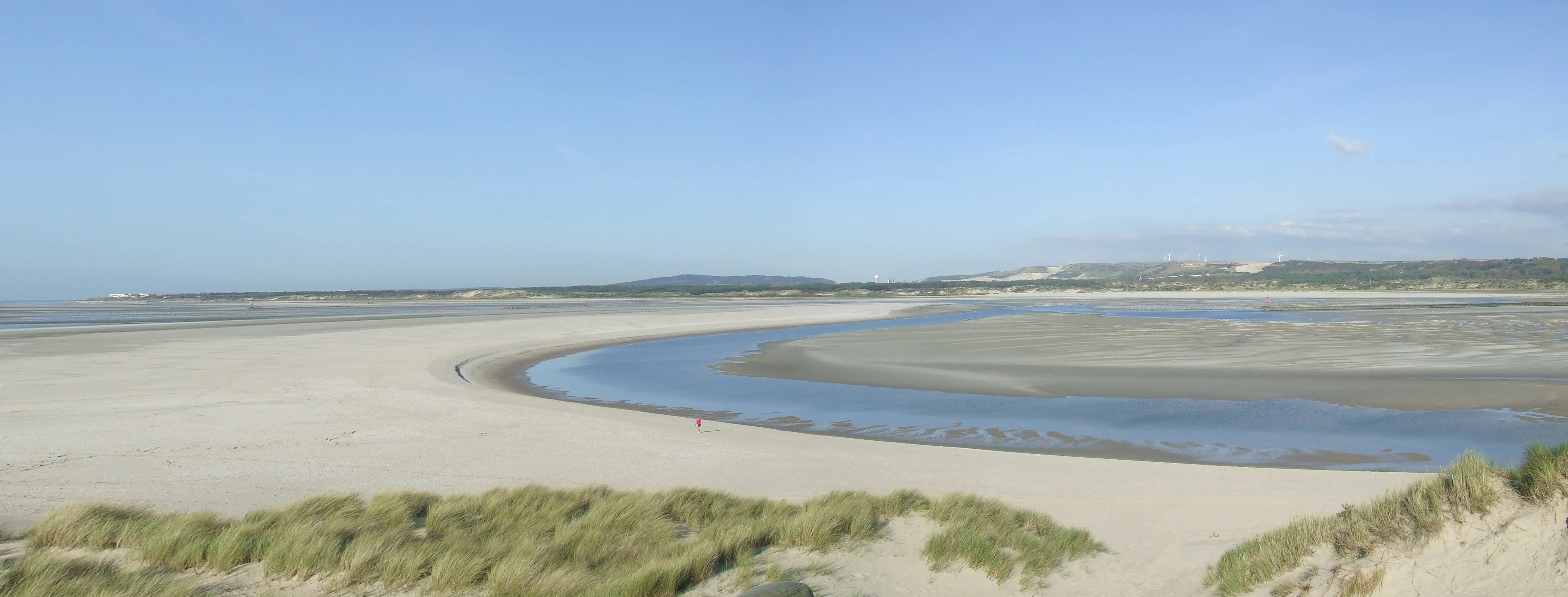
A wide view of the Canche estuary at low tide, featuring sandy tidal flats and a winding river channel under a clear blue sky, with sand dunes and grasses in the foreground.
The Canche river estuary during low tide, revealing extensive tidal flats and meandering channels.

Réserve naturelle nationale de la baie de Canche ecosystems, habitats, and plant life

The ecological character of the reserve is governed by two dominant gradients: tidal rhythm and salinity. The estuary rises toward the sea, with salinities climbing sharply at the port d'Étaples to reach close to open sea values. These oscillations sustain a productive benthic fauna that has been intensively studied by laboratories such as the hydrobiology and ecotoxicology group of Université Lille 1, especially during the 1980s and 1990s. The high productivity of the mudflats feeds both invertebrates and the migratory birds that depend on them.

Vegetation reflects the estuarine to dune transition. Halophytic plants such as glasswort and sea purslane dominate the lower salt marshes (schorres), while the upper marshes gradually yield to non-halophytic grasses and shrubs where freshwater from the Canche and chalk seeps dilute the salinity. Dune systems host classic coastal vegetation adapted to sand and salt spray, including sea buckthorn, lichens on shrub branches, and mosses in the dune understory. Behind the dunes, open back-coastal habitats have shifted toward scrub due to the absence of large wild herbivores, a change the management plan seeks to counter.

In the aquatic realm, the Canche was historically rich in salmon, sea trout, and European eel, which underlies its status as a first-category river for migratory fish. The estuary's value is reinforced by adjacent acquisitions by the Conservatoire du littoral and a Natura 2000 marine zone, so that the terrestrial and marine portions of the system form a single ecological continuum for many species.
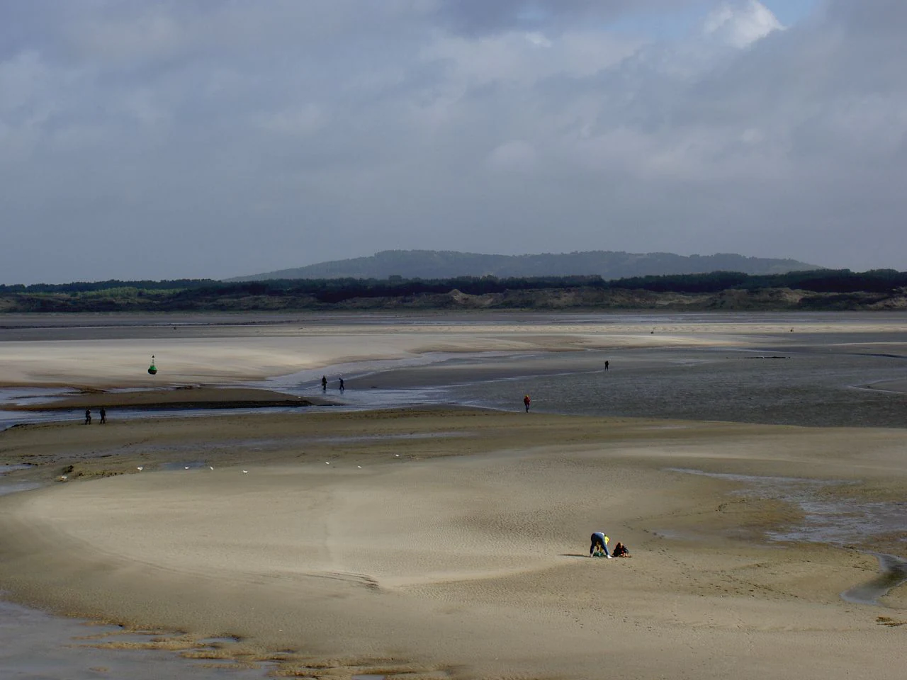
A wide, sandy estuary at low tide with people foraging for shellfish in the distance and a person harvesting in the foreground.
Low tide shellfish harvesting in the Canche estuary.

Réserve naturelle nationale de la baie de Canche wildlife and species highlights

The Bay of Canche is primarily recognized for its richness in coastal and estuarine birds. The vast mudflats and coastal salt marshes support large numbers of waterbirds and shorebirds throughout the migration seasons, ranking the site as important at the pan-European level. Nesting species in and around the reserve include the European nightjar, the European honey buzzard, the bluethroat, the hen harrier, the marsh harrier, and the white stork, while stopover visitors include the greater spotted eagle and the osprey. The common shelduck is emblematic of the bay, nesting in burrows dug into the sand.

The invertebrate fauna of the reserve is a key element of the food web. Because this stretch of coastline has been relatively spared from heavy insecticide use, several invertebrate species that have become rare elsewhere in the region still persist here, including in the strandline (laisses de mer), where they in turn nourish the birds. The macrobenthic fauna of the estuary has been the subject of dedicated studies documenting community composition and seasonal variation.

Among mammals, wild boar and red foxes are present in and around the reserve, with smaller mammals also recorded. The fox population around the bay attracted attention in the late 1990s: concerns over predation led to a focused eco-ethological study commissioned by the reserve's management committee under the authority of the local sous-préfecture, with results presented in early 2000. The study concluded that the local fox population had been significantly overestimated. Marine mammals, including harbour seals, still appear episodically in the estuary, recalling a richer prehistoric fauna that likely once used the bay as a refuge.
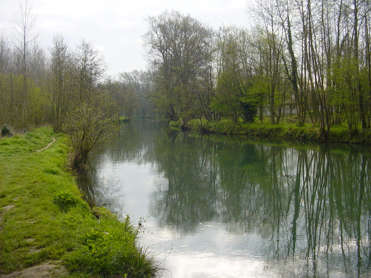
A calm, narrow river winds through a green, forested landscape under an overcast sky.
The Canche river flowing through a lush, tree-lined riparian zone.

Réserve naturelle nationale de la baie de Canche conservation status and protection priorities

From a conservation perspective, the reserve is significant for both its estuarine and dune habitats and its role in the broader French network of coastal protected areas. The site's designation in 1987 was driven by the need to safeguard a fragile dune environment from urbanization, curb intensive hunting pressure on the tidal flats, and preserve ecological and landscape values already recognized through regional scientific study. Its management has since shifted toward an integrated approach covering benthic fauna, dune vegetation, predatory mammals, and visitor pressure.

The reserve benefits from layered protection. On land, it sits within the national nature reserve perimeter, overlapping with a ZNIEFF type I classification for the dunes of Camiers and the Bay of Canche, and is adjacent to several sites purchased by the Conservatoire du littoral (Lornel garennes, Stella dunes, Mayville dunes). On water, a Natura 2000 Special Protection Zone (ZPS FR3110038) covers more than 5,000 hectares of the marine estuary, with planned extensions to the marine Natura 2000 network. The reserve is also expected to be incorporated into the future Parc naturel marin des trois estuaires, alongside the Authie and Somme estuaries.

Active threats tracked by managers include water pollution from the Canche, which carries nutrients, pesticides, and sediment from the agricultural and urbanized catchment, contributing to eutrophication and turbidity. Air pollution, tourism pressure, hunting and historical poaching, and ecological fragmentation from a busy coastal road all constrain the system. Climate change is also a long-term concern: rising sea levels could eventually inundate parts of the reserve. The reserve's management plan and associated Atlas Polmar documentation aim to mitigate these cumulative pressures.

Réserve naturelle nationale de la baie de Canche cultural meaning and human context

The bay and its reserve sit within a coastal landscape where human activity and natural dynamics have long been intertwined. Étaples, the main town bordering the reserve, combines a working port with a long tradition of estuarine hunting on the mudflats, which is part of why the area features numerous hunting hides (huttes de chasse). This culture of shorebird hunting is recognized in the reserve's history as one of the pressures that led to the 1987 protection classification.

The wider memory of the site reaches back to the First World War, when the bay hosted a vast Anglo-American military camp and a hospital that was bombed late in the war, leaving an enduring human mark on the dunes and the port. In the late twentieth century, the defense of the bay against a freshwater dam project crystallized a regional conservation movement, contributing to the creation of the Nord Nature federation and reinforcing a local identity of citizen-led protection of the Opal Coast. The reserve now forms part of the regional network of sensitive natural areas managed by Eden 62 under the Conseil général du Pas-de-Calais.
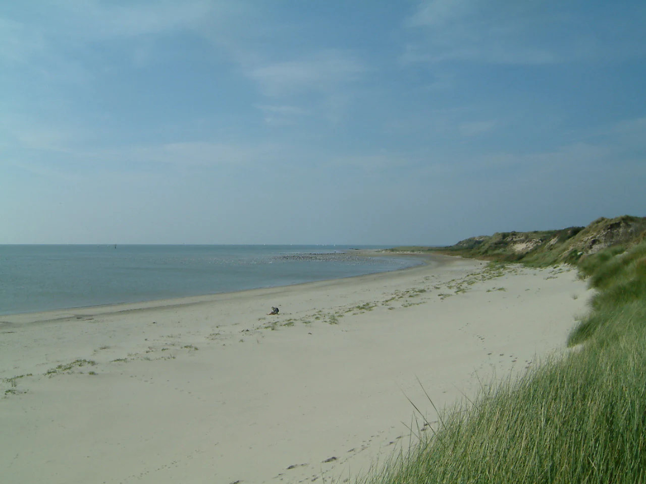
A wide-angle landscape shot of a long, empty sandy beach bordering the sea under a clear blue sky, with grassy sand dunes on the right side.
A view of the wild sandy beach within the Réserve naturelle nationale de la baie de Canche, featuring dunes covered in marram grass.

Top sights and standout views in Réserve naturelle nationale de la baie de Canche

The reserve's standout features include its rare 'plaqued dunes' perched above chalk cliffs, its pan-European importance for migratory shorebirds and waterbirds, and a high-productivity tidal mudflat system that has attracted sustained scientific research. The dynamic asymmetry between the eroding northern bank and the accreting southern bank gives the bay a distinctive morphosedimentary signature along the Opal Coast.

Equally distinctive is the layered conservation framework: a UNESCO-relevant estuarine ecosystem under national nature reserve status, a Natura 2000 marine zone, ZNIEFF recognition, Conservatoire du littoral acquisitions, and an anticipated role within the Three Estuaries Marine Park. Together, these designations place the Bay of Canche among the most closely monitored and protected estuarine systems on France's northern coast.
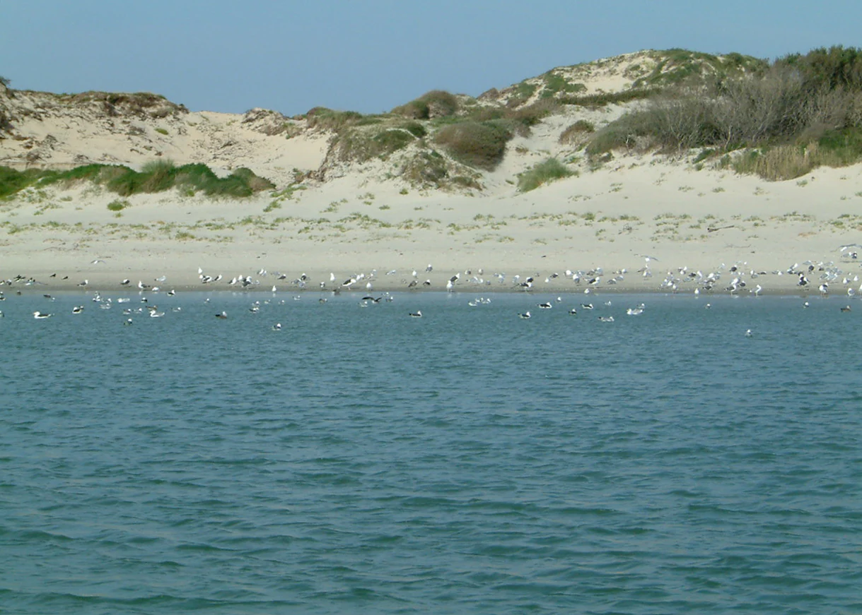
A wide view of the Canche river estuary featuring sandy coastal dunes in the background and a large flock of seabirds resting along the shoreline.
The sandy dunes and estuary waters of the Baie de Canche nature reserve.

Best time to visit Réserve naturelle nationale de la baie de Canche

The reserve's character shifts strongly with the seasons. Migratory bird activity peaks during spring and autumn passage periods, when the mudflats host the largest concentrations of waterbirds and shorebirds, making these seasons especially rewarding for naturalists. Late winter and early spring can also be a time of active dune morphology, as storms reshape the beach and foredune profiles.

In summer, the site's ecological mood softens with warmer temperatures, denser vegetation on the back-dune scrub, and increased visitor activity. The reserve, however, is sensitive to heavy tourist pressure, so quieter shoulder seasons are typically more favorable for observing wildlife and appreciating the dune and estuary landscapes. Coastal weather along the Opal Coast is changeable year-round, and tides strongly condition access to mudflats and shoreline.
Monthly climate preview

Long-term representative temperature and precipitation averages across the protected area

Réserve naturelle nationale de la baie de Canche Monthly Climate Normals and Temperature Patterns

Historical NASA Power measurements record a steady progression of average monthly temperatures and precipitation rates across the representative coordinate. Detailed month-by-month records provide complete context for understanding long-term climate normals within the protected area.
Annual mean10 °C
4 °C17 °C
Jan
Feb
Mar
Apr
May12°
Jun15°
Jul17°
Aug17°
Sep15°
Oct11°
Nov
Dec
Warmest month
August

17.1 °C

Coolest month
January

3.6 °C

Wettest month
December

3 mm/day

Driest month
April

1.7 mm/day

Park location guide

Geography guide, regional context, and park location map for Réserve naturelle nationale de la baie de Canche

Réserve naturelle nationale de la baie de Canche park geography, regions, and map view in France

Understand where Réserve naturelle nationale de la baie de Canche sits in France through a broader geographic reading of the surrounding landscape, nearby location context, and its mapped position within the national park landscape.

How Réserve naturelle nationale de la baie de Canche fits into France

France is a unitary semi-presidential republic and one of the world's largest economies. It borders Belgium, Luxembourg, Germany, Switzerland, Italy, Monaco, Andorra, and Spain, with a maritime border to the United Kingdom. The country is known for its cultural influence, art, cuisine, and political history spanning centuries.

Wider geography shaping Réserve naturelle nationale de la baie de Canche in France

France is located in Western Europe. Metropolitan France extends from the Rhine to the Atlantic Ocean and from the Mediterranean Sea to the English Channel and North Sea. The country borders Belgium, Luxembourg, Germany, Switzerland, Italy, Monaco, Andorra, Spain, and has a maritime border with the United Kingdom.

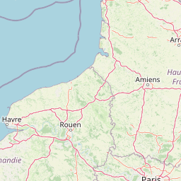
Map view of Réserve naturelle nationale de la baie de Canche

Use this park location map to pinpoint Réserve naturelle nationale de la baie de Canche in France, understand its exact geographic position, and read its mapped placement within the surrounding landscape more clearly.

Pigeon | © OpenStreetMap contributors

Location context for Réserve naturelle nationale de la baie de Canche

Pas-de-Calais
Recorded earthquake history

Review the Historical Earthquake Catalogue for this Protected Landscape

Consult the compiled history of seismic activity recorded in the surroundings of the Réserve naturelle nationale de la baie de Canche. Review event data including magnitudes and epicentre distances to understand regional historical patterns through the MoriAtlas structured geography archive.

Réserve naturelle nationale de la baie de Canche Earthquake History

Catalogued events

7 events

Strongest magnitude

Magnitude 4

Most recent event

Jan 27, 1998

This history includes earthquakes recorded inside the park or within 50 km of its borders

Visual exploration of rare plaqued dunes, tidal mudflats, and coastal habitats

Réserve naturelle nationale de la baie de Canche Landscapes and Scenery Photography

Visual documentation captures the dynamic estuarine terrain, shifting sand formations, and vital shorebird habitats of Réserve naturelle nationale de la baie de Canche. Detailed photography reveals the complex geomorphology and protected coastal environments spanning the Opal Coast.

A wide angle view of sandy dunes covered in marram grass leading down to a wide, flat beach and the ocean under a blue sky.

A wide, scenic view of a sandy estuary landscape with grassy sand dunes in the foreground and a calm tidal bay meeting distant hills under a clear blue sky.

A wide view of the Canche estuary at low tide, featuring sandy tidal flats and a winding river channel under a clear blue sky, with sand dunes and grasses in the foreground.

A wide, sandy estuary at low tide with people foraging for shellfish in the distance and a person harvesting in the foreground.

A calm, narrow river winds through a green, forested landscape under an overcast sky.

A common shelduck standing on a rocky bank next to water, with its distinctive dark green head, bright red bill, white body, and chestnut band across its chest.

A wide-angle landscape shot of a long, empty sandy beach bordering the sea under a clear blue sky, with grassy sand dunes on the right side.

A wide view of the Canche river estuary featuring sandy coastal dunes in the background and a large flock of seabirds resting along the shoreline.

A close-up shot of sea buckthorn branches covered with bright orange berries, growing on a sandy dune in the Canche Bay nature reserve.

A wide, high-angle view looking over a dense forest canopy in the foreground towards a broad, sunlit estuary and the distant coastline under a hazy sky.

A wide, eye-level view of vegetated sand dunes under a bright, overcast sky, with a sliver of distant water visible on the horizon.

Park atlas

Compare adjacent coastal ecosystems, estuarine reserves, and nearby protected landscapes.

Parks Near Réserve naturelle nationale de la baie de Canche and Regional Protected Areas

Browsing other protected areas near Réserve naturelle nationale de la baie de Canche reveals connected estuarine habitats, tidal mudflats, and chalk-cliff coastal landscapes. Evaluating surrounding regional parks provides broader geographic context for coastal conservation and dynamic marine environments.
A soft watercolor illustration showing a low-lying landscape with gentle rolling hills, grassy foreground vegetation, and light, hazy atmospheric tones.
Nature reserveHauts-de-France
8.2 km away#1 closest

North

Réserve naturelle régionale du marais de Condette: Wetland Geography and Protected Landscape

A vital ecological corridor within the Hauts-de-France region

Spanning 35 hectares, the Réserve naturelle régionale du marais de Condette protects a unique mosaic of marshland, peat-forming habitats, and forested massifs. This wetland reserve near the Opal Coast acts as an essential green infrastructure link, providing critical sanctuary for flora and fauna while maintaining hydrological balance in a heavily transformed northern French landscape.

Area
0.35 km²
Established
2009
IUCN
IV
Relief
Lowland
A watercolor painting of a rolling rural landscape with bare trees, grassy hills, and distant purple and red hills against a pale sky.
Nature reserveHauts-de-France
14 km away#2 closest

Northeast

Réserve naturelle régionale du Molinet: Protected Calcareous Woodlands and Grassland Mosaic

Geographic and Habitat Analysis of a Pas-de-Calais Nature Reserve

Located in the Boulonnais landscape of northern France, this protected area serves as a vital refuge for calcareous flora. The reserve preserves a rare mosaic of limestone woodlands and grasslands, serving a dual role in both ecological conservation and water catchment protection within the Hauts-de-France administrative region.

Area
0.067 km²
Established
1987
IUCN
IV
Relief
Lowland
A soft watercolor illustration showing a landscape with sparse trees, a sunlit clearing, and rolling hills in the background, set against a plain white background.
Nature reserveHauts-de-France
About 26 km away#3 closest

South

Réserve naturelle régionale du bois des Agneux: Protected Nature Reserve Landscape

Wetland habitat and acidiphile woodland in Hauts-de-France

Examine the geography of Réserve naturelle régionale du bois des Agneux, a nature reserve in the Somme department of Hauts-de-France. This protected area stands out for its mosaic of acidiphile oak woodland, seasonal pools, and sandy micro-relief, serving as a critical refuge for specialized flora and fauna on the Picardy coast.

Area
0.256 km²
Established
2015
IUCN
IV
Relief
Lowland
Nature reserveHauts-de-France
About 27 km away#4 closest

North

Réserve naturelle régionale du pré communal d'Ambleteuse: Regional Nature Reserve Geography

Coastal dune relics and protected marshland in Hauts-de-France.

This protected area provides an essential look at the coastal geography of the Opal Coast. Featuring a complex mosaic of ancient dune turf, dry heath, and wet meadows, the reserve stands as a landmark for biodiversity and traditional land management in northern France.

Area
0.605 km²
Established
1991
IUCN
IV
Relief
Lowland
Watercolor painting of a coastal salt marsh with winding tidal channels, grassy banks, and soft green and purple tones.
Nature reserveSomme
About 32 km away#5 closest

South

Reserve naturelle nationale de la baie de Somme: Estuarine Geography and Protected Boundaries

Coastal mapping of the Somme estuary in northern France

Covering a wide range of tidal environments, the Reserve naturelle nationale de la baie de Somme represents one of France's most significant protected estuarine systems. This overview focuses on the interplay of river and tide, showcasing the expansive mudflats, salt marshes, and dune habitats that support immense bird populations and harbor seals along the Picardy shoreline.

Area
34.209 km²
Established
1994
IUCN
IV
Relief
Lowland
Nature reserveHauts-de-France
About 34 km away#6 closest

North

Réserve naturelle régionale de la forteresse de Mimoyecques: Regional Nature Reserve Geography

Protected subterranean habitat and wartime heritage in Hauts-de-France.

Located in the rolling lowlands of the Pas-de-Calais, the Réserve naturelle régionale de la forteresse de Mimoyecques is a uniquely managed protected area. Its landscape integrates historical military architecture with modern biodiversity conservation, focusing on the protection of rare underground roosting environments for diverse bat species within the regional Hauts-de-France terrain.

Area
0.016 km²
Established
2012
Relief
Lowland
Climate
Temperate
A horizontal watercolor painting showing a soft landscape with green vegetation, pink accents, and a winding body of water leading towards distant hills.
Nature reserveFrance
About 35 km away#7 closest

North

Réserve naturelle régionale du mont de Couple: Protected Chalk Escarpment and Coastal Viewpoint

A limestone ridge sanctuary in the northern French Boulonnais region

Spanning a rare chalk cuesta in northern France, this protected area balances ecological conservation with distinct geological features. The reserve provides critical habitat for orchids and protected flora while serving as a strategic viewpoint across the Straits of Dover and the surrounding Opal Coast terrain.

Area
0.136 km²
Established
1997
Relief
Upland
Climate
Temperate
Nature reservePas-de-Calais
About 37 km away#8 closest

Southeast

Réserve naturelle régionale du marais de la Grenouillère: Wetland Geography and Map

Protected alluvial floodplain in the Pas-de-Calais region

This regional nature reserve encompasses sixteen hectares of high-density wetland habitats along the Ternoise river. Its flat topography sustains a delicate mosaic of alkaline marshes, wet meadows, and riparian alder woodlands that serve as a critical ecological buffer within the broader landscape of northern France.

Area
0.166 km²
Established
2000
IUCN
IV
Relief
Lowland

Common questions about visiting, size, designation, and location context for Réserve naturelle nationale de la baie de Canche

Réserve naturelle nationale de la baie de Canche FAQs for park facts, access, geography, and protected area context

Find quick answers about Réserve naturelle nationale de la baie de Canche, including protected-area facts, park geography, trail and visitor context, and how the park fits into its surrounding country and regional landscape.
MoriAtlas Explorer

Continue Your Protected Areas Search Across the Global Atlas

Deepen your exploration by continuing the structured search for national parks and protected areas worldwide. Utilize the comprehensive filtering capabilities to compare different conservation landscapes and refine your understanding of global park geography. Discover more about the distribution and characteristics of protected natural areas.

Global natural geography