Mori Atlas logo
Nearby park discovery

Geographic discovery of the surrounding protected landscape and regional park network

Protected Areas and Natural Landscapes Near Réserve naturelle régionale du Crêt des Roches

Examine the distribution of protected areas and natural sites located within the regional context of the Réserve naturelle régionale du Crêt des Roches. This overview tracks nearby natural reserves and protected lands across the Bourgogne-Franche-Comté landscape to provide a clearer understanding of the area's geographic connectivity and protected-site concentration.

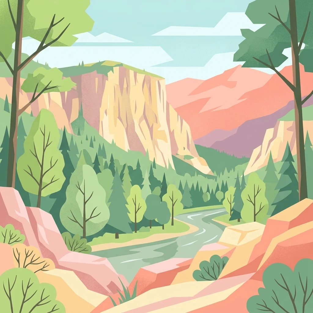
A stylized vector illustration of a river flowing through a deep valley between vertical limestone cliffs, surrounded by coniferous and deciduous trees.

A limestone corniche reserve overlooking the Doubs valley, protecting relic steppe flora and a major raptor migration corridor.

Réserve naturelle régionale du Crêt des Roches

The Réserve naturelle régionale du Crêt des Roches is a small but ecologically rich regional nature reserve in the Bourgogne-Franche-Comté region of eastern France. Set in the Doubs department, southeast of the town of Pont-de-Roide-Vermondans, it protects a Jurassic limestone corniche belonging to the Lomont range that rises roughly one hundred meters above the Doubs valley. The reserve is notable for combining two distinct kinds of natural heritage in a compact area of about 43 hectares. On the geological and botanical side, it shelters relict dry-grassland and thermophilic plant species that sit at the edge of their natural range, including extremely localized populations found nowhere else in the Franche-Comté region. On the ornithological side, the exposed corniche acts as a natural leading line for migrating birds and is recognized as one of the most important autumn raptor and passerine observation sites in the region. Equally important is the site's long history of botanical study and its educational role today. Known to scientists since the nineteenth century, the corniche remains an open-air reference site for Mediterranean-margin flora in the Jura and offers visitors panoramic viewpoints, an orientation table, interpretation panels, and a marked trail that ties together geology, biodiversity, and landscape heritage.

Location
France
Park type
Nature reserve
Established
2009
Area
0.4 km²
Highest point
787 m
Explore Réserve naturelle régionale du Crêt des Roches
Regional park map

See the ranked park cluster in its geographic setting

Nearby parks around Réserve naturelle régionale du Crêt des Roches

This regional map shows the same 20 nearby parks ranked below around Réserve naturelle régionale du Crêt des Roches. Select a ranked marker to highlight that park’s boundary where boundary data is available.
Reference park: Réserve naturelle régionale du Crêt des RochesRanked nearby park20 nearby parks shown
20 nearby parks

Distance ranked regional park geography and surrounding protected landscapes

Parks and Protected Areas Geographically Near Réserve Naturelle Régionale du Crêt des Roches

Examine the geographic separation and directional spread of protected areas surrounding Réserve naturelle régionale du Crêt des Roches through direct spatial ranking. Analyze recorded environmental characteristics and country context to compare surrounding natural terrain patterns across the region.
A wide watercolor painting depicting a calm river or lake flanked by green and purple vegetation, with distant mountains under a soft pink and yellow sky.
Nature reserveDoubs
About 18 km away#1 closest

North

Réserve naturelle régionale de la basse vallée de la Savoureuse: Regional Nature Reserve

Protected alluvial floodplain geography in Doubs, France.

This nature reserve safeguards a significant fragment of the Savoureuse river floodplain. The protected area offers a complete alluvial sequence within 42 hectares, including active gravel bars and mature ash-alder woodlands, providing a high-density ecological core amidst an industrial landscape in the Doubs department.

Area
0.419 km²
Established
2008
IUCN
IV
Relief
Lowland
Watercolor painting of a green forested landscape with rolling hills under a soft pink and yellow sunrise sky.
Nature reserveJura
About 25 km away#2 closest

Southeast

Franches-Montagnes Nature Reserve: A Detailed Atlas of Jura Plateau and Peat Bog Geography

Protected karst limestone landscapes and highland pasture geography.

The Franches-Montagnes nature reserve spans a unique high plateau in the Swiss Jura, characterized by its complex karst substrate and iconic raised bog systems like the Etang de la Gruère. This protected area supports a mosaic of traditional wooded pastures and wetlands, serving as a primary site for understanding the intersection of human pastoral heritage and sensitive highland ecology.

Area
39.57 km²
Established
1977
Relief
Upland
Climate
Temperate
Nature reserveBourgogne-Franche-Comté
About 32 km away#3 closest

West

Réserve naturelle régionale des Grottes du Cirque: Regional Nature Reserve and Karst Network

Protected limestone valley and bat hibernation site in Bourgogne-Franche-Comté

Located in the pre-Jura hills, this regional nature reserve features a compact reculée landscape defined by six limestone caves. These protected underground habitats serve as vital wintering grounds for various bat species and contain significant prehistoric fossil remains, marking the site as a key area for both geological and ecological study in eastern France.

Area
0.153 km²
Established
2015
IUCN
IV
Relief
Upland
A pale, abstract watercolor painting showing rolling green hills and distant mountain ridgelines on a white background.
Nature reserveCanton of Bern
About 32 km away#4 closest

Southeast

Combe Grède Nature Reserve: Geological Gorge and Protected Mountain Landscape in Bern

Folded Jura limestone terrain and biodiversity hotspots.

The Combe Grède nature reserve presents a striking half-cluse gorge carved into Cretaceous limestone. This protected area within the Canton of Bern showcases an instructive geological sequence, ancient pine stands, and diverse mountain habitats that span from shaded cliffs to alpine pastures.

Area
12 km²
Established
1932
Relief
Mountain
Climate
Temperate
A horizontal watercolor illustration depicting rolling green hills, a winding lake shore, and distant mountains in a soft, muted palette.
Protected landscapeCanton of Bern
About 42 km away#5 closest

Southeast

Linkes Bielerseeufer Protected Landscape: Map and Regional Geography in Canton of Bern

Protected Jura lakeshore and vineyard terrain

Investigate the precise boundaries and varied micro-landscape of Linkes Bielerseeufer. This protected area showcases a dramatic rise from Lake Biel into the Jura range, encompassing karst topography, historic dry-stone terraces, and diverse forest ecosystems within the Canton of Bern.

Area
7.079 km²
Relief
Mountain
Climate
Temperate
Access
Easy access
A wide watercolor painting showing a body of water in the foreground, green trees along the banks, and rolling hills and mountains in soft pink, yellow, and green hues in the background.
Nature reserveFrance
About 45 km away#6 closest

Northwest

Réserve naturelle régionale de la tourbière de la Grande Pile: Regional Nature Reserve

Protected peatland ecosystems and climate archive in eastern France

This regional nature reserve provides a compact study of peatland development and palaeo-environmental history. It preserves diverse wetland habitats at the edge of the Vosges saônoises, offering a rich environment for rare flora and dragonfly species within the wider Région des Mille étangs.

Area
0.593 km²
Established
2016
Relief
Lowland
Climate
Temperate
A pale, minimalist watercolor painting depicting rolling hills and mountains in shades of soft green, purple, and yellow against a white background.
Natural monumentNeuchâtel
About 47 km away#7 closest

South

Creux du Van et Gorges de l’Areuse Natural Monument and Regional Protected Landscape

Geological exploration of the Folded Jura and Areuse river valley

Spanning the Cantons of Neuchâtel and Vaud, this protected area unites the dramatic rock bowl of the Creux du Van with the narrow, cascading passages of the Gorges de l’Areuse. The site provides a comprehensive view of Jura mountain landforms, highlighting millions of years of river erosion, glacial activity, and karst weathering in a singular, well-defined geographic corridor.

Area
21.21 km²
Established
1876
Relief
Mountain
Climate
Temperate
Nature reserveGrand Est
About 49 km away#8 closest

Northeast

Réserve naturelle régionale Im'Berg: Mapping a Unique Protected Nature Reserve in France

A rare calcareous grassland habitat in the Grand Est region.

Réserve naturelle régionale Im'Berg preserves a sun-drenched limestone slope in the commune of Tagolsheim. Known as the Buxberg, this protected area guards one of the most significant natural boxwood populations in Europe alongside specialized dry-habitat flora. The reserve functions as an essential geographic reference for studying how steep, calcareous terrain creates isolated, warm microclimates within the broader Alsatian landscape.

Area
0.017 km²
Established
2013
IUCN
IV
A soft watercolor painting of a rolling landscape with green hills, light blue distant mountains, and patches of pink and yellow vegetation.
Nature reserveGrand Est
About 53 km away#9 closest

North

Réserve naturelle régionale de la forêt des volcans de Wegscheid: Geological Protected Area

Mapping volcanic terrain in the Grand Est region of eastern France.

Located in the Haut-Rhin, this regional nature reserve preserves a distinct volcanic landscape characterized by rocky promontories, basalt columns, and mature forest stands. The protected terrain features varied elevation from 700 meters to the Rossberg ridge, showcasing geological formations that have remained largely untouched by intensive historical forestry.

Area
1.015 km²
Established
2008
IUCN
IV
Relief
Mountain
A watercolor illustration of a river landscape with a gentle bend, shoreline greenery, and distant low hills, rendered with soft, faded edges.
Protected landscapeCanton of Bern
About 54 km away#10 closest

Southeast

Stausee Niederried Protected Landscape: A Geographic Map and Atlas of Swiss Floodplains

Mapped alluvial terrain and sandstone cliffs in the Canton of Bern.

Stausee Niederried functions as a vital protected landscape, blending a historic hydroelectric reservoir with a four-kilometer riverine floodplain. The area is characterized by high geomorphic contrast, ranging from the vast Runtigenfluh molasse cliff to critical riparian marshes and orchid-rich pine forests. This entry provides a structured look at the park boundaries, geological features, and the wider fluvial mosaic found near the confluence of the Aare and the Saane.

Area
2.97 km²
Established
1991
IUCN
V
Relief
Mixed relief
A soft watercolor painting depicting a calm river winding through a green, hazy floodplain environment.
Nature reserveSolothurn
About 54 km away#11 closest

Southeast

Naturschutzgebiet Aare bei Altreu: Protecting Aare Valley Floodplains and Alluvial Forest

Riverine meander habitat in the Solothurn canton landscape.

Naturschutzgebiet Aare bei Altreu serves as a vital refuge for floodplain flora and fauna, standing out for its intact meander loops and silver willow gallery forests. Located in the Solothurn region, this protected area preserves a rare stretch of the Aare river ecosystem that contrasts sharply with adjacent canalized banks. Studying its terrain reveals the importance of alluvial corridors in maintaining wetland connectivity within the Swiss Mittelland.

Area
0.205 km²
Established
1992
IUCN
IV
Relief
Lowland
A horizontal watercolor painting showing a soft, impressionistic landscape with layers of green hills and trees against a pale, light background.
Nature reserveBourgogne-Franche-Comté
About 55 km away#12 closest

Northwest

Réserve naturelle nationale du Sabot de Frotey: Geographic and Protected Area Overview

Limestone plateau and calcareous grasslands in Haute-Saône

Located near Vesoul, the Réserve naturelle nationale du Sabot de Frotey features a prominent southwest-facing cliff and a rich expanse of dry grassland. This nature reserve provides critical habitat for orchids and diverse butterfly assemblages within a landscape defined by erosion-shaped monoliths and Mediterranean-edge flora.

Area
0.98 km²
Established
1981
IUCN
IV
Relief
Upland
Nature reserveBourgogne-Franche-Comté
About 55 km away#13 closest

Northwest

Réserve naturelle régionale de la grotte de la Baume: Regional Nature Reserve Atlas

Mapping karst cave systems and bat habitats in Haute-Saône

The Réserve naturelle régionale de la grotte de la Baume protects a limestone cave system on the edge of the plateau near Échenoz-la-Méline. Its small but intensive protected perimeter serves as a vital hibernation site and autumn transit corridor, forming part of a broader ecological network across the Franche-Comté landscape.

Area
0.175 km²
Established
2015
IUCN
IV
Relief
Upland
A panoramic watercolor painting depicting a calm wetland or marsh with pink and yellow reeds in the foreground, green trees in the midground, and soft purple mountains in the background.
Nature reserveHaut-Rhin
About 57 km away#14 closest

Northeast

Réserve naturelle régionale des marais et landes du Rothmoos Protected Landscape and Geography

Regional nature reserve in the Haut-Rhin department of Alsace

The Réserve naturelle régionale des marais et landes du Rothmoos encompasses a rare inland saline habitat complex within the Nonnenbruch forest. Its terrain is defined by stable pools created from mining subsidence, transitioning into heathland and oak forests. This protected area stands as an ecological refuge for migratory waterbirds and specialized aquatic species within an industrial-legacy environment.

Area
1.457 km²
Established
1988
IUCN
IV
Relief
Lowland
Wildlife reserveBourgogne-Franche-Comté
About 58 km away#15 closest

Southwest

Tourbières et lacs de la montagne jurassienne: Mapping High-Altitude Wetlands and Glacial Landscapes

A vast protected wildlife reserve in the Bourgogne-Franche-Comté region

Covering more than 12,000 hectares, this wildlife reserve forms a crucial conservation benchmark for peatland and glacial lake systems in the Jura Massif. The landscape encompasses deep combes, broad plateaus, and clear-water basins like Lac de Saint-Point, providing a vital habitat mosaic for diverse flora and fauna across the French highlands.

Area
121.56 km²
Established
2021
Relief
Mountain
Climate
Temperate
A horizontal watercolor painting depicting a soft-edged, green-and-white landscape of rolling hills and distant limestone ridgelines.
Nature reserveBourgogne-Franche-Comté
About 61 km away#16 closest

Southwest

Réserve naturelle nationale du ravin de Valbois: Protected Jura Blind Valley and Limestone Ravines

Geographic landscape exploration of the Doubs department's protected natural reserve.

Spanning 235 hectares, this protected nature reserve in Bourgogne-Franche-Comté preserves a textbook Jura reculée. The terrain showcases vertical limestone cliffs, deep forested ravines, and a 40-meter cascade. As a hotspot for butterfly diversity and Mediterranean-montane vegetation, the area offers a significant study in microclimatic gradients and old-growth forest conservation within the French landscape.

Area
2.35 km²
Established
1983
IUCN
IV
Relief
Mountain
A horizontal watercolor illustration showing a winding river through a flat, green landscape with distant hills under a soft pink and yellow sky.
Nature reserveHaut-Rhin
About 64 km away#17 closest

Northeast

Réserve naturelle nationale de la Petite Camargue alsacienne: Protected Rhine Floodplain Geography

A unique wetland and alluvial forest habitat in Haut-Rhin

Investigate the geographic significance of the Réserve naturelle nationale de la Petite Camargue alsacienne. This site acts as a protected reference for Upper Rhine floodplain ecology, showcasing a rare intersection of relict river meanders, marshy depressions, and diverse vegetation types near the French, Swiss, and German borders.

Area
9.04 km²
Established
1982
IUCN
IV
Relief
Lowland
Nature reserveBourgogne-Franche-Comté
About 64 km away#18 closest

West

Réserve naturelle régionale de la grotte de la Baume noire Protected Area Map and Geography

Regional karst landscape in Bourgogne-Franche-Comté

This 19-hectare reserve in the Monts de Gy is defined by its Jurassic limestone geology and protected cave systems. The site remains a primary focal point for monitoring subterranean bat habitats and maintaining the ecological integrity of the surrounding deciduous forest landscape.

Area
0.191 km²
Established
2015
IUCN
IV
Relief
Upland
A watercolor painting showing a soft, panoramic landscape of a peat bog or wetland with light green vegetation, scattered trees, and distant rolling hills on a white background.
Nature reserveGrand Est
About 65 km away#19 closest

North

Réserve naturelle régionale de la tourbière des Charmes: Protected Mountain Peatland Geography

High Vosges mountain wetland and subalpine forest landscape

Located on the granite ridges of the Vosges mountains in the Grand Est region, this nature reserve preserves a vast, perched mountain peatland. Its distinct geographic character includes deep peat deposits and a habitat gradient transitioning from acidic wetland to mature fir and spruce forest, serving as a critical study area for specialized flora and cold-adapted wildlife.

Area
0.68 km²
Established
2008
IUCN
IV
Relief
Mountain
Watercolor painting of a hilly landscape featuring green rolling hills, a rocky cliff formation to the right, and trees against a soft white background.
Nature reserveBourgogne-Franche-Comté
About 67 km away#20 closest

Southwest

Réserve naturelle régionale des grottes de Chenecey: Protected Karst and Limestone Cliffs

Regional Nature Reserve in the Doubs, France

This nature reserve protects a diverse mosaic of habitats along the Loue valley. The site integrates surface calcareous grasslands with fragile underground cave galleries, providing critical refuge for rare bat species. It represents a significant conservation effort in the Jura region, mapping the intersection of subterranean voids and exposed limestone terrain.

Area
0.214 km²
Established
2017
IUCN
IV
Relief
Upland
Distance methodology

Geographic measurements, not driving distances

How nearby park distances are calculated

Distances use park boundaries whenever the available geometry allows it. When one or both boundaries are missing, the mapped park locations provide a clearly labelled estimate. Every value represents straight-line geographic separation and does not use roads or routing.

Boundary distance

Calculated between the nearest points of both park boundaries.

Location-to-boundary estimate

Estimated from one mapped park location to the nearest boundary of the other park.

Mapped-location estimate

Estimated between the mapped locations of both parks.

MoriAtlas Explorer

Examine the Geography of Réserve naturelle régionale du Crêt des Roches

Use MoriAtlas to study the precise boundaries and vertical terrain of this unique nature reserve. Gain a deeper understanding of how the Lomont range limestone formations influence regional biodiversity and migration patterns in the Doubs department.