
Named stones
Park geography
Detailed metrics for terrain, elevation, and protected natural landscape features
Comprehensive Geographic Profile and Mapped Boundaries of Réunion National Park
Examine the physical geography and spatial dimensions of Réunion National Park. This profile covers the recorded 1,053.84 square kilometer boundary, high-elevation mountain terrain reaching 3,071 meters, and the distribution of internal rivers, streams, and forest habitats across the protected area.
Volcanic peaks, ancient cirques, and endemic biodiversity on a French Indian Ocean island
Réunion National Park
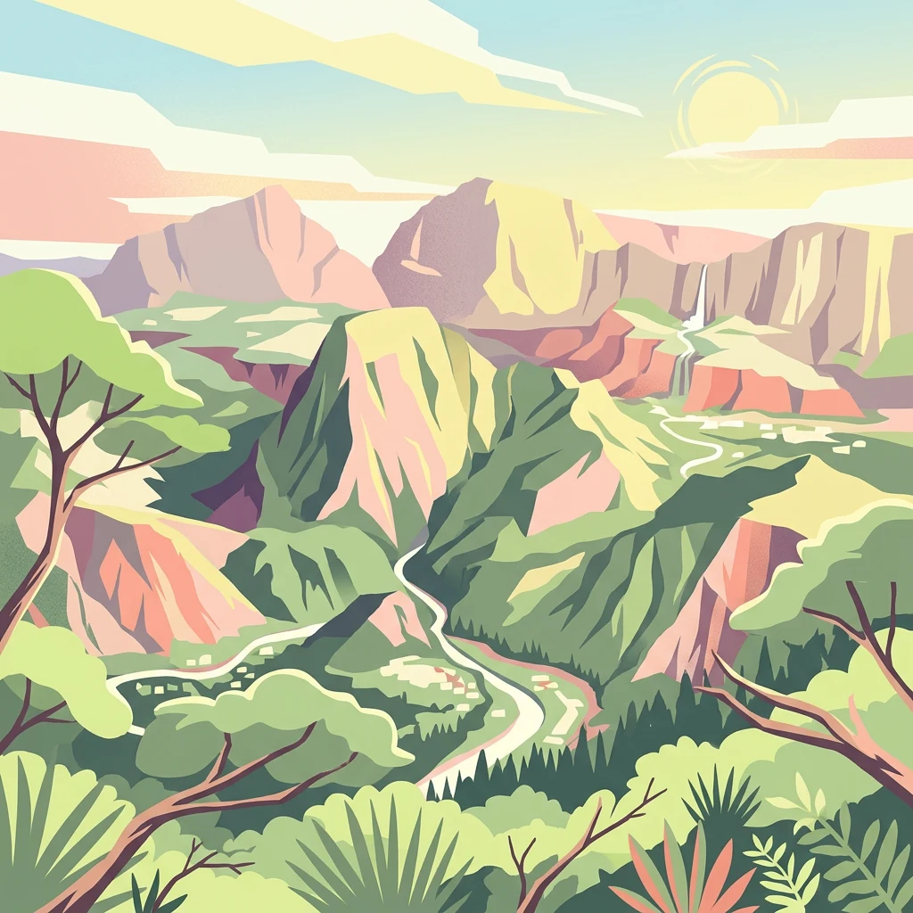
Réunion National Park is a French national park established in 2007 on the island of Réunion, an overseas department of France located in the western Indian Ocean. The park protects the mountainous interior of the island known as Les Hauts, covering approximately 42% of the island's surface area. This volcanic landscape features dramatic cirques, steep remparts, and two major shield volcanoes—Piton des Neiges, the Indian Ocean's highest point at 3,071 meters, and the still-active Piton de la Fournaise. The park's extraordinary geological heritage and exceptional biodiversity led to its designation as a UNESCO World Heritage Site in 2010 under the name "Pitons, cirques and remparts of Réunion Island." The park preserves highly endemic ecosystems with species found nowhere else on Earth, making it one of the most significant conservation areas in the Mascarene Islands region.
- Location
- France
- Park type
- National park
- Established
- 2007
- Area
- 1,053.8 km²
- Highest point
- 3,071 m
Location overview
Exploring the French jurisdiction and island park status
Geographic Profile of Réunion National Park in France
Réunion National Park is managed as a protected island park under the sovereign jurisdiction of France. Verified records confirm its isolated island status and sovereign administrative relationships.
- Countries
- France
- Primary location
- France
- Geographic setting
- Inland · Island
Boundary and coordinates
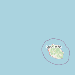
Réunion’s outline maps 1,053.84 km² of recorded land
Réunion National Park mapped boundary and 1,053.84 km² land area
Réunion National Park’s mapped footprint spans 1,053.84 km², equal to its recorded land area. The geometry supplies strong atlas context for the park without defining exact legal limits.
- Boundary area
- 1,055.2 km²
- Boundary perimeter
- 748.9 km
- Northernmost point
- 20.893° S
- Southernmost point
- 21.3586° S
- Easternmost point
- 55.8143° E
- Westernmost point
- 55.3431° E
- Geographic centre
- 21.137° S, 55.5753° E
- North–south span
- 51.5 km
- East–west span
- 49 km
Elevation and terrain
Mountain relief metrics and recorded natural water features
Réunion National Park Terrain and Elevation Range Geography
Recorded elevation metrics establish a peak altitude of 3071 meters across the mountain terrain of Réunion National Park. Mapped feature cards detail streams, rivers, and viewpoints located within the protected boundary.
- Maximum elevation
- 3,071 m
- Highest point
- 3,071 m
Selected named natural features
Streams
Bras Scierie
Streams
Ravine La Pompe
Viewpoints
La Vallée de la Rivière des Remparts
Streams
Bras Montplaisir
Streams
Bras de Sainte-Suzanne
Environmental setting
Interpreting tropical relief, volcanic terrain, and forest cover
Réunion National Park Environmental Classifications and Physical Setting
Recorded landscape features, tropical climate zones, and forest classifications combine to frame the physical setting. Structured categories connect directly to related protected areas and mapped terrain within the atlas.
- Relief
- Mountain
- Climate
- Tropical
- Water
- Major water bodies
- Forest cover
- Mostly forested
- Seasonality
- Year-round
Landscape features
Mountains · Valleys · Forest · Rivers · Waterfalls · Cliffs · Volcano
Habitat types
Tropical forest · Montane forest · Riverine habitat · Wetland
Park atlas
Trace the regional protected areas, comparing volcanic island ecosystems and unique conservation landscapes.
Explore Other National Parks and Protected Areas Near Réunion National Park
After exploring Réunion National Park, browse a curated selection of other national parks and protected areas within the surrounding Indian Ocean region. Compare these diverse conservation landscapes to understand their shared volcanic geology, unique island biodiversity, and distinct approaches to ecological preservation.
National parkMauritius
179 km away#1 closest
East

Black River Gorges National Park: Key Protected Landscape and National Park in Mauritius
Explore mapped boundaries and endemic wildlife conservation in the southwest highlands.
Black River Gorges National Park is the largest protected area on Mauritius, critically preserving native rainforest and unique endemic species. This national park encompasses approximately 67.54 square kilometers, showcasing varied ecosystems from humid upland forests to marshy heathlands within its rugged highland terrain. The park's geography, characterized by deep gorges and steep slopes, provides essential habitats and plays a crucial role in the island's conservation efforts, making it a significant site for understanding Mauritius's natural heritage.
- Area
- 67.54 km²
- Established
- 1994
- Relief
- Upland
- Climate
- Tropical
Nature reserveChamarel
About 182 km away#2 closest
East
Ebony Forest Nature Reserve: A Detailed Atlas of Chamarel's Restored Protected Landscapes
Indigenous forest restoration in southwest Mauritius
Ebony Forest stands as a primary nature reserve in the Chamarel hills of Mauritius, where extensive restoration efforts have reclaimed native semi-dry forest and upland ecosystems. This site offers an essential look at the island's endemic biodiversity through its protected ebony stands and rehabilitated slopes, making it a key component of the broader southwestern Mauritian conservation network.
- Established
- 2017
- Relief
- Upland
- Climate
- Tropical
- Access
- Easy access
Nature reserveMauritius
About 201 km away#3 closest
Northeast
Monvert Nature Park: Exploring Protected Indigenous Landscapes in Mauritius
Regenerated highland forest and endemic flora reserve
Located in the central highlands of Mauritius near Curepipe, Monvert Nature Park protects a significant portion of recovering indigenous woodland. The park functions as a major botanical conservation site, featuring an arboretum with over 150 endemic species and a network of nature trails that traverse its unique highland terrain. This reserve offers a grounded look at the island's botanical diversity and ongoing forest restoration efforts.
- Relief
- Upland
- Climate
- Subtropical
- Access
- Easy access
- Scope
- Terrestrial
Nature reserveMoka District
About 210 km away#4 closest
Northeast
Le Pouce Nature Reserve: Volcanic Geography and Protected Upland Habitat in Mauritius
A rugged basalt peak in the Moka District mountain range.
Le Pouce Nature Reserve guards a critical 0.69 square kilometer patch of upland forest on the slopes of the third highest mountain in Mauritius. This protected area is recognized for its dramatic volcanic terrain and as the rare surviving home for the critically endangered Le Pouce Mountain Screwpine, providing an essential window into the island's unique ecological and geological history within the Moka Range.
- Area
- 0.69 km²
- Established
- 1951
- Relief
- Mountain
- Climate
- Tropical
Nature reserveGrand Port District
About 217 km away#5 closest
East
Vallée de Ferney Nature Reserve: Protected Mountain Landscapes in the Grand Port District
Indigenous rainforest, volcanic terrain, and conservation refuge
Located in the Bambou mountains of southeastern Mauritius, Vallée de Ferney is a 200-hectare nature reserve known for its protected indigenous rainforest and ongoing rewilding projects. As a key conservation site in the Grand Port District, the reserve offers a look at rare endemic species and the unique moisture-loving vegetation of the island's eastern volcanic series. Explore the mapped boundaries and natural terrain of this significant protected landscape.
- Area
- 2 km²
- Established
- 2006
- Relief
- Mountain
- Climate
- Tropical
Nature reserveMauritius
About 217 km away#6 closest
East
Ile aux Aigrettes: Exploring the Protected Coral Coastal Landscape of Mauritius
A critical nature reserve and rewilding site in the Grand Port bay
Ile aux Aigrettes represents a unique geographic outpost off the south-east coast of Mauritius, defined by its flat coral limestone terrain. As a protected nature reserve, it offers insights into the recovery of rare dry coastal forest ecosystems and the ongoing scientific efforts to maintain endemic biodiversity on a small maritime scale.
- Area
- 0.27 km²
- Established
- 1965
- Relief
- Lowland
- Access
- Easy access
National parkMauritius
About 223 km away#7 closest
East
Île aux Fouquets National Park: Coral Islet Geography and Lighthouse Heritage in Mauritius
Protected maritime landscape and offshore reef terrain
This compact coral island represents a critical piece of the national park system in Mauritius. Known for its distinct limestone geology and nineteenth-century lighthouse ruins, it provides a unique window into the maritime history and offshore reef ecosystems of the Indian Ocean, contrasting with the volcanic landforms of the mainland.
- Area
- 0.025 km²
- Established
- 2004
- Relief
- Lowland
- Access
- Remote access
National parkMauritius
About 230 km away#8 closest
Northeast
Bras d'Eau National Park: Mauritius National Park Protected Landscape Discovery
Explore coastal terrain, endemic species habitats, and wetland geography.
Bras d'Eau National Park, situated on Mauritius, offers an in-depth look at a protected coastal lowland landscape vital for conservation. This national park showcases remnant forest patches critical for endemic flora and fauna, complemented by a unique system of four mares, including the mangrove-rich Mare sarcelle. Its mapped geography provides context for island ecosystems and serves as a key location for understanding Mauritius's protected natural areas.
- Area
- 4.97 km²
- Established
- 2011
- Relief
- Lowland
- Climate
- Tropical
MoriAtlas Explorer
Continue Exploring Réunion National Park's Volcanic Terrain and Protected Geography
Deepen your understanding of Réunion National Park by examining its specific mapped boundaries and the unique regional geography it occupies within the Mascarene Islands. This atlas entry provides a factual foundation for appreciating the park's volcanic landscape, endemic ecosystems, and its significant role as a protected natural area. Continue to discover the intricate details of its terrain and its place within broader conservation geography.
Browse next
Global natural geography
Explore related park routes
Explore MoriAtlas Global ParksBrowse All MoriAtlas ParksGlobal Park Map DiscoveryMoriAtlas: Browse All CountriesBrowse All MoriAtlas ContinentsNational Park Environment AtlasGrand Canyon National Park AtlasYellowstone National Park AtlasYosemite National Park Atlas and GeographySerengeti National Park AtlasGalápagos National Park Protected LandscapeBanff National Park Geography and AtlasKruger National Park Atlas EntryUluṟu-Kata Tjuṯa National Park AtlasExplore Uluru-Kata Tjuta National Park GeographyPlitvice Lakes National Park AtlasFiordland National Park Protected LandscapeGreat Smoky Mountains National Park AtlasAfghanistan National Parks and Protected AreasAlbania National Parks and Protected AreasAlgeria National Parks and Protected AreasAmerican Samoa National Parks and Protected AreasAndorra National Parks and Protected AreasAngola National Parks and Protected AreasAntarctica National Parks and Protected AreasAntigua and Barbuda Park List