Mori Atlas logo
National parkRéunion National Park

Discover the mapped terrain and protected area geography of this UNESCO World Heritage volcanic island.

Réunion National Park: French National Park Protecting Volcanic Cirques and Endemic Landscapes

(Parc national de La Réunion)

Réunion National Park represents a significant protected landscape within the western Indian Ocean, safeguarding a vast 42% of the island's mountainous interior. This French national park showcases an extraordinary volcanic geography defined by three dramatic cirques—Mafate, Salazie, and Cilaos—and two major shield volcanoes, including the active Piton de la Fournaise. Its unique geological heritage and exceptionally endemic ecosystems, found nowhere else on Earth, underscore its importance as a conservation area and UNESCO World Heritage site. Explore the park's mapped boundaries and distinct natural terrain.

Volcanic landscapeEndemic speciesUNESCO World HeritageNational parkIsland conservationTropical forest
Stylized illustration of a mountainous landscape with green valleys, a winding river, and colorful rock formations under a partly cloudy sky

Réunion National Park

National park

Park overview

Structured park overview, official facts, and landscape profile for Réunion National Park

Réunion National Park park facts, protected area profile, and essential visitor context
Review the core facts for Réunion National Park, including designation, size, terrain, visitor scale, habitats, and operating context in one park-focused overview.

About Réunion National Park

Réunion National Park was established on March 5, 2007, becoming France's newest national park at the time. It protects the heart of Réunion Island, a volcanic island in the Indian Ocean that rises dramatically from sea level to over 3,000 meters in elevation. The park's creation followed decades of planning beginning in 1985, with the concept formally endorsed by the Réunion Environmental Charter and Regional Development Plan. The park's mission extends beyond biodiversity conservation to include preserving the cultural heritage of Les Hauts—the traditional highland communities—and fostering sustainable economic development for the region. The park is governed by Parcs nationaux de France and operates under a charter that outlines four major objectives: preserving landscape diversity, reversing biodiversity loss, safeguarding highland culture, and supporting economic development. The park's visitor center, Maison du parc, opened in La Plaine-des-Palmistes in 2014 and provides educational exhibits about the island's natural and cultural heritage.

Quick facts and research context for Réunion National Park

Réunion National Park spans 1,053.84 km² of core protected area plus a 876.96 km² buffer zone across 23 of the island's 24 communes. The park encompasses three major cirques—Mafate, Salazie, and Cilaos—each formed by volcanic collapse and surrounded by dramatic cliff walls. The volcanic origin of the island, sitting over the Réunion hotspot, has created diverse habitats ranging from tropical forests at lower elevations to alpine zones near the summit. The park contains 110 distinct habitat types and harbors 94% of the island's biodiversity. With 230 endemic plant species and numerous endemic bird species, the park represents a critical refuge for species found nowhere else on the planet.

Park context

Deeper park guide and search-rich context for Réunion National Park

Réunion National Park history, landscape, wildlife, and travel context
Explore Réunion National Park through its history, landscape character, ecosystems, wildlife, conservation priorities, cultural context, and seasonal travel timing in a structured park guide built for atlas discovery and search intent.

Why Réunion National Park stands out

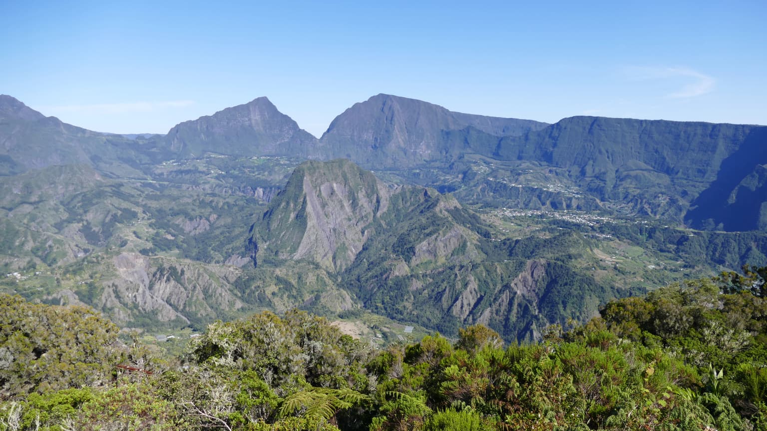
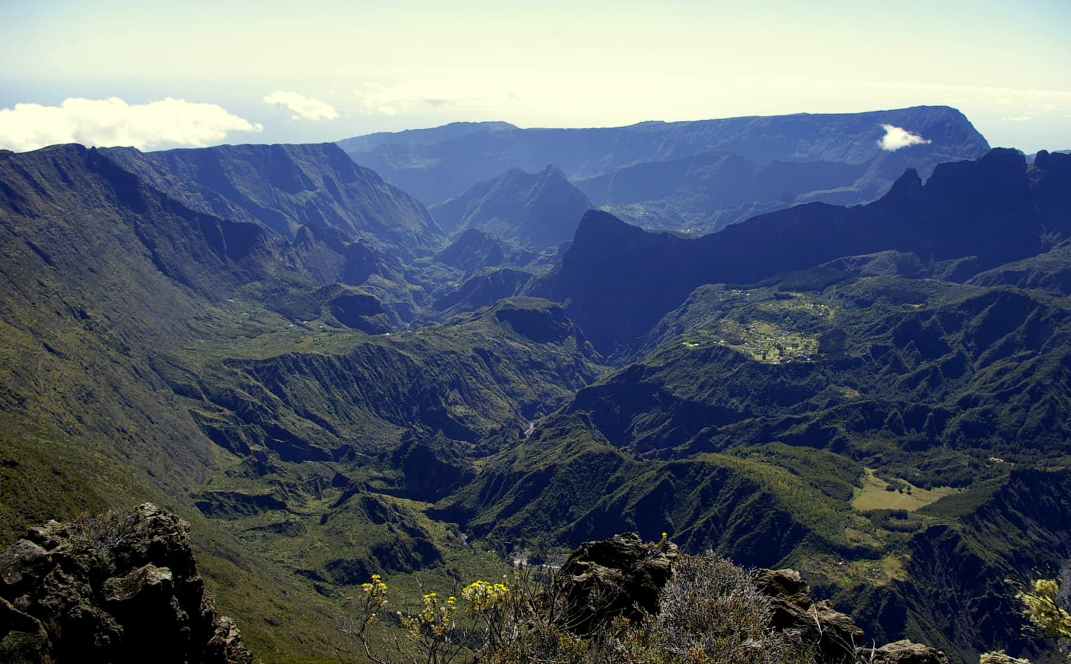
Réunion National Park is best known for its dramatic volcanic landscape featuring the three spectacular cirques of Mafate, Salazie, and Cilaos, massive caldera-like depressions surrounded by towering remparts. The park protects Piton de la Fournaise, one of the world's most active and accessible volcanoes, which draws over 400,000 visitors annually. The island's exceptional endemism distinguishes this park, with species like the Réunion cuckooshrike, Réunion Island day gecko, and numerous endemic palms and other flora found only here. The contrast between the stark lunar landscapes of the volcanic highlands and the lush tropical forests in the lower elevations creates a unique ecological mosaic.

Mountainous landscape with deep valleys and lush green vegetation under a clear blue sky
Panoramic view of Cirque de Salazie from Belouve refuge

Réunion National Park history and protected-area timeline

The establishment of Réunion National Park traces back to 1985 when proposals for protecting the island's mountainous interior first emerged. The Réunion Environmental Charter and Regional Development Plan formalized the principle of creating a park in Les Hauts during the mid-1990s. Between 2000 and 2003, an intensive consultation process involved the French state, regional authorities, and local municipalities. Following a positive public survey in 2004 where all 24 communes approved the project, the French Prime Minister signed a decree in March 2003 acknowledging the park project. After years of negotiations on boundaries and objectives, the park officially came into existence on March 5, 2007, through a decree approved by the Council of State. The Administration Council took office in April 2007, and the park's charter was developed between 2007 and 2009. On August 1, 2010, UNESCO inscribed the "Pitons, cirques and remparts of Réunion Island" on the World Heritage List, recognizing the site's outstanding universal value. The park's creation replaced two earlier nature reserves—the Mare-Longue Nature Reserve established in 1981 and the Roche Écrite Nature Reserve created in the 1990s.

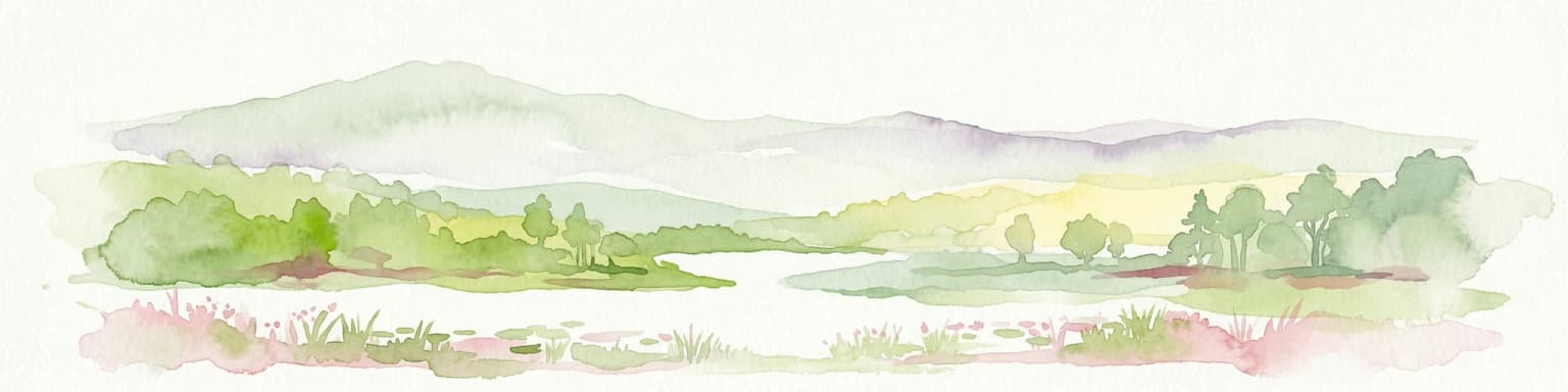
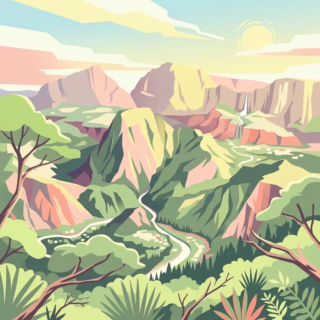
Réunion National Park landscape and geographic character

The landscape of Réunion National Park is defined by its volcanic origins and dramatic topography. The island rises from the Indian Ocean as a massive shield volcano, with two primary volcanic massifs forming its backbone. Piton des Neiges, an extinct volcano that has not erupted for approximately 12,000 years, dominates the island's center and reaches 3,071 meters—the highest point in the Indian Ocean. Despite its name, permanent snow is rare at the summit due to the island's tropical latitude. Piton de la Fournaise remains actively erupting and is among the world's most monitored volcanoes. The park's most spectacular features are the three cirques—Mafate, Salazie, and Cilaos—massive amphitheater-like depressions formed by volcanic collapse and subsequent erosion. These cirques feature towering cliff walls called remparts, with the Bras Rouge River cutting through Cilaos creating narrow gorges. The landscape also includes the Plaine des Sables, a lunar-like volcanic plain, and the Enclos, the active volcano's unique caldera. The western slopes feature remnants of semi-evergreen forest, while the eastern slopes receive year-round rainfall supporting different vegetation patterns.

Close-up of a bright green panther chameleon with a distinctive red eye pattern, standing on a surface with blurred green foliage background
Male panther chameleon (Furcifer pardalis) on Réunion Island

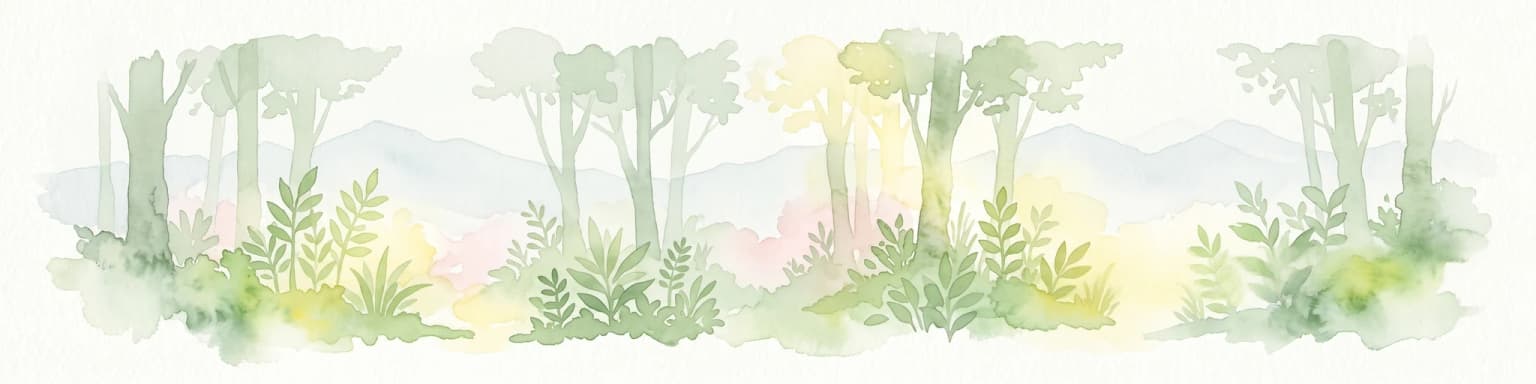
Réunion National Park ecosystems, habitats, and plant life

The nature of Réunion National Park is characterized by extraordinary endemism resulting from the island's isolation and diverse microclimates. Of the 850 known native plant species on Réunion, 230 are endemic, with half of those endangered. The park encompasses 110 different habitat types spanning from coastal zones to the alpine summit, including tropical rainforests, semi-evergreen forests, tamarinaies (Acacia heterophylla woodlands), pandanaies, and volcanic rock fields. The forests of Réunion are classified as the Mascarene forests ecoregion, considered endangered by the World Wildlife Fund. The park is part of the Madagascar and Indian Ocean Islands biodiversity hotspot, recognized by Conservation International as a global priority for conservation. The rough topography has facilitated allopatric speciation, with bird species like Barau's petrel, Réunion harrier, Réunion cuckooshrike, and Réunion grey white-eye evolving distinct populations. The park's core area contains 94% of the island's biodiversity, representing more than four-fifths of the Mascarene Islands' total biodiversity.

Phelsuma inexpectata gecko with green, red, and white patterns resting on a brown rock
Close-up of a Phelsuma inexpectata gecko on a rock

Réunion National Park wildlife and species highlights

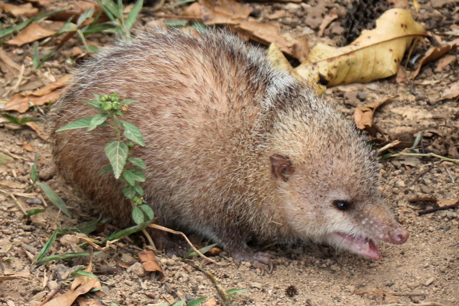
The wildlife of Réunion National Park reflects the island's position as a biodiversity hotspot with high levels of endemism. Among the most notable endemic birds are Barau's petrel, which nests on the island's high peaks, the Réunion harrier, the Réunion cuckooshrike, and the Réunion grey white-eye—together representing half of the island's 18 bird species. The park supports endemic reptiles including the Réunion Island day gecko and the Endormi (a legless skink). Notable butterfly species include Papilio phorbanta and Salamis augustina. The Mauritian flying fox, a large fruit bat, has recolonized the island after being locally extinct. However, introduced species including cats, rats, and giant land snails pose significant threats to native wildlife. Approximately 25% of the island retains original vegetation, with most native habitats now restricted to higher elevations within the park. The loss of at least 22 bird species since human colonization highlights the conservation challenges facing this island ecosystem.

Mountainous landscape with Mafate Cirque, rocky foreground, and deep valleys extending toward distant peaks
Panoramic view of Mafate Cirque from Grand Bénare summit

Réunion National Park conservation status and protection priorities

Réunion National Park represents one of the most important conservation areas in the Indian Ocean region due to the island's exceptional endemism and the threats facing its native ecosystems. The park protects 94% of Réunion's biodiversity within its core area, making it critical for the survival of numerous endemic species. The UNESCO World Heritage designation in 2010 provides international recognition and additional protection mechanisms. However, the park faces significant challenges including competition from approximately 830 naturalized exotic plant species, of which 50 are considered invasive. Habitat loss to agriculture and development, combined with predation by introduced species, has driven the extinction of numerous native species. The park's charter commits to reversing biodiversity loss, and management includes partnerships with local communes across all 24 municipalities. Conservation efforts also focus on protecting the remaining old-growth forest areas, particularly at Mare Longue and La Grande Chaloupe, which contain some of the best-preserved examples of low-altitude tropical forest.

Réunion National Park cultural meaning and human context

Réunion National Park encompasses inhabited areas within Les Hauts, the traditional highland region of the island. Small settlements called îlets are scattered throughout the cirques, where communities practice agriculture and maintain traditional的生活方式. These communities have faced tensions with park management, with inhabitants criticizing restrictions on farming activities that they consider part of their historical tradition. The park's charter explicitly includes objectives to preserve and add value to the culture of the highlands and ensure the transmission of its values. The cultural landscape reflects centuries of human settlement in these mountainous areas, with evidence of agricultural terraces, traditional housing, and pastoral practices. The park also encompasses areas of historical significance related to the island's colonial past and the development of highland communities. The designation as a national park, rather than a strict wilderness preserve, acknowledges the long history of human presence in these lands.

A waterfall cascading down a lush green mountain slope in Réunion National Park, surrounded by dense vegetation with multiple smaller waterfalls visible in the background
Voile de la Mariée waterfall in Salazie, Réunion National Park

Top sights and standout views in Réunion National Park

Réunion National Park offers exceptional geological wonders including the active volcano of Piton de la Fournaise, the dramatic cirques of Mafate, Salazie, and Cilaos with their towering remparts, and the lunar landscapes of Plaine des Sables. The park contains over 900 kilometers of marked hiking trails, including three long-distance GR trails approved by the French Hiking Federation, making it a premier hiking destination. Wildlife highlights include endemic species such as the Réunion cuckooshrike, Barau's petrel nesting on high peaks, and the colorful Réunion Island day gecko. The visitor center at La Plaine-des-Palmistes provides educational exhibits about the island's natural and cultural heritage. The contrast between lush tropical forests and stark volcanic terrain creates remarkable visual diversity within a relatively small area. The park's UNESCO World Heritage status recognizes its outstanding universal value as a geological and ecological showcase.

Small brown-furred common tenrec standing on dirt ground surrounded by dry leaves and small green plants
Common tenrec on forest floor with dry leaves and small green plants

Best time to visit Réunion National Park

Réunion National Park can be visited year-round, though the austral winter months from June to September offer generally more stable weather conditions in the highlands. The warm and humid summer season from December to March corresponds with the cyclone season and can bring heavy rainfall, particularly on the eastern slopes, though this period also sees the volcano at its most active. The transition months of April, May, October, and November often provide good conditions for hiking with fewer crowds. Temperature decreases significantly with elevation, so visitors to the high peaks should prepare for cool conditions regardless of the season. The Piton de la Fournaise area is popular year-round, though visibility and access can change rapidly depending on weather. The cirques experience their own microclimates, with Salazie often receiving more rainfall than Cilaos due to its eastern exposure.

Park location guide

Geography guide, regional context, and park location map for Réunion National Park

Réunion National Park park geography, regions, and map view in France
Understand where Réunion National Park sits in France through a broader geographic reading of the surrounding landscape, nearby location context, and its mapped position within the national park landscape.

How Réunion National Park fits into France

France is a unitary semi-presidential republic and one of the world's largest economies. It borders Belgium, Luxembourg, Germany, Switzerland, Italy, Monaco, Andorra, and Spain, with a maritime border to the United Kingdom. The country is known for its cultural influence, art, cuisine, and political history spanning centuries.

Wider geography shaping Réunion National Park in France

France is located in Western Europe. Metropolitan France extends from the Rhine to the Atlantic Ocean and from the Mediterranean Sea to the English Channel and North Sea. The country borders Belgium, Luxembourg, Germany, Switzerland, Italy, Monaco, Andorra, Spain, and has a maritime border with the United Kingdom.

Map view of Réunion National Park

Use this park location map to pinpoint Réunion National Park in France, understand its exact geographic position, and read its mapped placement within the surrounding landscape more clearly.

Pigeon | © OpenStreetMap contributors

Visually grasp the park's iconic cirques, active volcanoes, and lush endemic habitats within the Indian Ocean's protected terrain.

Réunion National Park Photos: Explore its Dramatic Volcanic Landscapes and Unique Island Scenery
Browse a curated collection of Réunion National Park images, showcasing its dramatic volcanic formations, endemic tropical forests, and unique high-altitude landscapes. These visual insights provide essential context for comprehending the park's geological heritage, diverse habitats, and overall protected-area character.

Mountainous landscape with deep valleys and lush green vegetation under a clear blue sky

Close-up profile view of a small bird with greenish-yellow back, gray underparts, and distinctive white eye-ring

Close-up of a bright green panther chameleon with a distinctive red eye pattern, standing on a surface with blurred green foliage background

Phelsuma inexpectata gecko with green, red, and white patterns resting on a brown rock

Mountainous landscape with Mafate Cirque, rocky foreground, and deep valleys extending toward distant peaks

Close-up view of pink Ruizia cordata flowers with large green leaves

A waterfall cascading down a lush green mountain slope in Réunion National Park, surrounded by dense vegetation with multiple smaller waterfalls visible in the background

Small brown-furred common tenrec standing on dirt ground surrounded by dry leaves and small green plants

Vibrant red Hibiscus boryanus flower with yellow center and orange stamens, surrounded by green leaves and branches

A dense cluster of yellow-flowered plants with green foliage, set against dark mountainous terrain under a clear sky

Lava flowing from volcanic eruption into ocean with smoke rising, showing bright orange lava against dark rocks and blue water

Close-up view of light pink Dombeya ficulnea flowers with green leaves and buds

Dirt road traversing arid volcanic plain (Plaine des Sables) with Demi-Piton volcanic cone visible in distant background under partly cloudy sky

Panoramic view of steep volcanic mountain peaks with green valleys and scattered vegetation under a partly cloudy sky

A mountain peak with rocky slopes partially obscured by clouds, under a clear blue sky

A tall palm tree with green fronds against a clear blue sky

Park atlas

Trace the regional protected areas, comparing volcanic island ecosystems and unique conservation landscapes.

Explore Other National Parks and Protected Areas Near Réunion National Park
After exploring Réunion National Park, browse a curated selection of other national parks and protected areas within the surrounding Indian Ocean region. Compare these diverse conservation landscapes to understand their shared volcanic geology, unique island biodiversity, and distinct approaches to ecological preservation.
Watercolor illustration of a forest scene with trees, ferns, and distant mountains
National parkMauritius

Bras d'Eau National Park: Mauritius National Park Protected Landscape Discovery

Explore coastal terrain, endemic species habitats, and wetland geography.

Bras d'Eau National Park, situated on Mauritius, offers an in-depth look at a protected coastal lowland landscape vital for conservation. This national park showcases remnant forest patches critical for endemic flora and fauna, complemented by a unique system of four mares, including the mangrove-rich Mare sarcelle. Its mapped geography provides context for island ecosystems and serves as a key location for understanding Mauritius's protected natural areas.

Area
4.97 km²
Established
2011
Relief
Lowland
Climate
Tropical
Watercolor illustration of a landscape featuring mountains, a lake, trees, and pink flowers in the foreground
National parkAlaotra-Mangoro

Analamazaotra National Park: Protected Rainforest Ecosystem and Mapped Landscape in Alaotra-Mangoro

Explore Madagascar's Eastern Highlands protected area geography.

Analamazaotra National Park, situated in Madagascar's Alaotra-Mangoro region, represents a critical segment of the island's protected eastern rainforests. This national park is mapped as a vital conservation area, offering insights into its unique ecosystems and natural terrain. Understanding Analamazaotra National Park's geographic placement and protected boundaries provides essential context for regional landscape exploration and atlas-based geographic discovery within Madagascar.

Area
26.53 km²
Established
2015
IUCN
II
Relief
Highland
National parkAlaotra-Mangoro

Andasibe-Mantadia National Park: National Park and Protected Landscape Identity

Explore its mapped boundaries and geographic context.

Andasibe-Mantadia National Park is a distinct protected territory within the Alaotra-Mangoro region, serving as a crucial focal point for understanding Madagascar's regional geography and protected land distribution. This detail page provides essential atlas-style information on the park's mapped area and its natural landscape characteristics. Engage with structured data that highlights the park's protected status and its position within the broader geographic framework of eastern Madagascar, supporting focused discovery for researchers and explorers.

Area
155 km²
Established
1989
IUCN
II
Visitors
26.1K annual
National parkMadagascar

Zahamena National Park: Madagascar National Park Exploration and Geographic Context

Mapping the protected boundaries and landscape of Zahamena National Park.

Delve into Zahamena National Park, a vital protected territory situated in Madagascar. This national park offers a unique perspective on the island's natural geography and its status as a significant protected landscape. Understand its position within Madagascar's broader context, focusing on the mapped aspects of its protected area identity and its contribution to the country's renowned biodiversity hotspot status.

Area
423 km²
Established
1997
IUCN
II
Relief
Mountain
National parkMadagascar

Marolambo National Park: Madagascar's National Park and Protected Landscape

Explore mapped boundaries and regional geography.

Marolambo National Park stands as a protected national park within Madagascar's globally recognized biodiversity hotspot. This entry provides focused insight into its protected landscape, its specific geographic context within the island nation, and its role in the conservation of unique natural terrain. Understanding Marolambo National Park through its mapped boundaries and regional geography contributes to a broader atlas exploration of Madagascar's endemic ecosystems.

Area
950.63 km²
Climate
Tropical
Access
Remote access
Scope
Terrestrial
National parkMadagascar

Ranomafana National Park: Madagascar's premier Tropical Rainforest Protected Area

Explore its unique mapped geography and landscape context.

Ranomafana National Park stands as a crucial national park within Madagascar's protected lands, safeguarding a significant expanse of tropical rainforest. This page offers a deep dive into its geographic setting, detailing the mapped boundaries and the distinctive natural terrain that supports its exceptional biodiversity. Discover the atlas value of this protected landscape for understanding regional conservation and geographic context.

Area
416 km²
Established
1991
IUCN
II
Climate
Tropical
National parkHaute Matsiatra

Andringitra National Park: A Protected Landscape within Haute Matsiatra's Geography

Explore mapped park boundaries and regional terrain.

Andringitra National Park represents a vital protected area within the Haute Matsiatra region, contributing significantly to the mapped landscape of central Madagascar. Its designation as a national park underscores its importance for conservation and geographic study. Users exploring this destination can gain a detailed understanding of its specific protected boundaries, the surrounding natural terrain, and its overall contribution to the regional geography, making it a key site for atlas-based landscape discovery.

Area
311.6 km²
Established
1999
IUCN
II
Visitors
3.4K annual
National parkAtsimo-Atsinanana

Midongy du sud National Park: National Park in Atsimo-Atsinanana, Madagascar

Explore its protected landscape and mapped geography.

Midongy du sud National Park is a significant protected area located in the Atsimo-Atsinanana region of Madagascar. This entry provides detailed geographic context, focusing on the park's mapped boundaries and its identity as a national park. It supports atlas-based discovery by offering insights into the park's specific landscape and its regional setting within southeastern Madagascar, serving as a factual resource for understanding its protected status.

Area
1,922 km²
Established
1997
IUCN
II
Relief
Mountain

Common questions about visiting, size, designation, and location context for Réunion National Park

Réunion National Park FAQs for park facts, access, geography, and protected area context
Find quick answers about Réunion National Park, including protected-area facts, park geography, trail and visitor context, and how the park fits into its surrounding country and regional landscape.
MoriAtlas Explorer

Continue Your Protected Areas Search Across the Global Atlas

Deepen your exploration by continuing the structured search for national parks and protected areas worldwide. Utilize the comprehensive filtering capabilities to compare different conservation landscapes and refine your understanding of global park geography. Discover more about the distribution and characteristics of protected natural areas.

Global natural geography