
Rivers
Park geography
Structured data on landscape features, regional context, and protected area dimensions
Comprehensive Geographic Profile and Mapped Boundaries of Somawathiya National Park in Sri Lanka
This geographic profile covers the spatial dimensions and environmental characteristics of Somawathiya National Park, located across Sri Lanka's North Central and Eastern Provinces. The data includes the park's 376.455 square kilometer extent, the influence of the Mahaweli River, and the lowland terrain classifications defined by its recorded boundary coordinates.
Related tags
wetland reserveelephant habitatbirdwatching destinationflood plain ecosystemBuddhist pilgrimage site
Wetland sanctuary protecting Mahaweli River flood plains and a sacred Buddhist stupa
Somawathiya National Park
Somawathiya National Park is a protected wetland area in northeastern Sri Lanka, spanning the deltaic flood plains where the Mahaweli River divides into two branches flowing toward the coast. Established as a national park in 1986 after originating as a wildlife sanctuary in 1966, the park covers approximately 37,645 hectares and forms part of a larger contiguous protected area network that includes Flood Plains National Park and Trikonamadu Nature Reserve. The park is distinguished by its network of shallow seasonal water basins known as villus, which create a rich and productive wetland habitat supporting exceptional biodiversity. A notable cultural landmark within the park is the Somawathiya Chaitya, an ancient Buddhist stupa said to contain a relic of the tooth of the Buddha, making the area both an ecological sanctuary and a significant pilgrimage site.
- Location
- Sri Lanka
- Park type
- National park
- Established
- 1986
- Area
- 376.5 km²
Location overview
Regional membership within the North Central and Eastern Provinces
Somawathiya National Park Geographic Setting and Location
Somawathiya National Park lies in Sri Lanka, spanning the North Central Province and Eastern Province. Regional records establish its official administrative boundaries and high-level geographic location.
- Countries
- Saudi Arabia, Sri Lanka
- Regions
- Eastern Province, North Central Province
- Primary location
- Sri Lanka
Boundary and coordinates
Compare 401.996 km² geometry with 376.457 and 376.455 km² fields
Somawathiya National Park boundary and three area records
Somawathiya National Park’s mapped geometry calculates to 401.996 km² with a 169.724 km perimeter. This remains separate from the 376.457 km² entity area and 376.455 km² fact area; no land, marine or fact-perimeter values are stored.
- Boundary area
- 402 km²
- Boundary perimeter
- 169.7 km
- Northernmost point
- 8.3203° N
- Southernmost point
- 8.0501° N
- Easternmost point
- 81.2815° E
- Westernmost point
- 80.9141° E
- Geographic centre
- 8.2155° N, 81.1482° E
- North–south span
- 29.9 km
- East–west span
- 40.5 km
Terrain and natural features
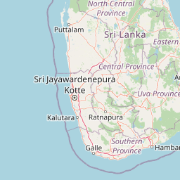
Lowland terrain classifications and recorded river features
Somawathiya National Park Terrain and River Geography
Recorded lowland terrain classifications define the protected landscape alongside internal river features. Linked feature cards supply names, types, measurements, and spatial relationships.
Selected named natural features
Rivers
Mahaweli River
Environmental setting
Analysis of lowland tropical relief, dominant water features, and seasonal forest cover
Somawathiya National Park Environmental Setting and Habitat Classification
Recorded landscape features and habitat types frame the physical setting through complementary tropical lowland categories. Connected classifications link recorded environmental data directly to relevant atlas destinations.
- Relief
- Lowland
- Climate
- Tropical
- Water
- Water-dominated
- Forest cover
- Partial forest
- Seasonality
- Seasonal
Landscape features
Valleys · Forest · Wetland · Marsh · Lakes · Rivers
Habitat types
Wetland · Riverine habitat · Lacustrine habitat · Tropical forest · Grassland
Park atlas
Compare regional protected areas, tracing connected wetland habitats and national parks within Sri Lanka's Mahaweli River basin.
Explore More Protected Areas Near Somawathiya National Park: Compare Wetland Ecosystems and Wildlife Habitats
After exploring Somawathiya National Park, browse other national parks and protected areas across Sri Lanka's Mahaweli River delta, encompassing contiguous flood plains and surrounding wetland reserves. Compare diverse protected landscapes, trace the regional spread of conservation efforts, and understand how adjacent park geography shapes unique wildlife habitats and ecological corridors.
National parkNorth Central Province
Park boundaries overlap#1 closest
South

Flood Plains National Park: Sri Lanka's Vital Wetland and Elephant Corridor
Mapping the geography of its unique villus system and Mahaweli River flood plain.
Flood Plains National Park stands as a paramount protected wetland ecosystem in Sri Lanka's North Central Province, critically important as an elephant corridor along the Mahaweli River. The park's landscape is defined by its unique villus system, shallow swampy depressions that support extraordinary biodiversity and serve as vital feeding grounds for Asian elephants and migratory waterfowl. Understanding the mapped park boundaries and its regional geographic context reveals its significance in landscape-level conservation efforts within the Mahaweli basin.
- Area
- 173.5 km²
- Established
- 1984
- IUCN
- II
- Relief
- Lowland
National parkNorth Central Province
Park boundaries overlap#2 closest
West
Kaudulla National Park: Sri Lanka's Protected National Park Geography
Mapped landscape and regional context for Kaudulla National Park.
Kaudulla National Park stands as a protected national park offering valuable geographic insights for atlas explorers. This page details the park's location within the North Central Province, providing context on its mapped terrain and protected area status. Users can delve into the structured geographic data associated with Kaudulla National Park, enhancing their understanding of Sri Lanka's conservation landscapes.
- Area
- 69 km²
- Established
- 2002
- IUCN
- II
- Visitors
- 10K annual
National parkNorth Central Province
18 km away#3 closest
Southwest
Minneriya National Park: A Protected National Park in North Central Province
Explore mapped boundaries and regional landscape context.
Minneriya National Park is a designated national park offering unique protected landscape exploration within Sri Lanka's North Central Province. This entry provides structured data crucial for understanding the park's geographic features, its defined boundaries, and its significance as a protected area. Dive into the atlas context that illuminates the natural terrain and regional setting of Minneriya National Park.
- Area
- 88.894 km²
- Established
- 1997
- IUCN
- II
- Relief
- Mixed relief
National parkNorth Central Province
20 km away#4 closest
Southwest
Angammedilla National Park: Protecting the Watershed for Parakrama Samudra in North Central Province
Mapped dry evergreen forests and mountainous terrain boundaries.
Angammedilla National Park is a national park in Sri Lanka's North Central Province renowned for its pivotal role in safeguarding the drainage basin for the large Parakrama Samudra reservoir. This protected landscape features significant dry evergreen forest ecosystems and mountainous terrain, contributing to the region's ecological stability and wildlife habitats. Its establishment highlights a commitment to preserving vital natural resources and understanding the complex interplay between protected areas and regional geography.
- Area
- 75.29 km²
- Established
- 2006
- IUCN
- II
- Relief
- Mountain
National parkCentral Province
21 km away#5 closest
Southwest
Wasgamuwa National Park: A National Park in Central Province for Geographic Exploration
Mapped protected boundaries and landscape context.
Wasgamuwa National Park is a significant national park located in Sri Lanka's Central Province, offering valuable data for atlas exploration and geographic understanding. This protected area's mapped boundaries and regional setting within Central Province provide essential context for researchers and explorers focused on conservation landscapes. Discover the park's unique geographic identity and its contribution to the regional atlas, highlighting its role as a structured natural landscape.
- Area
- 393.22 km²
- Established
- 1984
- IUCN
- II
- Relief
- Upland
National parkNorth Central Province
About 36 km away#6 closest
Northwest
Horowpathana National Park: Protected Landscape within North Central Province's Dry Zone
Explore its mapped boundaries and vital wildlife habitat.
Horowpathana National Park is a designated national park in Sri Lanka's North Central Province, covering 2,570 hectares of dry zone forest. Established to protect critical habitats for endangered species like the Sri Lankan elephant and leopard, it plays a vital role in regional wildlife conservation and managing human-wildlife conflict. Its landscape is characterized by dry forest ecosystems situated near the Tawalamham Hammillewa reservoir system, presenting a unique environmental context within the broader mapped geography of the island.
- Area
- 25.7 km²
- Established
- 2011
- IUCN
- II
- Climate
- Tropical
National parkEastern Province
41 km away#7 closest
South
Maduru Oya National Park: Sri Lanka National Park Landscape and Geographic Context
Mapped protected area boundaries within Eastern Province.
Maduru Oya National Park represents a distinct protected area within the Eastern Province of Sri Lanka, offering valuable geographic context for atlas-based exploration. This national park's mapped boundaries and its placement within the regional landscape provide critical data points for understanding conservation geography. Discover the park's identity as a protected natural landscape and its role in the broader geographic atlas of Sri Lanka.
- Area
- 588.5 km²
- Established
- 1983
- IUCN
- II
- Relief
- Mountain
National parkEastern Province
About 44 km away#8 closest
North
Pigeon Island National Park National Park: Eastern Province Protected Landscape Atlas
Mapped geographic context and park boundaries.
Dive into the protected area details of Pigeon Island National Park, a national park situated in Sri Lanka's Eastern Province. This entry provides essential context for understanding its mapped landscape and geographic significance within a regional atlas framework, facilitating discovery of its specific protected area identity.
- Area
- 4.714 km²
- Established
- 2003
- IUCN
- II
- Relief
- Lowland
MoriAtlas Explorer
Continue exploring Somawathiya National Park's mapped geography and protected landscape
To deepen your understanding of Somawathiya National Park, continue exploring its specific geographic features and protected area context. Examining its mapped boundaries and role as a national park in Sri Lanka provides crucial insights for any atlas-driven study of natural landscapes. Discover how Somawathiya National Park fits into the regional geography and the broader network of protected lands.
Browse next
Global natural geography
Explore related park routes
Explore MoriAtlas Global ParksBrowse All MoriAtlas ParksGlobal Park Map DiscoveryMoriAtlas: Browse All CountriesBrowse All MoriAtlas ContinentsNational Park Environment AtlasGrand Canyon National Park AtlasYellowstone National Park AtlasYosemite National Park Atlas and GeographySerengeti National Park AtlasGalápagos National Park Protected LandscapeBanff National Park Geography and AtlasKruger National Park Atlas EntryUluṟu-Kata Tjuṯa National Park AtlasExplore Uluru-Kata Tjuta National Park GeographyPlitvice Lakes National Park AtlasFiordland National Park Protected LandscapeGreat Smoky Mountains National Park AtlasAfghanistan National Parks and Protected AreasAlbania National Parks and Protected AreasAlgeria National Parks and Protected AreasAmerican Samoa National Parks and Protected AreasAndorra National Parks and Protected AreasAngola National Parks and Protected AreasAntarctica National Parks and Protected AreasAntigua and Barbuda Park List