
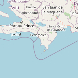
Streams
Park geography
A comprehensive analysis of mountain elevations, hydrologic networks, and forest landscapes
Geographic Profile of Valle Nuevo National Park: Mapped Boundaries and Natural Terrain
Examine the detailed geographic layout of Valle Nuevo National Park, covering 910 square kilometers of mountainous terrain within the Dominican Republic. This profile maps the park's vertical reach from 2200m to the 2842m peak, while identifying its internal river networks, valleys, and diverse forest habitats.
Related tags
National ParkHighland EcosystemNearctic EcozonePine ForestCloud Forest
Caribbean highlands with Nearctic ecosystems and glacial heritage
Valle Nuevo National Park
Valle Nuevo National Park is a protected area in the central highlands of the Dominican Republic, representing one of the Caribbean's most distinctive ecological environments. Established as a national park in 1996, the park occupies a high-altitude plateau at elevations exceeding 2,200 meters within the Cordillera Central mountain range, making it the southeastern terminus of this major Caribbean mountain system. The park's remarkable elevation creates conditions atypical for the Caribbean, supporting vegetation and wildlife more commonly associated with North American ecosystems, earning it classification within the Nearctic ecozone. With an area of 910 square kilometers, Valle Nuevo encompasses dramatic mountain peaks, extensive pine forests, cloud forest habitats, and over 500 freshwater sources that feed major river systems. The geological legacy of glacial activity during the Last Glacial Maximum remains visible in the park's highest terrain, including cirques, moraines, and glacial channels around Alto de la Bandera, the fourth-highest peak on Hispaniola.
- Location
- Dominican Republic
- Park type
- National park
- Established
- 1996
- Area
- 910 km²
- Highest point
- 2,842 m
Location overview
Territorial placement and national jurisdiction within the Dominican Republic
Valle Nuevo National Park Geographic Setting in the Dominican Republic
Valle Nuevo National Park is situated entirely within the terrestrial borders of the Dominican Republic. As a single country inland reserve, its administrative jurisdiction remains fully defined by national conservation frameworks.
- Countries
- Dominican Republic
- Primary location
- Dominican Republic
- Geographic setting
- Inland
Boundary and coordinates
Interactive boundary geometry and recorded spatial measurements
Valle Nuevo National Park Boundary Map and Geographic Extent
Mapped park outlines provide precise spatial context for exploring protected terrain boundaries. Accompanying facts detail total area measurements, coordinate limits, and regional geographic spans.
- Boundary area
- 906.4 km²
- Boundary perimeter
- 369.4 km
- Northernmost point
- 18.9684° N
- Southernmost point
- 18.5983° N
- Easternmost point
- 70.4522° W
- Westernmost point
- 70.8882° W
- Geographic centre
- 18.7924° N, 70.6478° W
- North–south span
- 41 km
- East–west span
- 46 km
Elevation and terrain
Mountain relief metrics and recorded natural water features
Valle Nuevo National Park Terrain and Elevation Summary
Recorded elevation ranges span from two thousand two hundred meters to two thousand eight hundred forty two meters across the mountain terrain. Linked feature cards supply names, types, and spatial relationships for interior rivers, peaks, and reservoirs.
- Minimum elevation
- 2,200 m
- Maximum elevation
- 2,842 m
- Highest point
- 2,842 m
Selected named natural features
Viewpoints
Mirador
Peaks
loma Los Paredones
Viewpoints
Antenas De Comunicación Alto Bandera
Reservoirs
Embalse Presa Pinalito
Rivers
Río Tireo
Environmental setting
Subtropical mountain relief, forest cover, and diverse habitat records
Valle Nuevo National Park Environmental Classifications and Physical Setting
Recorded landscape features, habitat types, and climate zones offer complementary ways to read the physical setting of Valle Nuevo National Park. Associated classifications connect stored environmental data to relevant protected area destinations across the atlas.
- Relief
- Mountain
- Climate
- Subtropical
- Water
- Minor water
- Forest cover
- Mostly forested
- Seasonality
- Year-round
Landscape features
Mountains · Forest · Glacier · Rivers · Cliffs · Valleys
Habitat types
Temperate coniferous forest · Montane forest · Alpine meadow
Park atlas
Compare nearby highland protected areas and diverse mountain landscapes within the Dominican Republic's Cordillera Central region.
Discover Other Protected Areas and National Parks Near Valle Nuevo National Park
After exploring Valle Nuevo National Park's unique Nearctic ecosystems and glacial mountain terrain, expand your geographic understanding by tracing other nearby protected areas. This structured view allows for comparing high-altitude pine forests, cloud forest habitats, and critical freshwater sources across the Dominican Republic's vital Cordillera Central mountain system.
National parkDominican Republic
13 km away#1 closest
Northwest

José Armando Bermúdez National Park: Dominican Republic National Park Atlas and Landscape Context
Discover the mapped protected area and geographic setting of this Dominican Republic national park.
Gain an understanding of José Armando Bermúdez National Park as a distinct protected landscape within the Dominican Republic. This entry focuses on its role as a national park, providing geographic context and highlighting its mapped boundaries for atlas exploration. Explore the park's specific terrain and its place within the nation's conservation network.
- Area
- 766 km²
- Established
- 1956
- IUCN
- II
- Relief
- Mountain
National parkDominican Republic
About 36 km away#2 closest
North
Pueblo Viejo National Park: Dominican Republic Colonial Ruins and Gold Mining Heritage
Explore early Caribbean colonization and its archaeological landscape.
Pueblo Viejo National Park stands as a crucial archaeological site in the Dominican Republic, preserving the remnants of Concepción de la Vega, a significant colonial settlement established during the era of Christopher Columbus. This national park offers a unique window into the beginnings of European presence and the first major gold extraction operations in the Americas. Examine the mapped foundations of its fortress and town structures, understanding the colonial urban planning and the historical geography of early Caribbean heritage.
- IUCN
- II
- Access
- Easy access
- Scope
- Terrestrial
- Water
- No major water
National parkDominican Republic
57 km away#3 closest
East
Los Haitises National Park: Dominican Republic Protected Landscape & Park Geography
Mapped terrain and protected area boundaries in the Dominican Republic.
Los Haitises National Park is a vital protected national park in the Dominican Republic, offering unique insights into the region's geography and natural landscapes. This page delves into its mapped boundaries, regional context, and the importance of its protected status for understanding Dominican Republic's conservation areas. Gain a structured view of this important natural landscape and its place within a broader geographic atlas.
- Area
- 826 km²
- Established
- 1976
- IUCN
- II
- Relief
- Upland
National parkIndependencia Province
About 71 km away#4 closest
Southwest
La Gran Sabana National Park: National Park Identity and Geographic Mapping
Exploring protected landscapes and regional context.
This detail entry focuses on La Gran Sabana National Park, delineating its identity as a protected national park within Independencia Province. It provides essential context for understanding the park's mapped boundaries, its specific geographic setting, and its role within the natural landscape. Users can explore its atlas-relevant features and understand its place in the broader geography of the Dominican Republic.
- Area
- 219.58 km²
- Established
- 2009
- IUCN
- II
- Relief
- Lowland
National parkDominican Republic
About 72 km away#5 closest
East
The Three Eyes National Park: Dominican Republic National Park Geography and Atlas Context
Mapped protected landscapes and natural terrain within Hispaniola.
Delve into the protected area details of The Three Eyes National Park, a designated national park situated in the Dominican Republic. This page facilitates a structured discovery of its geographic scope, mapped boundaries, and the surrounding natural landscapes, offering essential context for anyone exploring the atlas of protected areas within Hispaniola. Understand its unique character as a key element of the country's conservation geography.
- IUCN
- II
- Relief
- Lowland
- Climate
- Tropical
- Access
- Easy access
National parkDominican Republic
About 89 km away#6 closest
East
La Caleta Underwater National Park: Dominican Republic National Park Geography and Atlas Exploration
Discover its protected marine landscape and mapped underwater terrain.
La Caleta Underwater National Park is a designated national park within the Dominican Republic, offering a unique focus on protected marine geography. Explore the mapped underwater terrain and understand its protected landscape identity. This entry provides essential context for atlas-based discovery of its specific geographic features and conservation significance in the Caribbean.
- IUCN
- II
- Scope
- Marine
National parkPedernales Province
108 km away#7 closest
Southwest
Jaragua National Park: Dominican Republic National Park Protected Landscape Atlas
Discover the mapped geography and protected boundaries of Jaragua National Park.
Jaragua National Park stands as a crucial national park within the Dominican Republic, located in Pedernales Province. This entry provides an in-depth, atlas-style examination of the park's protected landscape, focusing on its geographic features and mapped extent. Users can explore the park's position within the regional geography and understand its significance as a conservation area.
- Area
- 1,374 km²
- Established
- 1983
- IUCN
- II
- Relief
- Mountain
National parkMonte Cristi Province
111 km away#8 closest
Northwest
Monte Cristi National Park: Dominican Republic National Park Geography and Atlas
Explore mapped boundaries and regional landscape context.
Monte Cristi National Park serves as a vital component of the Dominican Republic's protected lands, located within the Monte Cristi Province. This entry provides essential geographic context and visualizes the park's mapped boundaries, contributing to a comprehensive understanding of its landscape. Delve into the atlas perspective of this national park, examining its terrain and regional significance for structured geographic exploration.
- Area
- 550 km²
- Established
- 1983
- IUCN
- II
- Relief
- Upland
MoriAtlas Explorer
Continue exploring Valle Nuevo National Park's protected landscape and mapped geography
Delve deeper into the distinct geography and protected landscape of Valle Nuevo National Park. Understand its role as a Nearctic ecosystem within the Caribbean, investigate its glacial terrain, and trace the mapped boundaries of this significant Dominican Republic national park.
Browse next
Global natural geography
Explore related park routes
Explore MoriAtlas Global ParksBrowse All MoriAtlas ParksGlobal Park Map DiscoveryMoriAtlas: Browse All CountriesBrowse All MoriAtlas ContinentsNational Park Environment AtlasGrand Canyon National Park AtlasYellowstone National Park AtlasYosemite National Park Atlas and GeographySerengeti National Park AtlasGalápagos National Park Protected LandscapeBanff National Park Geography and AtlasKruger National Park Atlas EntryUluṟu-Kata Tjuṯa National Park AtlasExplore Uluru-Kata Tjuta National Park GeographyPlitvice Lakes National Park AtlasFiordland National Park Protected LandscapeGreat Smoky Mountains National Park AtlasAfghanistan National Parks and Protected AreasAlbania National Parks and Protected AreasAlgeria National Parks and Protected AreasAmerican Samoa National Parks and Protected AreasAndorra National Parks and Protected AreasAngola National Parks and Protected AreasAntarctica National Parks and Protected AreasAntigua and Barbuda Park List