Mori Atlas logo
National parkAladağlar National Park

Explore rugged crimson peaks, alpine lakes, and high-altitude wilderness in Turkey's Anti-Taurus Mountains.

Aladağlar National Park: Turkey's Premier Alpine Protected Landscape & Mountaineering Destination

(Aladağlar Milli Parkı)

Aladağlar National Park represents a crucial alpine wilderness within Turkey's protected area network. Located in the formidable Anti-Taurus Mountains, this national park preserves a dramatic landscape of rugged granite peaks, steep valleys, and seasonal glacial lakes. Its name, meaning 'Crimson Mountains,' reflects the distinctive rusty hue of its summits at sunset, a spectacular visual characteristic unique to this high-altitude region. MoriAtlas provides a map-driven lens to understand this significant natural landscape and its place in Turkey's geography.

Alpine MountainsNational ParksTurkey Protected AreasMountaineering DestinationsGlacial LakesAnti-Taurus Range

Aladağlar National Park

National park

Park overview

Structured park overview, official facts, and landscape profile for Aladağlar National Park

Aladağlar National Park park facts, protected area profile, and essential visitor context
Review the core facts for Aladağlar National Park, including designation, size, terrain, visitor scale, habitats, and operating context in one park-focused overview.

About Aladağlar National Park

Aladağlar National Park represents a significant protected wilderness area in southern Turkey's mountainous interior, established to preserve the distinctive alpine environment of the Anti-Taurus range. The park spans parts of Yahyalı district in Kayseri Province, Çamardı district in Niğde Province, and Aladağ district in Adana Province, creating a trans-provincial protected area that reflects the natural continuity of the mountain range rather than administrative boundaries.

The landscape is characterized by massive granite peaks, steep-walled valleys, and a complex terrain that has shaped both the ecological character and human use patterns of the region. At elevations well above 3,000 meters, the park supports ecosystems adapted to harsh alpine conditions including cold temperatures, thin air, and strong seasonal variations. The vegetation transitions from forested slopes in the lower elevations through subalpine zones to bare rock and permanent snow at the highest points.

The park's establishment in 1995 reflected Turkey's growing commitment to protecting representative examples of its diverse mountain environments. Prior to national park designation, the area had long been recognized for its scenic and ecological values, though access and development remained limited due to the challenging terrain and remote location. The national park status provides a framework for balancing conservation of the alpine ecosystems with limited sustainable recreational use, particularly mountaineering and hiking activities concentrated in the warmer months.

Quick facts and research context for Aladağlar National Park

Aladağlar National Park occupies the central highlands of the Anti-Taurus range in southern Turkey, spreading across three provinces at elevations averaging 3,500 meters. The park was established in 1995 and protects approximately 55,000 hectares of mountain terrain containing four peaks above 3,700 meters, with Kızılkaya being the highest at 3,767 meters. The characteristic crimson coloration of the mountain slopes at sunset gives the range its name and contributes to its visual identity. Lakes and waterfalls appear throughout the park during spring and early summer as snowcover recedes, adding to the landscape's diversity.

Park context

Deeper park guide and search-rich context for Aladağlar National Park

Aladağlar National Park history, landscape, wildlife, and travel context
Explore Aladağlar National Park through its history, landscape character, ecosystems, wildlife, conservation priorities, cultural context, and seasonal travel timing in a structured park guide built for atlas discovery and search intent.

Why Aladağlar National Park stands out

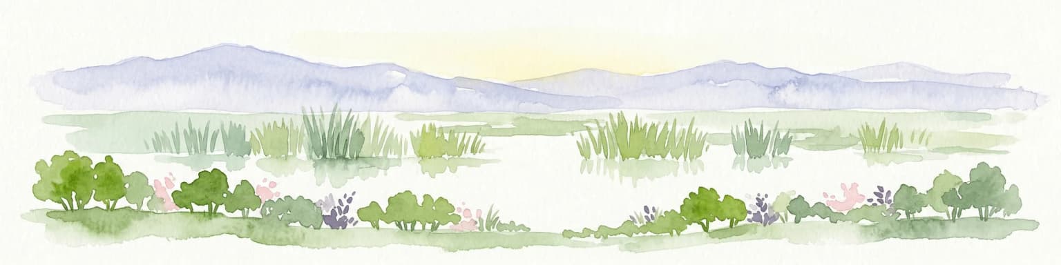
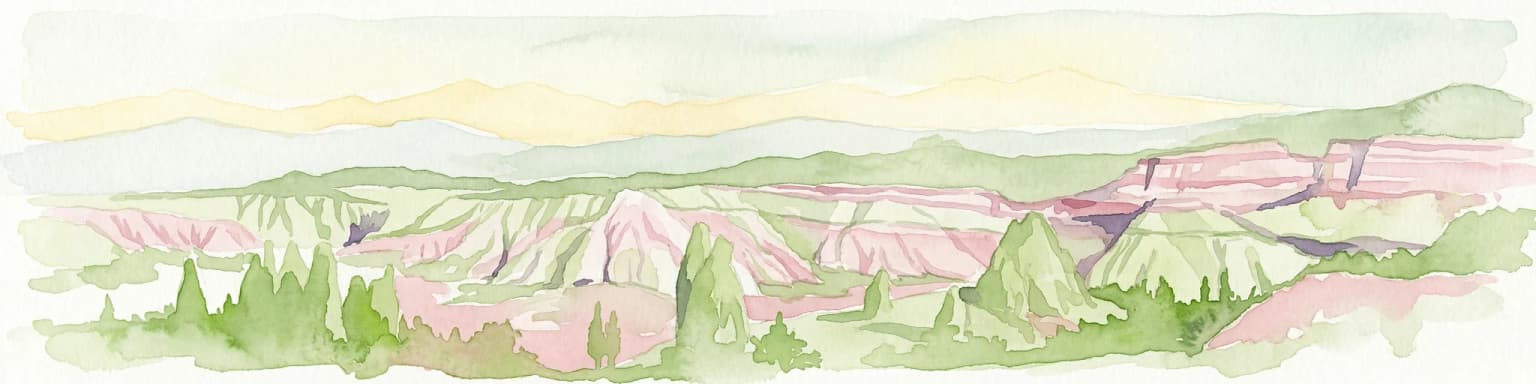
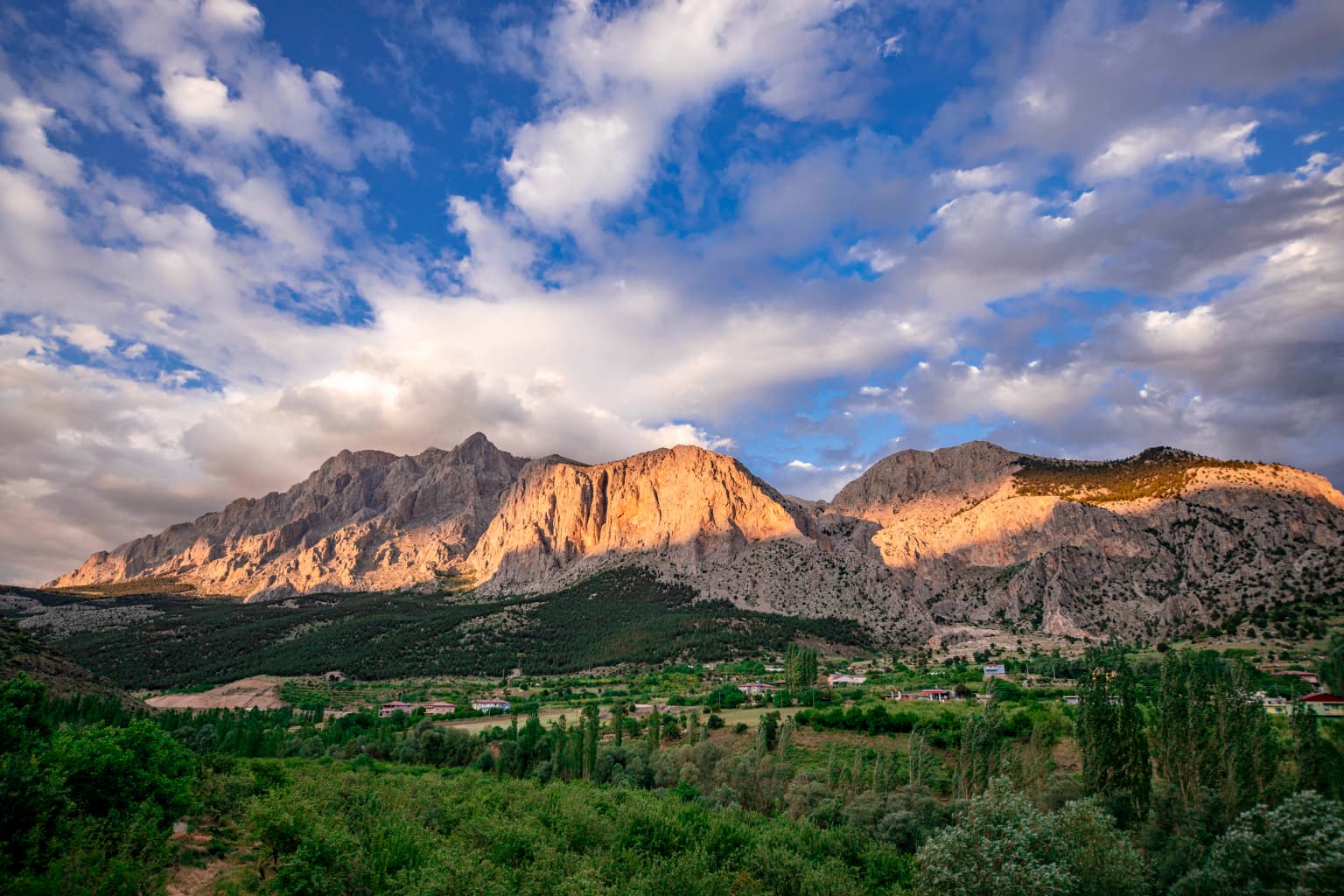
Aladağlar National Park is best known for its dramatic alpine landscape of crimson-colored peaks, high-altitude wilderness, and excellent mountaineering opportunities on summits exceeding 3,700 meters. The park protects one of Turkey's most significant subalpine and alpine environments, characterized by rugged terrain, scattered glacial lakes, and distinctive rust-colored granite formations that intensify in hue during sunset hours. The name "Crimson Mountains" directly references this landscape characteristic, making the evening light a particularly memorable aspect of any visit. The park's four major summits attract climbers seeking challenging ascents in a remote mountain setting, while the alpine lakes and waterfalls provide additional natural attractions for hikers exploring the terrain below the ridgelines.

Aladağlar National Park history and protected-area timeline

Aladağlar National Park was officially established on April 21, 1995, as part of Turkey's expanding network of national parks during the 1990s when the country was systematically identifying and protecting representative natural areas across diverse ecological zones. The establishment came after recognition that the Anti-Taurus mountain environment contained significant biodiversity and scenic values meriting national-level protection, particularly the distinctive alpine landscapes that characterized the range.

The park was created through the Turkish Ministry of Forest and Water Management, which retains administrative oversight of protected areas. The selection of this mountain area for national park status reflected both its ecological significance as one of the few protected alpine environments in central Anatolia and its value as a wilderness area with limited prior development or resource extraction pressure. The surrounding region had historically supported pastoral activities, with villages like Yelatan situated in the mountain valleys, but the high-altitude terrain remained largely in natural condition.

Since designation, the park has been managed under Turkish national park regulations that permit controlled recreational use while prioritizing conservation of the natural environment. The mountain climbing community has particularly valued the park's peaks, with Kızılkaya and the other high summits attracting experienced climbers seeking technical ascents in a high-altitude setting.

Aladağlar National Park landscape and geographic character

The physical landscape of Aladağlar National Park is defined by its position within the Anti-Taurus Mountains, a major branch of the Taurus range that traverses southern Turkey. The terrain consists of massive granite peaks rising sharply from valley floors, creating dramatic relief that characterizes the visual experience of the park. Ridges and summits display the distinctive rusty-red coloration that gives the range its Turkish name, a result of iron-rich minerals in the granite that become particularly visible during sunset when low-angle sunlight intensifies the color.

The elevation gradient from approximately 2,000 meters to nearly 3,800 meters at Kızılkaya creates a vertical succession of landscape zones. Steep-walled valleys channel meltwater from seasonal snowfields into streams that feed numerous small alpine lakes scattered throughout the park. These water bodies, along with occasional waterfalls that appear in spring, add to the landscape diversity and provide focal points for hiking routes. The terrain includes rocky outcrops, boulder fields, and steep grass-covered slopes, creating variety across relatively short distances.

The alpine character of the landscape means that snow persists in sheltered locations and on north-facing slopes throughout much of the year, while the highest ridgelines may retain snow cover even during summer. This harsh environment has limited human modification and contributed to the wilderness quality that distinguishes the park from more accessible mountain areas in Turkey.

Aladağlar National Park ecosystems, habitats, and plant life

The ecological character of Aladağlar National Park reflects its high-altitude setting within the Anti-Taurus Mountains, with vegetation zones arranged along the elevational gradient from valley floors to summit areas. The lower slopes support forest vegetation, though the specific composition varies with aspect and soil conditions. As elevation increases, forest gives way to subalpine scrub and meadows, eventually transitioning to alpine grassland and bare rock at the highest elevations.

The park lies within a region that experiences continental climate influences, with cold winters, mild summers, and relatively limited precipitation compared to coastal mountain ranges. This climate regime has shaped both the vegetation patterns and the seasonal rhythms of the ecosystem, with most plant growth occurring during the short summer growing season when snowmelt provides moisture and temperatures rise sufficiently for biological activity.

The protected area encompasses habitats that support species adapted to harsh mountain conditions, including both flora and fauna characteristic of Anatolian alpine environments. While detailed species inventories are limited in the available sources, the park's position within a mountain corridor that includes significant elevational range suggests diversity across habitat types.

Aladağlar National Park conservation status and protection priorities

Aladağlar National Park serves as an important protected area for preserving Turkey's alpine mountain ecosystems, representing one of the few areas in the country where substantial subalpine and alpine environments receive formal national park protection. The park's conservation significance stems from its role in maintaining ecological processes in a mountain system that has remained relatively unmodified by intensive human activity, particularly at higher elevations where the terrain limits agricultural or developmental pressures.

The protected status provides a framework for maintaining habitat connectivity within the Anti-Taurus corridor and ensuring that future development does not fragment the mountain landscape. Given the limited infrastructure within the park boundaries and the challenging terrain, the area has retained considerable wilderness character that would be difficult to restore if degraded. The national park designation also supports management of recreational activities to minimize impacts on sensitive alpine vegetation and wildlife.

The park's value as a conservation area is enhanced by its elevational range, which captures multiple habitat zones within a single protected unit and supports species with different ecological requirements across this gradient.

Top sights and standout views in Aladağlar National Park

Aladağlar National Park offers outstanding alpine mountaineering on peaks exceeding 3,700 meters, with Kızılkaya providing the primary summit objective for climbers seeking high-altitude ascents in Turkey. The park's most distinctive visual characteristic is the crimson coloration of its granite peaks during sunset, which creates memorable mountain scenery and explains the origin of the park's Turkish name. Alpine lakes that form each spring from snowmelt provide scenic attractions for hikers exploring the terrain below the summits, while the relatively remote and wild character of the area distinguishes it from more accessible mountain destinations.

The park protects one of Turkey's most significant alpine environments within a national park, preserving ecosystems and landscapes that represent the Anti-Taurus range at its most dramatic and natural. For visitors willing to undertake the physical challenges of high-altitude hiking and climbing, the park offers wilderness experiences increasingly rare in Turkey's more populated regions.

Best time to visit Aladağlar National Park

The most favorable conditions for visiting Aladağlar National Park occur during the summer months of June through September, when temperatures at altitude are moderate and access to trails and climbing routes is feasible. During this period, snow has melted from most accessible areas, though patches may persist in sheltered locations and on higher ridgelines. Summer brings extended daylight hours and generally stable weather conditions, though afternoon thunderstorms can develop rapidly in mountain environments.

Spring and early summer correspond with the snowmelt period when alpine lakes fill and waterfalls flow most dramatically, though trail conditions may be challenging with wet or snow-covered sections. The shoulder seasons of late spring and early autumn offer possibilities but carry risks of early snowfall and cold conditions at elevation. Winter access to the park is extremely limited due to heavy snowcover, low temperatures, and reduced services in the surrounding communities, making this a summer-focused destination for most visitors.

Park location guide

Geography guide, regional context, and park location map for Aladağlar National Park

Aladağlar National Park park geography, regions, and map view in Turkey
Understand where Aladağlar National Park sits in Turkey through a broader geographic reading of the surrounding landscape, nearby location context, and its mapped position within the national park landscape.

How Aladağlar National Park fits into Turkey

Turkey, officially the Republic of Türkiye, is a transcontinental country located mainly in Anatolia (West Asia) with a smaller portion in East Thrace (Southeast Europe). It borders the Black Sea to the north, several countries to the east and south, and the Aegean Sea and European countries to the west. The country has a population of over 86 million and operates as a secular, Muslim-majority presidential republic with Ankara as capital and Istanbul as its largest city.

Wider geography shaping Aladağlar National Park in Turkey

Turkey is a transcontinental country with the majority of its territory (about 97%) located in Anatolia (West Asia) and a smaller portion called East Thrace in Southeast Europe. It borders the Black Sea to the north, Georgia, Armenia, Azerbaijan, and Iran to the east, Iraq and Syria to the south, and the Mediterranean Sea to the southwest. To the west, Turkey borders the Aegean Sea, Greece, and Bulgaria. The terrain includes mountains, plateaus, and coastal plains, with the Taurus Mountains running along the southern coast.

Map view of Aladağlar National Park

Use this park location map to pinpoint Aladağlar National Park in Turkey, understand its exact geographic position, and read its mapped placement within the surrounding landscape more clearly.

Pigeon | © OpenStreetMap contributors

Location context for Aladağlar National Park

Adana ProvinceKayseri ProvinceNiğde Province
Park atlas

Compare Aladağlar's Alpine Wilderness with Other Protected Landscapes and National Parks Across Turkey

Explore Nearby National Parks and Protected Areas Beyond Aladağlar National Park in Turkey
Continue your exploration beyond Aladağlar National Park by browsing other significant national parks and protected areas within Turkey, focusing on the Anti-Taurus range and adjacent mountainous regions. This allows for direct geographic comparison, tracing the spread of conservation landscapes, and deepening your understanding of Turkey's diverse natural terrain and park distribution.
Watercolor illustration of a wetland landscape with distant mountains, grassy vegetation, and calm water.
National parkKayseri Province

Sultan Reedy National Park: A Vital Protected Wetland Ecosystem in Kayseri Province, Turkey

Mapped landscape focused on ornithological significance and lake ecosystems.

Sultan Reedy National Park stands as a cornerstone of wetland conservation in Turkey, located within the geographically distinct Kayseri Province. This national park is celebrated for its expansive freshwater lakes and dense reed marshes, forming a critical habitat for a vast diversity of bird species. Its Ramsar designation underscores its international importance as a stopover point for migratory birds traversing major flyways, offering a unique window into a dynamic aquatic ecosystem bordered by dramatic mountain terrain.

Area
243.57 km²
Established
2006
Relief
Lowland
Scope
Terrestrial
National parkTurkey

Göreme Historical National Park: A Mapped Volcanic Landscape and Protected Cultural Heritage in Turkey

Explore the unique geography and rock-cut churches of Cappadocia.

Göreme Historical National Park presents a globally significant protected landscape, celebrated for its dramatic volcanic geology and extensive rock-cut architecture. This national park in Turkey's Cappadocia region features iconic fairy chimneys and ancient cave dwellings, offering a rich context for exploring human adaptation to natural terrain. MoriAtlas facilitates a detailed discovery of its mapped boundaries and regional geography, highlighting the intersection of natural wonder and historical habitation within this unique protected area.

Watercolor illustration showing mountains, a reservoir, and green landscape
National parkOsmaniye Province

Karatepe-Aslantaş National Park: A National Park Bridging Ancient History and Natural Geography

Discover its protected landscape and mapped terrain in Osmaniye Province.

Karatepe-Aslantaş National Park stands as Turkey's second national park and its inaugural open-air museum, situated in Osmaniye Province. This protected area is renowned for its significant Neo-Hittite archaeological remnants, including iconic lion statues and the vital Karatepe Bilingual inscription. The park's landscape is characterized by slightly rugged terrain, woodlands, and maquis scrubland, all set against the backdrop of the Aslantaş Dam reservoir, providing a unique geographic context for exploring ancient heritage and natural ecosystems.

Area
41.45 km²
Established
1958
Relief
Lowland
Climate
Mediterranean
National parkYozgat Province

Yozgat Pine Grove National Park: Historic First National Park and Ancient Pine Forest

Explore the protected landscape of Turkey's original national park.

As Turkey's pioneering national park, Yozgat Pine Grove National Park offers a deep dive into a unique protected landscape. This site provides detailed geographic context for its ancient pine forest, set dramatically against the steppe terrain of Yozgat Province. Understand the park's mapped boundaries and its ecological significance as a historic conservation area. MoriAtlas facilitates a structured exploration of this important natural heritage site, highlighting its role in Turkish protected land history and its distinct regional geography.

Area
2.64 km²
Established
1958
IUCN
II
Relief
Highland
Watercolor painting of colorful rowboats on a lake with distant mountains
National parkKonya Province

Lake Beyşehir National Park: Protected Landscape Geography and Mapped Boundaries

Discover the geography and mapped context of this national park in Konya.

Lake Beyşehir National Park is a major protected area in Turkey's Central Anatolia region, celebrated for its immense freshwater lake and diverse wetland habitats. The park's identity is strongly tied to its mapped boundaries that protect critical ecosystems, islands, and surrounding forested terrain. This page provides a detailed look at the park's geographic setting within Konya Province, serving as a valuable resource for atlas-based discovery of its unique natural and cultural landscape.

Area
868.55 km²
Established
1993
Relief
Lowland
Climate
Temperate
National parkTurkey

Derebucak Çamlık Caves National Park: Turkey's Protected Karst Caves and Landscape

Explore Konya Province's longest cave system and its unique geological context.

Derebucak Çamlık Caves National Park is a vital protected landscape in central Turkey, celebrated for its extensive karst topography and significant cave formations. This national park encompasses thirteen unique caves and sinkholes, with Balatini Cave holding the distinction of being Konya Province's longest. The park's rugged terrain, characterized by pine forests and the Balat Stream feeding its underground systems, offers a profound look into Turkey's geological heritage and the conservation of its unique subterranean environments. MoriAtlas helps you navigate this mapped protected area.

Area
11.47 km²
Established
2022
Watercolor illustration showing a mountainous landscape with a lake and greenery
National parkAntalya Province

Altınbeşik Cave National Park: A Karst Landscape with Turkey's Largest Subterranean Lake

Protected lands and mapped geological formations in Antalya Province.

Altınbeşik Cave National Park represents a significant protected karst landscape within Antalya Province, Turkey. The park's primary feature is the renowned Altınbeşik Cave, home to Turkey's largest subterranean lake and exceptional travertine formations. Explore the mapped geography of this unique national park, understanding its role as a critical discharge point for one of the world's longest karst aquifer systems.

Area
11.47 km²
Established
1994
Relief
Mixed relief
Climate
Mediterranean
Watercolor illustration of green hills, pine trees, and distant mountains under a light sky
National parkIsparta Province

Kızıldağ National Park: Protected Taurus Mountain Landscape and Atlas Context

Mapped boundaries, alpine terrain, and unique cedar forests.

Kızıldağ National Park offers a detailed look into Turkey's protected natural heritage, specifically highlighting the dramatic mountainous terrain of the Taurus Ranges. This page provides atlas-level geographic information about its mapped boundaries, the significant Dedegöl Mountain, and the rare blue-leaf cedar forests unique to this region. Understand its role as a vital conservation area within Isparta Province and the broader Mediterranean mountain ecosystem.

Area
551.06 km²
Established
1969
Relief
Mountain
Scope
Terrestrial

Common questions about visiting, size, designation, and location context for Aladağlar National Park

Aladağlar National Park FAQs for park facts, access, geography, and protected area context
Find quick answers about Aladağlar National Park, including protected-area facts, park geography, trail and visitor context, and how the park fits into its surrounding country and regional landscape.
MoriAtlas Explorer

Continue Your Protected Areas Search Across the Global Atlas

Deepen your exploration by continuing the structured search for national parks and protected areas worldwide. Utilize the comprehensive filtering capabilities to compare different conservation landscapes and refine your understanding of global park geography. Discover more about the distribution and characteristics of protected natural areas.

Global natural geography