
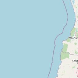
Rivers
Park geography
Detailed mountain relief, boundary area measurements, and natural environment data mappings
Structured Geographic and Landscape Profile of Alerce Costero National Park in Chile
Alerce Costero National Park spans a recorded area of 139.75 square kilometers across the Los Ríos Region of Chile. This geographic profile details the park mountain terrain, including the Cordillera del Mahuidanche, river systems like the Río Chaihuín, and temperate forest habitat classifications.
Related tags
temperate rain forestancient forestFitzroya treesChilean Coast Rangemountain biking
Ancient Fitzroya forests in Chile's coastal mountain range
Alerce Costero National Park
Alerce Costero National Park is a protected area in southern Chile situated within the Cordillera Pelada, a mountainous region of the Chilean Coast Range in the Los Ríos Region. The park is located approximately 137 kilometers from Valdivia and 49 kilometers from La Unión commune, encompassing a total area of 137 square kilometers. The park's defining feature is the ancient Fitzroya trees (Fitzroya cupressoides), a species of conifer that can live for thousands of years, from which the park derives its name meaning Coastal Fitzroya. Established originally as a National Monument in 1987, the area was elevated to national park status in 2010 through a collaboration between the Chilean government and The Nature Conservancy, which contributed adjacent land holdings including the former Valdivia National Reserve and Quitaluto estate. The park protects a significant portion of the Valudivian temperate rain forest, one of the world's rarest forest ecosystems, and serves as a critical watershed area for the Chaihuín river basin.
- Location
- Chile
- Park type
- National park
- Established
- 2010
- Area
- 139.8 km²
Location overview
Administrative placement within the Los Ríos Region and La Unión
Geographic Location and Regional Settings of Alerce Costero National Park
Alerce Costero National Park is located within Chile and Colombia, spanning La Unión and the Los Ríos Region. Geographic records confirm the park is a non transboundary, interior land area without island or marine zones.
- Countries
- Chile
- Regions
- La Unión, Los Ríos Region
- Primary location
- Los Ríos Region
- Geographic setting
- Inland
Boundary and coordinates
Mapping the 139.75 square kilometer extent of protected terrain
Alerce Costero National Park Geographic Boundary Map and Scope
Interactive boundary lines show the spatial layout and horizontal span of the protected reserve. Accompanying geographic facts outline the total area of 139.75 square kilometers alongside calculated center points.
- Boundary area
- 248.7 km²
- Boundary perimeter
- 146.1 km
- Northernmost point
- 39.9324° S
- Southernmost point
- 40.2133° S
- Easternmost point
- 73.2439° W
- Westernmost point
- 73.5694° W
- Geographic centre
- 40.0532° S, 73.422° W
- North–south span
- 31.2 km
- East–west span
- 27.8 km
Elevation and terrain
A 1,048-metre maximum with three named features
Alerce Costero National Park mountain terrain and elevation
Alerce Costero National Park is mountain terrain with a stored maximum elevation of 1,048 metres. Feature cards place Cordillera del Mahuidanche, Mirador, and Río Chaihuín within the park and identify their recorded types and measurements.
- Maximum elevation
- 1,048 m
Selected named natural features
Mountain ranges
Cordillera del Mahuidanche
Viewpoints
Mirador
Environmental setting
Temperate climate zones, dominant forest cover, and mountain relief profiles
Alerce Costero National Park Environmental Classifications and Physical Setting
Recorded mountain relief, dominant temperate forests, and minor river systems form complementary categories for reading the physical setting of Alerce Costero National Park. Connected atlas classifications link these stored environmental attributes directly to related protected areas.
- Relief
- Mountain
- Climate
- Temperate
- Water
- Minor water
- Forest cover
- Dense forest cover
- Seasonality
- Year-round
Landscape features
Mountains · Forest · Rivers
Habitat types
Temperate broadleaf forest · Montane forest
Park atlas
Explore the geographic spread of protected landscapes within Chile's Los Ríos Region, mapping adjacent conservation zones and comparing their distinct features.
Discover Nearby National Parks and Protected Areas Beyond Alerce Costero National Park
Continue your park discovery by tracing national parks and protected areas near Alerce Costero National Park, exploring the diverse Valdivian temperate rain forest and Chilean Coast Range geography. Compare ecological features and regional protected-area patterns, understanding how conservation efforts connect across the distinctive Cordillera Pelada landscape.

National parkLos Lagos Region
89 km away#1 closest
Southeast

Puyehue National Park: Mapped Boundaries and Volcanic Landscape in Los Lagos Region
Explore Chile's dramatic Andean protected area.
Puyehue National Park is a key protected area in the Los Lagos Region of Chile, recognized for its distinctive volcanic landscapes and geothermal features. This detail page offers an atlas-centric view, highlighting the park's mapped boundaries, the terrain shaped by volcanoes like Puyehue, and its ancient temperate rainforest ecosystems. Understand its geographic context within the Andes and its significance as a protected national park.
- Area
- 1,070 km²
- Established
- 1941
- IUCN
- II
- Visitors
- 133K annual
National parkLos Lagos Region
117 km away#2 closest
Southeast
Vicente Pérez Rosales National Park: Protected Landscape & Regional Geography Atlas
Mapped park boundaries and natural terrain in Los Lagos Region.
Delve into the protected area identity of Vicente Pérez Rosales National Park, a significant national park situated in Chile's Los Lagos Region. This detailed exploration focuses on understanding the park's geographic setting, its mapped landscape features, and its contribution to the regional atlas of protected territories. Discover the natural terrain and boundary context that define this unique Chilean landscape.
- Area
- 2,530 km²
- Established
- 1926
- IUCN
- II
- Visitors
- 332.3K annual
National parkNeuquén Province
121 km away#3 closest
East

Lanín National Park: Volcanic Landscapes and Ancient Forests in Neuquén Province
Explore the protected area's mapped terrain and glacial lakes.
Lanín National Park offers a deep dive into the dramatic geography of Argentine Patagonia, centered around the prominent Lanín volcano. This national park preserves ancient araucaria forests, diverse ecosystems, and breathtaking glacial lakes like Huechulafquen and Lácar. Its extensive protected landscape provides critical habitat and opportunities to explore unique Andean terrain through map-driven discovery.
- Area
- 3,790 km²
- Established
- 1937
- IUCN
- II
- Relief
- Mountain
National parkLa Araucanía Region
122 km away#4 closest
Northeast
Villarrica National Park: Chile's Protected Landscape in La Araucanía Region
Mapped boundaries and regional geography exploration
Villarrica National Park represents a crucial protected area within the diverse geography of Chile's La Araucanía Region. This atlas-focused entry provides detailed geographic context and mapped park boundaries, essential for understanding the park's landscape identity. Explore the foundational elements of this national park for structured geographic discovery.
- Area
- 630 km²
- Established
- 1940
- IUCN
- II
- Visitors
- 115.8K annual
National parkRío Negro Province
127 km away#5 closest
Southeast
Nahuel Huapi National Park: Protected Area Landscape and Geographic Context in Río Negro
Explore mapped natural terrain and park boundaries within Patagonia.
Nahuel Huapi National Park is a crucial protected area offering a deep dive into the Patagonian landscape. Situated in Argentina's Río Negro Province, this national park provides a detailed view of mapped natural terrain and its environmental context. Users can explore the park's geographic identity and protected boundaries, making it an essential stop for understanding the regional geography and conservation significance of this part of South America.
- Area
- 7,050 km²
- Established
- 1934
- IUCN
- II
- Relief
- Mountain
National parkLos Lagos Region
154 km away#6 closest
Southeast
Alerce Andino National Park: Protected Landscape Within Los Lagos Region Geography
Explore the national park's mapped boundaries and regional context.
Delve into the protected landscape of Alerce Andino National Park, a distinct national park entity situated in Chile's Los Lagos Region. This focus provides a clear understanding of its geographic setting, highlighting its importance within regional conservation efforts and offering a detailed view of its mapped terrain. Understand the park's place in the southern Chile geography through this detailed exploration.
- Area
- 393 km²
- Established
- 1982
- IUCN
- II
- Visitors
- 12.2K annual
National parkNeuquén Province
157 km away#7 closest
Southeast
Los Arrayanes National Park: Neuquén Province's Protected Arrayán Forest Atlas
Explore the ancient arrayán forest and mapped terrain.
Los Arrayanes National Park, nestled in Neuquén Province, is celebrated for its exceptional arrayán forest, one of the world's most concentrated stands of Luma apiculata. This protected area showcases a unique landscape where ancient, gnarled trees with striking cinnamon bark thrive on the Quetrihué Peninsula, overlooking Nahuel Huapi Lake. Its protected status ensures the preservation of this botanical marvel, offering a distinct geographical and ecological profile within the Patagonian region.
- Area
- 17.53 km²
- Established
- 1971
- IUCN
- II
- Relief
- Upland
National parkLa Araucanía Region
160 km away#8 closest
Northeast
Huerquehue National Park: Ancient Araucaria Forests and Glacial Lakes in La Araucanía
Mapped protected area in the Andean foothills of Southern Chile.
Delve into the protected landscape of Huerquehue National Park, a key component of Chile's southern conservation efforts within the La Araucanía Region. This national park is defined by its ancient araucaria forests, home to the iconic monkey puzzle tree, and a network of clear glacial lakes including Tinquilco Lake. Its mountainous terrain, rising from 720 to 2,000 meters, showcases a vital representative of the Andean-Patagonian forest ecosystem, offering rich context for map exploration and understanding protected-area geography.
- Area
- 125 km²
- Established
- 1967
- IUCN
- II
- Visitors
- 35.5K annual
MoriAtlas Explorer
Continue Exploring Alerce Costero National Park's Mapped Protected Landscape
Delve deeper into the geographic identity of Alerce Costero National Park, a crucial protected area showcasing ancient Fitzroya forests and the unique Valdivian temperate rainforest. Understand its place within the Los Ríos Region and the broader atlas through its distinct terrain, mapped boundaries, and ecological significance. Discover the layered natural history and landscape context that makes this protected area a key point of interest for geographic study.
Browse next
Global natural geography
Explore related park routes
Explore MoriAtlas Global ParksBrowse All MoriAtlas ParksGlobal Park Map DiscoveryMoriAtlas: Browse All CountriesBrowse All MoriAtlas ContinentsNational Park Environment AtlasGrand Canyon National Park AtlasYellowstone National Park AtlasYosemite National Park Atlas and GeographySerengeti National Park AtlasGalápagos National Park Protected LandscapeBanff National Park Geography and AtlasKruger National Park Atlas EntryUluṟu-Kata Tjuṯa National Park AtlasExplore Uluru-Kata Tjuta National Park GeographyPlitvice Lakes National Park AtlasFiordland National Park Protected LandscapeGreat Smoky Mountains National Park AtlasAfghanistan National Parks and Protected AreasAlbania National Parks and Protected AreasAlgeria National Parks and Protected AreasAmerican Samoa National Parks and Protected AreasAndorra National Parks and Protected AreasAngola National Parks and Protected AreasAntarctica National Parks and Protected AreasAntigua and Barbuda Park List