
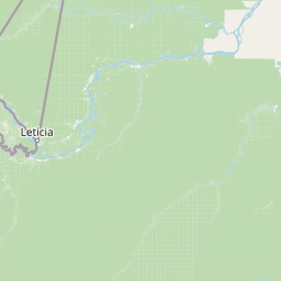
Streams
Park geography
Mapped boundaries, terrain elevation, and regional natural feature classifications
Structured Geographic Profile of Amacayacu National Natural Park in Colombia
This geographic profile presents the spatial extent of Amacayacu National Natural Park. It details the park's lowland terrain, ranging from 200 to 300 meters in elevation, alongside core environmental characteristics like tropical forest coverage, river systems, and wetland landscapes contained within the 2,935 square kilometer boundary.
Related tags
Amazon rainforestNational parkFlooded forestRiver islandsWildlife observation
Amazonian wilderness along the flooded forests of the world's most iconic river
Amacayacu National Natural Park
Amacayacu National Natural Park is a vast protected area in the southernmost region of Colombia, spanning approximately 2,935 square kilometers of pristine Amazonian rainforest along the Amazon River. The park occupies a critical position within the Amazon basin, encompassing seasonally flooded forests, river islands, and tierra firme (non-flooded) jungle that together support one of the most biodiverse ecosystems on Earth. The name Amacayacu derives from the Quechua language, translating to "River of the Hammocks," a reference to the traditional sleeping platforms used by indigenous river communities. Established in 1975 through the efforts of conservationist Julia Allen Field and Colombian environmental leaders, the park protects a landscape where the Amazon River's annual flood pulse shapes the ecology, vegetation, and wildlife patterns throughout the protected area. The park lies within the Amazonas Department, with Puerto Nariño serving as the nearest community of significance, and the terrain ranges from 200 to 300 meters above sea level with remarkably stable temperatures between 26 and 28 degrees Celsius year-round.
- Location
- Colombia
- Park type
- National park
- Established
- 1975
- Area
- 2,935 km²
Location overview
Protected land boundaries and regional placement within Colombia
Amacayacu National Natural Park Geographic Profile and Location
Amacayacu National Natural Park is situated within the sovereign territory of Colombia. Geographic records confirm its administrative status as a non-transboundary, continental protected area.
- Countries
- Colombia
- Primary location
- Colombia
- Geographic setting
- Inland
Boundary and coordinates
Mapping the 2,935 square kilometer spatial extent and geographic footprint
Boundary Map and Spatial Limits of Amacayacu National Natural Park
The mapped spatial outline provides critical geographic context for the protected wilderness boundary. Integrated regional data detail key physical metrics, including calculated total area, center coordinates, and spatial span.
- Boundary area
- 2,661.9 km²
- Boundary perimeter
- 386.1 km
- Northernmost point
- 3.0306° S
- Southernmost point
- 3.861° S
- Easternmost point
- 69.8912° W
- Westernmost point
- 70.4062° W
- Geographic centre
- 3.4333° S, 70.1421° W
- North–south span
- 91.8 km
- East–west span
- 57.2 km
Elevation and terrain
Recorded lowland relief metrics and named river and island features
Amacayacu National Natural Park Elevation Range and Terrain Geography
Recorded park elevation spans a low vertical range from two hundred to three hundred meters across lowland terrain. Feature cards catalog named streams, rivers, and islands situated within the protected landscape.
- Minimum elevation
- 200 m
- Maximum elevation
- 300 m
Selected named natural features
Rivers
Río Pureté
Streams
Quebrada Matá-Matá
Streams
Quebrada Bacaba
Forests
Bosque / Dosel selvático
Islands
Arenas
Environmental setting
Tropical lowland forest features, riverine wetlands, and major water systems
Amacayacu National Natural Park Environmental Setting and Habitat Classification
Recorded habitat types, climate zones, and relief categories provide structured ways to examine the physical setting of Amacayacu National Natural Park. These grouped classifications connect stored environmental data to broader atlas networks and regional geography.
- Relief
- Lowland
- Climate
- Tropical
- Water
- Major water bodies
- Forest cover
- Dense forest cover
- Seasonality
- Year-round
Landscape features
Rivers · Wetland
Habitat types
Tropical forest · Riverine habitat · Wetland
Park atlas
Explore the regional protected-area geography, comparing other significant conservation landscapes adjacent to Amacayacu.
Discover Other National Parks and Protected Areas Near Amacayacu National Natural Park
After exploring Amacayacu National Natural Park, continue your discovery by browsing other national parks and protected areas situated within its broader Amazonian region. Comparing these mapped protected landscapes provides valuable geographic context for understanding contiguous conservation efforts and the diverse ecosystems across the wider Amazon basin.
National parkLoreto Region
32 km away#1 closest
Northwest

Yaguas National Park: A Vast Protected Amazonian Landscape in Peru's Loreto Region
Mapping unique transboundary conservation and tropical biodiversity.
Yaguas National Park represents a monumental addition to Peru's protected lands, safeguarding an immense area of Amazonian rainforest within the Loreto Region. Its designation as a national park underscores its ecological importance as part of a critical international conservation corridor. This page provides detailed geographic context, showcasing the park's mapped boundaries, its characteristic lowland tropical forest terrain, and its role in preserving the rich biodiversity of the Amazon basin.
- Area
- 8,689 km²
- Established
- 2018
- IUCN
- II
- Relief
- Lowland
National parkPeru
416 km away#2 closest
Southwest
Sierra del Divisor National Park: Peru's Sacred Amazonian Protected Landmark
Explore dramatic mountain terrain and protected lowland rainforest.
Sierra del Divisor National Park in Peru is a vital protected area conserving over 1.35 million hectares of Amazon rainforest. Characterized by the unique Sierra del Divisor mountain range and the sacred pyramid peak of Cerro El Cono, the park offers a distinct landscape within the broader Amazon basin. As one of Peru's newer national parks, it represents a significant commitment to preserving critical biodiversity corridors and understanding the geographic context of protected lands in a region facing environmental pressures.
- Area
- 13,544.8 km²
- Established
- 2015
- IUCN
- II
- Relief
- Mixed relief
Nature reserveLoreto Region
About 455 km away#3 closest
Southwest
Tapiche Reserve: Geographic and Ecological Overview of a Peruvian Amazon Protected Area
Mapping forest mosaics and blackwater systems in Loreto
Spanning over 18,000 hectares in the Loreto Region, Tapiche Reserve protects a contiguous block of Amazonian forest. The landscape is characterized by its distinct transition from flooded aguajal swamps to well-drained terra firme slopes, all threaded by the acidic, dark waters of the Tapiche River system.
- Area
- 188.03 km²
- Relief
- Lowland
- Climate
- Tropical
- Access
- Remote access
National parkGuainía Department
531 km away#4 closest
North

Puinawai Natural Reserve National Park: Mapped Protected Landscape in Guainía Department
Explore exceptional Amazonian biodiversity and pristine natural terrain.
Puinawai Natural Reserve is a sprawling national park situated in the remote Guainía Department of Colombia. As one of the largest and most ecologically intact protected areas in the Amazon basin, it preserves a unique mosaic of humid tropical rainforest, tropical open savanna, and transitional zones. The park's immense size and isolation contribute to its remarkable state of preservation, offering a significant opportunity for atlas-driven discovery of its mapped boundaries, diverse ecosystems, and complex hydrological geography at the Amazon-Orinoco divide.
- Area
- 10,925 km²
- Established
- 1989
- IUCN
- II
- Relief
- Lowland
Wildlife reserveLoreto Region
536 km away#5 closest
Northwest
Huimeki Communal Reserve: Amazonian Geography and Protected Forest Atlas
Key wildlife reserve located in the Loreto Region, Peru
Huimeki Communal Reserve stands as a sentinel of the Putumayo basin, protecting vital lowland Amazonian environments. This reserve serves as a crucial link in a wider ecological corridor, preserving habitats that are restricted to this remote northeastern frontier of the Peruvian landscape.
- Area
- 1,412.34 km²
- Established
- 2012
- IUCN
- VI
- Relief
- Lowland
Wildlife reserveLoreto Region
539 km away#6 closest
Northwest
Airo Pai Communal Reserve: Protected Wildlife and Amazonian Landscapes in Loreto, Peru
Analyzing the geographic character of this communal wildlife reserve
Airo Pai Communal Reserve serves as a pillar of conservation in the Loreto Region of northern Peru. This wildlife reserve features a complex hydrological mosaic of upland forest, palm-dominated swamps, and periodically flooded lowlands. By protecting these vital ecosystems, the reserve ensures the continuity of both indigenous cultural heritage and the habitats of iconic Amazonian aquatic species.
- Area
- 2,478.88 km²
- Established
- 2012
- IUCN
- VI
- Relief
- Lowland
National parkColombia
About 570 km away#7 closest
Northwest
Chiribiquete National Park: A National Park in Colombia's Geographic Atlas
Explore protected land and mapped terrain within Colombia.
Chiribiquete National Park offers a crucial point for exploring Colombia's protected natural areas. As a national park, its geographic scope and mapped landscape provide valuable context for understanding conservation efforts and regional geography. This page serves as an atlas entry, detailing the park's boundaries and its importance within the broader South American context.
- Area
- 43,000 km²
- Established
- 2018
- Relief
- Mountain
- Climate
- Tropical
National parkPeru
581 km away#8 closest
Northwest
Güeppi-Sekime National Park: Protected National Park Atlas in Peru
Mapped landscape and regional geography of this Amazonian protected area.
Güeppi-Sekime National Park is a prominent protected area in Peru, recognized as a national park safeguarding a substantial expanse of tropical forest. Its landscape is characterized by diverse terrain, including rolling hills and seasonally inundated lowlands, vital for a rich tapestry of flora and fauna. The park's strategic location on the Ecuador border underscores its importance for transboundary conservation and ecological connectivity within the western Amazon basin. This page offers detailed information on its protected area identity, geographic context, and the mapped natural features that define this significant conservation landscape.
- Area
- 2,036 km²
- Established
- 2012
- IUCN
- II
- Relief
- Mixed relief
MoriAtlas Explorer
Continue Exploring Amacayacu National Natural Park's Amazonian Landscape and Geography
Deepen your understanding of Amacayacu National Natural Park by delving into its specific geographic features and protected land context. Discover the mapped boundaries, terrain characteristics, and the unique ecosystems shaped by the Amazon River. This exploration provides essential detail for anyone seeking to comprehend the park's significance within the broader Amazon basin's natural landscape and protected area network.
Browse next
Global natural geography
Explore related park routes
Explore MoriAtlas Global ParksBrowse All MoriAtlas ParksGlobal Park Map DiscoveryMoriAtlas: Browse All CountriesBrowse All MoriAtlas ContinentsNational Park Environment AtlasGrand Canyon National Park AtlasYellowstone National Park AtlasYosemite National Park Atlas and GeographySerengeti National Park AtlasGalápagos National Park Protected LandscapeBanff National Park Geography and AtlasKruger National Park Atlas EntryUluṟu-Kata Tjuṯa National Park AtlasExplore Uluru-Kata Tjuta National Park GeographyPlitvice Lakes National Park AtlasFiordland National Park Protected LandscapeGreat Smoky Mountains National Park AtlasAfghanistan National Parks and Protected AreasAlbania National Parks and Protected AreasAlgeria National Parks and Protected AreasAmerican Samoa National Parks and Protected AreasAndorra National Parks and Protected AreasAngola National Parks and Protected AreasAntarctica National Parks and Protected AreasAntigua and Barbuda Park List