
Mori Atlas logo
Marine protected areaAngafaru

Understand the mapped boundaries and regional setting of Angafaru within South Maalhosmadulu Atoll.

Angafaru Marine Protected Area: Geographic Atlas and Protected Landscape Context

Angafaru is a vital Marine Protected Area situated within the geographic expanse of South Maalhosmadulu Atoll in the Maldives. This dedicated page offers detailed insights into Angafaru's specific protected landscape identity, its mapped boundaries, and its integral role within the regional geography. Explore how Angafaru contributes to the atlas of protected natural areas, providing a foundation for understanding its unique environmental context and geographic significance.

marine protected areacoral reef ecosystemMaldives islandsturtle habitatmanta rayswhale sharks

Angafaru

Marine protected area

Park overview

Structured park overview, official facts, and landscape profile for Angafaru

Angafaru park facts, protected area profile, and essential visitor context
Review the core facts for Angafaru, including designation, size, terrain, visitor scale, habitats, and operating context in one park-focused overview.

About Angafaru

Angafaru represents a carefully delineated marine protected area in the western reaches of the Maldives archipelago, situated within South Maalhosmadulu Atoll. The protected zone encompasses the outer reef edges of four distinct subtidal features: Angafaru, Dhiguthila, Dhonfanu Thila, and Mahaangaa Thila. The boundaries extend 200 meters beyond the reef edge, creating a protective buffer that encompasses both reef crest and slope environments transitioning into pelagic waters. This strategic positioning captures the ecological gradient between established coral reef communities and the open ocean, protecting species that utilize both habitats. The declaration of Angafaru as a protected area in 2009 reflected growing recognition within the Maldives of the need to designate specific zones for marine conservation beyond general reef protection, focusing on areas with demonstrated biodiversity value and ecological significance.

Quick facts and research context for Angafaru

Angafaru is a 404-hectare marine protected area located in South Maalhosmadulu Atoll in the Maldives. Established on June 5, 2009 under directive 138-EE/2009/19, it is managed jointly by the Maldives Tourism and Hotels Enterprise (MHTE) and the Environmental Protection Agency (EPA). The protected zone encompasses the outer reef edge of four named subtidal features, creating a boundary that extends 200 meters beyond the reef edge into surrounding waters. The site is known for its rich marine biodiversity and serves as habitat for several protected marine species.

Park context

Deeper park guide and search-rich context for Angafaru

Angafaru history, landscape, wildlife, and travel context
Explore Angafaru through its history, landscape character, ecosystems, wildlife, conservation priorities, cultural context, and seasonal travel timing in a structured park guide built for atlas discovery and search intent.

Why Angafaru stands out

Angafaru is best known for its exceptional marine biodiversity and seasonal presence of large marine megafauna. The protected waters support significant populations of green turtles and hawksbill turtles, alongside diverse fish communities including groupers, bait fish, and clams. The area is particularly notable for seasonal visits from dolphins, whale sharks, and manta rays, with the reef containing designated manta ray cleaning stations where these graceful creatures gather for parasite removal. The coral communities in parts of Angafaru display remarkable diversity, making it a site of interest for marine ecological research and conservation within the Maldives archipelago.

Angafaru history and protected-area timeline

Angafaru was established as a protected area on June 5, 2009, through directive number 138-EE/2009/19. This designation represented a deliberate expansion of the Maldives' marine protected area network, identifying specific reef and surrounding marine environments that warranted formal conservation status. The management of Angafaru was assigned jointly to the Maldives Tourism and Hotels Enterprise (MHTE) and the Environmental Protection Agency (EPA), reflecting both the tourism context of the surrounding region and the environmental protection mandate required for effective conservation. The establishment came during a period when the Maldives was systematically reviewing its marine territories to identify priority areas for biodiversity protection, with particular attention to reef systems supporting significant marine life and seasonal megafauna presence.

Angafaru landscape and geographic character

The Angafaru protected area encompasses a distinctive marine landscape defined by its position at the outer margin of reef systems in South Maalhosmadulu Atoll. The reef edge here marks the transition between established coral communities and deeper open ocean waters, creating a complex underwater terrain that includes reef slopes, channels, and the subtidal features that give the area its name. The 200-meter boundary extending beyond the reef edge captures the productive zone where reef ecosystems meet pelagic environments, an area often characterized by stronger currents and greater nutrient exchange. This marginal position contributes to the site's ecological significance, as it serves as a pathway for migratory species moving between reef and ocean habitats.

Angafaru ecosystems, habitats, and plant life

The marine environment of Angafaru supports diverse ecosystems and habitat types that contribute to its protected status. The reef communities host a wide variety of coral species, with certain areas within the protected zone demonstrating particularly high coral diversity. These coral formations provide the structural foundation for the broader reef ecosystem, supporting fish communities, invertebrates, and the larger marine vertebrates that depend on healthy reef habitat. The waters surrounding Angafaru fall within a broader regional context of tropical marine ecosystems that characterize the Maldives, where consistent water temperatures, clear visibility, and extensive reef systems create conditions favorable for high marine biodiversity.

Angafaru wildlife and species highlights

Angafaru supports a notable array of marine species across multiple trophic levels. The reef environments provide critical habitat for both green turtles and hawksbill turtles, species that face significant conservation pressures throughout their ranges. Fish communities are well represented, with groupers and bait fish among the commonly encountered species. Invertebrate communities include sea cucumbers and various clam species that contribute to reef ecosystem functioning. The protected area is also significant for seasonal visitors, with dolphins, whale sharks, and manta rays observable during certain periods of the year. Manta rays are particularly associated with specific cleaning stations within the area, locations where these rays gather to be cleaned by smaller fish, providing important ecological interactions and observation opportunities.

Angafaru conservation status and protection priorities

The protected status of Angafaru reflects its significance as a area of marine biodiversity within the Maldives' extensive reef systems. By encompassing the outer reef edge with its 200-meter boundary, the designation protects both the established reef communities and the adjacent waters that serve as feeding and transit zones for larger marine species. The presence of turtle species, manta ray cleaning stations, and seasonal visits from whale sharks underscores the ecological connectivity of this area to broader marine ecosystems. The management arrangement involving both tourism and environmental protection authorities recognizes the need to balance conservation objectives with the broader development context of the Maldives, where marine resources support both ecological integrity and economic activities.

Top sights and standout views in Angafaru

The highlights of Angafaru center on its exceptional marine biodiversity and the seasonal presence of iconic ocean species. The reef supports resident populations of green and hawksbill turtles, while the surrounding waters draw seasonal visitors including dolphins, whale sharks, and manta rays. The manta ray cleaning stations represent particularly distinctive ecological features, where these large rays can be observed interacting with cleaner fish. Parts of the reef itself display remarkable coral diversity, providing the habitat foundation for the broader marine community. This combination of resident and migratory species, combined with healthy coral communities, makes Angafaru a notable site within the Maldives' system of marine protected areas.

Best time to visit Angafaru

The marine life observable at Angafaru varies with seasonal patterns, as certain species are more consistently present during specific times of year. Manta rays, dolphins, and whale sharks are reported during particular periods, suggesting that timing a visit around these seasonal patterns may enhance wildlife observation opportunities. Water conditions in the Maldives remain generally favorable for marine activities throughout the year, though conditions can vary with monsoon patterns. The warm tropical waters support year-round reef exploration, though the specific timing for optimal visibility and marine encounters may depend on which species visitors hope to observe.

Park location guide

Geography guide, regional context, and park location map for Angafaru

Angafaru park geography, regions, and map view in Maldives
Understand where Angafaru sits in Maldives through a broader geographic reading of the surrounding landscape, nearby location context, and its mapped position within the national park landscape.

How Angafaru fits into Maldives

The Maldives is an island nation in South Asia located in the Indian Ocean, southwest of Sri Lanka and India. Comprising 26 atolls stretching across the equator, it is the smallest and lowest-lying country in Asia, with an average elevation of just 1.5 metres above sea level. The country gained independence from Britain in 1965 and operates as a unitary presidential republic.

Wider geography shaping Angafaru in Maldives

The Maldives is an archipelagic nation in the eastern Arabian Sea, within the northern Indian Ocean. It lies southwest of Sri Lanka and India, approximately 750 kilometres from the Asian mainland. The country consists of 26 atolls stretching from Ihavandhippolhu Atoll in the north to Addu Atoll in the south. Though land area is only 298 km², waters span roughly 90,000 km².

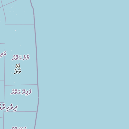
Map view of Angafaru

Use this park location map to pinpoint Angafaru in Maldives, understand its exact geographic position, and read its mapped placement within the surrounding landscape more clearly.

Pigeon | © OpenStreetMap contributors

Location context for Angafaru

South Maalhosmadulu Atoll
Park atlas

Compare the protected marine landscapes and coral reef ecosystems that surround Angafaru in the Maldives, tracing their regional geography.

Find Other Marine Protected Areas and National Parks Near Angafaru in the Maldives
After exploring Angafaru, browse other significant marine protected areas and national parks in the Maldives, focusing on their coral reef ecosystems and conservation landscapes. Comparing these protected zones helps users understand the regional geographic spread, from atoll transitions to open ocean habitats, placing Angafaru within its broader environmental context.
National parkKerala

Periyar National Park: National Park Protected Area Atlas and Geographic Context

Mapped protected lands and regional landscape exploration in Kerala.

Discover Periyar National Park as a distinct protected landscape offering rich geographic context for atlas exploration. This entry details its mapped boundaries and its significance within the broader regional geography of Kerala. Understand the natural terrain and protected-area distribution that makes Periyar National Park a key element in India's conservation mapping.

Area
350.54 km²
Established
1982
IUCN
II
Visitors
754.3K annual
National parkIdukki

Mathikettan Shola National Park: National Park Exploration and Geographic Mapping

Discover its protected landscape and regional context.

Mathikettan Shola National Park, a designated national park in the Idukki region, offers a focal point for understanding protected landscapes and their geographic distribution. This entry details the park's mapped boundaries and its specific setting within the regional geography, providing an atlas-level view of its conservation value. Users can explore the structured geographic identity of this protected natural area, enriching their understanding of India's park network.

Area
12.82 km²
Established
2003
IUCN
II
Relief
Mountain
National parkKerala

Eravikulam National Park: National Park with Mapped Protected Boundaries in Kerala

Understanding its geographic setting and landscape identity.

Delve into the protected landscape of Eravikulam National Park, a significant national park located in Kerala. This detailed entry focuses on its geographic coordinates, mapped boundaries, and its role as a distinct protected area within the regional geography. It serves as a valuable resource for exploring the park's natural terrain and its importance in conservation landscapes.

Area
97 km²
Established
1978
IUCN
II
Visitors
148.4K annual
Watercolor illustration of green hills, a river, and distant pink mountains
National parkKerala

Silent Valley National Park: Kerala's Protected Landscape and Geographic Atlas

Explore mapped boundaries and regional terrain in South India.

Silent Valley National Park stands as a key protected area within Kerala, India, offering rich insights into its geographic setting. This destination provides an atlas-driven view of the park's mapped boundaries, its integration with the surrounding regional geography, and the character of its natural landscapes. Users can engage with detailed information designed for structured exploration of protected natural areas and their mapped contexts.

Area
89.52 km²
Established
1984
IUCN
II
Relief
Mountain
National parkNilgiri District

Mukurthi National Park: Nilgiri District's Protected Montane Grassland and Shola Ecosystem

Explore a vital refuge for the endangered Nilgiri tahr.

Mukurthi National Park, situated in the Nilgiri District of India, is an essential protected area celebrated for its distinctive montane landscape. This national park plays a critical role in the survival of the endangered Nilgiri tahr, protecting the rare shola-grassland ecosystem where they thrive. Its dramatic terrain, high elevations, and unique ecological associations make it a focal point for understanding conservation geography and the mapped boundaries of protected lands within the Western Ghats.

Area
78.46 km²
Established
1990
IUCN
II
Relief
Mountain
National parkSouthern Province

Hikkaduwa National Park: Protected Area Identity and Geographic Context in Southern Province

Explore mapped boundaries and regional landscape features.

Hikkaduwa National Park stands as a vital national park, offering rich geographic details for atlas exploration. This page focuses on its protected landscape identity within Sri Lanka's Southern Province, providing insights into its mapped terrain and regional context. Understand the park's specific place in the landscape, ideal for users seeking structured geographic data and detailed map-based insights into protected natural areas.

Area
1.016 km²
Established
2002
IUCN
II
Climate
Tropical
National parkWestern Province

Horagolla National Park: Sri Lanka's Mapped Protected National Park in Western Province

Explore geographic boundaries and protected landscape context.

Horagolla National Park represents a significant protected natural area within Sri Lanka's Western Province. This detail page offers users the opportunity to examine the park's specific geographic setting, its mapped protected boundaries, and its overall context within the island's atlas of natural landscapes. Gain a structured understanding of this national park entity and its regional geographic features.

Area
0.33 km²
Established
1973
IUCN
II
Relief
Lowland
Watercolor painting showing green fields, pink and yellow areas, and distant mountains
National parkNilgiri District

Mudumalai National Park: National Park Identity and Geographic Context in Nilgiri District

Mapped protected area and natural terrain details for this key Indian park.

Delve into the specific geographic identity of Mudumalai National Park, a protected national park situated in the Nilgiri District. This detail page provides access to its mapped natural landscape, helping users understand its protected boundaries and regional geographic significance. It serves as a foundational point for exploring the park's unique terrain within India's atlas of natural protected areas.

Area
321 km²
Established
1940
IUCN
II
Relief
Mountain

Common questions about visiting, size, designation, and location context for Angafaru

Angafaru FAQs for park facts, access, geography, and protected area context
Find quick answers about Angafaru, including protected-area facts, park geography, trail and visitor context, and how the park fits into its surrounding country and regional landscape.
MoriAtlas Explorer

Continue Your Protected Areas Search Across the Global Atlas

Deepen your exploration by continuing the structured search for national parks and protected areas worldwide. Utilize the comprehensive filtering capabilities to compare different conservation landscapes and refine your understanding of global park geography. Discover more about the distribution and characteristics of protected natural areas.

Global natural geography