
Mori Atlas logo
National parkAouk National Park

Discover the mapped boundaries and regional geography of this protected area in Chad.

Aouk National Park National Park: Protected Landscape Identity and Geographic Atlas Context

Aouk National Park represents a key protected landscape within Chad, offering a unique entry point for exploring national park geography and mapped boundaries. As a designated national park, it contributes to the understanding of protected areas within Central Africa. This atlas-focused perspective allows for detailed examination of the park's geographic setting and its significance as a conservation landscape, providing a structured view for those interested in the mapped terrain and regional context of protected lands in Chad.

national parksavannawildlifesafariChadprotected area

Aouk National Park

National park

Park overview

Structured park overview, official facts, and landscape profile for Aouk National Park

Aouk National Park park facts, protected area profile, and essential visitor context
Review the core facts for Aouk National Park, including designation, size, terrain, visitor scale, habitats, and operating context in one park-focused overview.

About Aouk National Park

Aouk National Park occupies a significant territory in the southeastern part of Chad, within the Salamat Region. The park's extensive area encompasses diverse habitats that transition from open savanna to woodland corridors and seasonal floodplains. These varied ecosystems create a mosaic of environments that support a wide range of wildlife species. The park's remote location has both protected it from certain development pressures and presented challenges for effective management and enforcement. Despite these difficulties, Aouk maintains populations of wildlife that draw interest from safari operators and nature enthusiasts seeking to experience Chad's lesser-known protected areas. The park contributes to Chad's network of national parks, which collectively aim to preserve the country's biodiversity heritage across different ecological zones from the Sahara in the north to the savannas of the south.

Quick facts and research context for Aouk National Park

Aouk National Park spans roughly 7,400 square kilometers in southeastern Chad, making it one of the country's largest protected areas. The park is situated in the Salamat Region, characterized by a mix of savanna woodlands, grassy plains, and seasonal wetlands. It is classified as an IUCN Category II protected area, reflecting its national park status. The region experiences a subtropical climate with distinct wet and dry seasons, influencing the park's ecological cycles and wildlife behavior.

Park context

Deeper park guide and search-rich context for Aouk National Park

Aouk National Park history, landscape, wildlife, and travel context
Explore Aouk National Park through its history, landscape character, ecosystems, wildlife, conservation priorities, cultural context, and seasonal travel timing in a structured park guide built for atlas discovery and search intent.

Why Aouk National Park stands out

Aouk National Park is known for its impressive diversity of mammals and birds, despite not receiving the same level of protection and attention as some of Chad's other parks such as Zakouma. The park's savanna and woodland habitats support populations of large herbivores and predators, while its wetlands provide critical habitat for waterbird species. The park offers safari experiences in a remote corner of Chad, away from more crowded tourism destinations, allowing visitors to explore a wilderness area that retains much of its natural character.

Aouk National Park history and protected-area timeline

Aouk National Park was established as part of Chad's efforts to designate protected areas that preserve the country's natural landscapes and wildlife. The park was created to provide legal protection to the ecosystems and species found in the southeastern portion of the country. While the park has existed as a protected area, it has faced challenges related to funding, staffing, and enforcement capacity. Compared to Zakouma National Park, which has received more focused conservation investment and attention, Aouk has struggled to realize its full protective potential. Nevertheless, the park's designation as a national park has provided a framework for ongoing conservation efforts in the region.

Aouk National Park landscape and geographic character

The landscape of Aouk National Park consists primarily of tropical savanna and woodland ecosystems characteristic of southeastern Chad. The terrain includes open grassy plains interspersed with woodland areas and riparian zones along watercourses. The region receives seasonal rainfall that creates temporary wetlands and floodplains during the wet season. The vegetation patterns reflect the transition between Central African forest ecosystems and the more open savannas of the Sahel zone. Rolling terrain and scattered tree clusters define the visual character of the park, creating a classic African savanna landscape.

Aouk National Park ecosystems, habitats, and plant life

Aouk National Park protects important savanna and woodland habitats that form part of the broader Central African ecological region. The park's ecosystems support a diversity of plant communities adapted to the subtropical climate and seasonal water availability. These habitats provide ecological services including water regulation, soil preservation, and carbon storage. The protected area connects with surrounding landscapes, allowing for wildlife movement patterns that maintain genetic exchange between populations. The wetlands within the park serve as important ecological features, supporting both wildlife and contributing to the broader hydrological system of the Salamat Region.

Aouk National Park wildlife and species highlights

Aouk National Park is home to a notable mix of mammals and bird species. The park's mammal populations include various ungulate species adapted to savanna environments, as well as predators that follow the herbivore herds. The birdlife in the park is particularly diverse, with waterbird species utilizing the wetlands and forest birds found in the woodland areas. The park provides habitat for species that have declined in other parts of Chad due to hunting pressure and habitat loss. While comprehensive species surveys are limited, the park's wildlife assemblages represent an important conservation asset for the country.

Aouk National Park conservation status and protection priorities

Aouk National Park represents an important component of Chad's protected area network, contributing to the preservation of the country's biodiversity outside the more well-known Zakouma National Park. The park's designation as an IUCN Category II protected area indicates its role in conserving natural landscapes and associated wildlife. Conservation challenges in the region include limited resources for park management, enforcement difficulties in remote areas, and competing land uses. The park's relative remoteness provides some protection from certain development pressures, but also complicates conservation efforts that require sustained investment and presence. Maintaining the park's wildlife populations and habitats requires ongoing attention to protection measures and support for conservation activities in the region.

Aouk National Park cultural meaning and human context

Aouk National Park is located in the Salamat Region, an area with local communities whose traditional land use practices have shaped the landscape over generations. The region's communities maintain connections to the land and natural resources that the park now protects. While the park's establishment created a protected zone, the surrounding areas continue to support pastoral and agricultural activities by local populations. Understanding the relationship between protected area management and community livelihoods remains relevant for the park's long-term conservation success.

Top sights and standout views in Aouk National Park

Aouk National Park offers visitors the chance to explore a vast, relatively undeveloped protected area in one of Africa's less-visited countries. The park's wildlife, particularly its mammal and bird populations, provides the primary attraction for safari excursions. The remote character of the park means that visitors can experience a sense of wilderness that is increasingly rare in more heavily touristed African destinations. The park's size and diversity of habitats create opportunities for varied wildlife viewing experiences across different parts of the protected area.

Best time to visit Aouk National Park

The optimal time to visit Aouk National Park coincides with the dry season, typically from November to April, when wildlife is more concentrated around water sources and vegetation is less dense, improving visibility. The wet season from May to October brings green landscapes but also makes some areas less accessible and wildlife more dispersed. Visitors planning trips to the park should consider the seasonal patterns when making travel arrangements.

Park location guide

Geography guide, regional context, and park location map for Aouk National Park

Aouk National Park park geography, regions, and map view in Chad
Understand where Aouk National Park sits in Chad through a broader geographic reading of the surrounding landscape, nearby location context, and its mapped position within the national park landscape.

How Aouk National Park fits into Chad

Chad is a landlocked Central African nation spanning approximately 1.28 million km². It borders six countries and contains three distinct regions: the Sahara desert in the north, the Sahel in the center, and the Sudanian Savanna in the south. Lake Chad, after which the country is named, is the second-largest wetland in Africa. Chad gained independence from France in 1960 and has a population of about 19 million.

Wider geography shaping Aouk National Park in Chad

Chad is located in Central Africa and is landlocked, bordered by six countries. The terrain varies from the Sahara desert in the north through the Sahel arid zone in the center to the more fertile Sudanian Savanna in the south. Lake Chad, a major shallow wetland, lies in the southwestern part of the country near the Nigeria border.

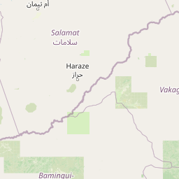
Map view of Aouk National Park

Use this park location map to pinpoint Aouk National Park in Chad, understand its exact geographic position, and read its mapped placement within the surrounding landscape more clearly.

Pigeon | © OpenStreetMap contributors
Park atlas

Trace the mapped geography and regional spread of protected areas in Central Chad and adjacent savanna landscapes, comparing their conservation value.

Explore National Parks and Protected Areas Geographically Related to Aouk National Park
Expand your protected area discovery by examining national parks and other conservation landscapes in Chad and the surrounding Central African savanna region, building on the context of Aouk National Park. Compare the distinct geographic features, ecological diversity, and conservation approaches across a wider selection of mapped protected areas.
National parkGuéra Region

Zakouma National Park: Chad's Premier National Park and Protected Landscape

Explore the mapped savanna, acacia forests, and wildlife geography.

Zakouma National Park is Chad's oldest and most ecologically vital protected area, spanning 3,000 square kilometers of Sudano-Sahelian landscape. Situated within the Guéra Region, it is globally recognized for its exceptional Kordofan giraffe population, significant elephant recovery, and ongoing conservation successes, offering a unique view into African wildlife and protected area management.

Area
3,000 km²
Established
1963
IUCN
II
Relief
Lowland
National parkMoyen-Chari Region

Manda National Park: National Park Protected Landscape and Geographic Identity in Moyen-Chari

Discover mapped terrain and regional context for this Chad national park.

Manda National Park, a protected natural area within Chad's Moyen-Chari Region, offers valuable insights into regional geography and mapped protected landscapes. This detail page provides focused information on the park's identity as a national park, emphasizing its geographic setting and the importance of its mapped boundaries for structured atlas exploration. Understand how this protected area contributes to the diverse natural terrain of the Moyen-Chari Region.

Area
1,140 km²
Established
1969
IUCN
II
Climate
Tropical
National parkSila Province

Goz Beïda National Park: National Park Protected Landscape and Geographic Context

Explore mapped boundaries and regional terrain.

Gain a structured understanding of Goz Beïda National Park, a key protected area within Sila Province. This detail page provides insights into its geographic setting, offering mapped landscape context for atlas-based discovery. Learn about the park's specific protected area identity and its position within the regional geography.

Area
3,000 km²
IUCN
II
Scope
Terrestrial
Water
No major water
National parkSudan

Radom National Park: A National Park in Sudan Offering Protected Landscape and Geographic Context

Explore mapped boundaries and regional terrain within Sudan.

Radom National Park is an important protected area designated as a national park in Sudan. This entry focuses on its specific geographic features and landscape characteristics, providing users with a detailed view of its mapped boundaries and regional context. Understanding Radom National Park's place within the atlas of African protected lands helps illuminate its natural terrain and conservation significance.

Area
12,509.7 km²
Established
1980
IUCN
II
Relief
Lowland
National parkFar North Region

Waza National Park: A Designated Protected Landscape in the Far North Region

Mapped Boundaries and Regional Geographic Context

Waza National Park stands as a vital protected natural landscape in Cameroon's Far North Region. This entry provides a deep dive into its mapped protected-area boundaries and its significance within the broader regional geography. Explore the specific landscape identity of this national park through an atlas-focused lens, understanding its terrain and context without travel logistics or visitor advice.

Area
1,700 km²
Established
1934
IUCN
II
Relief
Lowland
National parkCameroon

Bouba Njida National Park: A Protected Landscape within Cameroon's National Park Atlas

Discover its mapped geography and regional context.

Bouba Njida National Park represents a key component of Cameroon's protected lands, contributing essential context to any atlas of Central African geography. As a designated national park, it offers a distinct focus for understanding mapped landscape features and the distribution of protected areas within the country. This park serves as a vital point of reference for exploring the nation's natural terrain and its significance within the broader context of regional conservation efforts.

Area
2,200 km²
Established
1980
IUCN
II
Relief
Upland
National parkNigeria

Chad Basin National Park: Exploring Nigeria's Protected Natural Landscape

Mapped protected area and regional geography context.

Chad Basin National Park is a key protected landscape within Nigeria, designated as a national park. This page serves as a gateway to understanding its specific geographic identity, mapped boundaries, and its role within the country's natural terrain. Users can explore detailed information, focusing on the park's atlas-relevant features and its contribution to Nigeria's protected areas, offering a distinct view of the nation's geography.

Area
2,258 km²
Established
1991
IUCN
II
Relief
Lowland
Watercolor illustration of a landscape with rolling hills, a winding river, and varied terrain in soft colors
National parkBénoué Department

Bénoué National Park: Protected Landscape Atlas in Bénoué Department, Cameroon

Explore savanna woodland, riparian ecosystems, and geographic context.

Bénoué National Park is a vast protected landscape in Cameroon, defined by its Sudanian savanna woodland and significant frontage along the Bénoué River. Recognized as a UNESCO Biosphere Reserve, it offers critical insights into regional geography, habitat diversity, and the broader atlas of conservation lands in West Africa. Users can explore its varied terrain, from riverine zones to higher massifs, gaining a detailed understanding of this important protected area.

Area
1,800 km²
Established
1968
IUCN
II
Relief
Mixed relief

Common questions about visiting, size, designation, and location context for Aouk National Park

Aouk National Park FAQs for park facts, access, geography, and protected area context
Find quick answers about Aouk National Park, including protected-area facts, park geography, trail and visitor context, and how the park fits into its surrounding country and regional landscape.
MoriAtlas Explorer

Continue Your Protected Areas Search Across the Global Atlas

Deepen your exploration by continuing the structured search for national parks and protected areas worldwide. Utilize the comprehensive filtering capabilities to compare different conservation landscapes and refine your understanding of global park geography. Discover more about the distribution and characteristics of protected natural areas.

Global natural geography
