
Peaks
Park geography
Mapping the natural landscape, boundaries, and regional context of this protected area
Comprehensive Geographic and Terrain Profile of Avon Valley National Park in Western Australia
This geographic profile details the physical dimensions and environmental characteristics of Avon Valley National Park. Spanning across a recorded area of 43.66 square kilometers, the park includes diverse terrain features such as the Avon River, Bald Hill, and Emu Falls set within a temperate broadleaf forest ecosystem.
Related tags
National ParkWestern AustraliaJarrah WoodlandBirdwatchingWildflowers
Western Australian jarrah woodland and birdwatching sanctuary
Avon Valley National Park
Avon Valley National Park is a protected natural area in Western Australia, situated approximately 47 kilometres northeast of Perth near the town of Toodyay. The park covers an area of 43.66 square kilometres and was officially established in 1970, taking its name from the Avon River which flows through the valley. The landscape consists of an undulating plateau with the valley sides steeply descending approximately 200 metres down to the river corridor below. Granite outcrops punctuate the terrain, and the soils include loams, gravels and lateritic sands that support distinctive southwestern Australian vegetation communities.
- Location
- Australia
- Park type
- National park
- Established
- 1970
- Area
- 43.7 km²
Location overview
National and regional territory placement within Western Australia
Geographic Position of Avon Valley National Park in Western Australia
Avon Valley National Park is situated entirely within the state of Western Australia under Australian jurisdiction. Geographic records confirm its status as an inland reserve with no marine or coastal boundaries.
- Countries
- Australia
- Regions
- Western Australia
- Primary location
- Western Australia
- Geographic setting
- Inland
Boundary and coordinates
Spatial footprint, coordinate limits, and 43.66 square kilometer area
Avon Valley National Park Boundary Mapping and Geographic Limits
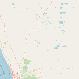
Interactive spatial mapping illustrates the shape and layout of the park relative to the surrounding region. Supporting geographic data details the area of 43.66 square kilometers alongside calculated coordinate limits and center points.
- Boundary area
- 44.6 km²
- Boundary perimeter
- 77.7 km
- Northernmost point
- 31.5628° S
- Southernmost point
- 31.6645° S
- Easternmost point
- 116.2826° E
- Westernmost point
- 116.1538° E
- Geographic centre
- 31.6046° S, 116.2172° E
- North–south span
- 11.3 km
- East–west span
- 12.2 km
Terrain and natural features
Mixed terrain classifications and verified natural landforms
Avon Valley National Park Terrain Explorer And Named Features
Recorded natural features include Bald Hill, Emu Falls, and Avon River positioned within the mixed terrain classification. Linked feature cards supply names, types, measurements, and spatial relationships where recorded.
Selected named natural features
Rapids
Emu Falls
Rivers
Avon River
Environmental setting
Temperate broadleaf forest, river valleys, and plateau relief profiles
Avon Valley National Park Environmental Classifications and Physical Settings
Recorded landscape features and habitat types provide complementary perspectives on the physical setting of Avon Valley National Park. Linked categories connect stored environmental classifications to relevant atlas destinations where available.
- Relief
- Mixed relief
- Water
- Major water bodies
- Forest cover
- Partial forest
Landscape features
Plateau · Valleys · Rivers · Forest · Cave
Habitat types
Temperate broadleaf forest
Park atlas
Trace the geographic spread of protected areas and compare similar landscapes across Western Australia near Avon Valley National Park.
Explore Nearby National Parks and Protected Areas Beyond Avon Valley National Park in Western Australia
After exploring Avon Valley National Park, browse other national parks and protected areas situated within its surrounding region of Western Australia. Gain valuable regional context and compare diverse conservation landscapes, from river valleys to granite outcrops, to deepen your geographic understanding.
National parkWestern Australia
3.7 km away#1 closest
Southwest

Walyunga National Park: National Park Discovery in Western Australia's Geographic Landscape
Mapped boundaries and regional protected area context.
Walyunga National Park serves as a key protected area within the expansive geography of Western Australia. This detailed view focuses on its identity as a national park, offering insights into its mapped landscape and its specific role within the state's conservation network. Users can explore its protected boundaries and understand its place in the regional geography, contributing to a structured atlas of natural areas.
- Area
- 18.14 km²
- Established
- 1970
- IUCN
- II
- Relief
- Mixed relief
Wildlife reserveWestern Australia
About 19 km away#2 closest
South
Karakamia Sanctuary: Geography and Wildlife Reserve Conservation in Western Australia
Mapped landscapes and mammal recovery in the Darling Scarp.
Located in the Darling Scarp of Western Australia, Karakamia Sanctuary is a protected wildlife reserve defined by its lateritic plateau and jarrah forest ecosystems. This reserve provides a critical refuge for species recovery through predator exclusion and habitat management, offering a clear window into the ecological restoration of the region.
- Area
- 2.75 km²
- Established
- 1992
- Relief
- Upland
- Climate
- Mediterranean
National parkWestern Australia
20 km away#3 closest
South
John Forrest National Park: National Park Atlas and Western Australia Protected Landscape
Mapped boundaries and regional geographic context.
Delve into the atlas-level details of John Forrest National Park, a protected area situated in Western Australia. This park's designation as a national park provides a focal point for understanding its specific geographic features and mapped extent. Users can explore its place within the broader regional geography of Western Australia, gaining structured insight into the protected landscape.
- Area
- 26.78 km²
- Established
- 1900
- IUCN
- II
- Relief
- Upland
National parkWestern Australia
27 km away#4 closest
South
Beelu National Park: Exploring Western Australia's Protected Jarrah-Marri Forest Landscape
Mapped Geographic Context & Natural Terrain Discovery
Beelu National Park, situated in Western Australia's Darling Range, offers an immersive experience within old-growth jarrah-marri forests. This protected area provides a vital glimpse into the region's natural landscapes, characterized by rolling hills and the Helena River valley. Users can explore the park's geographic setting, its mapped boundaries, and the unique ecological context it preserves. It stands as a significant natural reserve contributing to the understanding of Western Australia's conservation efforts and diverse terrain.
- Area
- 46.17 km²
- Established
- 1995
- IUCN
- II
- Relief
- Highland
National parkWestern Australia
28 km away#5 closest
South
Greenmount National Park: Western Australia National Park Landscape and Geography Atlas
Explore its protected boundaries and regional landscape context.
Greenmount National Park represents a distinct protected landscape within the diverse geography of Western Australia. As a National Park, its mapped boundaries are integral to understanding its regional context and offering users a point of detailed geographic discovery. This entry provides essential data on its protected status and geographic setting, supporting exploration of Australia's significant natural areas through an atlas-driven lens.
- Area
- 2.02 km²
- Established
- 1970
- IUCN
- II
- Relief
- Upland
National parkWestern Australia
32 km away#6 closest
South
Gooseberry Hill National Park: A Protected Landscape in Western Australia's Geography
Explore mapped boundaries and regional park context.
Gooseberry Hill National Park is a significant protected area designated as a national park within the diverse geography of Western Australia. This entry provides detailed insights into its specific location, mapped boundaries, and role as a conservation landscape. Understand how Gooseberry Hill National Park contributes to the broader atlas of protected lands in Western Australia, offering a foundational view for geographic exploration and landscape context.
- Area
- 0.33 km²
- Established
- 1970
- IUCN
- II
- Relief
- Highland
National parkWestern Australia
33 km away#7 closest
South
Kalamunda National Park: Explore Darling Scarp Woodland & Western Australia's Natural Terrain
A protected national park with distinct mapped landscape features.
Kalamunda National Park is an essential protected area located on the western slopes of the Darling Scarp, offering a clear representation of southwestern Australia's characteristic eucalypt woodland ecosystems. Its geography is defined by the escarpment's terrain, supporting tall marri, jarrah, and wandoo forests with a diverse understorey. As a national park, it provides critical habitat and contributes to the regional landscape context within Western Australia, making it a valuable point for atlas-driven discovery of protected natural areas.
- Area
- 3.75 km²
- Established
- 1964
- IUCN
- II
- Relief
- Mixed relief
National parkWheatbelt
34 km away#8 closest
Southeast
Wandoo National Park National Park: Explore Protected Landscape and Geographic Boundaries
Discover Wheatbelt's mapped protected area.
Wandoo National Park is a designated national park situated in Australia's Wheatbelt region, offering a focal point for understanding protected landscapes. This page provides detailed geographic context for the park, highlighting its mapped boundaries and its significance within the broader regional geography. Users can explore the park's protected area status and its contribution to the mapped natural landscape of Western Australia, serving as a key entry point for atlas-based discovery.
- Area
- 463.68 km²
- Established
- 2004
- IUCN
- II
- Climate
- Temperate
MoriAtlas Explorer
Continue Exploring Avon Valley National Park's Protected Landscape Geography
Further your atlas exploration of Avon Valley National Park by examining its detailed protected-area boundaries and geographic setting. Understanding this national park's unique landscape context within Western Australia provides valuable insights for any map-based or regional geography discovery. Continue to map its protected terrain and its significance within Australia's conservation network.
Browse next
Global natural geography
Explore related park routes
Explore MoriAtlas Global ParksBrowse All MoriAtlas ParksGlobal Park Map DiscoveryMoriAtlas: Browse All CountriesBrowse All MoriAtlas ContinentsNational Park Environment AtlasGrand Canyon National Park AtlasYellowstone National Park AtlasYosemite National Park Atlas and GeographySerengeti National Park AtlasGalápagos National Park Protected LandscapeBanff National Park Geography and AtlasKruger National Park Atlas EntryUluṟu-Kata Tjuṯa National Park AtlasExplore Uluru-Kata Tjuta National Park GeographyPlitvice Lakes National Park AtlasFiordland National Park Protected LandscapeGreat Smoky Mountains National Park AtlasAfghanistan National Parks and Protected AreasAlbania National Parks and Protected AreasAlgeria National Parks and Protected AreasAmerican Samoa National Parks and Protected AreasAndorra National Parks and Protected AreasAngola National Parks and Protected AreasAntarctica National Parks and Protected AreasAntigua and Barbuda Park List