Mori Atlas logo
National parkBanke National Park

Discover the mapped boundaries and regional geographic context of this protected national park in Nepal.

Banke National Park: National Park of Nepal, Mapped Landscape and Protected Area Geography

Banke National Park stands as a significant protected natural landscape within Nepal, offering a detailed view for geographic and atlas-based exploration. As a designated national park, its mapped boundaries contribute to understanding the distribution of protected areas across the South Asian region. This page focuses on Banke National Park's specific identity as a protected territory, providing context for its natural terrain and its placement within the broader geographical framework of Nepal.

National ParkSiwalik HillsTiger ConservationBengal TigerFour-horned AntelopeSubtropical Forest

Banke National Park

National park

Park overview

Structured park overview, official facts, and landscape profile for Banke National Park

Banke National Park park facts, protected area profile, and essential visitor context
Review the core facts for Banke National Park, including designation, size, terrain, visitor scale, habitats, and operating context in one park-focused overview.

About Banke National Park

Banke National Park represents Nepal's commitment to conserving the biodiversity of its Siwalik Hills region, established as the tenth national park in the country's protected area network. The park's location in western Nepal places it within the larger Terai Arc Landscape, a priority conservation area that spans the lowland ecosystems along the southern foothills of the Himalayas. The park's terrain is dominated by the Siwalik formation, characterized by steep ridges, narrow valleys, and undulating hillsides that have been shaped by ancient geological processes. The vegetation communities reflect the subtropical climate of the region, with sal-dominated forests covering the lower slopes and transitional forest types on the higher terrain. Banke's conservation significance is amplified by its connection to Bardia National Park, creating a continuous protected area that supports viable populations of large carnivores and their prey species. The buffer zone surrounding the core protected area involves three districts and reflects a community-based conservation approach that integrates local livelihoods with wildlife protection. The park's establishment in 2010 marked a significant expansion of Nepal's national park system into the western Siwalik region, addressing gaps in conservation coverage that had existed in this biodiversity-rich area.

Quick facts and research context for Banke National Park

Banke National Park lies in the Siwalik Hills of western Nepal, approximately 400 kilometers west of Kathmandu. The park was established on 12 July 2010 and covers 550 square kilometers, making it one of Nepal's larger protected areas. It forms the western component of the Bardia-Banke Tiger Conservation Unit, a 1,518 square kilometer contiguous protected landscape that represents one of the most important tiger habitats in Asia. The nearest settlement of note is Kohalpur, which serves as a gateway community for visitors accessing the park. The vegetation reflects the subtropical bioclimate of the Siwalik zone, with sal forest as the dominant tree community.

Park context

Deeper park guide and search-rich context for Banke National Park

Banke National Park history, landscape, wildlife, and travel context
Explore Banke National Park through its history, landscape character, ecosystems, wildlife, conservation priorities, cultural context, and seasonal travel timing in a structured park guide built for atlas discovery and search intent.

Why Banke National Park stands out

Banke National Park is best known as a critical habitat for Bengal tigers within the transboundary tiger conservation landscape of the Bardia-Banke Tiger Conservation Unit. The park protects one of the last remaining extensive tracts of subtropical Siwalik forest ecosystem in Nepal, harboring significant populations of four-horned antelopes and other endangered wildlife. Its position along the Karnali River corridor makes it an important area for biodiversity conservation in the Terai-Siwalik ecological gradient, representing a transition zone between the Himalayan foothills and the Gangetic plain.

Banke National Park history and protected-area timeline

Banke National Park was officially established on 12 July 2010, becoming Nepal's tenth national park and the second protected area in the Banke District following the designation of the earlier Banke Wildlife Reserve. The creation of the park fulfilled a long-standing conservation priority to provide formal protection to the Siwalik forests of western Nepal, which had faced increasing pressure from agricultural expansion and resource extraction. The park's designation as a Gift to the Earth reflects the international recognition of its ecological significance, particularly as a component of the larger Bardia-Banke conservation landscape. Prior to national park status, the area had existed as a wildlife reserve, and its elevation to national park status provided enhanced legal protection and administrative resources. The establishment also coincided with Nepal's broader push to expand its network of protected areas and strengthen tiger conservation efforts, as the Bardia-Banke region had been identified as one of the most promising areas for tiger population recovery in the country.

Banke National Park landscape and geographic character

The physical landscape of Banke National Park is defined by its location in the Siwalik Hills, the southernmost mountain range of the Himalayas also known as the Churia Hills. The terrain consists of steep, east-west trending ridges separated by narrow valleys and seasonal watercourses that drain into the Karnali River system. The elevation range within the park spans from the lower foothills to approximately 1,000 meters above sea level, creating a topographic diversity that supports varied habitat types. The underlying geology consists of sedimentary formations including sandstones, siltstones, and conglomerates that have been folded and uplifted, resulting in the characteristic ridge-and-valley topography. The park contains several perennial and seasonal streams that provide critical water sources for wildlife, particularly during the dry season. The landscape transitions from the steeper, forested slopes of the Siwaliks to more gentle terrain at the park's periphery, where agricultural lands and settlements create the boundary with the buffer zone.

Banke National Park ecosystems, habitats, and plant life

The ecological character of Banke National Park reflects the subtropical climate of the Siwalik zone, supporting diverse vegetation communities that include at least 113 tree species, 107 herbal species, and 85 shrub and climber species. Sal forest dominates the lower elevations, forming a dense canopy that provides critical habitat for many wildlife species. The tree species composition includes sal as the dominant species, along with axlewood, Semecarpus anacardium, khair, and Terminalia alata as common associates. The forest structure varies from pure sal stands in some areas to mixed deciduous forests on slopes receiving more sunlight. The park's position along the Karnali River system creates ecological connectivity that facilitates wildlife movement between the Siwalik hills and the Terai floodplains, supporting the large mammal communities that require extensive home ranges. The diverse vegetation supports a corresponding diversity of invertebrate and vertebrate species, making the park a biodiversity hotspot within the Terai Arc Landscape.

Banke National Park wildlife and species highlights

Banke National Park supports significant populations of large mammals, with the Bengal tiger being the flagship species and primary conservation focus. The park forms part of the Bardia-Banke Tiger Conservation Unit, which represents one of the most important tiger habitats in Nepal and potentially one of the last areas in the country capable of supporting viable tiger populations. The four-horned antelope, a species of conservation concern, is among the notable ungulate species found within the park. Small mammal diversity includes the ruddy mongoose, which was first recorded in the park in 2014, expanding the known range of this species. The diverse forest habitats support numerous bird species and smaller mammals that form the prey base for larger carnivores. The park's connectivity to Bardia National Park allows for wildlife movement across a larger landscape, supporting genetic exchange between populations and enhancing long-term conservation viability.

Banke National Park conservation status and protection priorities

Banke National Park plays a crucial role in Nepal's conservation strategy, particularly regarding tiger recovery and Siwalik ecosystem protection. The park's inclusion in the Bardia-Banke Tiger Conservation Unit represents a landscape-level approach to conservation that recognizes the space requirements of large carnivores and the importance of connectivity between protected areas. The 1,518 square kilometer coherent protected area formed by Banke and Bardia represents one of the largest contiguous conservation landscapes in Nepal and serves as a model for integrated conservation planning. The surrounding buffer zone of 344 square kilometers reflects a collaborative approach that involves local communities in conservation through sustainable resource use and anti-poaching efforts. The park's designation as a Gift to the Earth acknowledges its global significance as a representative sample of Siwalik biodiversity and its contribution to international conservation targets for species like the Bengal tiger.

Banke National Park cultural meaning and human context

Banke National Park is located in a region of Nepal with rich cultural heritage, situated within Lumbini Province near the birthplace area of the Buddha. The local communities in the surrounding Banke, Salyan, and Dang Deukhuri Districts have historical connections to the landscape, with traditional land use practices that have shaped the region's character. The buffer zone approach recognizes these community relationships and seeks to balance conservation objectives with the livelihoods of people who have inhabited the area for generations. While the park itself focuses on wildlife protection, the broader region includes important cultural sites and the buffer zone management involves local stakeholders in conservation planning.

Top sights and standout views in Banke National Park

The Banke-Bardia conservation landscape represents one of Nepal's last great wilderness areas, protecting extensive Siwalik forest ecosystems and supporting viable populations of Bengal tigers. The park's position in the Siwalik Hills creates distinctive terrain with forested ridges and valleys that offer a different character from the more famous Terai parks of central Nepal. The diversity of vegetation, with over 100 tree species, supports a corresponding richness of wildlife and creates a vibrant forest environment. The relatively recent establishment of the park in 2010 means it remains one of Nepal's less-visited national parks, offering a wilder and more remote experience compared to more established destinations.

Best time to visit Banke National Park

The optimal time to visit Banke National Park coincides with the dry season from October through May, when wildlife viewing opportunities are best as animals concentrate around remaining water sources. The period from November to February offers comfortable temperatures and clear skies, making it the most popular time for visitors. The pre-monsoon months of March through May can be particularly good for wildlife viewing as the landscape dries, though temperatures may rise significantly. The monsoon season from June to September brings heavy rainfall to the Siwalik region, making some areas difficult to access and reducing visibility for wildlife observation.

Park location guide

Geography guide, regional context, and park location map for Banke National Park

Banke National Park park geography, regions, and map view in Nepal
Understand where Banke National Park sits in Nepal through a broader geographic reading of the surrounding landscape, nearby location context, and its mapped position within the national park landscape.

How Banke National Park fits into Nepal

Nepal is a federal parliamentary republic in South Asia, landlocked between China and India. It spans the Himalayas and includes eight of the world's ten highest mountains. Kathmandu is the capital and largest city.

Wider geography shaping Banke National Park in Nepal

Nepal is located in South Asia, landlocked between China to the north and India to the south, east, and west. The country occupies the Himalayan region in the north and extends into the Indo-Gangetic Plain in the south. Terrain includes the Terai lowlands, subalpine hills, and the Himalayas with peaks including Mount Everest.

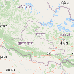
Map view of Banke National Park

Use this park location map to pinpoint Banke National Park in Nepal, understand its exact geographic position, and read its mapped placement within the surrounding landscape more clearly.

Pigeon | © OpenStreetMap contributors

Location context for Banke National Park

Lumbini Province
Park atlas

Compare Banke National Park with adjacent protected landscapes, tracing interconnected Siwalik Hill ecosystems across western Nepal and the broader Terai.

Explore Other National Parks and Protected Areas Near Banke National Park, Nepal
Browse additional national parks and protected areas geographically near Banke National Park, exploring the extensive Siwalik Hill landscapes and important conservation corridors of western Nepal. This curated selection allows for direct comparison of protected-area features and regional spread, deepening your atlas-based understanding of Nepal's unique ecological zones.
National parkBardiya District

Bardiya National Park: Nepal's Expansive Terai Protected Landscape and Atlas

Mapped geography, tiger habitat, and rhino conservation in Bardiya District.

Bardiya National Park represents a significant protected area within Nepal's Terai lowlands, providing an exceptional resource for geographic discovery. Its diverse terrain, including vast grasslands and dense forests bisected by major river systems like the Karnali and Babai, creates unique ecosystems. As the largest national park in Nepal, it is instrumental in mapping wildlife corridors and understanding regional landscape dynamics, particularly for endangered species such as Bengal tigers and Indian rhinoceroses. This park offers a profound glimpse into the mapped natural heritage of the Bardiya District.

Area
968 km²
Established
1988
IUCN
II
Relief
Mixed relief
National parkLakhimpur Kheri district

Dudhwa National Park: Terai Grasslands and Alluvial Plain Geography within Lakhimpur Kheri

Discover the mapped protected landscape of this vital Indian national park.

Dudhwa National Park in Lakhimpur Kheri district stands as a crucial example of the Terai grassland ecosystem, characterized by its expansive alluvial plains and marshy habitats. This page provides an atlas-style exploration of its protected landscape, detailing the unique terrain and geographic context essential for understanding its conservation significance.

Area
614 km²
Established
1977
IUCN
II
Visitors
26K annual
National parkNepal

Rara National Park: Nepal's National Park with Mapped Protected Landscape Context

Discover its geographic setting and park boundaries

Rara National Park is a key protected area within Nepal, offering a distinct focus for geographic exploration. This page details its identity as a national park, highlighting its mapped boundaries and its contribution to the country's atlas of natural landscapes. Understand the park's specific role and regional geographic context, providing a solid foundation for atlas-driven discovery of Nepal's protected areas.

Area
106 km²
Established
1976
IUCN
II
Relief
Mountain
National parkNepal

Khaptad National Park: Nepal's National Park Landscape and Protected Area Geography

Explore the mapped terrain and regional context of this protected landscape.

Khaptad National Park is a designated national park in Nepal, offering a unique entry point for exploring protected landscapes and regional geography. This entry details the park's mapped boundaries and its significance within the broader atlas of natural terrain. Users can delve into the specific geographic context of this protected area, understanding its role within Nepal and the wider South Asian context for structured landscape discovery.

Area
225 km²
Established
1984
IUCN
II
Relief
Mountain
National parkNepal

Shey Phoksundo National Park: Nepal's Largest Trans-Himalayan Protected Landscape with Phoksundo Lake

Explore alpine terrain and unique protected ecosystems.

Delve into the geographical distinctiveness of Shey Phoksundo National Park, Nepal's expansive protected area. This park is defined by its dramatic elevation changes and the striking Phoksundo Lake, a vivid turquoise alpine reservoir set against barren, mountainous terrain. Understanding its trans-Himalayan setting and protected landscape context reveals its importance within the broader atlas of global natural areas.

Area
3,555 km²
Established
1984
IUCN
II
Relief
Mountain
Watercolor scene of grassy fields and a winding river with distant hills and trees
National parkSudurpashchim Province

Shuklaphanta National Park: A National Park in Nepal's Sudurpashchim Province

Explore mapped protected areas and regional landscape context.

Shuklaphanta National Park is a key protected landscape within Sudurpashchim Province, Nepal. As a designated national park, its geographic identity is significant for understanding regional conservation and natural terrain. This entry focuses on its mapped boundaries and role as a protected area, providing foundational geographic context for atlas exploration and discovery of Nepal's natural landscapes.

Area
305 km²
Established
2017
IUCN
II
Relief
Lowland
National parkWest Champaran District

Valmiki National Park: A Vital National Park and Protected Landscape in Bihar

Explore unique Sivalik terrain and mapped protected area boundaries

Valmiki National Park, located in the West Champaran District of Bihar, is a significant protected area renowned for its unique geography. Situated at the interface of the Himalayas and the Gangetic plains, the park showcases a varied terrain including ridges, gorges, dense forests, and extensive wetlands. As Bihar's only national park and a designated tiger reserve, it offers rich insights into conservation landscapes and regional biodiversity for atlas exploration.

Area
898.45 km²
Established
1990
IUCN
II
Relief
Mixed relief
National parkNepal

Chitwan National Park: Nepal's Designated National Park Landscape

Explore mapped boundaries and surrounding regional geography.

Chitwan National Park is a vital protected area offering critical insights into Nepal's natural geography. This entry provides detailed information on the park's specific landscape characteristics and its mapped boundaries, crucial for anyone interested in the atlas-level understanding of protected lands within South Asia. Discover the geographic context of this national park and its significance within the broader conservation framework of Nepal.

Area
952.63 km²
Established
1973
IUCN
II
Relief
Mixed relief

Common questions about visiting, size, designation, and location context for Banke National Park

Banke National Park FAQs for park facts, access, geography, and protected area context
Find quick answers about Banke National Park, including protected-area facts, park geography, trail and visitor context, and how the park fits into its surrounding country and regional landscape.
MoriAtlas Explorer

Continue Your Protected Areas Search Across the Global Atlas

Deepen your exploration by continuing the structured search for national parks and protected areas worldwide. Utilize the comprehensive filtering capabilities to compare different conservation landscapes and refine your understanding of global park geography. Discover more about the distribution and characteristics of protected natural areas.

Global natural geography