
Mori Atlas logo
National parkBicuar National Park

Discover the protected landscape of Bicuar National Park within the geography of Angola.

Bicuar National Park: National Park in Angola with Mapped Boundaries and Geographic Context

Bicuar National Park stands as a key protected area within Angola, offering a unique lens into the country's natural geography. This page focuses on understanding the park as a defined national park entity, detailing its boundaries and its place within the broader landscape context of Southern Africa. Explore its geographic significance and the structured data available for atlas-based discovery of this protected region.

protected areaAngolasouthern AfricaKavango-Zambezinational park

Bicuar National Park

National park

Park overview

Structured park overview, official facts, and landscape profile for Bicuar National Park

Bicuar National Park park facts, protected area profile, and essential visitor context
Review the core facts for Bicuar National Park, including designation, size, terrain, visitor scale, habitats, and operating context in one park-focused overview.

About Bicuar National Park

Bicuar National Park is a protected natural area located in southern Angola, situated in the Cuando Cubango province. The park encompasses a portion of the Kavango-Zambezi Transfrontier Conservation Area, a vast transnational conservation landscape that spans portions of Angola, Botswana, Namibia, Zambia, and Zimbabwe. While the specific ecological characteristics and detailed landscape description of Bicuar require more comprehensive source documentation, the park forms part of Angola's growing network of protected areas established to preserve the country's diverse natural heritage.

Park location guide

Geography guide, regional context, and park location map for Bicuar National Park

Bicuar National Park park geography, regions, and map view in Angola
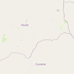
Understand where Bicuar National Park sits in Angola through a broader geographic reading of the surrounding landscape, nearby location context, and its mapped position within the national park landscape.

How Bicuar National Park fits into Angola

Angola is a unitary presidential republic on the western coast of Southern Africa. Gaining independence from Portugal in 1975, it borders Namibia, the Democratic Republic of the Congo, Zambia, and the Atlantic Ocean. The country has an exclave province called Cabinda. With a population of over 36 million, Angola is rich in oil and mineral resources.

Wider geography shaping Bicuar National Park in Angola

Angola is located on the western coast of Southern Africa along the Atlantic Ocean. It is bordered by Namibia to the south, the Democratic Republic of the Congo to the north, Zambia to the east, and the Atlantic Ocean to the west. The country includes the exclave province of Cabinda, which borders the Republic of the Congo and the Democratic Republic of the Congo. The terrain includes coastal lowlands, highland plateaus, and interior plains.

Common questions about visiting, size, designation, and location context for Bicuar National Park

Bicuar National Park FAQs for park facts, access, geography, and protected area context
Find quick answers about Bicuar National Park, including protected-area facts, park geography, trail and visitor context, and how the park fits into its surrounding country and regional landscape.
MoriAtlas Explorer

Continue Your Protected Areas Search Across the Global Atlas

Deepen your exploration by continuing the structured search for national parks and protected areas worldwide. Utilize the comprehensive filtering capabilities to compare different conservation landscapes and refine your understanding of global park geography. Discover more about the distribution and characteristics of protected natural areas.

Global natural geography

