
Islands
Park geography
Analyzing the coastal island terrain, physical dimensions, and core natural features of this Swedish protected area.
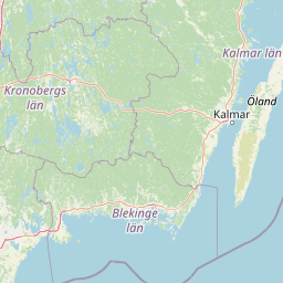
Comprehensive Geographic Profile and Mapped Boundaries of Blå Jungfrun National Park in Sweden
Examine the precise geographic footprint of Blå Jungfrun National Park, an island-based protected area covering 1.897 square kilometers. This detailed profile identifies the park coordinates, boundary-derived span, and associated natural features including the Toppen peak and various coastal rock formations.
A mystical Baltic island of blue-hued granite and rich birdlife
Blå Jungfrun National Park
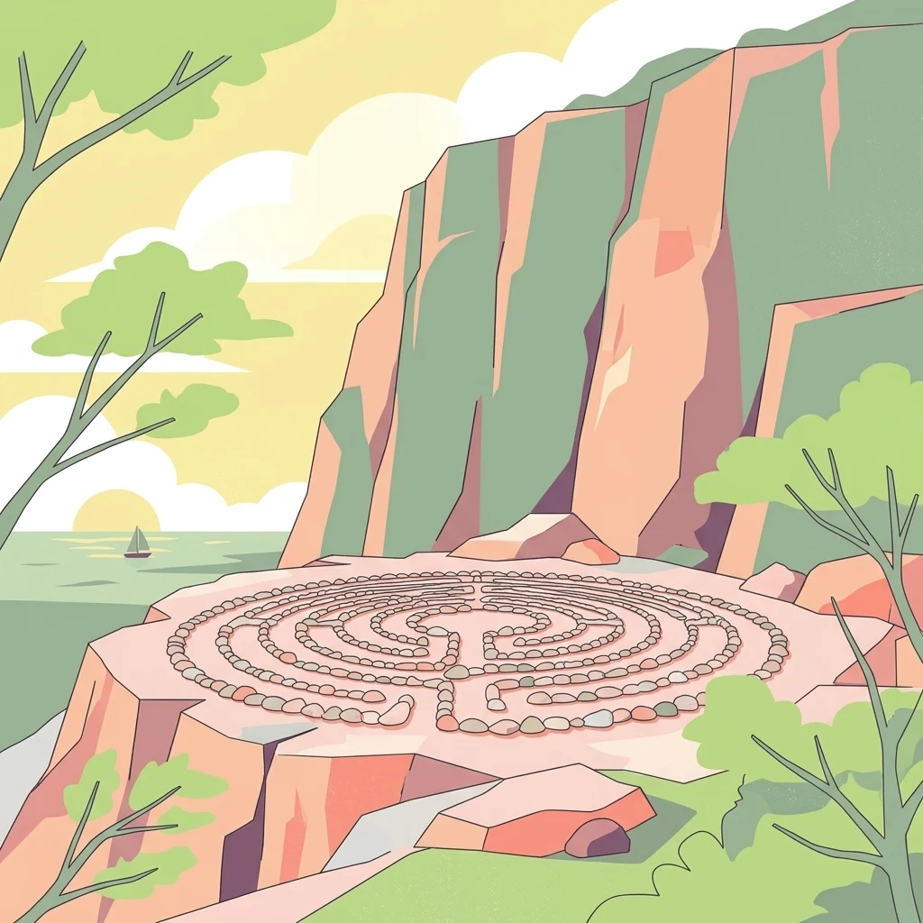
Blå Jungfrun National Park is a nature reserve located on a small island in the Baltic Sea off the coast of Kalmar County in southeastern Sweden. The park encompasses the island itself and its surrounding marine waters, creating a unique coastal protected area known for its distinctive blue-tinted granite cliffs and rich biodiversity. The island's name, which translates from Swedish as "Blue Virgin," derives from the bluish hue that appears on the island's rocky surfaces when seen from the mainland, caused by the mineral glauconite in the granite. The park is recognized as one of Sweden's most distinctive coastal natural areas, combining unusual geological formations with important ecological habitats and cultural heritage elements including the ruins of an ancient church.
- Location
- Sweden
- Park type
- National park
Location overview
Sweden coastal and island park status classification
Geographic Position of Blå Jungfrun National Park in Sweden
Blå Jungfrun National Park is located within the sovereign borders of Sweden. Official registry records identify the protected territory as an island park with coastal designation.
- Countries
- Sweden
- Primary location
- Sweden
- Geographic setting
- Coastal · Island
Boundary and coordinates
Spatial footprint, coordinate limits, and total area of the protected reserve
Blå Jungfrun National Park Geographic Boundary Map and Spatial Limits
Detailed spatial geometries map out the exact outline of Blå Jungfrun National Park to offer clear regional context. Accompanying geographic data points define key measurements like total area, coordinate limits, and center points.
- Boundary area
- 1.9 km²
- Boundary perimeter
- 5 km
- Northernmost point
- 57.2599° N
- Southernmost point
- 57.2444° N
- Easternmost point
- 16.8051° E
- Westernmost point
- 16.7807° E
- Geographic centre
- 57.252° N, 16.7935° E
- North–south span
- 1.7 km
- East–west span
- 1.5 km
Terrain and natural features
Mixed terrain classifications and recorded geological formations
Blå Jungfrun National Park Terrain and Named Natural Features
Mixed relief classifications govern the terrain across Blå Jungfrun National Park alongside recorded island, rock, cave, and peak formations. Linked feature cards supply names, types, measurements, and spatial relationships where documented.
Selected named natural features
Rock formations
Klippöverhänget
Cave entrances
Jungfrukammaren
Cave entrances
Kyrkan
Bays
Lervik
Peaks
Toppen
86 m
Environmental setting
Interpreting recorded coastal, marine, and mixed relief properties across the island terrain
Blå Jungfrun National Park Environmental Classifications and Physical Setting
Recorded island, coastal, and marine classifications outline the physical setting and mixed relief features across the protected landscape. Stored environmental categories connect directly to corresponding atlas destinations for broader geographical reference.
- Relief
- Mixed relief
- Water
- Major water bodies
- Seasonality
- Seasonal
Landscape features
Islands · Coast · Beach · Cliffs
Habitat types
Coastal habitat · Marine habitat
Park atlas
Explore surrounding Baltic Sea island ecosystems and coastal protected areas, tracing their unique geography and conservation values.
Discover Other Protected Areas and National Parks Near Blå Jungfrun National Park, Sweden
Continue your park exploration from Blå Jungfrun National Park by browsing other protected areas, national parks, and coastal reserves within Sweden's Baltic Sea region. Compare their unique island ecosystems, granite landscapes, and bird sanctuary habitats to understand the broader conservation geography of Nordic protected areas.
National parkKalmar County
90 km away#1 closest
Northwest

Norra Kvill National Park: Ancient Coniferous Forest Protected Landscape in Kalmar County
Discover its unique mapped terrain and natural forest heritage.
Norra Kvill National Park safeguards a remarkable old-growth coniferous forest ecosystem, a rarity in southern Sweden. This park is characterized by ancient pines, some dating back over 350 years, thriving on steep fault-formed terrain and amid boulder fields. Its protected status ensures the preservation of this unique natural landscape, providing invaluable insight into forest ecology and regional geography within Kalmar County. MoriAtlas offers a structured approach to understanding its mapped boundaries and ecological significance.
- Area
- 1.14 km²
- Established
- 1927
- IUCN
- II
- Relief
- Highland
National parkJönköping County
165 km away#2 closest
West
Store Mosse National Park: Explore Sweden's Largest Bog Landscape & Protected Area
Detailed park map, geography, and peatland ecosystem context.
Delve into Store Mosse National Park, a significant protected landscape in Jönköping County, Sweden, celebrated for its vast peat bog, the largest south of Lapland. This page provides detailed geographic context, mapping its unique wetland terrain, interspersed lakes like Kävsjön, and surrounding pine forests. Understand the park's ecological importance as a Ramsar site and its place within the South Småland peneplain for structured natural area discovery.
- Area
- 78.5 km²
- Established
- 1982
- IUCN
- II
- Relief
- Lowland
National parkSweden
187 km away#3 closest
Northeast
Gotska Sandön National Park: Unique Baltic Island Protected Landscape & Dune Atlas
Mapped geography and ancient pine forests on a Swedish island.
Delve into Gotska Sandön National Park, a distinct national park encompassing an entire Baltic island renowned for its significant sand dune systems and ancient pine forests. This protected area showcases a rare sandy island ecosystem and a unique landscape shaped by coastal influences. MoriAtlas provides structured geographic context to understand the mapped boundaries and natural terrain of Gotska Sandön, highlighting its role as a vital protected natural landscape in the Scandinavian region.
- Established
- 1963
- IUCN
- II
- Scope
- Terrestrial
- Water
- Minor water
National parkSweden
204 km away#4 closest
Northwest
Tiveden National Park: Sweden's Protected Granite Landscape and Ancient Forest
Explore protected wilderness, fracture valleys, and geological heritage.
Tiveden National Park is a protected area in southern Sweden renowned for its ancient forests and rugged granite landscape. The park's terrain features deep fracture valleys, formed by ancient geological events, and stands as one of the last large remnants of older forest in the region. Discover the park's unique topography, mapped boundaries, and its significance as a protected natural landscape for atlas-based exploration.
- Area
- 20.3 km²
- Established
- 1983
- IUCN
- II
- Relief
- Mixed relief
National parkStockholm County
About 232 km away#5 closest
North
Tyresta National Park: Explore Protected Old-Growth Forest and Rift Valley Landscape
Stockholm County National Park, Sweden
Tyresta National Park stands as a crucial protected area, showcasing one of southern Sweden's largest expanses of old-growth coniferous forest, featuring trees up to 400 years old. Its distinctive rift valley terrain, lakes, and post-fire recovery zones offer a rich geographic profile for atlas exploration. Within Stockholm County, this national park provides essential context for understanding the preservation of ancient forest ecosystems and unique geological formations.
- Area
- 20 km²
- Established
- 1993
- IUCN
- II
- Relief
- Mixed relief
National parkSkåne County
234 km away#6 closest
Southwest
Stenshuvud National Park: Discover Skåne County's Distinctive Baltic Headland National Park
Explore broadleaf forests, heathlands, and panoramic coastal geography.
Stenshuvud National Park is a notable national park in Sweden's Skåne County, characterized by a prominent hill that rises 97 meters above the Baltic Sea. This protected landscape offers a rich diversity of habitats within a small area, including dense broadleaf forests, open heathlands, and coastal terrains. Its unique geographic position and varied ecosystems make it a key destination for exploring protected natural areas, mapped terrain, and regional landscape context within the MoriAtlas platform.
- Area
- 3.9 km²
- Established
- 1986
- IUCN
- II
- Relief
- Lowland
National parkÖrebro County
250 km away#7 closest
Northwest
Garphyttan National Park: Pioneer Protected Landscape and Historic Swedish Terrain
Explore meadows, forests, and historic geography in Örebro County.
Garphyttan National Park, established in 1909, is a testament to early Swedish nature conservation efforts. This protected landscape features rolling forested terrain and distinctive flower-rich meadows, maintained through traditional practices that highlight Sweden's cultural heritage. Located within Örebro County, the park offers valuable insights into regional geography and the formation of mapped protected areas, making it a key destination for understanding historical landscape preservation.
- Area
- 1.11 km²
- Established
- 1909
- IUCN
- II
- Relief
- Lowland
National parkSweden
255 km away#8 closest
Southwest
Söderåsen National Park: A Protected Ridge Landscape in Southern Sweden's Geography
Mapped protected area with varied terrain and dense forest cover.
Delve into the protected landscape of Söderåsen National Park, a national park in Southern Sweden distinguished by its unique ridge topography, steep slopes, and extensive forests. This site serves as a key point for atlas-based exploration of natural terrain and regional geography, offering a clear view of its mapped boundaries and ecological significance within the Southern Swedish highlands. Understand the character of this protected area and its place in the broader mapped landscape.
- Established
- 2001
- IUCN
- II
- Scope
- Terrestrial
MoriAtlas Explorer
Continue exploring the Blå Jungfrun National Park's mapped protected landscape and regional geography
Deepen your understanding of Blå Jungfrun National Park by exploring its precise geographic setting and protected landscape features. MoriAtlas allows for detailed examination of the park's mapped boundaries and its role within the Baltic Sea's natural geography. Discover the specific terrain and unique characteristics that define this important Swedish national park.
Browse next
Global natural geography
Explore related park routes
Explore MoriAtlas Global ParksBrowse All MoriAtlas ParksGlobal Park Map DiscoveryMoriAtlas: Browse All CountriesBrowse All MoriAtlas ContinentsNational Park Environment AtlasGrand Canyon National Park AtlasYellowstone National Park AtlasYosemite National Park Atlas and GeographySerengeti National Park AtlasGalápagos National Park Protected LandscapeBanff National Park Geography and AtlasKruger National Park Atlas EntryUluṟu-Kata Tjuṯa National Park AtlasExplore Uluru-Kata Tjuta National Park GeographyPlitvice Lakes National Park AtlasFiordland National Park Protected LandscapeGreat Smoky Mountains National Park AtlasAfghanistan National Parks and Protected AreasAlbania National Parks and Protected AreasAlgeria National Parks and Protected AreasAmerican Samoa National Parks and Protected AreasAndorra National Parks and Protected AreasAngola National Parks and Protected AreasAntarctica National Parks and Protected AreasAntigua and Barbuda Park List