
Mori Atlas logo
Natural monumentBlue Eye

Understanding the geological significance and protected forest boundaries of this iconic Albanian spring.

Blue Eye Natural Monument: Mapped Karst Landscapes and Hydrology in Vlore County, Albania

(Syri i Kaltër)

The Blue Eye serves as a remarkable natural monument within Vlore County, representing a deep karst spring that marks the headwaters of the Bistrice River. This protected area encompasses 1.8 square kilometers of limestone terrain, featuring an unusual blue-hued water basin surrounded by mature oak and sycamore forests. The site provides a critical look at southern Albania's karst hydrology and woodland ecosystems within the Ionian Sea watershed.

karst springnatural monumenthydrological featurefreshwater ecosystemoak forestsycamore forest
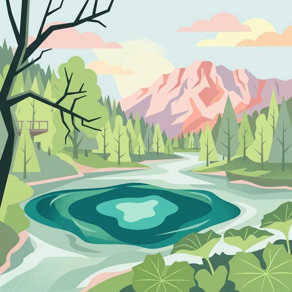
A flat-style digital illustration featuring a vibrant blue karst spring in the foreground, surrounded by green trees, a small wooden viewing platform to the left, and pinkish-toned mountains in the distance.

Blue Eye

Natural monument

Park overview

Structured park overview, official facts, and landscape profile for Blue Eye

Blue Eye park facts, protected area profile, and essential visitor context

Review the core facts for Blue Eye, including designation, size, terrain, visitor scale, habitats, and operating context in one park-focused overview.

About Blue Eye

The Blue Eye, known in Albanian as Syri i Kaltër, is one of southern Albania's most distinctive natural landmarks. It consists of a powerful karst spring that erupts from an underground limestone system in the foothills near the village of Muzinë, in Finiq municipality. The spring bursts upward through a roughly oval karst basin and immediately begins to form the Bistricë River, one of the notable small rivers of the region.

What makes the site visually unusual is the character of the spring itself. Water rises through a vertical karst conduit and collects in a pool where the centre appears dark, almost otherworldly, while the surrounding water glows in shades of brilliant blue and turquoise. The result is the "eye" effect that gives the spring its name. Even though divers have reached depths of about fifty metres, the true bottom of the system remains uncharted, and the spring continues to fascinate both scientists and visitors.

Hydrologically, the spring is the principal outlet for the karst aquifer of Mali i Gjerë, a nearby limestone massif. The water emerges at the tectonic and geological contact between highly karstified limestone and less permeable terrigenous formations, which is what allows the pressurized water to rise so forcefully. With an average discharge on the order of 18 cubic metres per second, the Blue Eye stands among the most substantial karst springs in Albania.

The surrounding 1.8-square-kilometre area was declared a Natural Monument in 1996 and is administered as part of Albania's protected natural heritage. Its mix of mature oak, sycamore woodland, and other deciduous cover, combined with the cool microclimate produced by the spring, has helped protect the broader landscape around this fragile hydrological feature. The site occupies a position in the hinterland between Sarandë, Delvinë, and Gjirokastër, and is often included in regional tourism and nature-discovery routes through southern Albania.

Quick facts and research context for Blue Eye

The Blue Eye is a karst spring in Vlorë County, southern Albania, near the villages of Muzinë and Krongj. It is the primary source of the Bistricë River, a 25-kilometre watercourse that reaches the Ionian Sea south of Sarandë. The spring discharges roughly 18,400 litres per second from an elevation of 152 metres above sea level.

The site has held Natural Monument status since 1996, covering an immediate area of about 1.8 square kilometres. The protected landscape is dominated by oak and sycamore trees growing on karst geology. Divers have explored the central shaft to about 50 metres depth, though the true bottom of the karst hole has not been confirmed.

Protection and recognition

Explore the terrestrial protection scope and official designation timeline for Blue Eye.

Blue Eye Protection Status and Documented Designation History

Terrestrial protection parameters for Blue Eye establish a clear baseline for conservation geography since 1996. Structured records aggregate official designation history and management scope without supplementary international recognition sources.

Protection details

Protection scope
Terrestrial
Designated year
1996
Park context

Deeper park guide and search-rich context for Blue Eye

Blue Eye history, landscape, wildlife, and travel context

Explore Blue Eye through its history, landscape character, ecosystems, wildlife, conservation priorities, cultural context, and seasonal travel timing in a structured park guide built for atlas discovery and search intent.

Why Blue Eye stands out

The Blue Eye is renowned for the extraordinary clarity and colour of its water, which rises from a deep karst vent and takes on an intense blue and turquoise hue. The oval shape of the karst depression and the contrast between the dark centre and the glowing blue edges create the visual impression of a giant eye set into the landscape. It is equally recognized for its scale. With a discharge rate among the highest of Albania's karst springs, the Blue Eye feeds an entire river system from a single powerful upwelling. The combination of depth, clarity, and volume has made it one of the most iconic natural landmarks in southern Albania.
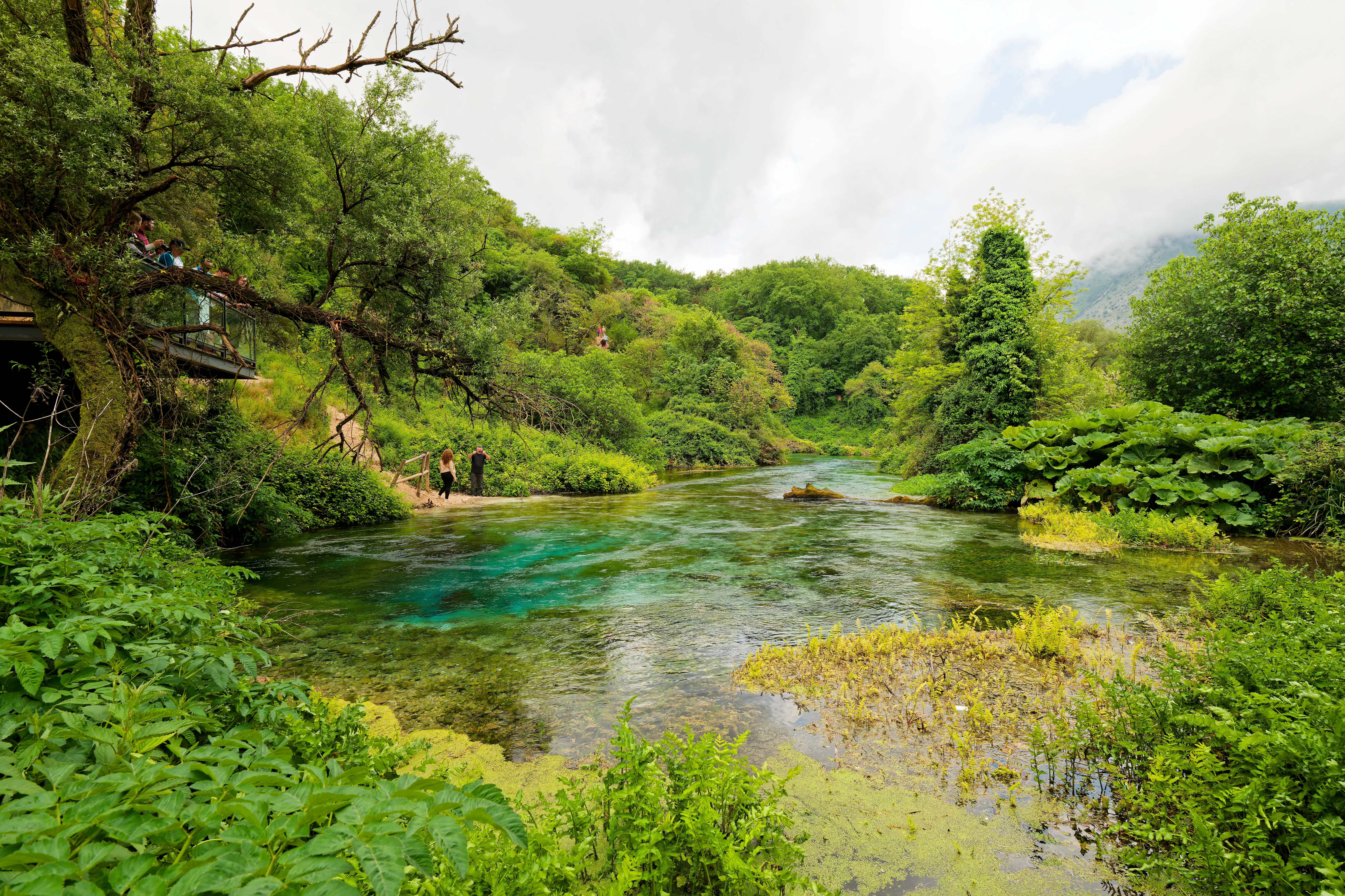
A vibrant blue natural spring surrounded by lush green foliage and trees in Albania.
The Blue Eye, a natural water spring in southern Albania known for its vibrant blue depths.

Blue Eye history and protected-area timeline

The Blue Eye has long functioned as the headwater source of the Bistricë River, but the formal recognition of its natural importance is more recent. In 1996, the area surrounding the spring was officially designated as a Natural Monument under Albanian environmental legislation, placing it within the national system of protected areas.

The designation reflected growing awareness of the spring's geological, hydrological, and ecological value, particularly its role as the principal outlet of the Mali i Gjerë karst system. Since then, the protection status has anchored ongoing management of the surrounding woodland and riparian environment, even as the spring's popularity as a visitor attraction has grown substantially. The site has also experienced environmental pressures. In summer 2004, the spring reportedly ran dry temporarily, and in summer 2017 a wildfire affected part of the location, highlighting the vulnerability of the ecosystem around this otherwise resilient karst feature.

Blue Eye landscape and geographic character

The Blue Eye sits within a karst landscape in the interior of southern Albania, between the coastal zone around Sarandë and the higher terrain that leads toward Gjirokastër. The local geology is dominated by limestone formations shaped by long-term dissolution of rock by groundwater, producing the underground conduits, sinkholes, and sudden resurgences that characterize the regional topography.

The spring itself occupies a deep karst depression that opens unexpectedly into a small, intensely coloured basin. From this basin, water spills outward to begin the course of the Bistricë River, a short but ecologically important stream that flows generally southward toward the Ionian coast. The river traces a narrow corridor through a woodland valley, with cool, clear water characteristic of karst-fed systems.

Around the spring, the terrain is gently to moderately sloped, supporting mature deciduous woodland. Oak and sycamore form the principal canopy, with their roots anchored in shallow soils over limestone bedrock. The combination of forested slopes and the striking blue basin produces a contrast that gives the site a notably memorable visual character within an otherwise typical southern Albanian hill country.
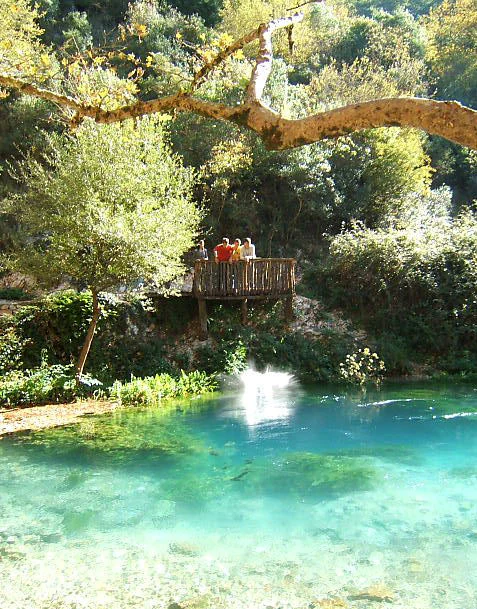
A vibrant blue natural spring pool surrounded by dense green forest foliage and trees with a wooden observation deck containing several people overlooking the water.
The Blue Eye karst spring in southern Albania, characterized by its intensely blue, clear water.

Blue Eye ecosystems, habitats, and plant life

Ecologically, the Blue Eye belongs to the karst ecosystem of Mali i Gjerë and the broader limestone uplands of southern Albania. The spring itself creates a distinctive microclimate around it; air temperatures near the rising water are noticeably cooler than the surrounding summer heat, and humidity stays consistently high where spray and damp ground meet the forest.

The vegetation of the protected area reflects this cool, moist influence. Mature oak and sycamore trees dominate, forming a shaded canopy over leaf litter and mossy boulders. The spring feeds into the upper Bistricë, so the riparian vegetation along the river's first kilometres thrives on constant, cold, oxygen-rich karst water, supporting a greener corridor than much of the surrounding Mediterranean hill country.

The broader landscape is also part of a wider karst network, in which groundwater flows through underground passages in soluble limestone and emerges at various points across the region. The Blue Eye is the most visible and dramatic outlet of this network, but it shares its hydrogeological character with many other karst features nearby.

Blue Eye wildlife and species highlights

The Blue Eye is best understood ecologically through its freshwater habitats and its surrounding woodland rather than through charismatic large mammals. The consistently cold, clear karst water of the spring and the upper Bistricë River creates conditions suitable for freshwater species adapted to stable temperatures and high oxygen content, while the surrounding oak and sycamore forest supports typical animal communities of Mediterranean deciduous woodland.

Birds typical of southern Albanian hillside forests and riparian corridors are likely to be found in the protected zone, particularly species that favour mature broadleaf canopy and water-edge environments. Small mammals, reptiles, and invertebrates associated with karst landscapes and leaf-litter habitats also contribute to the site's broader biodiversity, though the spring itself is more important ecologically as a hydrological feature than as a wildlife viewing destination.

Blue Eye conservation status and protection priorities

The Blue Eye is protected as a Natural Monument, a designation that recognizes its combined geological, hydrological, ecological, and landscape value. This status places it within Albania's network of formally protected natural areas and acknowledges the spring as a defining natural feature of the Mali i Gjerë karst region.

The conservation significance of the site lies primarily in its role as the main outlet of a substantial karst aquifer and as the source of the Bistricë River. Protecting the spring and its immediate catchment helps safeguard water quantity and quality downstream, including for the river's lower reaches and its eventual discharge into the Ionian Sea. The surrounding oak and sycamore forest further contributes to soil protection, microclimate regulation, and habitat continuity in a region where karst ecosystems are particularly sensitive to disturbance.

The site has also faced environmental pressures, including a reported temporary drying of the spring in summer 2004 and a wildfire affecting part of the location in summer 2017. These episodes underscore why formal protection and careful management of the surrounding woodland and watershed matter for the long-term integrity of the spring.

Blue Eye cultural meaning and human context

The Blue Eye sits in a region of southern Albania with a layered history of rural settlement, trans-regional travel routes, and proximity to the Ionian coast. The spring has been a persistent feature of local life as the starting point of the Bistricë River and as a recognizable landmark in the inland area between Sarandë, Delvinë, and Gjirokastër.

In local and national culture, the spring is part of how southern Albanians describe the natural identity of their region. It is frequently presented as a symbol of the country's karst heritage and as a must-see natural stop for visitors traveling between the coastal Riviera and the historic city of Gjirokastër, reflecting its embedded role in regional travel and tourism narratives.

Top sights and standout views in Blue Eye

The defining highlight of the Blue Eye is its extraordinarily deep, blue karst vent, whose clarity and colour give the site its name. The spring's scale is equally striking: it discharges enough water to feed the entire 25-kilometre Bistricë River from a single concentrated upwelling, and serves as the main outlet of the Mali i Gjerë karst system.

Equally compelling is the protected forest setting around the spring. Mature oak and sycamore woodland surrounds the basin, creating a cool, shaded atmosphere that contrasts with the broader Mediterranean hill country. Together, the powerful spring, the exceptionally clear water, and the surrounding deciduous canopy make the Blue Eye one of the most visually memorable protected natural sites in southern Albania.

Best time to visit Blue Eye

The Blue Eye can be visited across much of the year, but character varies with the seasons. Late spring and early summer typically bring richer forest foliage, fuller water levels in the spring, and a more vivid contrast between the cool blue water and the green woodland canopy. Mid-summer is the busiest period, as the site draws many visitors traveling between Sarandë and Gjirokastër; visitors who prefer quieter conditions often aim for shoulder seasons.

Winter and early spring can bring higher rainfall and cooler conditions, which can affect local access and make the trail environment more demanding, though the spring itself remains striking. Because the site has historically experienced very low discharge during unusually dry summers, visiting during periods of normal rainfall offers the most representative view of the spring's full power and colour.
Monthly climate preview

Measured monthly averages for temperature and precipitation rhythm across the park landscape

Blue Eye Climate Normals and Long Term Temperature Records

Long term climate data for Blue Eye documents a measured progression of average temperatures from winter lows to summer highs alongside shifting monthly precipitation rates. Detailed twelve month statistical profiles provide comprehensive context for analyzing annual weather patterns across the representative coordinate.
Annual mean15 °C
6 °C26 °C
Jan
Feb
Mar
Apr13°
May18°
Jun23°
Jul26°
Aug26°
Sep21°
Oct17°
Nov12°
Dec
Warmest month
August

25.9 °C

Coolest month
January

6.4 °C

Wettest month
November

4.9 mm/day

Driest month
July

0.5 mm/day

Park location guide

Geography guide, regional context, and park location map for Blue Eye

Blue Eye park geography, regions, and map view in Albania

Understand where Blue Eye sits in Albania through a broader geographic reading of the surrounding landscape, nearby location context, and its mapped position within the national park landscape.

How Blue Eye fits into Albania

Albania is a unitary parliamentary republic in Southeast Europe, situated on the Balkan Peninsula along the Adriatic and Ionian coastal regions. With a population of approximately 2.4 million people, it borders Montenegro, Kosovo, North Macedonia, and Greece. The country features varied landscapes ranging from the Albanian Alps to fertile coastal plains, with Tirana as its capital and largest city.

Wider geography shaping Blue Eye in Albania

Albania occupies the western part of the Balkan Peninsula in Southeast Europe. The country features a varied terrain with rugged mountain ranges including the Albanian Alps (Accursed Mountains), Korab, Skanderbeg Mountains, Pindus, and Ceraunian Mountains. Fertile lowland plains extend along the Adriatic and Ionian coastal regions. The country borders Montenegro to the northwest, Kosovo to the northeast, North Macedonia to the east, and Greece to the south.

Map view of Blue Eye

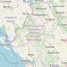
Use this park location map to pinpoint Blue Eye in Albania, understand its exact geographic position, and read its mapped placement within the surrounding landscape more clearly.

Pigeon | © OpenStreetMap contributors

Location context for Blue Eye

Vlorë County

Explore high-resolution park imagery capturing rare spring formations, oak woodlands, and Mediterranean terrain.

Blue Eye Photos and Scenery: Visualizing Karst Landscapes and Protected Waters

Visual documentation of Blue Eye reveals the intricate limestone topography, vibrant turquoise water basins, and shaded forest canopies defining the protected natural monument. Examining detailed park photography helps researchers and travelers interpret the distinct hydrological features, geological formations, and regional ecosystems shaping southern Albania.

A vibrant blue natural spring surrounded by lush green foliage and trees in Albania.

A top down view of a deep natural karst spring with vibrant turquoise and dark blue water, with clear visibility of underwater rocks and surrounding foliage.

A vibrant blue natural spring pool surrounded by dense green forest foliage and trees with a wooden observation deck containing several people overlooking the water.

Park atlas

Compare adjacent limestone karst landscapes and regional river sources

Parks Near Blue Eye and Protected Areas Across the Surrounding Region

Browsing parks near Blue Eye reveals connected limestone karst formations and protected woodland valleys across southern Albania. Comparing adjacent protected areas provides wider geographic context for regional hydrological systems and Mediterranean topography.
Watercolor landscape painting showing a lake, distant mountains, and vegetation
National parkVlorë County
About 17 km away#1 closest

Southwest

Butrint National Park: Archaeological Heritage and Mediterranean Wetland Landscape

Explore its unique geography and protected park boundaries.

Butrint National Park presents a singular opportunity for geographic and protected-area discovery, showcasing an unparalleled fusion of ancient history and ecological richness. Located in Albania's Vlorë County, this national park encompasses Lake Butrint, coastal lagoons, and vital wetland habitats, recognized internationally for their biodiversity. Through MoriAtlas, users can explore the mapped extent of this unique landscape, understand its role within regional geography, and uncover the interplay between its preserved archaeological sites and the surrounding Mediterranean environment.

Area
94.244 km²
Established
2000
IUCN
II
Relief
Lowland
Watercolor painting showing a river valley with mountain ranges in the background and green fields
National parkGjirokastër County
About 37 km away#2 closest

North

Vjosa Wild River National Park: Europe's Pioneer Free-Flowing River Protected Area

Mapping dynamic canyons and vital river ecosystems in Gjirokastër County.

Vjosa Wild River National Park is recognized as Europe's first Wild River National Park, a groundbreaking designation protecting an entire river system from source to sea. This protected area in Gjirokastër County preserves remarkable topography, including dramatic canyons, natural rapids, and meandering islands, all shaped by the free flow of the Vjosa River and its tributaries. Explore the mapped boundaries and unique landscape context of this significant biodiversity hotspot, offering a crucial case study for river conservation and atlas discovery.

Area
127.27 km²
Established
2023
IUCN
II
Relief
Mixed relief
National parkGreece
About 46 km away#3 closest

East

Vikos-Aoös National Park: Deepest Gorge and Protected Mountain Landscape Atlas

Discover protected area boundaries and regional geography in Epirus.

Vikos-Aoös National Park in Greece's Pindus mountains is a premier destination for exploring dramatic natural geography. Best known for the Vikos Gorge, considered the world's deepest canyon relative to its width, the park also features towering alpine peaks like Mount Tymphe, glacial lakes such as Drakolimni, and rich botanical diversity. As a UNESCO Geopark and part of the Natura 2000 network, it safeguards critical habitats, including significant brown bear populations. This park offers a profound look into protected landscapes, offering detailed geographic context and mapped terrain for atlas-based discovery.

Area
126 km²
Established
1973
IUCN
II
Visitors
100K annual
Watercolor painting of a landscape with green fields, scattered trees, and rolling hills under a light sky
National parkGjirokastër County
About 46 km away#4 closest

Northeast

Fir of Hotovë-Dangëlli National Park: Ancient Forests & Mountain Wilderness Atlas

Explore a premier protected landscape in Gjirokastër County, Albania.

Fir of Hotovë-Dangëlli National Park stands as a monumental protected area, celebrated for its exceptional old-growth Hotova Fir forests, which are a rare Mediterranean plant relic. This national park in Gjirokastër County offers a detailed look at a vast mountainous terrain, featuring dramatic canyons like Lengarica Canyon, and serving as a critical habitat for diverse wildlife. MoriAtlas provides structured geographic context for this significant landscape, highlighting its mapped boundaries and role as a key component of regional protected area networks.

Area
360.038 km²
Established
2008
IUCN
II
Relief
Mountain
A watercolor painting showing a river winding through a mountainous gorge with a stone arch bridge on the right bank.
National parkEpirus
About 46 km away#5 closest

East

Northern Pindus National Park: A Geographic Survey of Mountain Landscapes in Epirus Greece

Mapped terrain, karst river gorges, and alpine forest ecosystems.

Northern Pindus National Park preserves an extensive mountain environment characterized by steep limestone ridges, the profound Vikos Gorge, and glacial lake basins. Located in the Pindus range of Epirus, this area offers deep insight into the intersection of geological processes, rare wildlife habitats, and traditional human settlements integrated into the mountainous terrain.

Area
157.4 km²
Established
2005
IUCN
II
Relief
Mountain
A soft watercolor painting of a coastal lagoon featuring dunes, grassy vegetation, and a distant treeline under a light sky.
Protected areaIonian Islands
About 58 km away#6 closest

Southwest

Korission Lagoon Protected Area: Coastal Wetlands and Dune Geography in Corfu, Greece

A coastal landscape defined by sand dunes, freshwater, and juniper forests

Korission Lagoon represents a rare ecological convergence on the Ionian Islands, where a tall sand dune barrier separates a freshwater lagoon from the open sea. This protected area supports an intricate mosaic of reed beds and unique juniper woodlands, providing a crucial habitat for a vast array of bird species and endemic wildlife within the coastal plains of Corfu.

Area
4.27 km²
Relief
Lowland
Climate
Mediterranean
Access
Easy access
Watercolor painting depicting mountains, forests, and valleys
National parkVlorë County
About 61 km away#7 closest

Northwest

Llogara National Park: Vlorë County's Dramatic Ceraunian Mountain Protected Landscape

Explore Albania's rugged national park geography and mapped terrain.

Llogara National Park stands as a vital protected area within Vlorë County, Albania, renowned for its spectacular Ceraunian Mountain topography. This page provides access to detailed geographic information, highlighting the park's unique landscape characteristics, from alpine peaks to coastal vistas. Discover the mapped extent of this national park and its significance within the regional geography, perfect for structured atlas exploration.

Area
17.69 km²
Established
1966
IUCN
II
Relief
Mountain
Watercolor painting showing mountains, a river, and vegetation
National parkAlbania
About 69 km away#8 closest

North

Tomorr Mountain National Park: Sacred Peak & Karst Protected Landscape in Albania

Explore Albania's dramatic mountain geography and protected areas.

Tomorr Mountain National Park offers a unique exploration of southern Albania's dramatic limestone anticline. Dominated by the sacred Mount Tomorr and featuring the spectacular Osum Canyon, this national park provides insight into karst terrain, old-growth forests, and significant biodiversity. Discover its mapped boundaries and regional geographic context within the Pindus Mountains for structured atlas exploration.

Area
271.855 km²
Established
1956
IUCN
II
Relief
Mountain

Common questions about visiting, size, designation, and location context for Blue Eye

Blue Eye FAQs for park facts, access, geography, and protected area context

Find quick answers about Blue Eye, including protected-area facts, park geography, trail and visitor context, and how the park fits into its surrounding country and regional landscape.
MoriAtlas Explorer

Continue Your Protected Areas Search Across the Global Atlas

Deepen your exploration by continuing the structured search for national parks and protected areas worldwide. Utilize the comprehensive filtering capabilities to compare different conservation landscapes and refine your understanding of global park geography. Discover more about the distribution and characteristics of protected natural areas.

Global natural geography