
Mori Atlas logo
Protected areaBonampak

Mapping the confluence of ancient Maya archaeological sites and tropical rainforest ecology

Bonampak Protected Area and the Lacandon Rainforest Landscape in Chiapas, Mexico

(Zona Arqueológica de Bonampak)

Bonampak stands as a critical protected area in Mexico, preserving both an ancient Maya archaeological site and the surrounding Lacandon rainforest. This landscape provides a vital record of Classic Maya history set within a dense, humid jungle environment near the Usumacinta River basin. MoriAtlas offers a detailed view of the site boundaries and its integration into the broader tropical geography of the Chiapas region.

maya archaeological siteclassic mayamaya muralslacandon rainforestchiapastropical rainforest
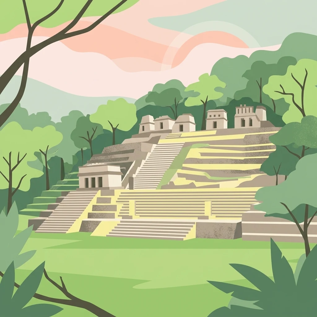
A flat-style digital illustration showing an ancient stepped stone temple complex surrounded by lush green trees and foliage under a pale pastel sky.

Bonampak

Protected area

Park overview

Structured park overview, official facts, and landscape profile for Bonampak

Bonampak park facts, protected area profile, and essential visitor context

Review the core facts for Bonampak, including designation, size, terrain, visitor scale, habitats, and operating context in one park-focused overview.

About Bonampak

Bonampak is a late Classic Maya archaeological site tucked into the dense Lacandon rainforest of Chiapas, Mexico, in the broader Usumacinta cultural region. Although only a fourth-rank city in the early twentieth-century hierarchy proposed by Sylvanus Morley, it has earned a global reputation out of proportion to its size because its builders chose to decorate a single long building from floor to vault with an extraordinary cycle of narrative paintings.

Structure 1, the Temple of the Murals, is a low rectangular edifice capping the lower terrace of the site's acropolis. Three vaulted rooms are coated in lime plaster and painted in brilliant blues, reds, greens, and yellows. Together, the paintings describe a connected sequence of events that took place largely during the reign of Chan Muwan II, a local lord installed after Yaxchilán victory and linked by marriage to that powerful city's ruling dynasty. In the first room, the heir to the throne is presented before the court, with musicians, masked dancers, tributary gifts of cacao, and visiting nobles arrayed in jaguar pelts and quetzal feathers. The second room depicts military campaigns against rivals such as Sak' Tz'i', the humiliation of captives, and scenes of bloodletting and human sacrifice. The third room portrays the joyful aftermath: musicians strumming turtle-shell drums and conch trumpets, nobles dancing, and the still-beating heart of a sacrificial victim held up in ritual triumph.

Surrounding this small ceremonial core, the site preserves a Great Plaza flanked by raised platforms, low residential ranges, and the so-called Frey Group on a low hill above. Recording stelae and lintels describe the lineage of Bonampak's rulers and the alliances and warfare that defined their era. Outside the buildings themselves, the broader protected zone of Monumento Natural Bonampak shelters one of the most biodiverse stretches of tropical rainforest in all of Mesoamerica, with more than 990 recorded plant and animal species, including numerous protected and endemic taxa. Bonampak is therefore both a centerpiece of Maya art history and an important contemporary natural reserve.

Quick facts and research context for Bonampak

Bonampak lies in the municipality of Ocosingo, Chiapas, in the heart of the Selva Lacandona, about 21 kilometers south of Yaxchilán and along the broader Usumacinta basin frequented by Classic Maya cities.

The site was inhabited during the Classic Period, reaching its main flowering between roughly 650 and 850 AD, after which it declined together with its powerful neighbor Yaxchilán. Its independent fame rests almost entirely on Structure 1, a long, low, three-roomed building inaugurated on 14 December 790 AD, whose vaulted interior is covered by more than 150 square meters of mural painting. The surrounding Monumento Natural Bonampak shelter more than 990 species of plants and animals, including 128 species listed under Mexican environmental risk categories.

Protection and recognition

Review the recorded terrestrial management framework and designation metrics for Bonampak.

Bonampak Protection Status and Documented Conservation Scope

Examine the documented protection status and terrestrial management scope established for Bonampak within the protected area registry. Research records provide baseline administrative details and international recognition data for comparative geographical analysis.

Protection details

Protection scope
Terrestrial
Transboundary protection
No
Park context

Deeper park guide and search-rich context for Bonampak

Bonampak history, landscape, wildlife, and travel context

Explore Bonampak through its history, landscape character, ecosystems, wildlife, conservation priorities, cultural context, and seasonal travel timing in a structured park guide built for atlas discovery and search intent.

Why Bonampak stands out

Bonampak is best known for the Bonampak Murals, one of the most complete and best preserved mural cycles of the entire pre-Columbian world. Created by a team of plasterworkers, pigment preparers, painters, and calligraphers commissioned around 790 AD, they unfold across three vaulted chambers and portray royal presentation rituals, the victory and sacrifices of war, and a culminating ceremony. The murals are particularly celebrated for shattering the long-standing scholarly image of the Maya as a peaceful civilization, because their explicit depiction of warfare, torture, and human sacrifice offers a vivid, almost photographic chronicle of Classic Maya court life.
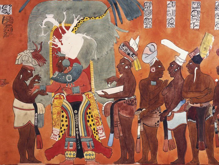
A section of an ancient Maya mural painting from Bonampak featuring several human figures in elaborate traditional dress, standing against a reddish-orange background.
A detail from the historic Maya murals at Bonampak, depicting figures in ceremonial attire.

Bonampak history and protected-area timeline

Bonampak likely originated as a small Maya settlement in the early centuries of the Classic Period, around 300 to 400 AD. For several generations it stood in the political orbit of larger centers along the Usumacinta, particularly Yaxchilán and Piedras Negras. In the early fifth century, the ruler Pájaro Jaguar was captured by Yaxchilán's K'inich Tatb'u Cráneo I, and later local nobles were again seized by Jaguar Ojo de Nudo I of Yaxchilán.

A brief respite came in 514 AD, when Bonampak's overlord was captured in turn by Piedras Negras, but by 526 AD Yaxchilán had reasserted control. By about 600 AD, Bonampak had effectively become a satellite city of Yaxchilán. The Yaxchilán ruler installed Chan Muwan I, also known as Cielo Arpía I, as lord of Bonampak, rebuilding the site to face its powerful neighbor. The city's most spectacular moment came in 790 AD, when Yaxchilán's Escudo Jaguar III arranged the marriage of his sister, Lady Yax T'ul, to Chan Muwan II and commissioned the celebrated mural cycle of Structure 1 to commemorate these events. Bonampak then declined together with Yaxchilán during the ninth-century Maya collapse.

The modern era of Bonampak began in 1946, when Giles Healey and Mateo Bolívar were guided to the ruins by Lacandon Maya informants on their way to perform ceremonies. The United States Carnegie Institution and Mexico's National Institute of Anthropology and History mounted a joint expedition in 1948, during which the murals were uncovered using kerosene to temporarily strip away a protective lime coating. They were extensively photographed, although early conservation efforts sometimes caused more damage than they prevented. Since 1996, Yale University professor Mary Miller has directed the Bonampak Documentation Project, which has combined high-resolution photography with infrared imaging and full-scale painted reproductions by artists Heather Hurst and Leonard Ashby. From 1990, Mexico's National Autonomous University has pursued parallel mural research through its La pintura mural prehispánica en México project, and in 1997 Ernesto Peñaloza produced the first complete photographic record of all three painted rooms.

Bonampak landscape and geographic character

The built environment of Bonampak sits within a clearing in the dense Lacandon rainforest, on a low rise overlooking a tributary of the Usumacinta River. The terrain is generally low and humid, framed by jungle-covered hills and shaped by the same network of streams that defined Classic Maya travel and trade along the river.

Within the site itself, the topography is gently stepped. The Great Plaza stretches roughly 90 by 110 meters between low platforms and leads up to the Acropolis, whose successive terraces carry the Temple of the Murals and other elite structures. A separate low hill to the north hosts the modest Frey Group, named for expedition member Carlos Frey, while the surrounding natural reserve preserves a continuous canopy of tropical rainforest extending toward the Guatemalan border.
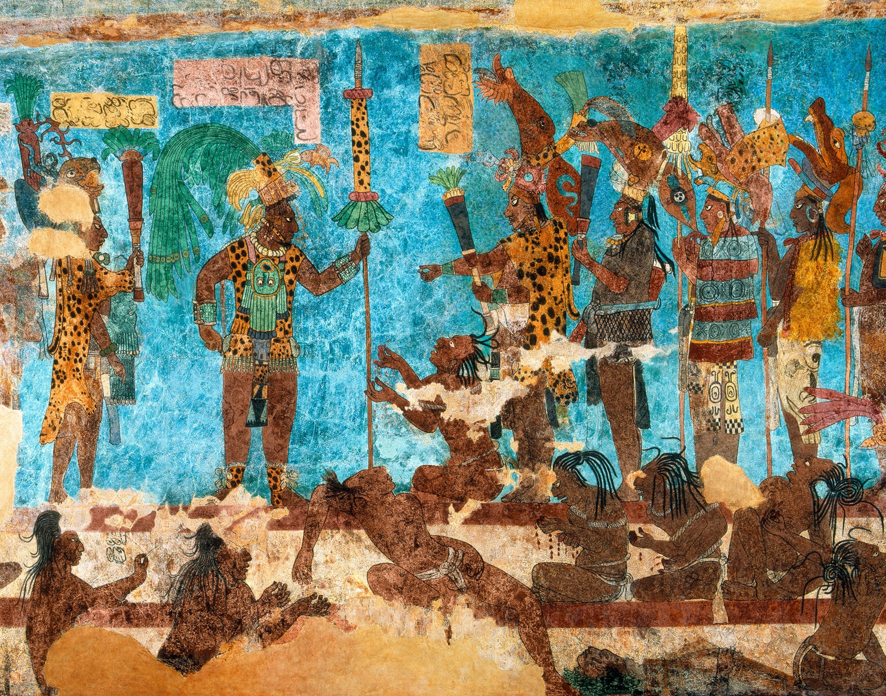
A vibrant ancient Mayan mural showing a group of people, including nobles wearing leopard skin patterned clothing and elaborate headdresses, standing and kneeling against a bright blue painted wall.
A detailed Mayan mural from Bonampak, featuring nobles and figures in ceremonial attire against a distinct blue background.

Bonampak ecosystems, habitats, and plant life

The Monumento Natural Bonampak protects one of the most biodiverse stretches of the Lacandon rainforest, a lowland evergreen ecosystem characteristic of the southern Maya region. According to Mexico's National Commission for the Knowledge and Use of Biodiversity, more than 990 species of plants and animals have been documented within the protected area, of which 128 fall under some risk category of the Mexican Official Standard NOM-059, and nine are classified as exotic.

The forest's tall canopy, dense understory, and streams along the Usumacinta basin support a complex mix of tropical wildlife. Jaguars still range through the protected zone, and the riverside habitats typical of the broader Usumacinta landscape host crocodilians, turtles, and a rich bird community. Because the archaeological site sits within this continuous natural mosaic, conservation of Bonampak involves sustaining not only pre-Columbian structures but also a living tropical ecosystem of international importance.
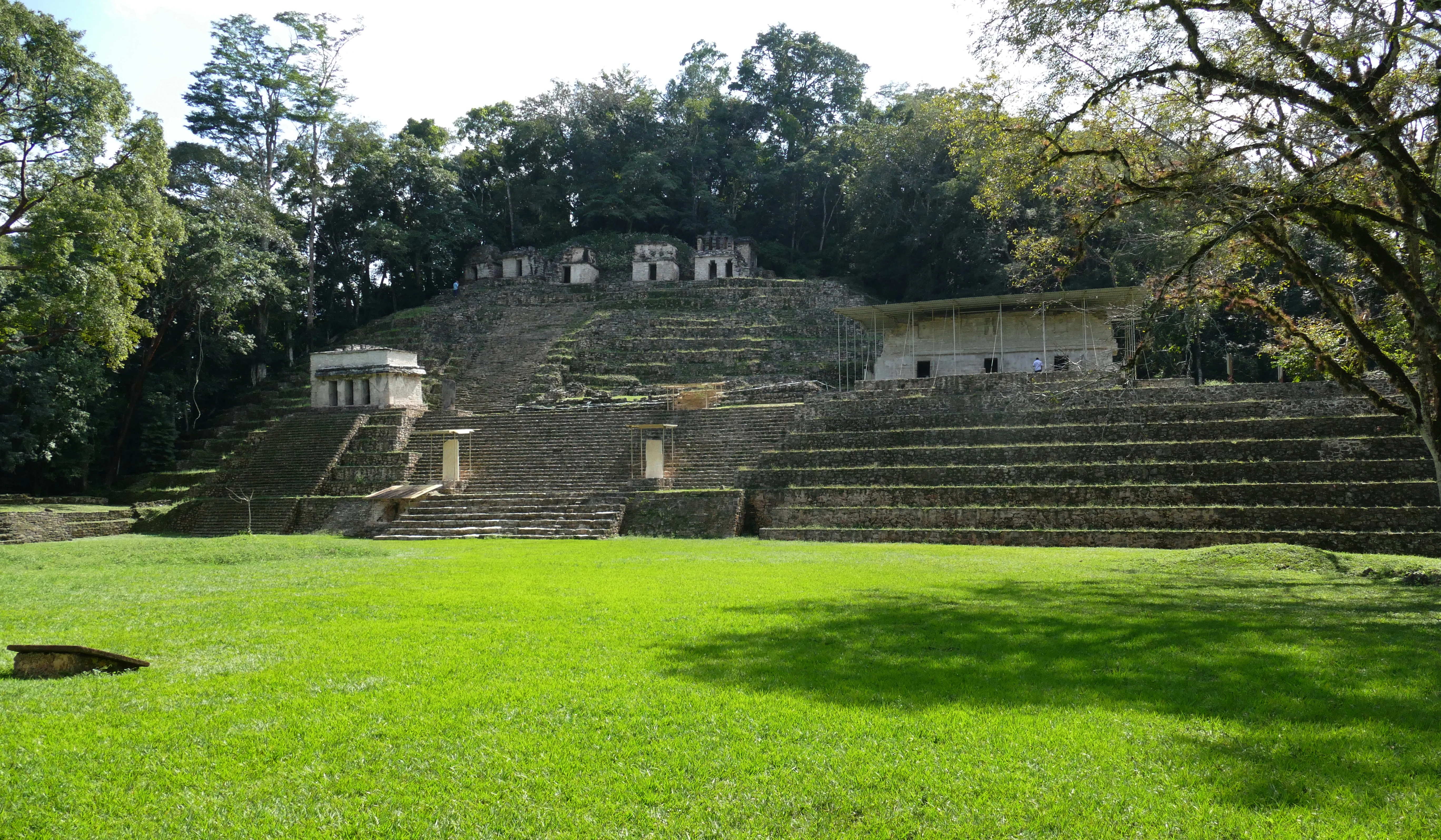
A wide view of the Mayan ruins at Bonampak, featuring a large grassy plaza in the foreground leading up to stone steps and structures surrounded by lush forest.
The Grand Plaza and Acropolis at the archaeological site of Bonampak.

Bonampak wildlife and species highlights

Wildlife within Bonampak's protected zone reflects the broader biodiversity of the Lacandon rainforest, a system famed throughout Mesoamerica for its concentration of tropical species. Common faunal elements in this belt of Chiapas include jaguars, which still patrol the area's denser forest, alongside other mammals typical of the Usumacinta basin such as howler monkeys, spider monkeys, and various smaller forest ungulates.

The rivers and streams that lace the zone sustain aquatic wildlife including turtles, crocodilians, and abundant fish. The canopy and understory host a tall list of birds, ranging from large raptors and gamebirds to smaller tropical passerines, and the humid forest supports a wide variety of reptiles, amphibians, and insects whose presence contributes to the site's unusually high species count.
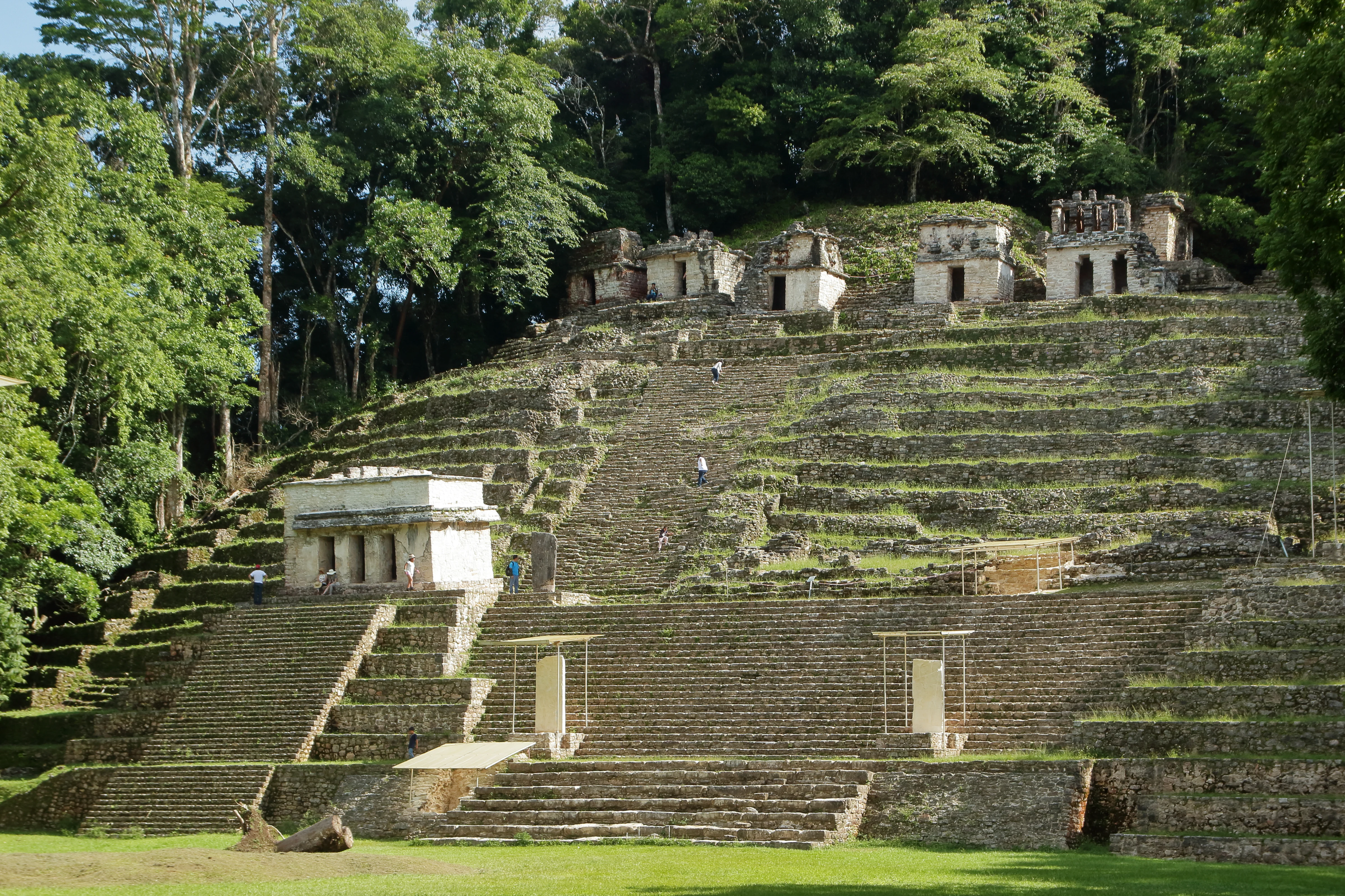
A wide shot of a multi-tiered Mayan stone pyramid at Bonampak, surrounded by dense jungle.
The main pyramid at the Bonampak archaeological site in the Chiapas jungle.

Bonampak conservation status and protection priorities

Bonampak is protected under the figure of Monumento Natural Bonampak, a designation that couples archaeological preservation with the safeguarding of one of Mexico's richest tropical forests. The site's administration falls to the National Institute of Anthropology and History, while its natural component is overseen in coordination with the National Commission for Protected Natural Areas and the National Commission for the Knowledge and Use of Biodiversity.

The conservation status of the area is significant because the surrounding forest contains more than 990 recorded species of plants and animals and 128 species listed under some risk category of NOM-059. This makes the protected area important not only for the safeguarding of Classic Maya architecture and murals but also for the long-term survival of threatened tropical biodiversity in the Usumacinta basin. Modern murals research, particularly through infrared documentation led by Yale University and by Mexico's National Autonomous University, has also been framed as a conservation effort, allowing scholars and visitors to study the paintings without further endangering the original surfaces.

Bonampak cultural meaning and human context

Bonampak sits in a region long inhabited by Maya peoples, and its modern identity is inseparable from the Lacandon Maya communities that live in the surrounding rainforest. Knowledge of the site's location never disappeared from local indigenous memory, and it was Lacandon guides who first led outsiders to the ruins in the mid-twentieth century, reframing the so-called "discovery" as a rediscovery by outside scholars.

The site's name itself reflects this layered cultural inheritance. The modern designation Bonampak means "painted walls," while the older indigenous name Ak'e and the local synonym Usiij Witz, meaning "Hill of the Vulture," preserve a Maya sense of place that long predates modern archaeological interest. The murals themselves remain a key resource for understanding Classic Maya court culture, language, costume, music, and ritual, which makes the site a touchstone for wider Maya cultural identity in Chiapas and beyond.
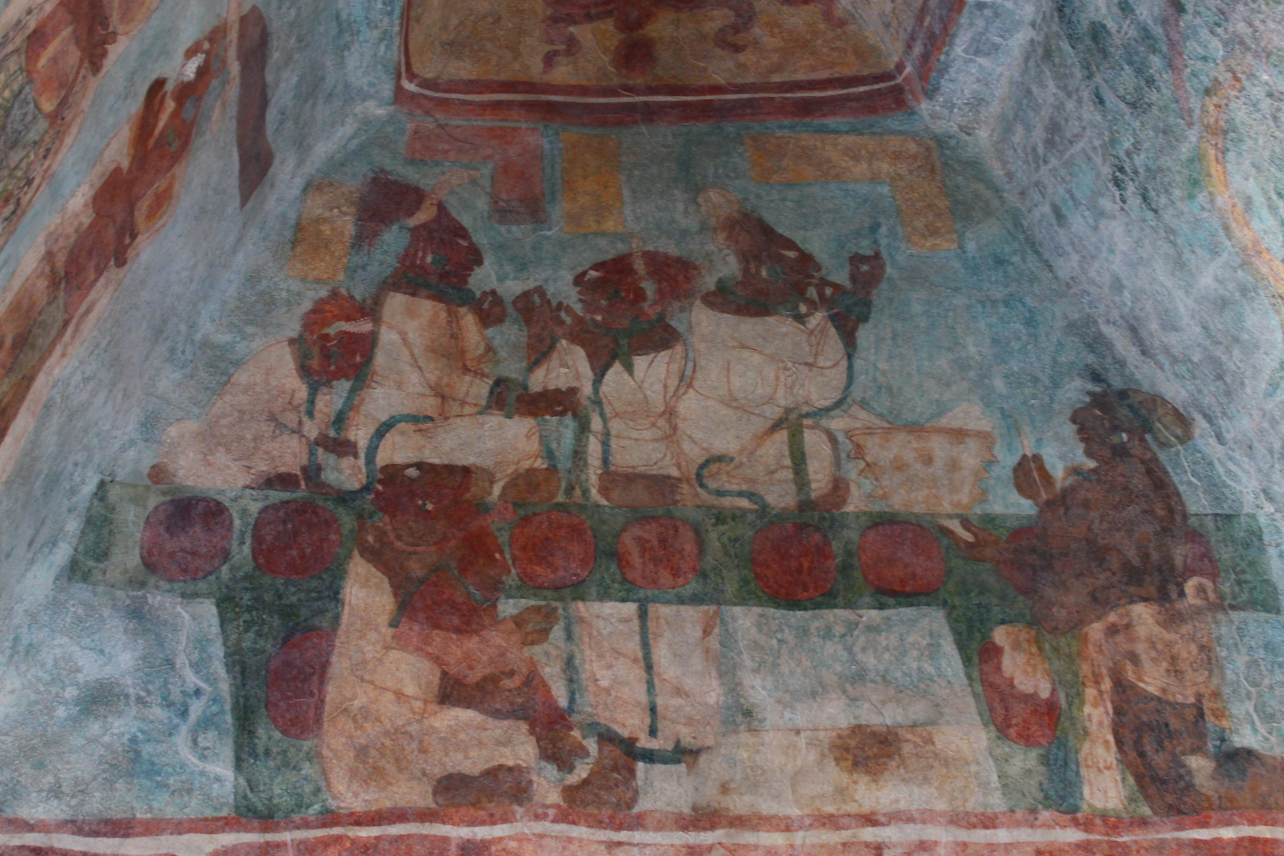
A faded ancient Mayan mural on a stone wall depicting several figures, likely dignitaries, seated at a table or dais.
Ancient Mayan mural painting located at the Bonampak archaeological site in Chiapas.

Top sights and standout views in Bonampak

The Temple of the Murals crowns the Bonampak experience: three vaulted rooms painted from floor to ceiling in a continuous narrative covering presentation of an heir, a victorious battle, and a royal celebration. Slightly more than 150 square meters of plaster carry about 114 glyphic clauses and 272 human figures, many identified by name, making this the most detailed surviving visual archive of any Classic Maya court.

Complementing the murals, Stela 1 in the Great Plaza rises nearly six meters high and depicts Chan Muwan II at the height of his power, while smaller stelae and carved lintels document familial alliances with Yaxchilán. Finally, the Lacandon rainforest setting itself, with documented populations of jaguars, monkeys, and one of Mexico's richest tropical species inventories, gives Bonampak an unusually powerful combination of cultural and natural heritage.
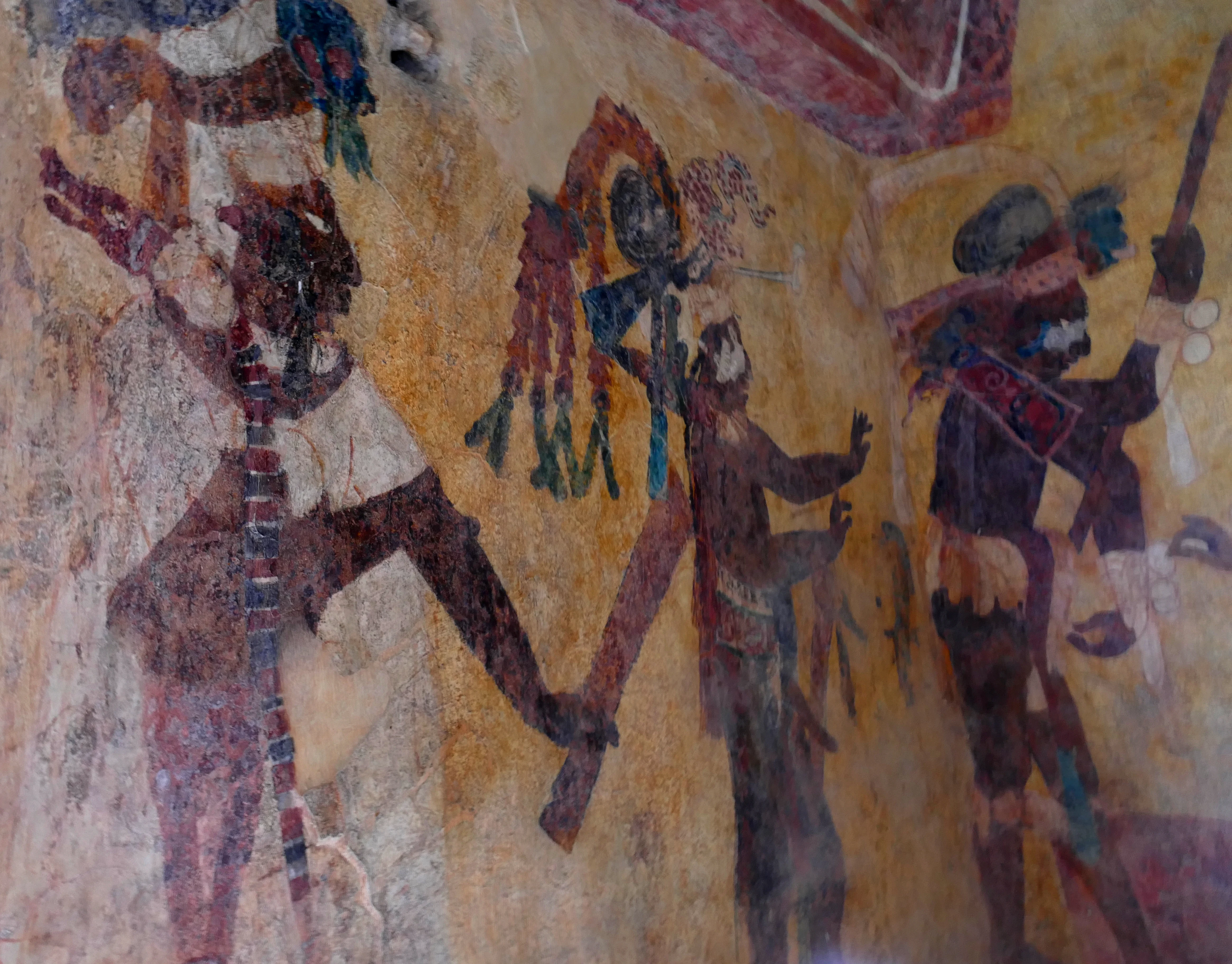
A close up view of faded ancient Mayan wall paintings depicting figures in ceremonial attire and headdresses in warm ochre and earth tones.
Ancient Maya murals inside the Temple of the Murals at Bonampak.
Monthly climate preview

Monthly temperature ranges and precipitation averages recorded at reference coordinates

Bonampak Climate Normals, Long-Term Temperature and Precipitation Patterns

Representative coordinates record measured monthly temperature swings and precipitation variation across the annual cycle. Detailed monthly breakdowns provide complete long-term climate normals for comparative analysis.
Annual mean23 °C
20 °C27 °C
Jan20°
Feb22°
Mar24°
Apr27°
May26°
Jun24°
Jul24°
Aug24°
Sep23°
Oct23°
Nov21°
Dec20°
Warmest month
April

26.7 °C

Coolest month
January

20 °C

Wettest month
September

10 mm/day

Driest month
March

0.8 mm/day

Park location guide

Geography guide, regional context, and park location map for Bonampak

Bonampak park geography, regions, and map view in Mexico

Understand where Bonampak sits in Mexico through a broader geographic reading of the surrounding landscape, nearby location context, and its mapped position within the national park landscape.

How Bonampak fits into Mexico

Mexico, officially the United Mexican States, is a country in North America spanning the Sierra Madre mountain ranges, coastal plains, and tropical regions. It borders the United States to the north, Guatemala and Belize to the southeast, and has coastlines along the Pacific Ocean, Gulf of Mexico, and Caribbean Sea. With a population exceeding 130 million, Mexico is home to one of the world's most significant concentrations of Indigenous languages alongside Spanish.

Wider geography shaping Bonampak in Mexico

Mexico occupies a land area of 1,972,550 km2, making it the thirteenth-largest country in the world. The terrain is highly diverse, featuring the Sierra Madre Occidental and Sierra Madre Oriental mountain ranges, the Mexican Plateau, coastal lowlands along the Pacific and Gulf/Caribbean margins, and the Yucatan Peninsula. The country spans multiple climate zones from desert in the north to tropical rainforest in the south.

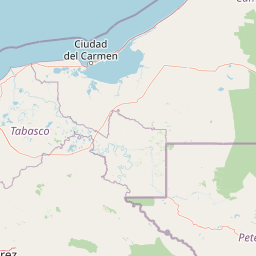
Map view of Bonampak

Use this park location map to pinpoint Bonampak in Mexico, understand its exact geographic position, and read its mapped placement within the surrounding landscape more clearly.

Pigeon | © OpenStreetMap contributors

Visual reference of protected jungle terrain, tropical habitats, and ancient ruins.

Bonampak Photos and Landscape Scenery in the Lacandon Rainforest

Visual records capture the dense tropical terrain and ancient stone architecture embedded within the protected rainforest reserve. Photographic documentation reveals the distinct environmental character and jungle canopy surrounding the archaeological site.

A section of an ancient Maya mural painting from Bonampak featuring several human figures in elaborate traditional dress, standing against a reddish-orange background.

An ancient stone lintel relief carving featuring a Maya figure in elaborate headdress and clothing, with surrounding glyphic script and decorative elements.

A vibrant ancient Mayan mural showing a group of people, including nobles wearing leopard skin patterned clothing and elaborate headdresses, standing and kneeling against a bright blue painted wall.

A wide view of the Mayan ruins at Bonampak, featuring a large grassy plaza in the foreground leading up to stone steps and structures surrounded by lush forest.

A wide shot of a multi-tiered Mayan stone pyramid at Bonampak, surrounded by dense jungle.

A section of an ancient Maya wall mural depicting a procession of figures holding instruments against a blue background.

A faded ancient Mayan mural on a stone wall depicting several figures, likely dignitaries, seated at a table or dais.

A close up view of faded ancient Mayan wall paintings depicting figures in ceremonial attire and headdresses in warm ochre and earth tones.

A wide view of a green grassy area surrounded by dense forest at Bonampak, featuring two ancient stone stelae under protective metal roof structures.

Ancient Maya mural painting showing a stylized, reclining human figure painted in earthy tones on an aged stone wall.

Faded ancient Maya wall paintings showing a group of figures in traditional attire standing in a row.

Ancient Maya mural painting depicting a procession of figures wearing elaborate headpieces against a faded teal background.

Park atlas

Compare surrounding jungle reserves and connected forest habitats

Other Parks Near Bonampak and Related Protected Landscapes in the Region

Visitors exploring Bonampak can browse nearby national parks and protected areas across the surrounding tropical rainforest. Comparing these adjacent regional landscapes provides deeper geographic context for the broader basin.
A stylized vector illustration of tiered Mayan pyramid structures rising above a dense green jungle landscape under a soft pastel sky.
Biosphere reservePetén Department
About 20 km away#1 closest

North

Maya Biosphere Reserve: Geographic Overview and Protected Landscapes in Petén

Tropical forest ecosystems and ancient archaeological mapping

Covering roughly one-fifth of Guatemala, the Maya Biosphere Reserve represents a pioneering model of zoned conservation. The landscape features a complex mosaic of lowland rainforests, savanna patches, and seasonal wetlands formed over a weathered limestone platform. This atlas summary examines the reserve's ecological boundaries, its vital role in protecting Mesoamerican biodiversity, and the concentration of pre-Columbian cities located across the Petén Department.

Area
21,602 km²
Established
1990
Relief
Mixed relief
Climate
Tropical
Natural monumentChiapas
About 24 km away#2 closest

Northeast

Yaxchilan Natural Monument: Geography and Protected Rainforest Boundaries in Chiapas

A mapped overview of river-cradled jungle terrain.

Yaxchilan encompasses a vital protected landscape within the Chiapas rainforest, centered on the dynamic Usumacinta River meander. This park record maps the intersection of tropical forest ecosystems and historical monument sites, offering a grounded look at the physical terrain, river-borne geography, and the natural corridors preserved within this distinct Mexican natural monument.

Relief
Lowland
Climate
Tropical
Access
Moderate access
Scope
Terrestrial
A soft watercolor illustration of a landscape with green trees, pink flowering bushes, and small plants against a pale, distant hilly background.
Wildlife reserveChiapas
About 29 km away#3 closest

East

Área de protección de flora y fauna Chan-Kin: Mapped Wildlife Reserve and Forest Landscape

Exploring protected tropical lowland ecosystems in eastern Chiapas

Área de protección de flora y fauna Chan-Kin represents a critical conservation node within the Selva Lacandona. This protected area maintains a continuous high-canopy forest structure, playing a decisive role in regional biodiversity and the persistence of wide-ranging tropical species across the Usumacinta basin.

Area
121.85 km²
Established
1992
Relief
Lowland
Climate
Tropical
Protected areaChiapas
About 69 km away#4 closest

Northwest

Área de protección de flora y fauna Nahá-Metzabok: A Protected Landscape in Chiapas

Mapping tropical rainforests, karst hydrology, and cultural heritage

The Área de protección de flora y fauna Nahá-Metzabok serves as a vital corridor in the Lacandon Jungle, protecting humid rainforests and rare montane cloud forest habitats. Its rugged karst terrain is characterized by prehistoric rock-art caves and critical aquatic systems that sustain regional river basins, offering a layered study of ecological and cultural significance in southern Mexico.

Area
8,617.49 km²
Established
1998
National parkChiapas
About 94 km away#5 closest

Southwest

Lagunas de Montebello National Park: Chiapas Protected Landscape Geography & Mapped Boundaries

Explore this national park's unique landscape context within Chiapas.

Lagunas de Montebello National Park offers a detailed view of protected landscape features and regional geographic context within Chiapas, Mexico. As a designated national park, its mapped boundaries are essential for understanding the distribution of protected areas and the natural terrain. This entity provides critical data for exploring the atlas of Mexican natural reserves and their specific environmental settings.

Area
64.11 km²
Established
1959
IUCN
II
Relief
Highland
A soft, minimalist watercolor painting showing a winding river flowing through rolling green hills against a white background.
Wildlife reserveTabasco
About 96 km away#6 closest

Northwest

Cañón del Usumacinta Wildlife Reserve: Geography and Protected Area Mapping in Tabasco, Mexico

Tropical rainforest, karst cenotes, and riverine canyons

Cañón del Usumacinta represents an ecologically significant protected landscape in southeastern Mexico. This wildlife reserve features high evergreen rainforest, prominent river rapids, and karst geological features such as cenotes and caves. The reserve maintains critical biological continuity through its position in the Mesoamerican Biological Corridor, bridging remote riverine terrain with significant Maya archaeological sites.

Area
461.28 km²
Established
2005
Relief
Mixed relief
Climate
Tropical
National parkPetén
About 99 km away#7 closest

East

El Rosario National Park: Protected National Park & Mapped Landscape Explorer

Geographic context and protected area boundaries within Petén.

Delve into the protected landscape of El Rosario National Park, identified as a national park within Guatemala's Petén region. This page provides an atlas-centric view, highlighting its mapped park boundaries and its significance in the regional geography. Understand the park as a distinct protected area contributing to the natural landscape context, ideal for geographic exploration and detailed mapping.

Area
11.05 km²
Established
1980
IUCN
II
Relief
Lowland
A soft watercolor painting of a series of cascading waterfalls surrounded by light green foliage and rolling hills in the background.
Protected areaChiapas
About 127 km away#8 closest

Northwest

Cascadas de Agua Azul: A Geological and Hydrological Survey of the Chiapas Protected Area

Limestone canyons, rainforest biodiversity, and river hydrology

Cascadas de Agua Azul offers a unique perspective on the karst terrain of Chiapas, Mexico. The site features shallow canyons carved by the Otulún and Tulijá rivers, sustained by a humid microclimate that supports dense mountain rainforest. This protected area acts as a crucial link in the regional conservation network, safeguarding limestone-rich soil environments and diverse habitats for migratory and endemic bird species.

Relief
Upland
Climate
Tropical
Access
Moderate access
Scope
Terrestrial

Common questions about visiting, size, designation, and location context for Bonampak

Bonampak FAQs for park facts, access, geography, and protected area context

Find quick answers about Bonampak, including protected-area facts, park geography, trail and visitor context, and how the park fits into its surrounding country and regional landscape.
MoriAtlas Explorer

Continue Your Protected Areas Search Across the Global Atlas

Deepen your exploration by continuing the structured search for national parks and protected areas worldwide. Utilize the comprehensive filtering capabilities to compare different conservation landscapes and refine your understanding of global park geography. Discover more about the distribution and characteristics of protected natural areas.

Global natural geography