Why Cangandala National Park stands out
Cangandala National Park is renowned as the primary conservation stronghold for the giant sable antelope, one of Africa's most iconic and critically endangered large mammals. This park represents the last refuge for the remaining wild populations of Hippotragus niger variani, a distinctive subspecies recognized for its impressive curved horns and dark coloration. Beyond this flagship species, the park protects significant stretches of intact miombo woodland ecosystem, a biome that spans much of southern Africa and supports unique biodiversity. The combination of riverine habitats along the Cuanza system with adjacent savanna and woodland creates a diverse ecological mosaic that supports multiple wildlife communities.
Cangandala National Park history and protected-area timeline
Cangandala National Park was established in 1970 by the Angolan government specifically to protect the last remaining wild populations of the giant sable antelope. The park's creation represented a proactive conservation response to growing concerns about the status of this distinctive subspecies, which was already recognized as facing significant threats across its limited range in central Angola. The timing of the park's establishment placed it directly in the path of one of Africa's longest and most devastating conflicts. The Angolan Civil War, which lasted from 1975 to 2002, had catastrophic consequences for the park's wildlife populations. Poaching intensified dramatically during the conflict years, and habitat disruption from landmines and uncontrolled human movement through the area further degraded the environment. The giant sable population was pushed to the brink of extinction, leading to serious fears that the subspecies might be lost entirely. Following the end of hostilities in 2002, concentrated conservation efforts began to stabilize and recover the remaining populations, including the establishment of highly protected sanctuary zones within the park boundaries.
Cangandala National Park landscape and geographic character
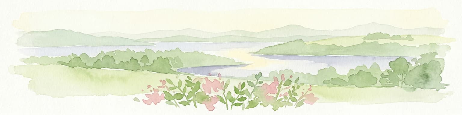
The physical landscape of Cangandala National Park reflects the characteristic terrain of central Angola's savanna biome. The topography consists primarily of flat to gently undulating plains, typical of the region where the Cuanza River system has laid down alluvial sediments over geological time. The park's position between the Cuanza River and its tributaries, the Maúndo and Cuije rivers, creates a landscape where watercourses play a defining role in shaping the local environment. Riverine corridors support denser vegetation and create seasonal wetlands that contrast with the more open miombo woodlands covering the higher ground. The vegetation follows the classic miombo woodland pattern, with a semi-open canopy of deciduous trees allowing sunlight to reach a grassy understory that greens dramatically during the wet season and turns golden and dry through the long dry months.
Cangandala National Park ecosystems, habitats, and plant life
The ecological character of Cangandala National Park is defined by the miombo woodland ecosystem, one of the most extensive forest types in southern Africa. The dominant tree species, Brachystegia and Julbernardia, create a distinctive landscape where trees spread their canopies in a relatively open configuration, permitting a dense ground layer of grasses and forbs. This habitat structure supports remarkable biodiversity, with the woodland serving as home to numerous species adapted to the seasonal contrasts between wet and dry periods. The presence of the Cuanza River system adds an important dimension to the park's ecology, with riverine forests providing more shaded and moisture-retentive habitats that contrast sharply with the surrounding woodland. Seasonal wetlands form along the river margins during the wet season, creating temporary habitats that attract waterbird species and provide grazing for larger mammals. The combination of woodland, grassland, and riverine habitats within a single protected area creates ecological diversity that supports multiple wildlife communities.
Cangandala National Park wildlife and species highlights
The wildlife community of Cangandala National Park centers on the critically endangered giant sable antelope, a subspecies that represents the park's primary conservation significance. These large antelopes, characterized by their dark chestnut to blackish coats and spectacularly curved horns that can reach over a meter in length, inhabit the miombo woodlands and adjacent grasslands. Beyond the flagship sable populations, the park supports various other antelope species adapted to the savanna environment, including smaller forest-dwelling and open-country species. Plains zebras maintain populations in the grassland areas, adding to the diverse large mammal community. The birdlife is particularly noteworthy, with numerous species occupying the various habitat types, from woodland interior species to wetland-associated waterbirds that follow the seasonal fluctuations of the river system. The river corridors also support specialized species that depend on the denser vegetation and water availability.
Cangandala National Park conservation status and protection priorities
Cangandala National Park holds exceptional conservation importance as the primary refuge for one of Africa's most threatened large mammal species. The giant sable antelope, classified as critically endangered by global conservation bodies, survives in the wild primarily within the boundaries of this protected area. The park's establishment created a dedicated sanctuary for this subspecies at a time when its numbers were already declining across its limited range. Conservation challenges intensified dramatically during the Angolan Civil War, when poaching and habitat degradation pushed the species toward extinction. Post-war conservation efforts have focused on strengthening protection within the park, including the designation of core sanctuary areas with enhanced security and management. The miombo woodland ecosystem itself represents a conservation priority, as this habitat type faces pressure across its range from agricultural expansion and logging. Protecting these woodlands within the park contributes to broader biodiversity conservation in central African savanna regions.
Cangandala National Park cultural meaning and human context
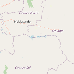
Cangandala National Park is situated in Malanje Province, a region with historical significance in Angola's colonial and post-colonial history. The park's name derives from local naming traditions, reflecting the geographic and cultural identity of the area. The broader Malanje region has been influenced by Portuguese colonial presence, with historical connections to the Cuanza River as a transport route during the colonial period. The local communities in the surrounding area have traditional connections to the land, though the park's strict protection status has limited direct human use within its boundaries. The conservation of the giant sable antelope carries cultural significance beyond its ecological value, as this species has become a symbol of Angolan natural heritage and a flagship for the country's conservation aspirations.
Top sights and standout views in Cangandala National Park
Cangandala National Park represents one of Africa's most significant conservation priorities, protecting the last wild populations of the giant sable antelope in a dedicated sanctuary setting. The park's miombo woodland landscape, traversed by the Cuanza River and its tributaries, creates a diverse habitat mosaic that supports multiple wildlife communities. The contrast between dry season golden grasslands and the seasonal greening during rains transforms the park's appearance throughout the year, offering different visual experiences. The riverine environments provide crucial water sources and more lush vegetation that contrasts sharply with the surrounding woodland. The park's historical significance as a conservation area established specifically to save a species from extinction demonstrates the potential for protected areas to serve as last-line defenses for threatened wildlife.
Best time to visit Cangandala National Park
The optimal time to experience Cangandala National Park depends on what visitors hope to observe and the seasonal conditions of the landscape. The dry season, typically from May through October, offers easier wildlife viewing as animals concentrate around remaining water sources and the vegetation is less dense. The landscape at this time displays the characteristic golden color of dried grasses beneath the canopy of deciduous miombo trees. The wet season, roughly November through April, transforms the park with fresh green growth and ephemeral water bodies, creating a different but equally compelling visual experience. Birdlife is particularly active during the wet months when migratory species arrive and resident birds become more vocal and visible. The timing of visits should consider the park's conservation status and the need to support ongoing protection efforts.