
Mori Atlas logo
Protected areaCascadas de Agua Azul

Examining the hydrology, limestone geology, and biodiversity of this regional river corridor

Cascadas de Agua Azul: A Protected Karst Landscape and River Ecosystem in Northern Chiapas, Mexico

(Área de Protección de Flora y Fauna Cascadas de Agua Azul)

Cascadas de Agua Azul represents a vital protected area in the northern mountains of Chiapas, where the rivers Otulún, Shumuljá, and Tulijá form a dramatic sequence of cascades and pools. The landscape is shaped by complex limestone geology and dissolved carbonate salts, which create the signature blue appearance of the river waters. This humid rainforest environment serves as a critical refuge for hundreds of bird species and supports high levels of endemism within the Grijalva basin watershed.

waterfallsChiapasmountain rainforestkarst landscaperiver corridorlimestone geology
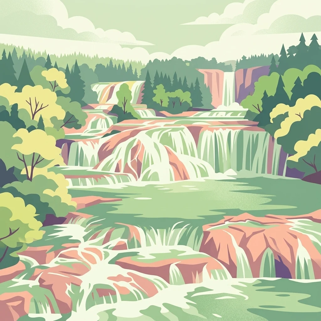
A stylized flat vector illustration of tiered waterfalls cascading over terraced rock formations, surrounded by a lush forest and soft clouds.

Cascadas de Agua Azul

Protected area

Park overview

Structured park overview, official facts, and landscape profile for Cascadas de Agua Azul

Cascadas de Agua Azul park facts, protected area profile, and essential visitor context

Review the core facts for Cascadas de Agua Azul, including designation, size, terrain, visitor scale, habitats, and operating context in one park-focused overview.

About Cascadas de Agua Azul

Cascadas de Agua Azul is a federal Área de Protección de Flora y Fauna located in the northern reaches of the Mexican state of Chiapas. The protected area centers on a chain of waterfalls and rapids formed by the rivers Otulún, Shumuljá, and Tulijá, which converge to carve shallow canyons with vertical limestone walls. The result is a sequence of block-segmented cascades and emerald-blue pools that descend through dense mountain rainforest.

The waterfall system's fame comes largely from the unusual color of its waters. Calcium carbonate and other dissolved salts from the karst geology filter most of the visible spectrum, leaving a vivid blue reflection in the pools. This effect is most prominent in the dry winter and spring months; during the rainy season, the river swells, the pools overflow, and the water loses its characteristic color while the canyon takes on a more powerful, flood-driven appearance.

Beyond its scenic appeal, Cascadas de Agua Azul holds substantial biological importance. The park lies in a region that researchers have identified as one of the most biodiverse in Mexico, and inventories of the protected area record a wide cross-section of flora and fauna, from centuries-old rainforest trees to birds, mammals, reptiles, and amphibians. The surrounding landscape includes the iconic Lacandón-style rainforest, mosaic agricultural lands, and areas affected by deforestation, fire, and cattle grazing, putting the park at the center of regional conservation efforts.

From a geographical standpoint, the area is part of the Grijalva hydrographic region, contributing flows to one of Mexico's largest river systems. Soils in the park are dominated by shallow, stony Leptosols, with smaller areas of Luvisols on slightly deeper terrain. The combination of very high rainfall, steep slopes, and porous limestone shapes both the waterfalls and the ecological character of the rainforest that surrounds them.

Quick facts and research context for Cascadas de Agua Azul

Cascadas de Agua Azul is located in northern Chiapas, Mexico, within the municipalities of Chilón, Tumbalá, and Salto de Agua. The site has been a federal protected area since 1980, originally designated as a Special Biosphere Reserve, and is today classified as an Área de Protección de Flora y Fauna managed by Mexico's National Commission of Natural Protected Areas (Conanp).

The park's hydrology is part of the larger Grijalva-Villahermosa basin, and the waterfalls themselves form from limestone terrain where dissolved carbonate minerals create the famous blue coloration. The climate is warm and humid, one of the rainiest in Mexico, and the local vegetation is classified as mountain rainforest with tall, dense canopy cover adjacent to the river corridor.

Protection and recognition

Documented terrestrial protection history and conservation framework

Cascadas de Agua Azul Protection Status and Designated Year

Cascadas de Agua Azul maintains documented terrestrial protection status established in the designated year 1980. Official records compile the historical designation timeline and administrative management scope for the protected area.

Protection details

Protection scope
Terrestrial
Designated year
1980
Transboundary protection
No
Park context

Deeper park guide and search-rich context for Cascadas de Agua Azul

Cascadas de Agua Azul history, landscape, wildlife, and travel context

Explore Cascadas de Agua Azul through its history, landscape character, ecosystems, wildlife, conservation priorities, cultural context, and seasonal travel timing in a structured park guide built for atlas discovery and search intent.

Why Cascadas de Agua Azul stands out

Cascadas de Agua Azul is best known for its stepped waterfalls and natural pools whose waters reflect an intense blue color, caused by dissolved carbonate salts from the surrounding limestone bedrock. The site is widely recognized as a regional natural icon of Chiapas and is among the most photographed water features in southern Mexico. Equally important is the protected area's ecological value: the surrounding mountain rainforest supports an exceptionally rich avifauna, with hundreds of resident and migratory bird species documented in the park, and a varied flora of more than 270 vascular plant species, including both common rainforest trees and species listed under Mexican conservation categories.
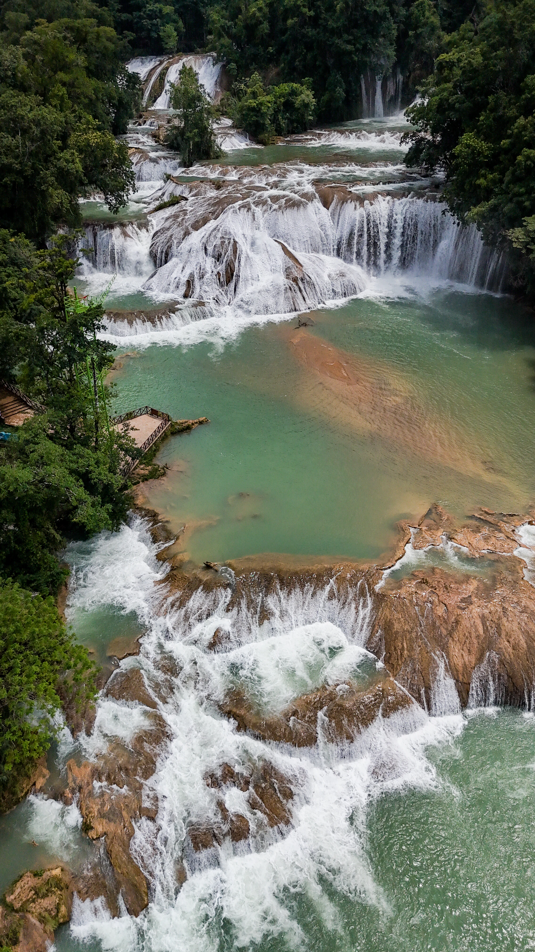
High-angle drone view of cascading waterfalls over rocky tiers into turquoise pools surrounded by lush green tropical forest.
An aerial view of the cascading blue waters at Cascadas de Agua Azul in Chiapas, Mexico.

Cascadas de Agua Azul history and protected-area timeline

Cascadas de Agua Azul was formally recognized as a protected area in 1980, when it was declared a Special Biosphere Reserve. The underlying motivation for its protection was the exceptional ecological value of the river corridor and the surrounding mountain rainforest, which together form a continuous and unusually rich landscape in northern Chiapas.

Since its designation, the area has been administered by federal environmental authorities, and conservation programs have been progressively developed to address threats such as deforestation, agricultural expansion, fire, illegal extraction of wildlife, and unmanaged tourism. An official management plan outlines objectives spanning protection, restoration, knowledge generation, cultural engagement, and governance, with continuous monitoring by bodies such as Conanp, Conabio, and Conagua.

Throughout its history, the park has also been shaped by the presence of indigenous and rural communities living within and around its boundaries. Local communities have played a complex role in its protection, participating in community surveillance brigades, fire prevention efforts, and reforestation initiatives, while also negotiating tensions around territorial rights, tourism income, and environmental enforcement.

Cascadas de Agua Azul landscape and geographic character

The landscape of Cascadas de Agua Azul is defined by cascading water and surrounding limestone geology. The rivers Otulún, Shumuljá, and Tulijá cut across the karst terrain, producing shallow but visually dramatic canyons with vertical cliffs, exposed limestone, and a series of segmented falls of varying height. The biggest individual drop in the main cascade is around 6 meters, but the overall visual effect of the staircase of falls and pools is what defines the site.

Outside the river corridor, the terrain transitions into steeply sloped, humid mountains clad in tall rainforest canopy. Leptosols, very thin, rocky, lime-rich soils, dominate the landscape, with nearly 80 percent of the protected area under this soil class. The remainder consists of Luvisols that form on more consolidated river deposits. These thin, calcium-rich soils support the dense vegetation but also explain the area's vulnerability to erosion when forest cover is removed.

Because the mountains here face the Gulf of Mexico, prevailing moisture-laden winds are forced upward, producing an exceptionally humid microclimate that sustains lush vegetation all year. Even in drier months, mist and frequent rainfall keep the canyon walls damp and rich in mosses, ferns, and climbing vines, reinforcing the rainforest impression even at the margins of the main waterfalls.
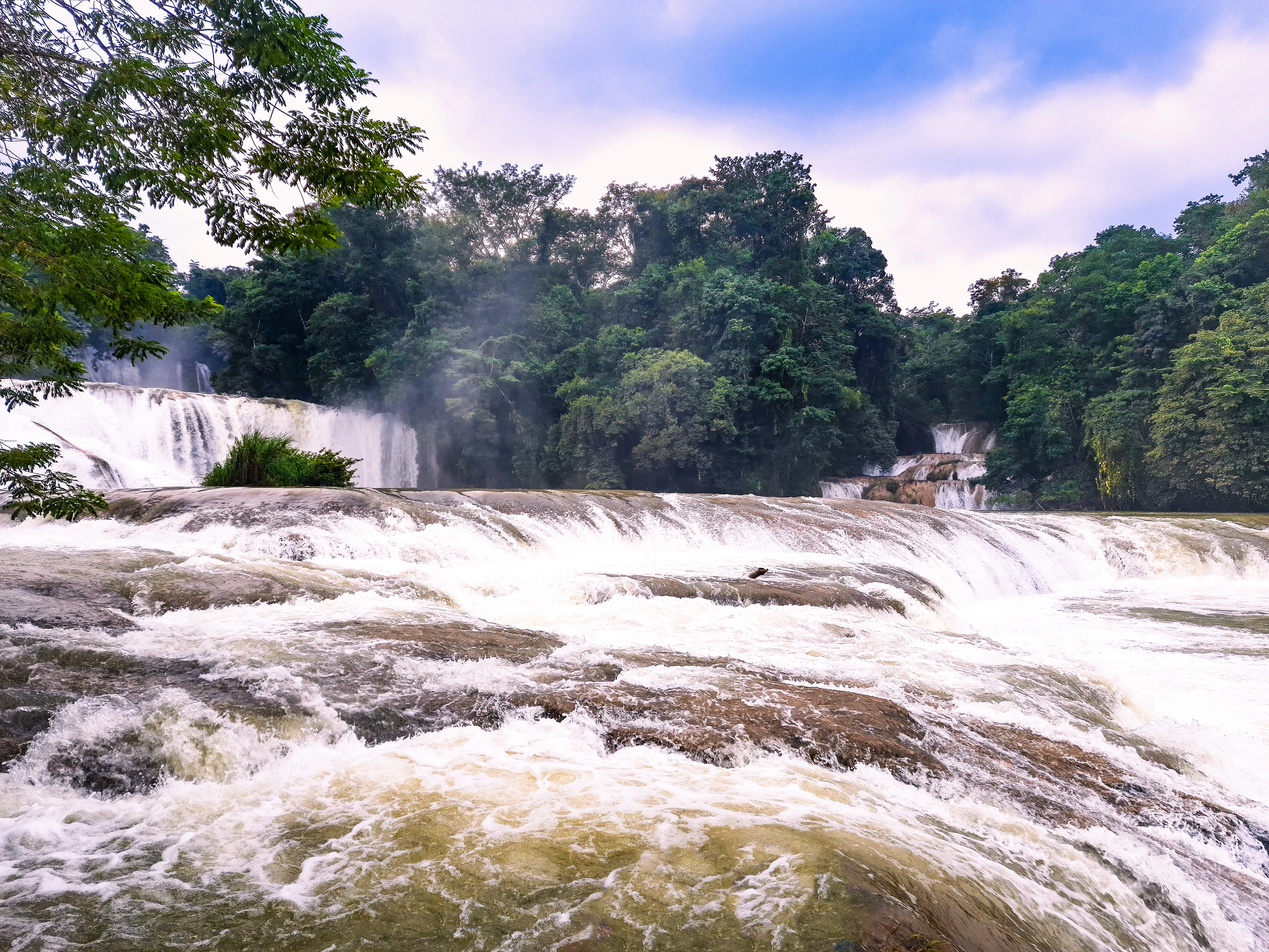
A wide shot of multi-tiered waterfalls cascading over rocky, carbonate-rich ledges surrounded by dense green forest, under a partially cloudy sky.
The cascading waters of Cascadas de Agua Azul, flowing over tiered limestone shelves in the Chiapas rainforest.

Cascadas de Agua Azul ecosystems, habitats, and plant life

The natural environment at Cascadas de Agua Azul is dominated by mountain rainforest that grows on karstic, carbonate-rich soil. The vegetation ranges from primary canopy with tall hardwoods to secondary growth and areas of acahual, where once-cleared lands have returned to a forested state. The dense canopy and humid climate favor epiphytes, ferns, and shade-tolerant understory species.

A total of around 278 vascular plant species have been recorded, distributed across 75 families and roughly 190 genera, reflecting the area's transition between different floristic zones. Notable tree species in the canopy include chicozapote, ramón, palo mulato, palo de rosa, pochote, bari, and zapote de mico, alongside orchids such as the green swan orchid. The flora also incorporates palm species and other characteristic components of tropical rainforest in the Grijalva basin.

The park's ecological significance extends beyond plants. Although botanical studies cover a narrower roster, the broader inventories record more than 860 species of plants and animals combined, and a meaningful share of these are represented in the protected-area lists for vascular plants, amphibians, reptiles, birds, and mammals. The surrounding forests and river system form a relatively intact habitat matrix that is critical for species that depend on both closed canopy and water resources.
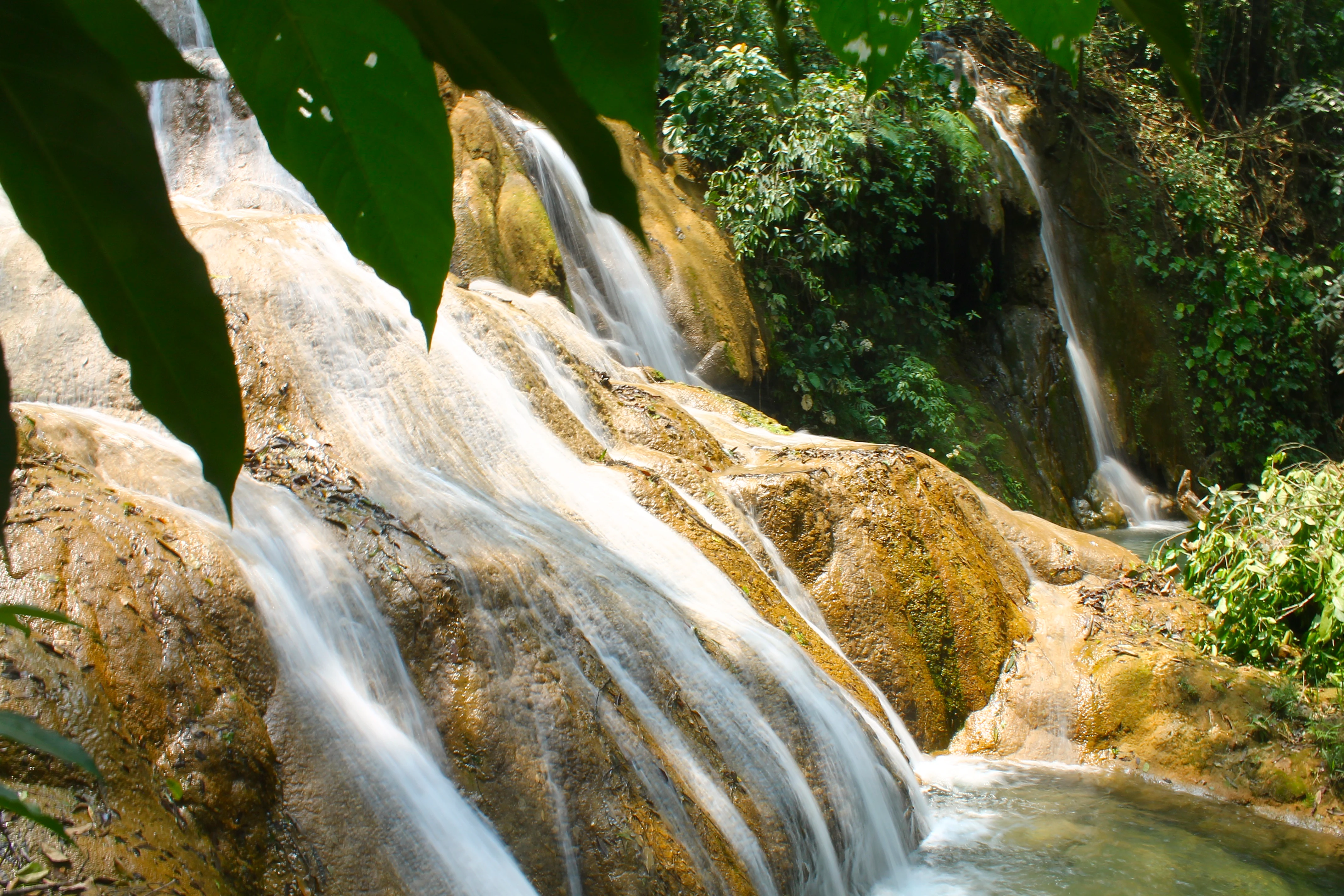
A close-up view of tiered limestone waterfalls cascading over light-brown rocks into a pool, framed by lush green jungle foliage in the foreground.
The cascading waters of Cascadas de Agua Azul, flowing over mineral-rich tiered rock formations.

Cascadas de Agua Azul wildlife and species highlights

Cascadas de Agua Azul supports a remarkably complete cross-section of Chiapas fauna, making it a regional wildlife refuge despite the site's fame as a scenic attraction. Documented vertebrates in the protected area total around 583 species, including 18 amphibians, 42 reptiles, 455 birds, and 68 mammals, with an additional 22 species considered endemic at or near the site.

The area is especially important for birds, both resident and migratory. Park bird records include 20 orders, 61 families, and 281 genera, accounting for a large portion of the regional avifauna. In addition to its bird richness, the protected area hosts mammals such as coyote, bobcat, white-tailed deer, desert cottontail, and various squirrels and rabbits, along with reptiles that range from turtles and skinks to whip-tail lizards and gerrhonotine lizards. Aquatic fauna, including several mojarra, carp-like fishes, and small-bodied livebearers, also inhabits the river corridor.

A particular point of conservation concern is the unusually large fraction of the recorded fauna and flora that falls under some category of risk in Mexico's NOM-059 listing. Threatened species, species under special protection, and endangered species have all been recorded in and around the park, including orchids and ornamental plants that face collection pressure from outside. The combination of high species richness, local endemism, and concentrated threat is what makes the area a priority site for community-based conservation.

Cascadas de Agua Azul conservation status and protection priorities

Conservation at Cascadas de Agua Azul rests on a combination of federal protection status and on-the-ground community management. Declared in 1980 as a Special Biosphere Reserve and later managed as an Área de Protección de Flora y Fauna under Conanp, the park benefits from a formal management plan covering protection, sustainable use, restoration, education, and governance. Conabio and Conagua also play important roles, particularly in biodiversity monitoring and watershed management within the larger Grijalva-Villahermosa basin.

The conservation picture is shaped by serious, ongoing threats. Sizable areas have been transformed by deforestation and agriculture, including the spread of oil palm plantations, which is targeted for eradication under park management programs. Forest fires associated with slash-and-burn agriculture periodically burn small but persistent areas; extensive cattle ranching reduces natural cover; unmanaged hunting and the collection of orchids and ornamental plants put pressure on vulnerable native wildlife; and contamination from waste and untreated sewage, as well as uncontrolled tourism, impact the river corridor itself.

In response, the management plan emphasizes community participation. Community surveillance brigades, certified by federal environmental authorities, patrol for illegal extraction of flora and fauna, while fire prevention programs coordinate with local communities to reduce the impact of agricultural burning. Reforestation programs have been expanding native vegetation cover since at least the mid-2000s, and invasive species programs target both exotic plants and animals that disrupt local ecosystems. Climate adaptation is also integrated into the current plan, including agroforestry, efficient cookstoves, and micro-watershed management.

Cascadas de Agua Azul cultural meaning and human context

Cascadas de Agua Azul sits in a long-inhabited region of northern Chiapas, where indigenous and rural communities have lived for generations and continue to play a central role in the protected area's present and future. Local towns, ejidos, and indigenous communities contribute to the management of the park, not only as laborers and guides in the ecotourism economy but also as participants in community surveillance, fire prevention, and reforestation activities.

The site also occupies a contested space in the region's political geography: scholars and local commentators have framed the park as a focal point of territorial negotiations between indigenous communities, environmental authorities, ecotourism operators, and state security forces. Periodic road blockades and disputes over access, fees, and land rights have shaped both visitor experience and conservation work in recent decades.

At the same time, the park's cultural identity is strongly tied to regional heritage in Chiapas. The waterfalls are widely considered an emblem of the state, referenced in tourism narratives, local art, and popular media, and the surrounding gastronomy, crafts, and markets contribute a rich cultural layer that complements the natural attraction. This combination of natural beauty and community-rooted cultural life is a defining feature of how Cascadas de Agua Azul is understood locally and beyond.

Top sights and standout views in Cascadas de Agua Azul

Cascadas de Agua Azul stands out for the optical singularity of its waters, which appear intensely blue because dissolved carbonate minerals filter incoming light through the limestone karst. This rare phenomenon, paired with the staircase of block-segmented falls and natural pools, makes the park one of the most visually distinctive river landscapes in southern Mexico.

The park is also notable for its biological richness, with more than 450 bird species recorded, around 278 plant species, and a substantial count of mammals, reptiles, and amphibians, including 22 endemic species. Such diversity in a relatively compact area, combined with regional endemism and proximity to the Grijalva basin, gives the park a meaningful role in the wider conservation network of Chiapas and southeastern Mexico.

Best time to visit Cascadas de Agua Azul

The most attractive time for visitors is during the dry season, particularly winter and early spring, when river levels are lower and the famous blue color of the water is most vivid. In these months the pools are calmer and considered safer for swimming, and the surrounding rainforest tends to be less oppressive in terms of humidity and bugs.

During the rainy season the character of the site changes dramatically: water volumes rise, the river overtops the pools, the blue color is replaced by a more opaque, muddy appearance, and swimming becomes risky. The lushness of the vegetation peaks in these months, however, and the waterfalls themselves become more powerful, offering a very different but equally dramatic experience.
Monthly climate preview

Long-term temperature and precipitation patterns across representative coordinates in Chiapas

Cascadas de Agua Azul Climate Normals and Annual Weather Rhythm

Historical climate normals for Cascadas de Agua Azul track measured monthly temperature ranges alongside shifting precipitation averages from NASA power records. Detailed month-by-month tables reveal complete annual weather patterns and long-term averages for this protected park coordinate.
Annual mean25 °C
22 °C29 °C
Jan22°
Feb23°
Mar26°
Apr29°
May29°
Jun27°
Jul26°
Aug27°
Sep26°
Oct25°
Nov23°
Dec22°
Warmest month
May

29.4 °C

Coolest month
January

21.7 °C

Wettest month
September

11.3 mm/day

Driest month
March

1.6 mm/day

Park location guide

Geography guide, regional context, and park location map for Cascadas de Agua Azul

Cascadas de Agua Azul park geography, regions, and map view in Mexico

Understand where Cascadas de Agua Azul sits in Mexico through a broader geographic reading of the surrounding landscape, nearby location context, and its mapped position within the national park landscape.

How Cascadas de Agua Azul fits into Mexico

Mexico, officially the United Mexican States, is a country in North America spanning the Sierra Madre mountain ranges, coastal plains, and tropical regions. It borders the United States to the north, Guatemala and Belize to the southeast, and has coastlines along the Pacific Ocean, Gulf of Mexico, and Caribbean Sea. With a population exceeding 130 million, Mexico is home to one of the world's most significant concentrations of Indigenous languages alongside Spanish.

Wider geography shaping Cascadas de Agua Azul in Mexico

Mexico occupies a land area of 1,972,550 km2, making it the thirteenth-largest country in the world. The terrain is highly diverse, featuring the Sierra Madre Occidental and Sierra Madre Oriental mountain ranges, the Mexican Plateau, coastal lowlands along the Pacific and Gulf/Caribbean margins, and the Yucatan Peninsula. The country spans multiple climate zones from desert in the north to tropical rainforest in the south.

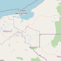
Map view of Cascadas de Agua Azul

Use this park location map to pinpoint Cascadas de Agua Azul in Mexico, understand its exact geographic position, and read its mapped placement within the surrounding landscape more clearly.

Pigeon | © OpenStreetMap contributors

Location context for Cascadas de Agua Azul

Chiapas

Visual reference of limestone canyons, travertine terraces, and rainforest habitats.

Cascadas de Agua Azul Photos and Landscape Scenery

Captured photographs reveal the distinct limestone geology and bright blue waters characteristic of the river corridor. Visual documentation provides insight into the steep mountain rainforest terrain supporting regional wildlife habitats.

High-angle drone view of cascading waterfalls over rocky tiers into turquoise pools surrounded by lush green tropical forest.

A wide, cascading waterfall flowing over limestone shelves into a turquoise pool, surrounded by dense green forest foliage under a partly cloudy blue sky.

A wide shot of multi-tiered waterfalls cascading over rocky, carbonate-rich ledges surrounded by dense green forest, under a partially cloudy sky.

A close-up view of tiered limestone waterfalls cascading over light-brown rocks into a pool, framed by lush green jungle foliage in the foreground.

Park atlas

Compare regional protected areas and surrounding mountain rainforest habitats

Parks Near Cascadas de Agua Azul and Related Protected Landscapes in Chiapas

Browsing other protected areas near Cascadas de Agua Azul reveals the broader ecological context of the regional river corridors and karst mountain terrain. Comparing adjacent conservation zones helps trace connected watershed networks and limestone geology across southeastern Mexico.
Protected areaChiapas
About 59 km away#1 closest

East

Área de protección de flora y fauna Nahá-Metzabok: A Protected Landscape in Chiapas

Mapping tropical rainforests, karst hydrology, and cultural heritage

The Área de protección de flora y fauna Nahá-Metzabok serves as a vital corridor in the Lacandon Jungle, protecting humid rainforests and rare montane cloud forest habitats. Its rugged karst terrain is characterized by prehistoric rock-art caves and critical aquatic systems that sustain regional river basins, offering a layered study of ecological and cultural significance in southern Mexico.

Area
8,617.49 km²
Established
1998
A soft, minimalist watercolor painting showing a winding river flowing through rolling green hills against a white background.
Wildlife reserveTabasco
About 67 km away#2 closest

East

Cañón del Usumacinta Wildlife Reserve: Geography and Protected Area Mapping in Tabasco, Mexico

Tropical rainforest, karst cenotes, and riverine canyons

Cañón del Usumacinta represents an ecologically significant protected landscape in southeastern Mexico. This wildlife reserve features high evergreen rainforest, prominent river rapids, and karst geological features such as cenotes and caves. The reserve maintains critical biological continuity through its position in the Mesoamerican Biological Corridor, bridging remote riverine terrain with significant Maya archaeological sites.

Area
461.28 km²
Established
2005
Relief
Mixed relief
Climate
Tropical
A stylized vector illustration of tiered Mayan pyramid structures rising above a dense green jungle landscape under a soft pastel sky.
Biosphere reservePetén Department
About 72 km away#3 closest

East

Maya Biosphere Reserve: Geographic Overview and Protected Landscapes in Petén

Tropical forest ecosystems and ancient archaeological mapping

Covering roughly one-fifth of Guatemala, the Maya Biosphere Reserve represents a pioneering model of zoned conservation. The landscape features a complex mosaic of lowland rainforests, savanna patches, and seasonal wetlands formed over a weathered limestone platform. This atlas summary examines the reserve's ecological boundaries, its vital role in protecting Mesoamerican biodiversity, and the concentration of pre-Columbian cities located across the Petén Department.

Area
21,602 km²
Established
1990
Relief
Mixed relief
Climate
Tropical
A minimalist watercolor illustration showing layers of green hills and distant mountain ridgelines against a white background.
Protected areaMexico
About 127 km away#4 closest

Southeast

Bonampak Protected Area: Geography and Landscape Context of the Lacandon Rainforest

An archaeological and natural monument in Chiapas, Mexico

Bonampak encompasses a rich protected area within the Lacandon rainforest, featuring low-lying jungle terrain and significant cultural heritage sites. This atlas entry examines the physical geography, including the site proximity to the Usumacinta River tributaries, and the preservation of continuous tropical canopy that defines the regional biodiversity and cultural landscape.

Relief
Lowland
Climate
Tropical
Scope
Terrestrial
Water
Minor water
Natural monumentChiapas
About 129 km away#5 closest

East

Yaxchilan Natural Monument: Geography and Protected Rainforest Boundaries in Chiapas

A mapped overview of river-cradled jungle terrain.

Yaxchilan encompasses a vital protected landscape within the Chiapas rainforest, centered on the dynamic Usumacinta River meander. This park record maps the intersection of tropical forest ecosystems and historical monument sites, offering a grounded look at the physical terrain, river-borne geography, and the natural corridors preserved within this distinct Mexican natural monument.

Relief
Lowland
Climate
Tropical
Access
Moderate access
Scope
Terrestrial
National parkChiapas
About 134 km away#6 closest

South

Lagunas de Montebello National Park: Chiapas Protected Landscape Geography & Mapped Boundaries

Explore this national park's unique landscape context within Chiapas.

Lagunas de Montebello National Park offers a detailed view of protected landscape features and regional geographic context within Chiapas, Mexico. As a designated national park, its mapped boundaries are essential for understanding the distribution of protected areas and the natural terrain. This entity provides critical data for exploring the atlas of Mexican natural reserves and their specific environmental settings.

Area
64.11 km²
Established
1959
IUCN
II
Relief
Highland
A soft watercolor illustration of a landscape with green trees, pink flowering bushes, and small plants against a pale, distant hilly background.
Wildlife reserveChiapas
About 153 km away#7 closest

Southeast

Área de protección de flora y fauna Chan-Kin: Mapped Wildlife Reserve and Forest Landscape

Exploring protected tropical lowland ecosystems in eastern Chiapas

Área de protección de flora y fauna Chan-Kin represents a critical conservation node within the Selva Lacandona. This protected area maintains a continuous high-canopy forest structure, playing a decisive role in regional biodiversity and the persistence of wide-ranging tropical species across the Usumacinta basin.

Area
121.85 km²
Established
1992
Relief
Lowland
Climate
Tropical
Protected landscapeCampeche
About 161 km away#8 closest

North

Laguna de Términos Protected Landscape: Geography and Mapped Boundaries in Campeche

Coastal wetland conservation and deltaic landscape patterns

Positioned along the southwestern edge of the Yucatán Peninsula, Laguna de Términos is a central coastal lagoon protected for its high biological productivity and extensive mangrove forests. This geographic overview highlights the interaction between major river systems, tidal channels, and the Gulf of Mexico that define this essential wetland landscape.

Area
7,050.16 km²
Established
1994
Water
Water-dominated

Common questions about visiting, size, designation, and location context for Cascadas de Agua Azul

Cascadas de Agua Azul FAQs for park facts, access, geography, and protected area context

Find quick answers about Cascadas de Agua Azul, including protected-area facts, park geography, trail and visitor context, and how the park fits into its surrounding country and regional landscape.
MoriAtlas Explorer

Continue Your Protected Areas Search Across the Global Atlas

Deepen your exploration by continuing the structured search for national parks and protected areas worldwide. Utilize the comprehensive filtering capabilities to compare different conservation landscapes and refine your understanding of global park geography. Discover more about the distribution and characteristics of protected natural areas.

Global natural geography