Mori Atlas logo
Nature reserveCentral Suriname Nature Reserve

Discover the geographic boundaries and landscape context of this vital nature reserve.

Central Suriname Nature Reserve: A Mapped Protected Area in Sipaliwini District

(Centraal Suriname Natuurreservaat)

The Central Suriname Nature Reserve represents a key protected landscape within the Sipaliwini District, offering a vital area for geographic study and conservation insight. This nature reserve serves as a crucial component of Suriname's protected lands, providing a defined geographic scope for understanding its natural terrain and regional context. Explore its mapped boundaries and its place within the broader natural atlas.

tropical rainforestUNESCO World Heritage Sitegranite domesGuianan moist forestsprimary forestmountain protected area

Central Suriname Nature Reserve

Nature reserve

Park overview

Structured park overview, official facts, and landscape profile for Central Suriname Nature Reserve

Central Suriname Nature Reserve park facts, protected area profile, and essential visitor context
Review the core facts for Central Suriname Nature Reserve, including designation, size, terrain, visitor scale, habitats, and operating context in one park-focused overview.

About Central Suriname Nature Reserve

The Central Suriname Nature Reserve stands as one of the most significant protected areas in the Guianas, preserving a vast contiguous landscape of untouched tropical rainforest that remains largely unaltered by human activity. Located in the remote interior of Suriname, the reserve encompasses both montane and lowland primary forest ecosystems within the Guianan moist forests ecoregion, a region recognized globally for its extraordinary biodiversity and endemism. The reserve was established in 1998 through the consolidation of three formerly separate protected areas—Ralleighvallen, Tafelberg, and Eilerts de Haan gebergte—creating a unified conservation unit of remarkable ecological coherence. This fusion was orchestrated through a partnership between Conservation International and the Surinamese government, reflecting international recognition of the area's global significance. The reserve's inclusion on the UNESCO World Heritage List in 2000 acknowledged not only its natural beauty but more importantly its role as a functioning ecosystem that has remained essentially untouched by modern human development. Visitors and researchers access the reserve primarily through the research station at Voltzberg, which serves as a base for scientific exploration and limited ecotourism activities.

Quick facts and research context for Central Suriname Nature Reserve

Located in Sipaliwini District, Central Suriname covers 1.6 million hectares of pristine Guianan moist forest ecosystem. The reserve contains Suriname's highest mountains including Julianatop (1,230m) and Tafelberg (1,026m), as well as notable granite domes such as Voltzberg. Over 5,000 plant species have been documented within the reserve boundaries. The area was created through a partnership between Conservation International and the Surinamese government, receiving additional support from Microsoft co-founder Jeff Harbers. A research station operates at the foot of Voltzberg supporting ongoing ecological studies.

Park context

Deeper park guide and search-rich context for Central Suriname Nature Reserve

Central Suriname Nature Reserve history, landscape, wildlife, and travel context
Explore Central Suriname Nature Reserve through its history, landscape character, ecosystems, wildlife, conservation priorities, cultural context, and seasonal travel timing in a structured park guide built for atlas discovery and search intent.

Why Central Suriname Nature Reserve stands out

The Central Suriname Nature Reserve is best known for its dramatic granite dome formations, particularly the 245-meter-high Voltzberg which rises like a monolith from the surrounding rainforest canopy. The reserve protects extensive pristine tropical forest in the Guianan moist forests ecoregion, representing one of the most biologically diverse regions in South America. Its birdlife is especially notable, featuring the Guiana Cock of the Rock with its spectacular display grounds. The reserve also encompasses Suriname's highest mountain, Julianatop at 1,230 meters, and the enigmatic Duivelsei (Devil's Egg), a precariously balanced boulder on a mountain ridge.

Central Suriname Nature Reserve history and protected-area timeline

The Central Suriname Nature Reserve was formally established in 1998 through the merger of three pre-existing nature reserves: Ralleighvallen, Tafelberg, and Eilerts de Haan gebergte. This consolidation was driven by Conservation International in partnership with the Surinamese government, creating a unified protected area that could better support ecosystem-level conservation planning. The creation of the reserve benefited from material support contributed by Jeff Harbers, co-founder of Microsoft. Within two years of its establishment, the reserve was inscribed on the UNESCO World Heritage List in 2000 at the 24th session of the World Heritage Committee, recognizing its outstanding universal value as a pristine tropical rainforest ecosystem. The Eilerts de Haan Mountains, which form part of the reserve's western boundary, were named in honor of Johannes Gijsbert Willem Jacobus Eilerts de Haan, an explorer who perished while exploring Suriname's interior. Conservation work within the reserve continues to be supported by Conservation International Suriname, which coordinates protected-area planning and management activities.

Central Suriname Nature Reserve landscape and geographic character

The Central Suriname Nature Reserve features a dramatic and varied landscape dominated by the sheer granite domes that rise abruptly from the surrounding rainforest. The most spectacular of these is Voltzberg, a 245-meter-high granite monolith whose bare rock face creates a stark contrast against the verdant forest. These granite domes represent uplifted bedrock that has resisted erosion while the surrounding terrain has weathered away, creating unique xerophytic habitats on their sun-baked surfaces with endemic plant species adapted to these harsh conditions. The reserve encompasses portions of the Guyana Highlands, with several of Suriname's highest peaks located within its boundaries. Julianatop rises to 1,230 meters as the country's highest mountain, while Tafelberg (Table Mountain) reaches 1,026 meters and Hendriktop stands at 908 meters. The Van Stockumberg peak at 360 meters and the curious balanced boulder known as Duivelsei (Devil's Egg) add to the geological diversity. The landscape also features numerous rapids along the rivers that traverse the reserve, cutting through the forest and adding dynamic water features to the terrain.

Central Suriname Nature Reserve ecosystems, habitats, and plant life

The reserve lies within the Guianan moist forests ecoregion, one of the most biodiverse forest regions in the world. The ecosystem encompasses both montane and lowland primary tropical forest, creating a complex mosaic of habitats that supports extraordinary species richness. Over 5,000 plant species have been documented within the reserve, reflecting the region's role as a botanical treasure trove. The forest ecosystem remains in a largely pristine condition, maintaining ecological processes without significant human alteration. The granite dome environments create unique microhabitats with specialized xerophytic vegetation adapted to the exposed, sun-baked rock surfaces. These rocky outcrops support endemic plant species found nowhere else on Earth, adding to the reserve's global conservation significance.

Central Suriname Nature Reserve wildlife and species highlights

The Central Suriname Nature Reserve supports impressive mammalian diversity, with large species including the jaguar roaming the forest in significant populations. The giant armadillo, a rarely encountered species across its range, maintains viable populations within the reserve's protected boundaries. Primate diversity is particularly notable with eight species present, representing a remarkable assemblage of Neotropical primates including various howler monkeys, spider monkeys, and smaller species. The avifauna is equally spectacular, with the Guiana Cock of the Rock being the most celebrated resident. This iconic bird performs elaborate mating displays on the forest floor, drawing researchers and nature enthusiasts to witness its vibrant orange plumage and distinctive silhouette. The rivers and rapids provide habitat for aquatic species and create viewing opportunities for wildlife observers.

Central Suriname Nature Reserve conservation status and protection priorities

The Central Suriname Nature Reserve represents one of the most important conservation areas in the Guianas, protecting a vast tract of virtually untouched tropical forest that serves as a reference ecosystem for the region. Its designation as a UNESCO World Heritage Site in 2000 acknowledged the outstanding universal value of its pristine rainforest ecosystem. Conservation International Suriname continues to support management and planning activities within the reserve. The Tropical Ecology Assessment and Monitoring (TEAM) network has conducted standardized camera-trap surveys within the reserve, generating peer-reviewed data on mammal communities and biodiversity trends that inform conservation planning. This research has established baseline datasets for understanding how tropical forest biodiversity responds to environmental changes across protected landscapes.

Central Suriname Nature Reserve cultural meaning and human context

The Eilerts de Haan Mountains within the reserve carry historical significance, named for Johannes Gijsbert Willem Jacobus Eilerts de Haan, an explorer who lost his life during expeditions into Suriname's interior. This naming preserves the memory of early European exploration of the Guianan rainforest and the risks inherent in such ventures. The reserve encompasses territories that have been inhabited by Indigenous peoples whose relationship with this landscape extends back millennia, though the protected area designation focuses primarily on the ecological values of the contemporary forest ecosystem.

Top sights and standout views in Central Suriname Nature Reserve

The reserve's dramatic granite domes rising above the canopy create one of the most visually striking landscapes in northern South America. Voltzberg's 245-meter granite face and the surrounding dome formations provide exceptional hiking and photography opportunities. The Guiana Cock of the Rock represents one of the most sought-after birdwatching targets in the Western Hemisphere. The presence of Suriname's highest peak, Julianatop, adds mountaineering significance for those seeking to summit the country's roof. The pristine nature of the forest, largely unaltered by human activity, offers visitors an experience of wilderness that has become increasingly rare in the Anthropocene.

Best time to visit Central Suriname Nature Reserve

The reserve can be visited throughout the year, though the dry season typically offers more accessible trail conditions and clearer visibility for wildlife viewing. The Guianan climate is consistently warm and humid year-round, with rainfall distributed across both wet and relatively drier periods. Visitors should be prepared for tropical conditions and the logistics of accessing one of South America's more remote protected areas, which requires advance planning and typically involves arrangements through the research station at Voltzberg.
Park location guide

Geography guide, regional context, and park location map for Central Suriname Nature Reserve

Central Suriname Nature Reserve park geography, regions, and map view in Suriname
Understand where Central Suriname Nature Reserve sits in Suriname through a broader geographic reading of the surrounding landscape, nearby location context, and its mapped position within the national park landscape.

How Central Suriname Nature Reserve fits into Suriname

Suriname is a small country on the northern coast of South America, bordering the Atlantic Ocean to the north. Over 90% of its territory is covered by rainforest, making it the most heavily forested country globally. The country gained independence from the Netherlands in 1975 and uses Dutch as its official language.

Wider geography shaping Central Suriname Nature Reserve in Suriname

Suriname is situated slightly north of the equator on the northern coast of South America. It is bordered by the Atlantic Ocean to the north, French Guiana to the east, Brazil to the south, and Guyana to the west. The terrain includes a narrow coastal plain, rolling hills, and mountainous areas in the southern interior.

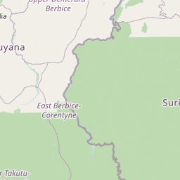
Map view of Central Suriname Nature Reserve

Use this park location map to pinpoint Central Suriname Nature Reserve in Suriname, understand its exact geographic position, and read its mapped placement within the surrounding landscape more clearly.

Pigeon | © OpenStreetMap contributors

Location context for Central Suriname Nature Reserve

Sipaliwini District
Park atlas

Compare the diverse protected landscapes of Suriname and the Guianas, tracing regional conservation efforts.

Explore Other National Parks and Protected Areas Near Central Suriname Nature Reserve
Explore additional national parks and protected areas in the region surrounding Central Suriname Nature Reserve, offering further insight into the diverse Guianan moist forests and unique granite dome landscapes. Compare these vital conservation zones to trace broader protected-area geography and understand regional ecological connections.
National parkSuriname

Brownsberg Nature Park: Suriname National Park with Tropical Forest and Waterfall Landscapes

Mapped geography and protected landscape context.

Brownsberg Nature Park stands as a vital protected landscape within Suriname, distinguished by its central mountain, tropical forest ecosystems, and scenic waterfalls such as Leo Waterfall. The park's location overlooking the vast Brokopondo Reservoir provides a unique geographic setting, making it an important destination for atlas and map-based exploration of Suriname's natural heritage. Understanding Brownsberg Nature Park offers insight into the Neotropical biodiversity and terrain characteristic of the Guianan moist forests.

Area
122 km²
Established
1969
IUCN
II
Visitors
20K annual
Watercolor painting of a landscape with rolling hills, green trees, and soft color gradients
National parkFrench Guiana

Guiana Amazonian Park National Park: French Guiana's Expansive Protected Rainforest

Explore mapped boundaries and regional geographic context.

Guiana Amazonian Park, a cornerstone of protected land in French Guiana, offers a profound exploration of untamed Amazonian rainforest. As the largest national park in the European Union, it showcases a vast, remote ecosystem characterized by towering trees and intricate river systems. This page provides detailed context on its geographic placement within French Guiana and its significance as a major protected landscape for atlas-based discovery and understanding of tropical forest conservation.

Area
20,300 km²
Established
2007
IUCN
II
Relief
Lowland
National parkPotaro-Siparuni

Kaieteur National Park: Iconic South American Waterfall and Protected Forest Landscape

Discover the unique geography and mapped boundaries of this Guiana Shield natural wonder.

Kaieteur National Park is a significant protected area in Guyana, celebrated globally for Kaieteur Falls, the world's largest single-drop waterfall by volume. This national park preserves over 242 square miles of untouched tropical rainforest, offering critical habitat for endemic species and a profound example of the Guiana Shield's ancient geological formations and diverse ecosystems. Its location deep within the Potaro-Siparuni Region underscores its role as a vital bastion of wilderness and a landmark in South American protected landscapes.

Area
630 km²
Established
1929
IUCN
II
Relief
Mixed relief
Protected areaGuyana

Kanashen Protected Area: Geographic Identity and Mapped Boundaries in Guyana

Explore the mapped landscape and protected land context.

Kanashen Protected Area serves as a critical point of geographic discovery within Guyana, offering detailed insights into its protected boundaries and natural landscape. This entry focuses on providing a structured, atlas-driven understanding of Kanashen, emphasizing its role within the regional geography of South America. Users can explore how this protected area fits into the larger mapped context, appreciating its specific terrain and conservation significance.

Area
6,485.67 km²
IUCN
VI
Relief
Mixed relief
Climate
Tropical
Nature reserveFrench Guiana

La Trinité National Nature Reserve: French Guiana Protected Landscape & Nature Reserve Atlas

Mapping the natural terrain and protected boundaries.

Delve into the protected landscape of La Trinité National Nature Reserve, an integral part of French Guiana's extensive natural terrain. This explorer view provides specific insights into the reserve's mapped boundaries and its geographic context within the South American region. Understand its identity as a designated nature reserve and its contribution to the broader protected areas atlas for French Guiana.

Area
769.03 km²
Established
1996
IUCN
IV
Relief
Mountain
Nature reserveFrench Guiana

Nouragues Nature Reserve: Protected Nature Reserve Landscape within French Guiana's Amazon

Mapped geography featuring a distinct inselberg formation.

Nouragues Nature Reserve stands as a critical protected area within French Guiana, safeguarding a significant expanse of pristine lowland tropical rainforest. Its most defining characteristic is the Nouragues Inselberg, a colossal granite formation that dramatically punctuates the dense forest canopy. This reserve is not only a testament to conservation efforts but also a globally recognized hub for tropical forest ecology research. Exploring Nouragues Nature Reserve offers a unique lens into the natural processes and geological features of the Guiana Shield ecosystems.

Area
1,000 km²
Established
1995
IUCN
IV
Relief
Mixed relief
Nature reserveFrench Guiana

Mont Grand Matoury Nature Reserve: French Guiana's Protected Landscape and Mapped Geography

Explore its protected boundaries and regional terrain.

Mont Grand Matoury Nature Reserve is an integral part of the protected areas network in French Guiana, offering a specific focus on its natural landscape and geographic setting. This entry provides a structured overview of the reserve, detailing its mapped extent and its contribution to the regional geography. Users can delve into the specifics of this protected land, understanding its character and location within the wider context of France's overseas territories and the Amazonian biome.

Area
21.23 km²
Established
2006
IUCN
IV
Relief
Mixed relief
Nature reserveFrench Guiana

Trésor Regional Nature Reserve: Protected Nature Reserve in French Guiana's Guianas Region

Mapped Protected Landscape and Regional Geography

Investigate Trésor Regional Nature Reserve, a vital protected nature reserve located in French Guiana. This reserve is mapped as a significant component of the region's protected areas, contributing to the understanding of its unique tropical rainforest geography. Its designation underscores its importance for atlas exploration, offering structured insights into the natural landscapes that characterize this South American territory.

Area
24.64 km²
Established
2010
IUCN
IV
Relief
Mountain

Common questions about visiting, size, designation, and location context for Central Suriname Nature Reserve

Central Suriname Nature Reserve FAQs for park facts, access, geography, and protected area context
Find quick answers about Central Suriname Nature Reserve, including protected-area facts, park geography, trail and visitor context, and how the park fits into its surrounding country and regional landscape.
MoriAtlas Explorer

Continue Your Protected Areas Search Across the Global Atlas

Deepen your exploration by continuing the structured search for national parks and protected areas worldwide. Utilize the comprehensive filtering capabilities to compare different conservation landscapes and refine your understanding of global park geography. Discover more about the distribution and characteristics of protected natural areas.

Global natural geography