

Mori Atlas logo
National parkChizarira National Park

Discover the rugged terrain, deep gorges, and wilderness character of this vast national park.

Chizarira National Park: Mapped Protected Landscape on Zimbabwe's Zambezi Escarpment

Chizarira National Park represents a significant protected area within Zimbabwe, distinguished by its dramatic positioning along the Zambezi Escarpment. This vast national park unfolds across approximately 2,000 square kilometers, offering a unique atlas view of rugged mountains, deep river gorges, and diverse woodland ecosystems. As one of Zimbabwe's most remote landscapes, it provides an exceptional opportunity to explore pristine wilderness and understand the geographic context of its protected boundaries.

Zimbabwe national parksZambezi EscarpmentMiombo woodlandsMopane woodlandsBig Five wildlifeWalking safaris

Chizarira National Park

National park

Park overview

Structured park overview, official facts, and landscape profile for Chizarira National Park

Chizarira National Park park facts, protected area profile, and essential visitor context

Review the core facts for Chizarira National Park, including designation, size, terrain, visitor scale, habitats, and operating context in one park-focused overview.

About Chizarira National Park

Chizarira National Park represents one of Zimbabwe's most significant protected wilderness areas, offering visitors an authentic and uncrowded safari experience far from the more frequented tourist destinations. The park's location on the Zambezi Escarpment places it at a critical ecological transition zone, where the Southern miombo woodlands of the northern plateau give way to the Zambezian and mopane woodlands of the lower slopes and valley floor. This ecological diversity is reflected in the varied terrain, from rocky outcrops and mountain peaks to river valleys and floodplains. The most striking feature of the landscape is the dramatic escarpment face, which drops approximately 600 meters vertically to the Zambezi River valley, creating sweeping vistas across the landscape. Rivers including the Mcheni and Lwizikululu have carved nearly sheer-walled gorges into the escarpment, while the southern boundary follows the Busi River, which is flanked by floodplains supporting distinctive winter thorn Faidherbia albida woodlands. Despite its size and ecological significance, Chizarira has remained relatively unknown due to its isolated position, limited access, and sparse tourism infrastructure, making it an destination for those seeking genuine wilderness.

Quick facts and research context for Chizarira National Park

Chizarira National Park covers 2,000 square kilometers in northern Zimbabwe, making it the third-largest national park in the country. The park was established under the Parks and Wild Life Act of 1975, though it was previously designated as a non-hunting reserve in 1938 and a game reserve in 1963. The park's headquarters are located at Manzituba. Its position on the Zambezi Escarpment offers spectacular views toward Lake Kariba, approximately 40 kilometers to the north. The park is notable for having populations of four of the Big Five African wildlife species, with rhinoceros absent from the area. The remote location and limited tourism infrastructure have resulted in fewer visitors compared to other Zimbabwean parks, preserving its wilderness character.

Protection and recognition

Tracking terrestrial protection boundaries and official conservation classification records.

Chizarira National Park Protected Area Designation and Conservation Framework

Chizarira National Park forms a critical terrestrial conservation landscape, managed to safeguard wilderness areas within the regional geography. Exploring official protected area designations and verified conservation status records provides essential data for tracking global conservation networks.

Protection details

Protection scope
Terrestrial
Transboundary protection
No
Park context

Deeper park guide and search-rich context for Chizarira National Park

Chizarira National Park history, landscape, wildlife, and travel context

Explore Chizarira National Park through its history, landscape character, ecosystems, wildlife, conservation priorities, cultural context, and seasonal travel timing in a structured park guide built for atlas discovery and search intent.

Why Chizarira National Park stands out

Chizarira is best known for its extraordinary wilderness appeal and dramatic escarpmnt landscapes. The park is celebrated for its excellent leopard populations, which thrive in the rugged, craggy terrain characterized by ragged mountains and deeply incised gorges. Walking safaris represent the primary attraction and visitor experience, allowing travelers to explore the pristine wilderness on foot. The park's remoteness and isolation have preserved its wild character, while the dramatic topography of the Zambezi Escarpment provides stunning views across the valley toward Lake Kariba. The combination of diverse woodland ecosystems, from miombo to mopane, with the steep escarpment environment creates a unique ecological setting that supports substantial wildlife populations.
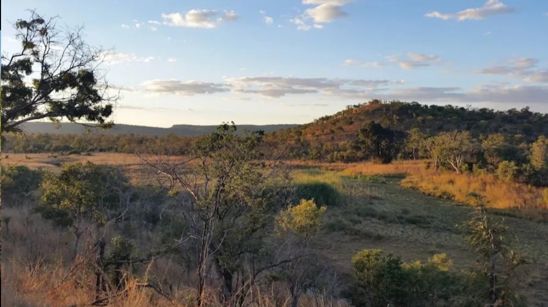
Wide view of Chizarira National Park featuring open grasslands, scattered trees, and distant hills under a blue sky with clouds
Chizarira National Park savanna landscape with rolling hills and scattered trees under a partly cloudy sky

Chizarira National Park history and protected-area timeline

Chizarira National Park has a long protection history dating back to the colonial era. The area was first declared a non-hunting reserve in 1938, recognizing its wildlife and scenic value even then. In 1963, it was formally designated as a game reserve, providing more comprehensive protection for the wildlife populations inhabiting the escarpment. The final step in its protected area status came in 1975 when it was elevated to national park status under the Parks and Wild Life Act, establishing its current legal framework as a Category II protected area under the IUCN classification system. The park's headquarters were established at Manzituba, serving as the administrative center for park operations. Despite this protected status, the park has faced significant challenges in recent decades, particularly from poaching activities that intensified during Zimbabwe's economic crisis in the early 2000s. The remoteness that makes Chizarira special has also made it difficult to patrol effectively, and the absence of significant tourism infrastructure has limited both visitor numbers and the economic resources available for conservation management.

Chizarira National Park landscape and geographic character

The landscape of Chizarira National Park is defined by its position on the Zambezi Escarpment, a dramatic geological feature that creates one of the most spectacular topographies in Zimbabwe. The escarpment rises abruptly from the Zambezi River valley floor, dropping roughly 600 meters in elevation over a relatively short distance. The terrain is characterized by craggy, rugged mountains and ragged hills that have been intensely incised by rivers cutting deep gorges. The Mcheni River and Lwizikululu River have created nearly vertical-walled gorges that slice through the escarpment, adding to the dramatic scenery. In the valleys between the mountain ridges, there are unique open plains where lush vegetation thrives, supported by natural springs that provide permanent water sources. The park's name, meaning great barrier in the Batonga language, reflects how this orientation of phenomenal mountains and copious hills forms a fabulous portion of the Zambezi Escarpment, creating a natural barrier between the highland plateau and the lowland valley. At the northeastern extremity lies Tundazi, a mountain of local legend associated with the river god Nyaminyami.

Chizarira National Park ecosystems, habitats, and plant life

The ecological character of Chizarira is defined by its position at a transition between two major African woodland ecosystems. The northern portion of the park falls within the Southern miombo woodlands ecoregion, characterized by miombo trees of the Brachystegia and Julbernardia genera that create a seasonally variable canopy. The southern part of the park is situated within the Zambezian and mopane woodlands ecoregion, featuring mopane Colophospermum mopane woodland that dominates the lower elevations and valley floors. This ecological transition creates a diversity of habitats within a single protected area, supporting different species assemblages across the elevation gradient. The escarpment environment creates additional habitat complexity, with rocky outcrops, steep slopes, and cliff faces providing specialized microhabitats. The floodplains along the Bbus River support distinctive Faidherbia albida woodlands, where the winter thorn trees create an open canopy that allows grass to grow beneath them during the dry season, providing important dry-season browse for herbivores.

Chizarira National Park wildlife and species highlights

Chizarira National Park supports a diverse array of wildlife, including populations of four of the iconic Big Five African mammals. African elephants move through the park in significant numbers, while lion prides maintain territories in the woodland and escarpment zones. Cape buffalo herds are found throughout the park, particularly in the vicinity of water sources and floodplains. The park is particularly noted for its excellent leopard populations, which thrive in the rugged, rocky terrain of the escarpment where they can find suitable den sites and abundant prey. Among smaller mammals, the klipspringer is notably present, a small antelope specially adapted to navigate near-vertical rocky outcrops with remarkable agility. The birdlife in Chizarira is exceptionally diverse, with hundreds of species recorded. Notable avian species include the African broadbill, Livingstone's flycatcher, western nicator, African emerald cuckoo, and the rare and elusive African pitta. The park also provides habitat for the Taita falcon, a species that breeds within the park's rocky cliff environments.

Chizarira National Park conservation status and protection priorities

Chizarira National Park holds significant conservation value as one of Zimbabwe's largest and most remote protected wilderness areas. Its Category II designation under the IUCN protected area classification system reflects its primary purpose of protecting natural ecosystems and biodiversity. The park's isolation, while creating management challenges, has also helped preserve relatively intact ecological processes and wildlife populations. The transition zone between miombo and mopane woodlands adds to the park's conservation significance by protecting a diverse range of habitats and the species that depend on them. However, the park faces ongoing conservation challenges, particularly from poaching pressures that have intensified during periods of economic instability. The limited tourism development and absence of significant safari operator presence has meant that the park lacks the tourism revenue that could support improved protection and management. The headquarters at Manzituba serves as the base for conservation activities, though resources are constrained by the park's remote location and limited income generation.

Chizarira National Park cultural meaning and human context

The cultural context of Chizarira National Park is deeply connected to the Batonga people, whose language has provided the park with its distinctive name. The word chijalila, from which Chizarira is derived, translates to great barrier, a name that reflects both the physical presence of the escarpment and its significance as a landmark in the landscape. Local legend associates the northeastern extremity of the park, particularly Tundazi mountain, with the river god Nyaminyami, a powerful serpent figure in Tonga folklore. This cultural connection to the landscape predates the formal protected area designation and reflects the long human relationship with this dramatic terrain. The floodplains along the Busi River and other valley areas have historically supported local communities and traditional land use patterns, though the park's remote location has limited human settlement within its boundaries.

Top sights and standout views in Chizarira National Park

Chizarira National Park offers exceptional wilderness experiences that set it apart from more developed safari destinations. The dramatic Zambezi Escarpment provides spectacular viewpoints overlooking the Zambezi Valley toward Lake Kariba. Walking safaris allow visitors to explore the park's rugged terrain on foot, providing an intimate connection with the landscape and wildlife. The excellent leopard viewing opportunities in the craggy mountain terrain represent a major draw for wildlife enthusiasts. The park's ecological diversity, transitioning from miombo woodlands in the north to mopane woodlands in the south, supports a wide variety of wildlife within a single protected area. The deep river gorges, mountain peaks, and spring-fed valleys create a visually varied landscape that rewards exploration. The park's remoteness ensures a truly wilderness experience, far from crowds and the more developed tourism infrastructure found in other Zimbabwean parks.

Best time to visit Chizarira National Park

The optimal time to visit Chizarira National Park aligns with Zimbabwe's dry season, typically from April to October, when wildlife viewing is most rewarding and the landscape remains accessible. During this period, vegetation thins and animals concentrate around remaining water sources, making wildlife easier to observe. The cooler months from May to August offer comfortable temperatures for walking safaris, which are the park's primary attraction. The scenery during the dry season maintains its dramatic character, with the escarpment and gorges providing striking views regardless of the season. The wet season from November to March brings lusher vegetation and, while making some areas more difficult to access, also results in birdlife becoming more active and colorful. The park can be visited year-round, though the dry season generally provides more predictable wildlife encounters and easier navigation through the rugged terrain.

Monthly climate preview

Long term climate baseline and monthly precipitation averages for Zimbabwe's rugged reserve.

Average Temperature and Weather by Month in Chizarira National Park

Long-term climate data for Chizarira National Park reveals a striking temperature progression with peak heat in October and November, followed by a dramatic decrease in mid-year temperatures. Examining the full monthly record provides a structured breakdown of these average precipitation patterns and historical temperature variations.
Annual mean24 °C
19 °C29 °C
Jan25°
Feb25°
Mar25°
Apr24°
May22°
Jun20°
Jul19°
Aug22°
Sep26°
Oct29°
Nov29°
Dec26°
Warmest month
October

29.1 °C

Coolest month
July

19.2 °C

Wettest month
January

5.9 mm/day

Driest month
July

0 mm/day

Park location guide

Geography guide, regional context, and park location map for Chizarira National Park

Chizarira National Park park geography, regions, and map view in Zimbabwe

Understand where Chizarira National Park sits in Zimbabwe through a broader geographic reading of the surrounding landscape, nearby location context, and its mapped position within the national park landscape.

How Chizarira National Park fits into Zimbabwe

Zimbabwe is a landlocked nation in Southeast Africa located between the Zambezi and Limpopo rivers. The country has a population of roughly 17 million people and uses English, Shona, and Ndebele as its primary languages. Once the site of the ancient Kingdom of Zimbabwe and the city of Great Zimbabwe, it gained independence from the United Kingdom in 1980.

Wider geography shaping Chizarira National Park in Zimbabwe

Zimbabwe is located in Southeast Africa between the Zambezi River to the north and the Limpopo River to the south. It is landlocked, bordered by South Africa, Botswana, Zambia, and Mozambique. The terrain includes highlands, savanna, and the Zambezi valley.

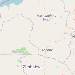
Map view of Chizarira National Park

Use this park location map to pinpoint Chizarira National Park in Zimbabwe, understand its exact geographic position, and read its mapped placement within the surrounding landscape more clearly.

Pigeon | © OpenStreetMap contributors

Explore the diverse landscapes of Chizarira National Park, from its dramatic Zambezi Escarpment and rugged gorges to unique miombo and mopane woodland habitats.

Explore Chizarira National Park Photos: Visual Guide to Escarpment Landscapes and Wildlife Habitats

Gain a deeper understanding of Chizarira National Park's unique topography and ecological zones by exploring a comprehensive collection of photographs. These images visually articulate the dramatic Zambezi Escarpment, the deep river gorges, and the distinct miombo and mopane woodland habitats, providing essential context for its remote wilderness character and rich biodiversity.

Wide view of Chizarira National Park featuring open grasslands, scattered trees, and distant hills under a blue sky with clouds

Park atlas

Explore Zimbabwe's protected area geography and compare national parks across the dramatic Zambezi Escarpment region surrounding Chizarira.

Explore Other National Parks and Protected Areas Near Chizarira National Park

Browse other national parks and protected areas in the immediate vicinity and broader geography surrounding Chizarira National Park. Comparing these protected landscapes reveals regional conservation efforts, diverse ecosystems from mopane to miombo woodlands, and the expansive terrain of the Zambezi Escarpment.
National parkZimbabwe
About 100 km away#1 closest

Northeast

Matusadona National Park: Zimbabwe's National Park Landscape Atlas and Geographic Context

Mapped boundaries and regional terrain for Matusadona National Park.

Matusadona National Park presents a vital component of Zimbabwe's protected land inventory. This detail page offers an atlas-centric view, highlighting the park's mapped geographic features and its distinct landscape character. It is designed to facilitate a structured understanding of Matusadona National Park as a specific protected area, providing essential context for regional geography and natural landscape exploration without delving into visitor logistics or park operations.

Area
1,400 km²
Established
1975
Relief
Mixed relief
Climate
Subtropical
National parkMatabeleland North
About 163 km away#2 closest

Southwest

Hwange National Park: Explore its Mapped Boundaries and Protected Landscape in Matabeleland North

National Park with distinct geographic and landscape context.

Gain a structured understanding of Hwange National Park, a designated national park within the Matabeleland North region of Zimbabwe. This detailed entry focuses on its precise mapped boundaries and its contribution to the regional geography. Ideal for atlas-based discovery, it highlights Hwange National Park as a key protected landscape for understanding conservation and natural terrain distribution.

Area
14,651 km²
Established
1961
IUCN
II
Relief
Lowland
National parkZambia
About 212 km away#3 closest

Northwest

Lochinvar National Park: A Mapped Zambian Floodplain Protected Landscape

Explore its unique wetland geography and protected area boundaries.

Lochinvar National Park in Zambia is a vital protected landscape characterized by extensive floodplains and seasonal wetlands along the Kafue River. As a national park, it safeguards the unique ecosystem of the Kafue Flats, renowned for hosting massive herds of endemic Kafue lechwe and a remarkable diversity of bird species, exceeding 400 recorded. The park's terrain varies from open marshes and lagoons like Chunga Lagoon to drier woodlands dotted with termite mounds and low hills, providing a geographically rich environment for detailed atlas exploration and landscape context.

Area
428 km²
Established
1972
IUCN
II
Relief
Lowland
National parkZimbabwe
About 213 km away#4 closest

Northeast

Mana Pools National Park: Zimbabwe National Park Atlas and Protected Floodplain Landscapes

Explore a World Heritage protected area with iconic baobab forests.

Mana Pools National Park presents a profound example of a preserved African wilderness, recognized globally for its ecological integrity. As a UNESCO World Heritage Site, this protected landscape along the Zambezi River in Zimbabwe is defined by its four permanent pools, vast sandbanks, and distinctive forests. The park's geography supports exceptional wildlife congregations, particularly during the dry season, offering a unique atlas-level perspective on floodplain ecosystems and conservation value.

Area
2,196 km²
IUCN
II
Relief
Lowland
Scope
Terrestrial
National parkZimbabwe
About 241 km away#5 closest

West

Victoria Falls National Park: A Protected Landscape Within Zimbabwe's Geography

Atlas exploration of park boundaries and natural terrain.

Victoria Falls National Park is a key component of Zimbabwe's protected natural areas. This page provides structured information ideal for atlas-based exploration, detailing the park's geographic position and mapped landscape features. Understand its significance as a national park and its contribution to the region's conservation geography.

Area
23.4 km²
IUCN
II
Relief
Mixed relief
Climate
Tropical
National parkSouthern Province
About 248 km away#6 closest

West

Mosi-oa-Tunya National Park: National Park Exploration and Geographic Atlas

Mapped boundaries and protected landscape context in Southern Province, Zambia.

Gain a comprehensive understanding of Mosi-oa-Tunya National Park, a designated national park in Zambia's Southern Province. This entry focuses on its protected area identity, mapped geographic scope, and its position within the regional atlas. Discover the essential landscape context and the structured geographic information that defines this important conservation area, providing a factual foundation for atlas-based exploration.

Area
66 km²
IUCN
II
Climate
Subtropical
Access
Easy access
National parkLusaka Province
About 250 km away#7 closest

North

Lusaka National Park: Protected Woodland Habitat and Geographic Context in Lusaka Province

Zambia's smallest national park, mapping natural terrain near the capital.

Lusaka National Park, Zambia's newest national park, offers a contained yet representative example of the woodland ecosystems found on the Lusaka plateau. This protected landscape, covering 6,715 hectares, is entirely fenced, creating a distinct conservation area within Lusaka Province. Its establishment over a former forest reserve highlights a unique approach to upgrading protected lands. Explore the park's mapped terrain and understand its significance as an accessible natural enclave amid regional development, providing a focused view of central Zambian woodland environments.

Area
67.15 km²
Established
2011
IUCN
II
Climate
Tropical
National parkZambia
About 255 km away#8 closest

Northwest

Kafue National Park: Zambia's Key National Park for Geographic and Protected Area Exploration

Mapped boundaries and landscape context in southern Africa.

Kafue National Park represents a vital component of Zambia's protected lands, offering a distinct perspective for atlas-driven geographic exploration. This national park's identity is tied to its extensive mapped boundaries and its contribution to the regional landscape of southern Africa. Users engaging with this entry can uncover the protected area's specific geographic context and map-based details, enhancing their understanding of conservation landscapes.

Area
22,400 km²
IUCN
II
Relief
Lowland
Climate
Tropical

Common questions about visiting, size, designation, and location context for Chizarira National Park

Chizarira National Park FAQs for park facts, access, geography, and protected area context

Find quick answers about Chizarira National Park, including protected-area facts, park geography, trail and visitor context, and how the park fits into its surrounding country and regional landscape.
MoriAtlas Explorer

Continue Your Protected Areas Search Across the Global Atlas

Deepen your exploration by continuing the structured search for national parks and protected areas worldwide. Utilize the comprehensive filtering capabilities to compare different conservation landscapes and refine your understanding of global park geography. Discover more about the distribution and characteristics of protected natural areas.

Global natural geography