
Viewpoints
Park geography
Mapped terrain, boundary dimensions, and environmental landscape characteristics
Comprehensive Geographic Profile of Christmas Island National Park in Australia
Examine the detailed geographic configuration of Christmas Island National Park within the broader Australian territory. This profile provides data on its 85 square kilometer area, upland relief, and associated natural features including coastal cliffs, tropical forests, and distinct island beaches.
Related tags
Australian territory parkIndian Ocean islandsEndemic species sanctuaryRainforest protected areaRed crab migration site
Australian territory park protecting one of Earth's most ecologically isolated islands and its extraordinary endemic species
Christmas Island National Park
Christmas Island National Park encompasses the majority of Christmas Island, an Australian external territory located in the Indian Ocean approximately 360 kilometers south of Java, Indonesia. Established in 1980 and expanded through subsequent years, the park covers approximately 85 square kilometers, representing roughly 63 percent of the island's total land area. The park is renowned for its extraordinary biodiversity and extremely high level of endemism, resulting from the island's profound geographical isolation atop an underwater mountain rising from the abyssal depths of the Indian Ocean. This isolation has produced a remarkable evolutionary laboratory where numerous species exist nowhere else on Earth, making the park of intense scientific interest and conservation significance.
- Location
- Australia
- Park type
- National park
- Established
- 1980
- Area
- 85 km²
Location overview
Coastal and island territory classifications in Australia and Canada
Geographic Location of Christmas Island National Park
Christmas Island National Park is located within Australia and Canada, specifically in the Christmas Island region. The protected area is classified as an island and coastal park rather than a transboundary or marine zone.
- Countries
- Australia
- Regions
- Christmas Island
- Primary location
- Australia
- Geographic setting
- Coastal · Island
Boundary and coordinates
Spatial boundaries and mapped area covering eighty five square kilometers
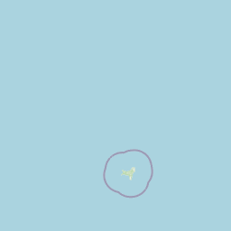
Christmas Island National Park Boundary Map and Geographic Limits
Map outlines provide essential spatial context for the protected zones of Christmas Island National Park. Accompanying geographic facts highlight the estimated area, center point, and coordinate limits.
- Boundary area
- 87.8 km²
- Boundary perimeter
- 147.6 km
- Northernmost point
- 10.4138° S
- Southernmost point
- 10.5706° S
- Easternmost point
- 105.7065° E
- Westernmost point
- 105.5327° E
- Geographic centre
- 10.4861° S, 105.6176° E
- North–south span
- 17.3 km
- East–west span
- 19 km
Terrain and natural features
Upland terrain classifications and recorded physical formations
Christmas Island National Park Terrain and Named Natural Features
Christmas Island National Park is categorized by upland terrain and includes recorded natural features located within its boundaries. Linked feature cards provide names, types, measurements, and spatial relationships where available.
Selected named natural features
Viewpoints
Golf Course Lookout
Capes
Tait Point
Capes
Andrews Point
Capes
South Point
Capes
Egeria Point
Environmental setting
Tropical forest covers, upland relief patterns, and coastal marine zones
Environmental Classifications and Terrain Settings of Christmas Island National Park
Recorded tropical forest habitats, upland relief formations, and major water systems combine to outline the physical setting of Christmas Island National Park. Stored classifications connect directly to broader atlas destinations featuring similar landscape types and environmental profiles.
- Relief
- Upland
- Climate
- Tropical
- Water
- Major water bodies
- Forest cover
- Dense forest cover
- Seasonality
- Year-round
Landscape features
Forest · Cliffs · Cave · Coast · Beach · Islands
Habitat types
Tropical forest · Coastal habitat · Marine habitat · Karst habitat · Wetland
Park atlas
Trace the regional context of protected landscapes and island geography, comparing areas in the Indian Ocean near Christmas Island National Park.
Explore Other Protected Areas and National Parks Near Christmas Island National Park
Continue your exploration from Christmas Island National Park by browsing other protected areas and national parks in its broad regional vicinity. This geographic view helps users compare distinct island ecosystems and diverse conservation landscapes, tracing interconnected protected zones across the Indian Ocean.
National parkBanten
391 km away#1 closest
North

Ujung Kulon National Park: Atlas of Java's Last Lowland Rainforest and Protected Landscapes
Explore the unique geography and critical conservation importance of this vital protected area.
Ujung Kulon National Park, located in Banten, Indonesia, is a crucial protected landscape recognized for its ecological significance. This national park represents the last substantial area of lowland rainforest remaining on Java, making it an indispensable sanctuary. It is globally recognized as the primary and final refuge for the Javan rhinoceros, a critically endangered species. The park's geography encompasses the Ujung Kulon peninsula and mountain ranges, alongside vital marine environments, contributing to its status as a UNESCO World Heritage Site and a cornerstone of regional conservation efforts.
- Area
- 497.59 km²
- Established
- 1992
- IUCN
- II
- Visitors
- 12K annual
National parkIndonesia
About 409 km away#2 closest
North
Gunung Halimun National Park: Mapped Protected Landscape within Indonesia's Geography
Explore the park's national park designation and regional terrain.
Gunung Halimun National Park stands as a key protected national park in Indonesia, offering a deep dive into its specific geographic identity and landscape context. Through this detail page, users can explore the mapped boundaries, understand its place within the regional geography of Indonesia, and gain insight into its protected area status. This content focuses on the atlas exploration value of Gunung Halimun National Park, detailing its terrain and conservation landscape.
National parkIndonesia
About 426 km away#3 closest
North
Gunung Gede Pangrango National Park: Indonesia's National Park with Distinct Protected Geography
Explore mapped boundaries and natural landscape context.
Gunung Gede Pangrango National Park represents a key protected area within Indonesia's diverse geography. This national park provides a focal point for understanding mapped boundaries and the specific natural landscape character it preserves. Its designation as a national park highlights its importance for regional protected land discovery and the detailed study of Indonesia's archipelagic features.
- Area
- 242.71 km²
- Established
- 1980
- Relief
- Mountain
- Climate
- Tropical
National parkIndonesia
About 490 km away#4 closest
Northeast
Mount Ciremai National Park: A Protected Landscape Within Indonesia's Geography
Explore mapped boundaries and regional park context.
This national park in Indonesia provides a unique opportunity to study protected landscape geography. Access detailed information on Mount Ciremai National Park's mapped boundaries and its regional context, contributing to a richer understanding of Indonesia's diverse natural terrain and protected areas. It serves as a crucial point for atlas-based geographic discovery within the archipelago.
- Area
- 155 km²
- Established
- 2004
- Visitors
- 15.1K annual
- Relief
- Mountain
National parkSumatra
507 km away#5 closest
North
Bukit Barisan Selatan National Park: Sumatra's Critical Tropical Rainforest Corridor
Explore mapped boundaries and regional geography within this protected area.
Bukit Barisan Selatan National Park is a substantial national park located in Sumatra, Indonesia, designated as a protected landscape along the southern Bukit Barisan mountain range. Spanning a considerable area, it functions as a crucial corridor of tropical rainforest, playing a pivotal role in conservation efforts and the preservation of Sumatra's unique geographic identity. This page serves as a dedicated entry point for understanding the park's protected area status and its mapped presence within the broader regional geography of Indonesia.
- Area
- 3,568 km²
- Established
- 1982
- IUCN
- II
- Relief
- Mountain

National parkIndonesia
About 530 km away#6 closest
North
Kepulauan Seribu National Park: Mapped Marine Protected Landscape in Indonesia
Explore the coral reefs and island geography of this unique national park.
Kepulauan Seribu National Park is a significant marine protected area located in Indonesia's Java Sea. This archipelago comprises numerous islands and extensive coral reef systems, serving as a crucial habitat for diverse marine life, including endangered sea turtles. The park's geography is characterized by low-lying coral islands and underwater reef platforms, offering unique opportunities for understanding marine conservation efforts and island ecosystems within the broader Indonesian context. Its protected status underscores its importance for both ecological preservation and geographic study.
- Area
- 1,074.89 km²
- Established
- 1982
- IUCN
- II
- Visitors
- 777K annual
National parkLampung
571 km away#7 closest
North
Way Kambas National Park: Mapped Lowland Rainforest and Wetland Ecosystems
Explore the geography and protected landscape of this Indonesian national park.
Way Kambas National Park in Lampung, Indonesia, is a significant protected area characterized by its extensive lowland rainforest and varied wetland habitats. The park's landscape features swamp forests, coastal fringes, and river systems, creating a unique ecological mosaic. It serves as a critical sanctuary for endangered species, offering a vital context for understanding Sumatra's remaining natural landscapes. Explore the mapped boundaries and geographic identity of this important conservation area.
- Area
- 1,300 km²
- Established
- 1989
- IUCN
- II
- Visitors
- 2.6K annual
National parkIndonesia
About 611 km away#8 closest
Northeast
Gunung Merapi National Park: Indonesia's Protected National Park Landscape and Geography
Explore mapped boundaries and regional natural terrain within Indonesia.
Gunung Merapi National Park stands as a distinct protected area within the Indonesian atlas, offering insights into its specific landscape and geographic identity. This page provides a focused entry point for understanding the park's designation as a national park, detailing its mapped environmental features and regional context. Discover the characteristics that define Gunung Merapi National Park as a key component of Indonesia's protected lands, facilitating a structured approach to geographic exploration.
- Area
- 64.1 km²
- Established
- 2004
- Relief
- Mountain
- Climate
- Tropical
MoriAtlas Explorer
Continue Exploring Christmas Island National Park's Geographic and Landscape Identity
Delve deeper into the specific mapped terrain and protected area characteristics of Christmas Island National Park. Understanding its unique place within the Australian regional geography enhances your atlas exploration. This focused view provides crucial context for appreciating its identity as a significant natural landscape, distinct from broader country-level park overviews.
Browse next
Global natural geography
Explore related park routes
Explore MoriAtlas Global ParksBrowse All MoriAtlas ParksGlobal Park Map DiscoveryMoriAtlas: Browse All CountriesBrowse All MoriAtlas ContinentsNational Park Environment AtlasGrand Canyon National Park AtlasYellowstone National Park AtlasYosemite National Park Atlas and GeographySerengeti National Park AtlasGalápagos National Park Protected LandscapeBanff National Park Geography and AtlasKruger National Park Atlas EntryUluṟu-Kata Tjuṯa National Park AtlasExplore Uluru-Kata Tjuta National Park GeographyPlitvice Lakes National Park AtlasFiordland National Park Protected LandscapeGreat Smoky Mountains National Park AtlasAfghanistan National Parks and Protected AreasAlbania National Parks and Protected AreasAlgeria National Parks and Protected AreasAmerican Samoa National Parks and Protected AreasAndorra National Parks and Protected AreasAngola National Parks and Protected AreasAntarctica National Parks and Protected AreasAntigua and Barbuda Park List