Mori Atlas logo
Nearby park discovery

Mapping the geographic landscape and protected surroundings near this island sanctuary

Regional National Parks and Protected Areas Near Codfish Island / Whenua Hou

Explore the geographic distribution of protected lands and national parks situated near Codfish Island / Whenua Hou. This regional overview provides a mapped perspective of surrounding islands and coastal reserves, detailing the spatial relationship between diverse protected areas across the Tasman Sea and southern New Zealand landscapes.

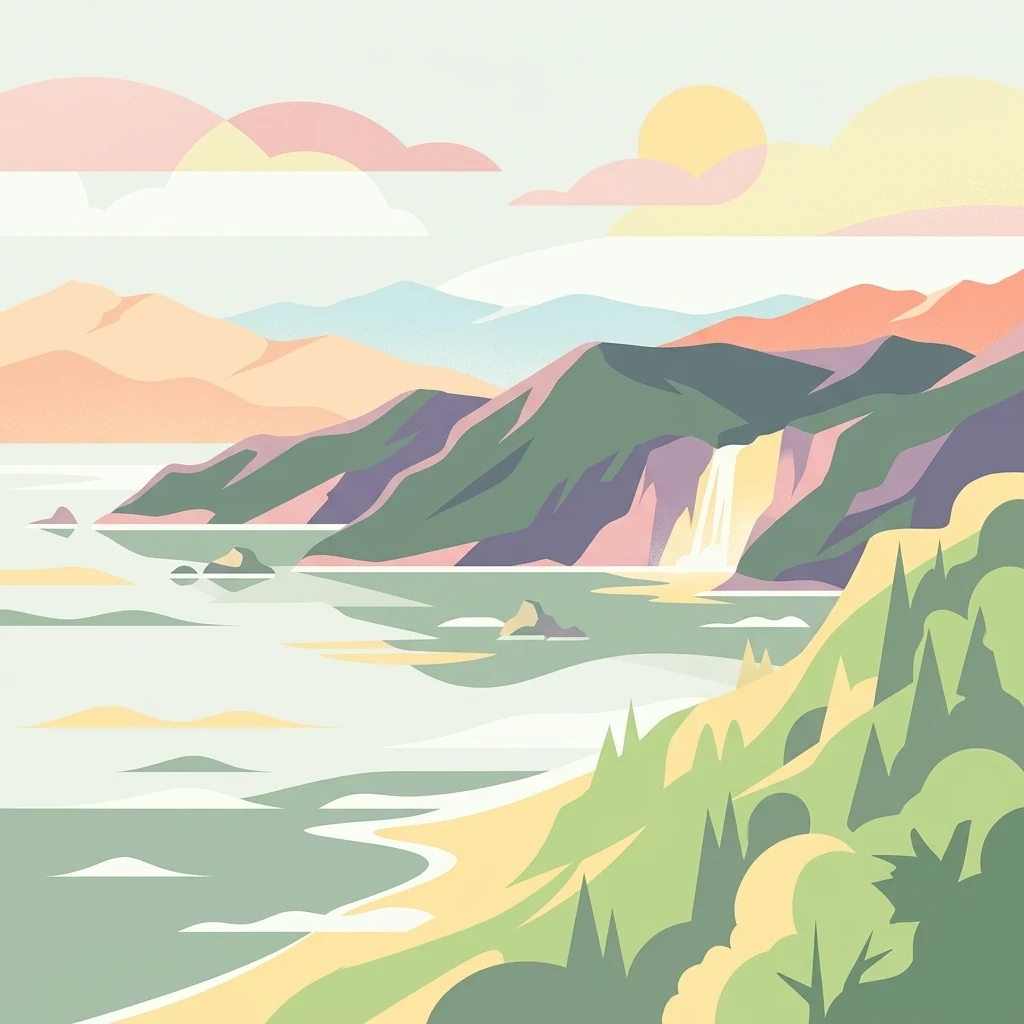
A flat, stylized digital illustration of a coastal scene with a sandy beach in the foreground, lush green hills, a small waterfall cascading into the sea, and mountain silhouettes under a warm, pastel-colored sky.

A predator-free sanctuary in southern New Zealand that anchors the global recovery of the kākāpō.

Codfish Island / Whenua Hou

Codfish Island / Whenua Hou is a small, uninhabited island lying to the west of Stewart Island / Rakiura in southern New Zealand. Covering around 14 square kilometres and rising to about 250 metres near its south coast, it is a remote, rugged landmass surrounded by the cool waters of the Tasman Sea. The island carries a dual English and Māori name and reflects both its natural heritage and its long history of human contact. The island is most famous as the centre of conservation efforts for the kākāpō, the critically endangered flightless parrot, of which roughly half of the global population lives on Whenua Hou. After rats and possums were eradicated in 1998, the island became one of New Zealand's most important predator-free sanctuaries for native birds, seabirds, and bats. Beyond its ecological role, Codfish Island / Whenua Hou is also a significant historical and archaeological site, recognizing one of the earliest recorded mixed Māori and European settlements in the region.

Location
New Zealand
Park type
Nature reserve
Established
1987
Area
14 km²
Highest point
250 m
Codfish Island / Whenua Hou Nature Reserve Geography
Regional park map

See the ranked park cluster in its geographic setting

Nearby parks around Codfish Island / Whenua Hou

This regional map shows the same 20 nearby parks ranked below around Codfish Island / Whenua Hou. Select a ranked marker to highlight that park’s boundary where boundary data is available.
Reference park: Codfish Island / Whenua HouRanked nearby park20 nearby parks shown
20 nearby parks

Explore surrounding protected areas ranked by direct geographic distance from Codfish Island / Whenua Hou

Parks and Protected Areas Geographically Near Codfish Island / Whenua Hou

Examine the ranked collection of protected areas situated within the immediate geographic radius surrounding Codfish Island / Whenua Hou. Compare regional park geography and recorded environmental profiles to understand broader conservation patterns across the surrounding maritime landscape.
National parkNew Zealand
About 5.3 km away#1 closest

East

Rakiura National Park: New Zealand's Remote Protected Wilderness & Landscape Atlas

Explore its rugged terrain and unique subantarctic ecosystem.

Rakiura National Park encompasses the majority of Stewart Island, offering a unique glimpse into one of New Zealand's most remote and undisturbed natural environments. This protected landscape features rugged forested hills, extensive coastlines with isolated beaches, and is globally recognized for its abundant kiwi populations. Discover the park's geographic setting and its significance as a protected area for both wildlife and cultural heritage within the broader atlas of New Zealand's natural wonders.

Area
1,399.6 km²
Established
2002
IUCN
II
Relief
Lowland
Wildlife reserveNew Zealand
About 42 km away#2 closest

Southeast

Ulva Island Wildlife Reserve: Mapped Geography and Protected Forest Landscapes

An open sanctuary located in Paterson Inlet, New Zealand

Explore the unique geography of Ulva Island, a 2.7 square kilometre wildlife reserve within Rakiura National Park. This predator free island features dense temperate rainforest, sheltered coastal bays, and vital recovery habitats for native bird species, offering a distinct study in southern New Zealand's protected forest terrain.

Area
2.67 km²
Relief
Lowland
Climate
Temperate
Access
Easy access
National parkSouthland Region
About 63 km away#3 closest

North

Fiordland National Park: A Protected Landscape of Glacier-Carved Fiords and Alpine Wilderness

Explore its vast boundaries and unique temperate rainforest.

Fiordland National Park, located in the Southland Region of New Zealand, is a testament to dramatic geological forces, featuring fifteen major fiords like Milford Sound, whose Mitre Peak rises majestically from the water. This protected national park encompasses an immense wilderness of alpine terrain, ancient beech forests, and numerous waterfalls, fueled by exceptional rainfall. Its inclusion in the Te Wāhipounamu World Heritage Area underscores its global significance for biodiversity and natural landscape preservation.

Area
12,607 km²
Established
1952
IUCN
II
Visitors
500K annual
Marine protected areaFiordland
About 139 km away#4 closest

Northwest

Moana Uta (Wet Jacket Arm) Marine Reserve: Mapped Protected Landscapes in Fiordland

Exploring unique fiord stratification and dense marine coral habitats

Located in the remote southwestern reaches of New Zealand, Moana Uta (Wet Jacket Arm) Marine Reserve preserves a complete fiord system. The area is notable for its exceptional physical conditions, including high black coral density and a distinct freshwater surface layer that sustains diverse underwater communities across steep rock walls, reefs, and deep basins.

Area
20.07 km²
Established
2005
Relief
Lowland
Climate
Temperate
Marine protected areaFiordland
About 154 km away#5 closest

North

Taipari Roa (Elizabeth Island) Marine Reserve: Fiordland Marine Landscape and Atlas Map

Protected marine terrain and glacial fjord geography

Taipari Roa (Elizabeth Island) Marine Reserve is a protected marine area situated within the complex fjord network of Doubtful Sound. The reserve is characterized by steep underwater rock walls, deep kelp forests, and a unique freshwater cap that allows rare corals and glass sponges to thrive at shallow depths. This geographic overview examines the reserve's protected status and its structural role within the broader Fiordland ecosystem, highlighting the vertical aquatic terrain and surrounding islet environments.

Area
6.13 km²
Established
2005
Relief
Lowland
Climate
Temperate
Watercolor painting of a green, hilly landscape with a winding river or inlet and pale, misty mountains in the background.
Marine protected areaFiordland
About 166 km away#6 closest

North

Kutu Parera (Gaer Arm) Marine Reserve: Fiordland Protected Marine Landscape Atlas

Mapped marine boundaries, stratified fiord ecology, and coastal terrain analysis

Explore the structured geography of Kutu Parera (Gaer Arm) Marine Reserve, a 433-hectare protected area located within the steep, mountain-flanked fjords of New Zealand. Gain insight into its complex underwater features, including vertical rock walls, estuarine basins, and stratified water columns that define this unique marine environment within the Fiordland region.

Area
4.33 km²
Established
2005
Relief
Mixed relief
Climate
Temperate
Marine protected areaFiordland
About 185 km away#7 closest

North

Kahukura (Gold Arm) Marine Reserve: Marine Protected Area and Fiordland Geographic Atlas

Submerged rocky reefs and vertical rock wall landscapes

Located in the heart of New Zealand, Kahukura (Gold Arm) Marine Reserve provides a vital map of protected coastal terrain. Its unique environment features freshwater caps, tannin-stained deep water, and diverse marine topography ranging from sheltered basin ecosystems to vertical cliff structures. This marine area offers deep insight into the complex geology and conservation dynamics of the Fiordland region.

Area
4.64 km²
Established
2005
Relief
Mixed relief
Climate
Temperate
Marine protected areaFiordland
About 217 km away#8 closest

North

Hawea (Clio Rocks) Marine Reserve: Protected Marine Geography in Fiordland, New Zealand

Mapping vertical rock walls and stratified fiord water ecosystems.

Hawea (Clio Rocks) Marine Reserve is an ecologically significant marine protected area situated within the deep waters of Hāwea / Bligh Sound. The reserve is defined by its dramatic vertical rock walls, tidal current channels, and the complex water stratification that sustains diverse black coral and reef communities. It offers a unique window into the geological and marine processes that have shaped the rugged coastal landscape of New Zealand's Fiordland.

Area
4.11 km²
Established
2005
IUCN
Ia
Relief
Mountain
National parkOtago
About 228 km away#9 closest

North

Mount Aspiring National Park: Glaciated Alpine Wilderness & Protected Landscape Atlas

Explore the U-shaped valleys and mapped boundaries of this iconic national park.

Mount Aspiring National Park showcases a breathtaking glacial landscape defined by steep-sided U-shaped valleys, active glaciers, and soaring alpine summits. As a designated national park within New Zealand's South Island, its protected status preserves a vast area of wilderness crucial for understanding regional geography and alpine terrain. This page provides an atlas-style exploration of its mapped boundaries and the stark, natural beauty that characterizes this significant conservation landscape in the Otago region.

Area
3,562 km²
Established
1964
IUCN
II
Relief
Mountain
A soft watercolor painting depicting a calm shoreline with rolling hills in the background under a pale sky.
Marine protected areaFiordland
About 236 km away#10 closest

North

Piopiotahi (Milford Sound) Marine Reserve: Mapped Protected Area and Fiord Geography

A signature marine landscape within New Zealand's Fiordland region.

Piopiotahi (Milford Sound) Marine Reserve protects a distinct underwater environment characterized by dramatic vertical rock walls and deep basins. By examining the geographic boundaries and oceanographic layering of this Fiordland site, users can better understand the interplay between the steep forested cliffs above and the thriving coral and marine wildlife habitats below the surface.

Area
6.9 km²
Established
1993
Relief
Mountain
Climate
Temperate
National parkWest Coast
About 380 km away#11 closest

Northeast

Westland Tai Poutini National Park: A Protected Landscape of Glaciers and Temperate Rainforests

Explore its mapped terrain and unique glacial features in West Coast, NZ.

Westland Tai Poutini National Park represents a remarkable intersection of glacial power and lush temperate rainforests along New Zealand's West Coast. As a protected national park, it showcases dramatic alpine scenery and the unique characteristic of glaciers descending to low elevations. Users can explore the mapped boundaries and the distinct natural landscapes that define this significant protected area, offering a clear view of its place within the region's geography.

Area
1,319.8 km²
Established
1960
IUCN
II
Relief
Mountain
National parkCanterbury Region
About 383 km away#12 closest

Northeast

Aoraki / Mount Cook National Park: New Zealand's Iconic Alpine Protected Landscape Exploration

Mapped glacial terrain and mountain peaks in the Canterbury Region.

Delve into the heart of New Zealand's alpine grandeur with Aoraki / Mount Cook National Park. This page offers an atlas-style exploration of its protected boundaries, dramatic glacial formations like the Tasman Glacier, and the towering peaks of the Southern Alps. Understand the park's significant geographic context within the Canterbury Region and discover the mapped landscape that defines this premier national park.

Area
707 km²
Established
1953
IUCN
II
Visitors
1M annual
A soft watercolor painting of stylized, rolling green hills against a white background.
Nature reserveNew Zealand
About 428 km away#13 closest

Northeast

Peel Forest Park Nature Reserve: Mapped Geography and Protected Forest Landscapes

Canterbury Foothills and Southern Alps transition zone

Located in the foothills of New Zealand, Peel Forest Park preserves a significant fragment of native podocarp forest. This reserve features a diverse landscape of river valleys and forested slopes, offering a clear view of the transition from the Canterbury Plains to the Southern Alps massif.

Area
7.686 km²
Established
1909
Relief
Mountain
Climate
Temperate
Nature reserveNew Zealand
About 450 km away#14 closest

South

Auckland Islands: Protected Subantarctic Geography and Volcanic Archipelago Map

An uninhabited island wilderness and nature reserve in southern New Zealand.

The Auckland Islands comprise a rugged, uninhabited volcanic archipelago south of New Zealand. This expansive nature reserve features deeply indented coastlines, sheltered harbours like Carnley Harbour, and complex subantarctic ecosystems. Gain detailed insights into this protected marine and land sanctuary, home to vital seabird colonies, endemic wildlife, and significant southern right whale gathering grounds.

Area
570 km²
Relief
Mountain
Climate
Subpolar
Access
Highly restricted
Marine protected areaNew Zealand
About 454 km away#15 closest

South

Auckland Islands Marine Mammal Sanctuary: Subantarctic Protected Area and Marine Geography

Mapping remote marine mammal habitats in the New Zealand southern Pacific

Covering over half a million hectares of oceanic terrain, the Auckland Islands Marine Mammal Sanctuary acts as a cornerstone of New Zealand conservation. The area protects complex underwater ecosystems, ranging from sheltered fjord-like inlets to deep-sea abyssal zones, while providing a stable recovery environment for vulnerable whale and sea lion populations in the subantarctic region.

Area
5,605.64 km²
Established
1993
Climate
Subpolar
Access
Highly restricted
National parkNew Zealand
About 513 km away#16 closest

Northeast

Arthur's Pass National Park: Dramatic Alpine Protected Landscape in the Southern Alps

Explore the unique geography and mapped boundaries of this South Island national park.

Arthur's Pass National Park, a substantial protected area within New Zealand's Southern Alps, presents a compelling focus for geographic and atlas exploration. Characterized by dramatic alpine terrain shaped by ancient glacial forces, the park exhibits a striking ecological contrast between its drier eastern beech forests and wetter western rainforests. Users can delve into the mapped park boundaries and understand the regional landscape context of this unique protected area, making it a key destination for understanding New Zealand's natural geography.

Area
1,184.7 km²
Established
1929
IUCN
II
Relief
Mountain
A soft watercolor illustration featuring a panoramic view of rolling green hills, distant mountains, a meandering stream, and wildflowers in the foreground.
Protected landscapeSouth Island
About 517 km away#17 closest

Northeast

Craigieburn Forest Park: Protected Alpine Landscape and Southern Alps Geography

High country terrain from beech forests to alpine ridges.

Situated along the eastern flanks of the Southern Alps, Craigieburn Forest Park offers a complex mountain geography that serves as both a recreational hub and an ecological restoration zone. The area features a clear transition from beech-clad valley floors and glacial terraces to wide tussock basins and craggy summits, providing a detailed look at the diverse natural terrain of the Canterbury region.

Area
446.948 km²
Established
1967
Relief
Mountain
Climate
Alpine
A horizontal watercolor illustration showing a calm bay surrounded by rolling hills and soft greenery, with faint mountains in the background.
Marine protected areaNew Zealand
About 526 km away#18 closest

Northeast

Akaroa Marine Reserve: Protected Harbour Geography and Marine Map

Volcanic coastal terrain and no-take zone boundaries

Located on the Banks Peninsula, Akaroa Marine Reserve represents a vital marine protected area within a deeply indented volcanic harbour. The reserve offers a unique look at the contrast between inner harbour mudflats and outer rocky reefs, serving as an essential case study for marine conservation and coastal geography in New Zealand.

Area
5.12 km²
Established
2014
IUCN
Ia
Relief
Lowland
A watercolor illustration of a rolling green coastal landscape with hills and cliffs meeting the sea, depicted in soft pastel tones against a white background.
Marine protected areaCanterbury
About 530 km away#19 closest

Northeast

Pōhatu Marine Reserve: Mapping Coastal Conservation and Protected Marine Landscapes in Canterbury

A vital marine protected area on the Banks Peninsula coastline

The Pōhatu Marine Reserve serves as a critical no-take zone within the volcanic crater landscape of Canterbury. Its geography consists of sheltered inlets, steep cliff faces, and rich reef systems that support diverse fish biomass and protected nesting sites for native penguin colonies. The area remains a primary example of integrated coastal wildlife conservation on the Banks Peninsula.

Area
2.153 km²
Established
1999
Relief
Upland
Climate
Temperate
Regional parkCanterbury Region
About 538 km away#20 closest

Northeast

Waimakariri River Regional Park: Geography and Protected Landscape Atlas for Canterbury

Braided river corridors and wetland habitats in the Canterbury Region

Waimakariri River Regional Park encompasses a significant managed corridor along the Waimakariri River, featuring an intricate mix of braided riverbeds, saltmarshes, and reforested land. This profile details the park topography, highlighting its role in regional flood management and its varied natural terrain across the Canterbury Plains, providing a clear geographic view of its multi-use protected boundaries.

Area
150 km²
Relief
Lowland
Access
Easy access
Scope
Terrestrial
Distance methodology

Geographic measurements, not driving distances

How nearby park distances are calculated

Distances use park boundaries whenever the available geometry allows it. When one or both boundaries are missing, the mapped park locations provide a clearly labelled estimate. Every value represents straight-line geographic separation and does not use roads or routing.

Boundary distance

Calculated between the nearest points of both park boundaries.

Location-to-boundary estimate

Estimated from one mapped park location to the nearest boundary of the other park.

Mapped-location estimate

Estimated between the mapped locations of both parks.

MoriAtlas Explorer

Explore the Mapped Protected Landscapes of Codfish Island / Whenua Hou

Navigate the rugged terrain and isolated geography of this New Zealand nature reserve. MoriAtlas provides a structured view of the island boundaries and regional context to help you understand the ecological importance of this sanctuary within the Southland Region.